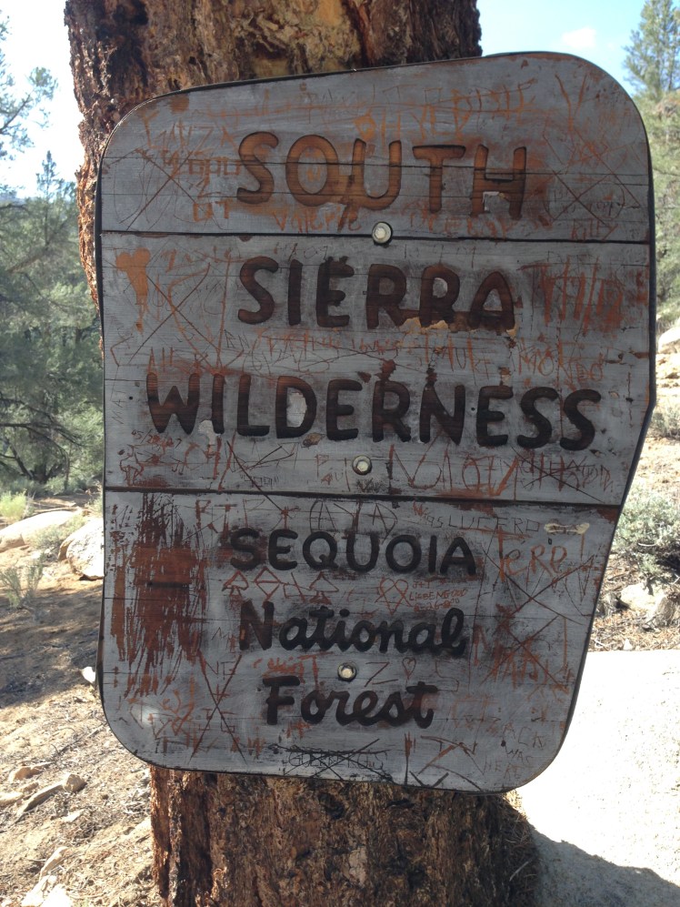
CHAPTER EIGHT (KENNEDY MEADOWS MILE 702 TO VVR MILE 879)
LESSON LEARNED: Worrying about what ‘could happen’ is pointless.
DAY 65 (June 4th):
Jim and I started the four-hour drive back to Kennedy Meadows in the early morning. I wanted Jim to return home safely before dark. To avoid hiking in the early afternoon heat, I planned to hang out at Kennedy Meadows until late afternoon and hike out 10 miles or so, making it a nero (partial day—instead of a full day of hiking).
My ice ax and micro spikes were left at home to save pack weight.
Seated at a table on the large shady patio, I was once again behind the hikers I knew.
I pushed the paper basket containing a hamburger away and drank the soda.
At a table next to me two sisters from Minnesota were talking about beginning their hike of the PCT from Kennedy Meadows and were also waiting for the abatement of the heat. Seated at the table in front of me was a hiker named The Animal.
The port-a-potties across the yard overflowed. The areas surrounding the store and café were hot and dusty. The store was poorly lit and dark inside. Hikers had cleaned the stock from the store shelves.
The patio was the only place to hang out. For a store catering to thru-hikers, it was unwelcoming. Resting up at home instead of camping at Kennedy Meadows had been a wise choice.
I started hiking earlier than planned, leaving around three in the afternoon.
I was on my own. There would be no other location along the trail where Jim could drive up and back home in one day. Going home again was now no longer an option.
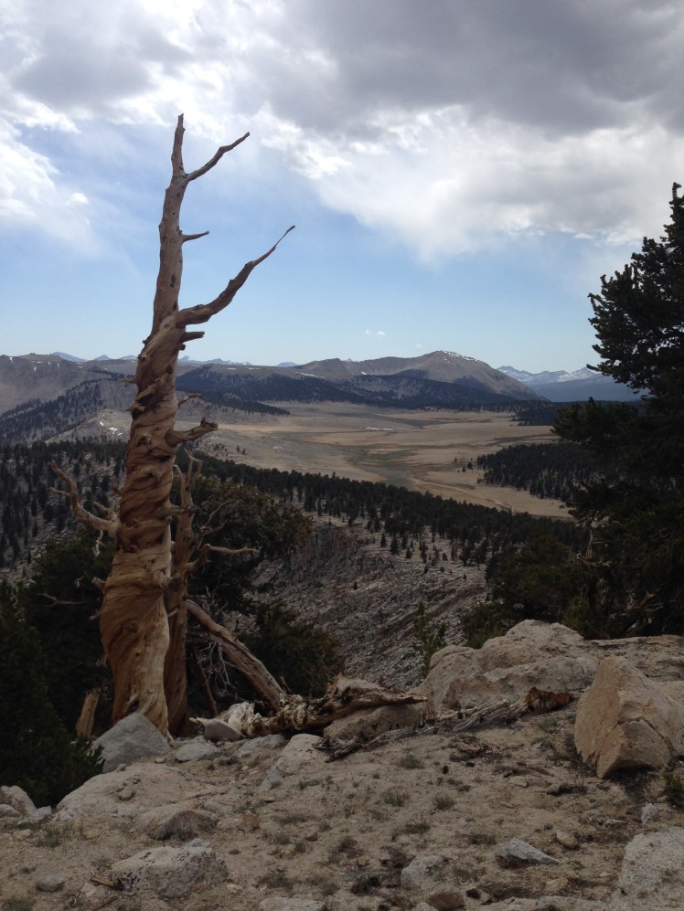
I was thrilled to have completed the desert section of the PCT. The challenge of getting through the mountains of the High Sierras lay ahead. Before departing on the hike, I had flown to Palm Springs from Seattle on a flight path above the High Sierras. It had taken the plane 40 minutes to fly over the Sierras and looking down at the snow covered mountains left me fearful and intimidated by the trail ahead.
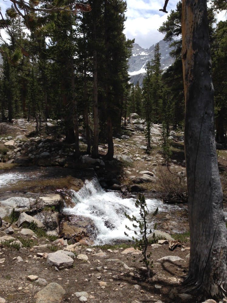
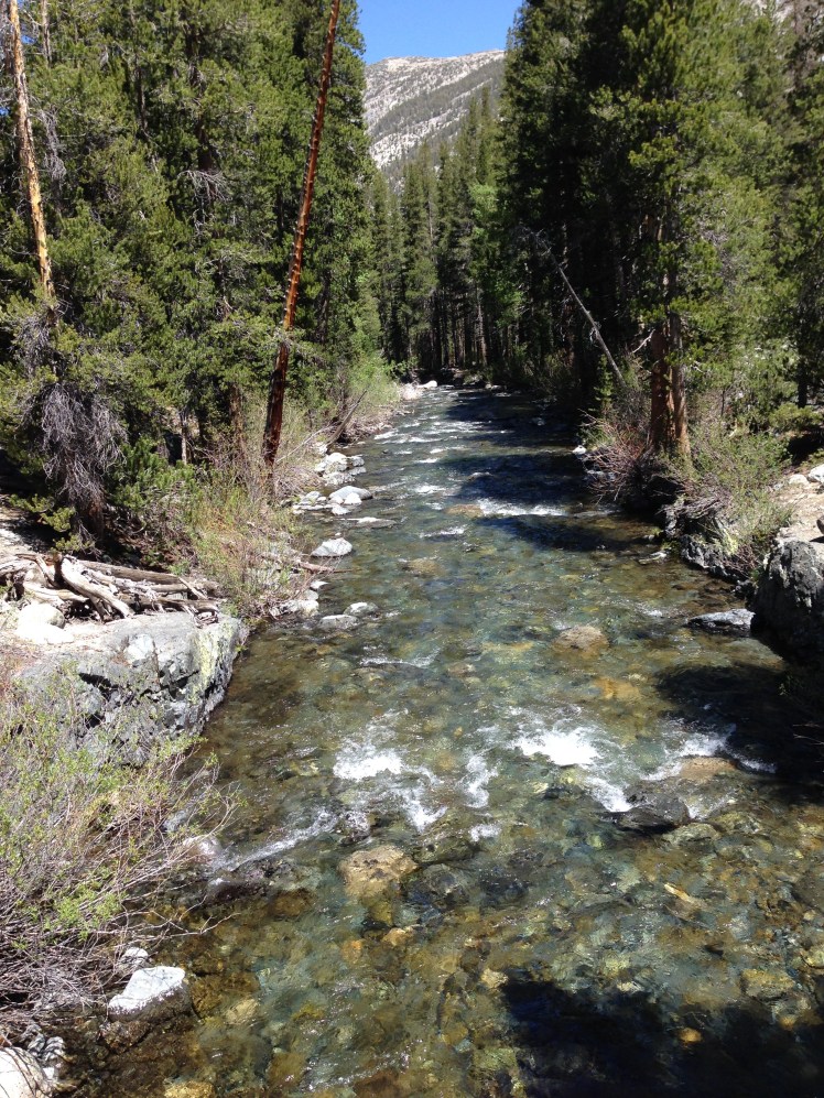
I passed along the edge of the empty Kennedy Meadows campground following the South Fork of the Kern River. It appeared to be a pleasant place to camp and a much better option than camping around the Kennedy Meadows store.
Shortly, I passed the two Minnesota sisters camping by the bridge crossing the River. A beautiful site for their first night on the trail.
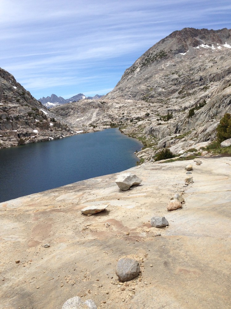
The pathway was relatively flat. As the trail turned Northward, the climb out of the valley entered the South Sierras. In a burn area at mile 709, I noticed I had somehow dropped my reading glasses. The glasses had been stowed in my waterproof Loksak belted wallet around my waist. The items in the Loksak were my most valuable: reading glasses, iPhone, small Swiss Army knife, money, credit cards, and drivers license.
Earlier I had referred to the map and returned the map to the side pocket and assumed I had replaced the glasses inside the belted wallet. Somehow the glasses must have accidentally dropped. I was in a panic. I could not read my maps, the water report, or see anything on my cell phone (GPS) without reading glasses. I dropped my backpack at the edge of the trail and hurriedly retraced my steps back 5 miles searching the trail as I descended. No luck.
When I made it back to my pack, it was growing dark. I pitched my tent in a dry ravine just short of mile 710.
It was now necessary to exit the trail at Trail Pass (the next exit) and go out via Horseshoe Meadows to hitch a ride to Lone Pine to buy reading glasses. It was a stop I had not planned. Until Trail Pass, I would be hiking without references to my maps or the water report. Scary thought.
Day 66:
It had taken almost 800 miles to get my feet calloused and trail ready. From this point, I no longer developed blisters on my feet.
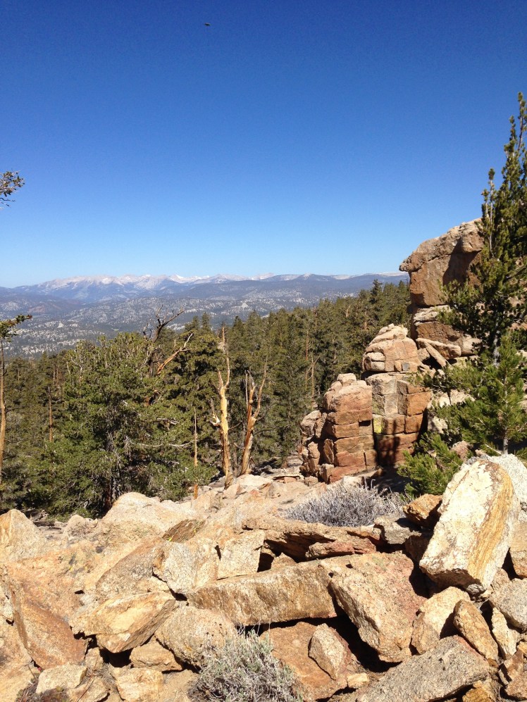
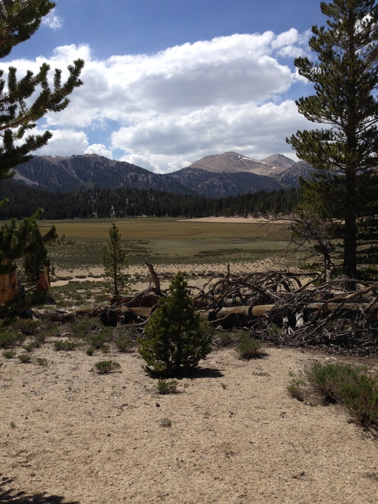
I began the steady climb acclimating hikers to higher altitudes. For most of the day, the trail remained over 10,000 ft. It was my first glimpse of the open meadows common in the Sierras. I passed through the beautiful and scenic Beck Meadow, Monache Meadow, Bear Trap Meadow, and Brush Meadow. It was a spectacular day. It was sunny but crisply cool.
Mid-Morning I met two young cousins hiking together who wrote out the balance of the water report in large print for me. (The water report has available water information up to the Sierras.) Their act of kindness was greatly appreciated.
I lunched at mile 716. Seated on the edge of the Kern River, I fired up my Jetboil to prepare hot soup for lunch. I had missed hot food on the trail between Interstate 10 and Kennedy Meadows. A hot lunch was a soothing luxury.
In the afternoon, walking a few miles with Apache, we made tentative plans to try to hitch a ride together to Lone Pine should we arrived at Horseshoe Meadow at the same time.
At dusk, we stopped at mile 731, Death Canyon Creek at a large open area among monster rocks surrounded by sparse stands of pine trees. In the early evening, we were the only other hiker in camp.
It was a small creek and I had to capture the water with my cup and pour it in the squeeze bag. In order to avoid getting grit and debris in the bag it took some time to collect sufficient water to fill the bag for filtration.
By the time we collected water from a spring and set up our tents a large crowd of hikers swarmed around for the night. I kept asking incoming hikers if anyone had found a pair of reading glasses on the trail. Finally, someone mentioned one of the military hikers, called 45, had found a pair of glasses.
I heard a noise.
“Hello,” A booming voice came from outside my tent door.
“Hi,” I unzipped my tent and stuck my head out.
“Did you lose a pair of glasses?” a large man loomed overhead.
“Yes,” I was very excited to get my glasses back.
“What color are they?”
“Pink reading glasses,” I replied turning my head to get a better look.
“Okay, here they are,” he sounded disappointed at locating the owner.
“Oh, thank you…thank you…I love you,” I gratefully replied and quickly asked, “What’s your name?”
“45.” He replied and stomped off. Later down the trail, he told me he had wanted to keep the glasses as a backup to his own reading glasses, and I understood his reluctance to part with my reading glasses. I made a mental note that an extra pair of glasses would be a good thing.
Four hikers built a small fire and began reading aloud from a book. When this group had finally gone off to their tents, there was much collective snoring and crinkling of Neo-air mattresses. I was awake most of the night. I slept poorly. I was beginning to appreciate solo camping.
Day 67:
I was up and out of camp quietly, not wanting to disturb the others. As the trail climbed upward, I passed the campsite of a young couple, Solstice and her Australian boyfriend. They had smartly sought higher ground, meaning less condensation for their tent and sleeping bags. Also, they had the added advantage of less collective camp noise.
When the two overtook me later in the day, Solstice had a slushy made from snow and flavorings. It looked wonderfully refreshing. Note to self, try making one sometime.
I had my glasses but had decided to keep the plan of going out to Lone Pine to purchase a spare pair.
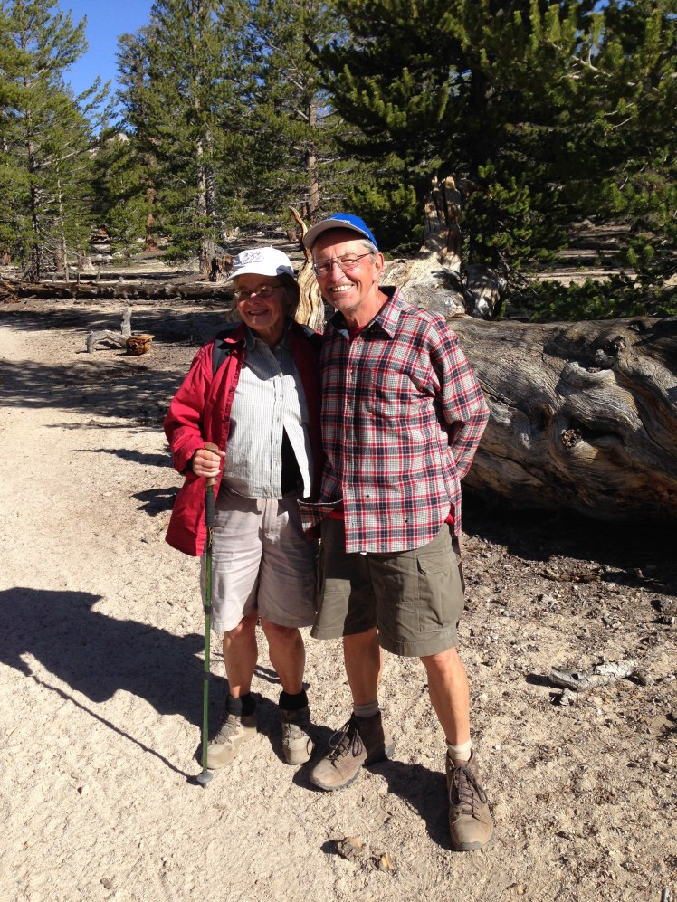
Along the trail, I met a German couple, day hikers, who warned me to stay on the PCT until Trail Pass as the Mulkey trail to Horseshoe Meadows had washed out and was now overgrown and not passable.
When I arrived at the point of the PCT where the Mulkey Pass trail headed down (mile 745), I cut off downhill despite the warning. As predicted the route turned out to be impossible to follow. I ended up blue blazing down the mountain, climbing over logs and rock falls. I stumbled onto a trail near Horseshoe Meadows and immediately came upon a hiker headed up to Trail Pass (the next trail exit from the PCT to Horseshoe Meadows) to help a fellow hiker in her group with a possible broken leg.
Horseshoe Meadow.
“Hello, hello.” I caught up with 45 and Crockpot, two of the four military hikers. We walked on together in search of the road to Lone Pine. 45, a tall and burly middle-aged man with balding blond hair cropped to the scalp, had a forceful manner. Crockpot, a thin tentative young man, walked along with us and said little as we chatted about our hikes.
We walked along the right side of the meadow, and upon reaching the road, we realized we had overshot the campground and had to backtrack.
45 and Crockpot had an arranged lift into Lone Pine. I was on my own to catch a hitch. I was contemplating what action I should best take to catch a ride when a white pickup truck pulled up.
“I’m taking these two hikers down, if you wait, I can drive back up for you.” The driver called through the open window of the truck.
“Oh, no, we’ll squish up and take her with us.” Solstice offered. Aussie jumped in the front seat and l climbed into the back seat of the cab with Solstice. The driver circled back around to tell the three guys he had earlier promised a ride that he would deliver us and return from Lone Pine for them.
Among the three hikers seated in the dirt next to the road was Apache. I waved to let him know I had a ride. It was the last time I saw Apache.
“We’re waiting for our friend who’s hurt, so go ahead.” One of them called up with a wave.
The drive from Horseshoe Meadow into Lone Pine took thirty minutes down a long steep, curvy road. It was a scary ride. The driver was familiar with the road and drove through the curves at high speed with ease, but my eyes were on the steep cliff drop off outside the truck window.
“We can put you up at our house. We live just on the outskirts of Lone Pine.” The driver generously offered.
“That’s sweet of you to offer. But at my age I need privacy. You can drop me off at the nicest hotel in town.” I called up from the back seat through the rushing wind from my open window.
After the heart-stopping drive down off the mountain to Lone Pine, he dropped me at the Historic Dow Hotel and graciously waited to make certain there was a room available before he drove off. I offered to pay for the hitch. He refused my money.
It was early in the day. I shopped for supplies and purchased an extra pair of reading glasses. I ran into Cheetos at the laundry mat. He had already crossed over Forester Pass and came out Kearsarge Pass to Independence and had hitched back down Highway 395 to Lone Pine.
“Where are you staying?
“Hiker’s hostel.” He pointed across the street.
“How was crossing Forester?”
“Scary. Trouble was we got down late in the day and camped right at the bottom by the lake. All of us had very wet shoes. Mermaid and Meg* didn’t enjoy wading the creeks before the pass. We made camp too late for our shoes to dry overnight.” He spoke with animation, and I was an apt listener trying to glean information about the trail ahead.
He spoke at length about crossing Forester Pass as we waited for our clothes to dry.
Day 68, June 7th:
Early the next morning I dropped my pack beside the road to hitch a ride back up to Horseshoe Meadows. I had anticipated this might be a difficult hitch, luckily, it was only a few minutes. A young woman driving a green Subaru pulled alongside the road and asked if I was headed for Horseshoe Meadows.
A journalist, she had been interviewing hikers along the trail. She had already been to Kennedy Meadows interviewing thru-hikers and was going up to Horseshoe Meadows to locate additional hikers to speak with.
“I am planning to hike the trail myself next year,” She smiled happily and added, “Do you mind if I interview you on the drive up?”
“Sure,” I was happy to oblige.
“What made you want to hike the PCT?”
A question I had been asked numerous times.
“My family camped and hiked when I was growing up. I believe hiking is something one learns to love when young.”
I looked out the window of the car and continued.
“As a child hiking with the family, we sometimes ran into thru-hikers on what was then the Pacific Cascade Trail in Washington. We were always curious about their hikes and when I asked what they ate on the trail most hikers mentioned Snickers.” I laughed at the memory and thought of the many times over the years I had hoped to hike the Pacific Crest Trail. She did not say anything. I continued.
“My husband doesn’t hike. When I married, it was something I had given up. Then, while my daughter was in middle school, her school arranged weeklong backpacking trips each Spring and each Fall for her class. Getting her geared up each year got me wishing to be outdoors hiking again. When we retired, I took up backpacking.”
“Did your daughter go to Lakeside?” she asked, totally off the subject.
“Oh, my gosh, are you from Seattle?” I turned to the young driver. I was astounded and excited at the possibility of meeting another person from Seattle as that is where I lived all my adult life.
“No, but several of my friends at Princeton attended Lakeside.”
“You’re kidding. My daughter went to Princeton. What year are you?”
Our conversation veered off to Princeton University, and we never revisited the PCT interview.
As I started up to Trail Pass, I saw the German couple I had met the day before. Every year they traveled from Germany to spend several weeks day hiking sections of the PCT. After a pleasant conversation about their family and past holidays, I resuming my hike up the trail.
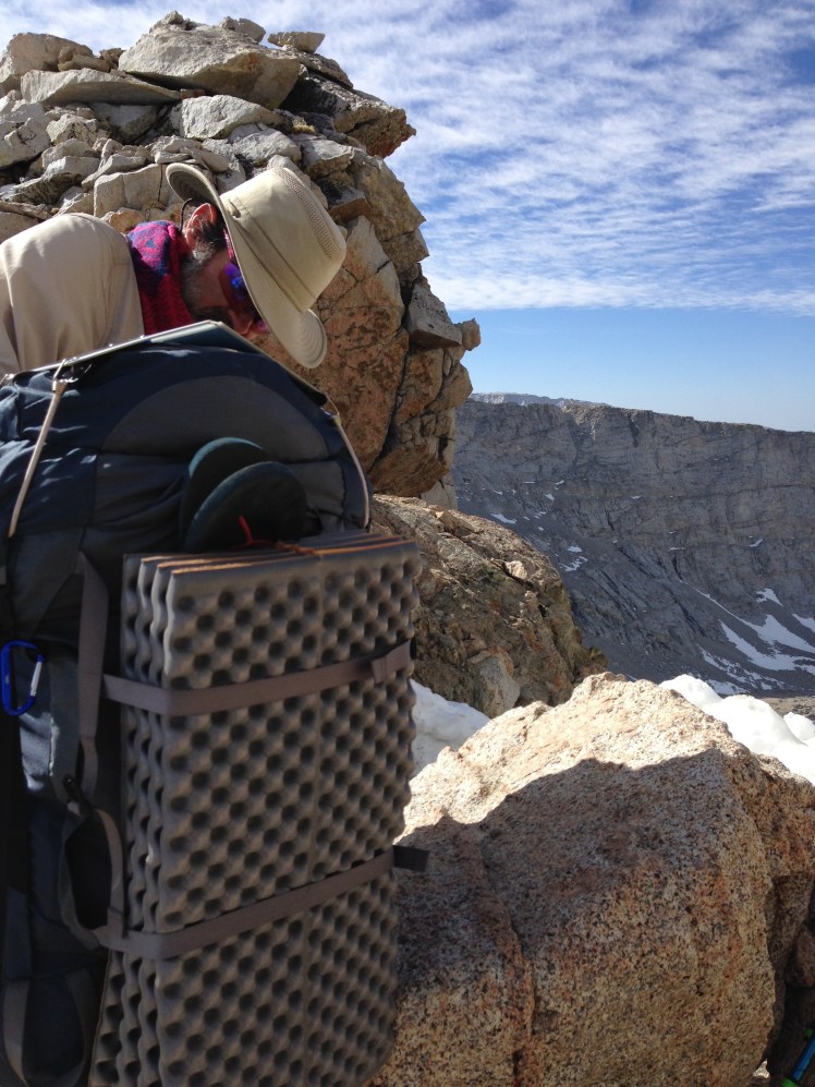
The day hikers from Germany.
After getting up to Trail Pass and back on the PCT, I was overtaken by Coppertone. This time he was wearing clothing. He stopped, and we spoke for a few minutes before he ran on. He was in the habit of trail running each day and picked spots along the trail where he could both offer trail magic and run the trails.

Coppertone tanned and fit at age 65.
Mid-morning I took a break at Chicken Spring Lake. It was a small lake in a wet, spongy, open meadow. One of the other hikers stopped there was a young blonde girl with the trail name of Blueberry. She was hiking with a group including a young fireman from Alaska called Snowman. Snowman was tall and a bit pudgy. He had a habit of leaning slightly forward.
As I climbed up Cottonwood Pass, I leapfrogged a few times with Blueberry and then did not see her again.
I hiked with Snowman until he stopped, complaining of suffering stomach problems.
“I’m going to have to rest a bit.” Snowman sat hunch over on a rock beside the trail. I left him worried he would be forced to turn back to Trail Pass.
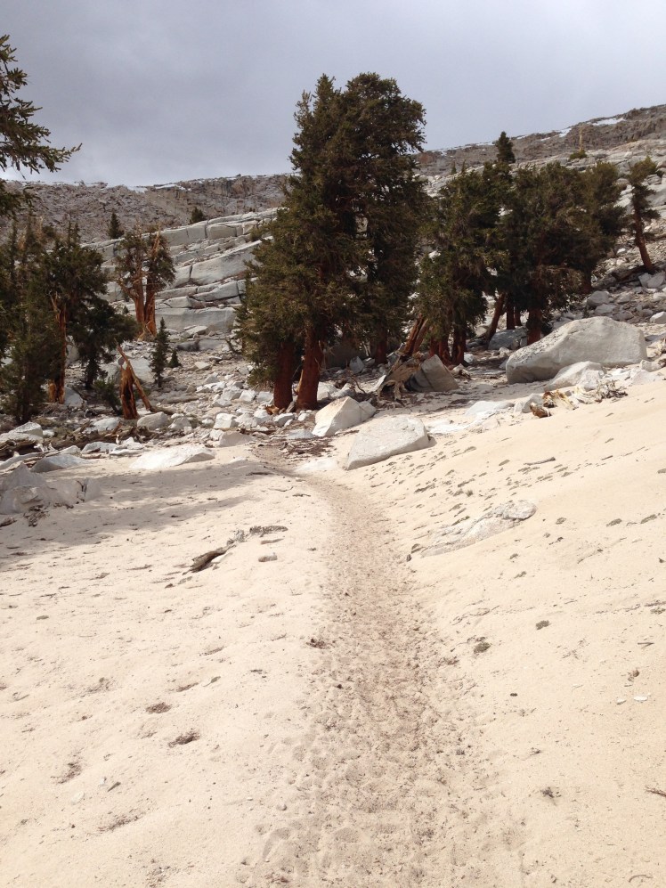
The sandy trail.
The trail was sandy. It was as if I was hiking on a beach only at 10,000 feet above sea level. I was up and over Cottonwood Pass and a few miles later started the descent down to Rock Creek. I camped along Rock Creek at mile 760. The camping area had bear boxes.
After leaving Kennedy Meadows, thru-hikers are required to carry a bear canister which was not easy to stow in my backpack and added two pounds of pack weight. My bear canister turned out to be difficult to remove the lid on cold mornings and required the use of the tip of the screwdriver of the mini Swiss Army knife to pry the lid passed the locking tab, an added annoyance.
As I set up camp, two section hikers built a campfire in their fire ring and invited me over. We three ate our dinners around their giant crackling bonfire.
Near dusk, Snowman arrived. I was relieved he had recovered. He said he was feeling somewhat better. As dusk turned to night, a few other hikers made camp under the trees along the creek.
The section hikers, returning from a weeklong camping trip to nearby hot springs, had many stories to share. I enjoyed hearing of their adventures. They offered to let me burn my paper trash in their campfire before I went off to bed. Waste of toilet paper, maps pages no longer necessary, other paper garbage (all of which hikers are required to pack out) is something I was happy to be rid of and burn in their campfire.
Day 69:
It was amusing to see the bear canisters lined up on top of the bear boxes when I hiked out in the morning.
I waved goodbye to my campfire mates as they prepared to leave in the opposite direction. Snowman was still sleeping.
In the morning, I arrived at the spur to turn off for Mount Whitney at mile 766. Most of the hikers along the trail were excited and making plans for the side trip to climb Mount Whitney. Many were planning to camp at Guitar Lake for an early morning ascent. I was planning to camp by the ranger station, rest for the day and starting climbing during the night.
It was a lovely day. I found the ranger station camping area at the far end of Crabtree Meadow. In a sunny spot at the edge of the meadow, I put up my tent and took a long, restful afternoon nap. There was no one around.
Camping at Crabtree Meadow
While I was resting, I decided the bragging rights of climbing Whitney was not worth the chance of getting hurt and not finishing the PCT. I decided I should stick to my purpose. I could return to climb Whitney at a later date.
In the evening several hikers, including Buttercup, came back from Whitney and camped nearby. Each person was exhilarated but exhausted from the climb. I felt guilty about my decision to skip the Whitney attempt.
Day 70, June 9th:
In the morning, instead of the climbing Whitney, I, with feelings of disappointment, hiked back to the PCT. Hiking the PCT had been on my bucket list too long to chance being distracted by side trips.
At mile 766, the PCT and the John Muir Trail (JMT) share the same path all the way to Tuolumne Meadows in Yosemite, except for one short section.
During the morning, I forded across Wallace Creek and then Wright Creek. Both were swarming with mosquitoes. As I did not want the weight of packing extra water shoes, I waded through the creeks in my shoes and socks. Because it was a sunny morning, the crossings were not uncomfortably cold. My shoes and socks dried relatively quickly.
I gained ground and looking back down to a green meadow below, a large buck with a multi-pointed rack stood watching me, head aloft. It was a brief magical moment.
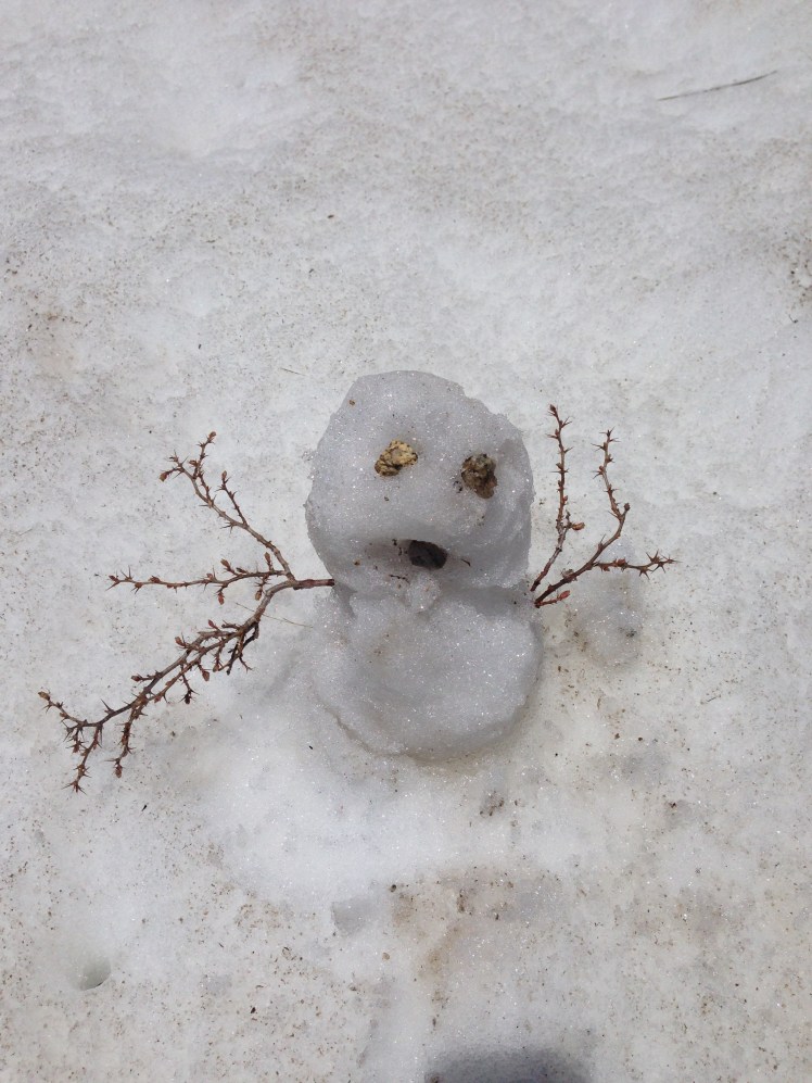
As the trail climbed higher, snow covering the trail. At one stretch of snow, I stopped to build a small snowman to greet the hikers behind me. I was feeling elated and eager to be heading into the high Sierras; although I knew it would be a terrifying challenge.
As timber area gave way to rocky, snowy terrain above the tree line dozens of marmots scampered about. The marmots watched me from on top of rocks and from the entrance to their cubbies.
Before I started on the PCT, I knew my two most significant challenges would be the desert and the high Sierras. I had made it through the desert section. Now I was heading into the mountain passes of the High Sierras, I thought with both exuberance and fear. Looking forward to the challenge I tried to keep my thoughts positive to keep my fearful feelings in check.
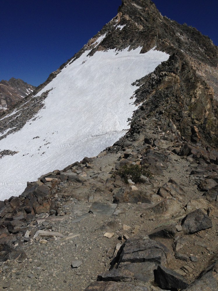
According to all I had read, the optimal time for crossing up and over each pass is late morning. If you arrive too early in the day, the snow will be hard ice. If you are up and over much after lunchtime, you will find yourself post-holing through soft slushy snow where you take a step sinking up to your hips. Post holing is time-consuming and tiring. I planned to reach each pass between ten in the morning and noon. On this day I was headed for a small exposed campsite below Forester Pass to have the optimal time tomorrow to cross over in the morning.
I arrived mid-afternoon, too early to camp, but decided to stay anyway. I had been post-holing my way through the snow to get to the outcropping of rocks forming an island surrounded by snow and partially frozen lakes. The campsite had room for one tent.
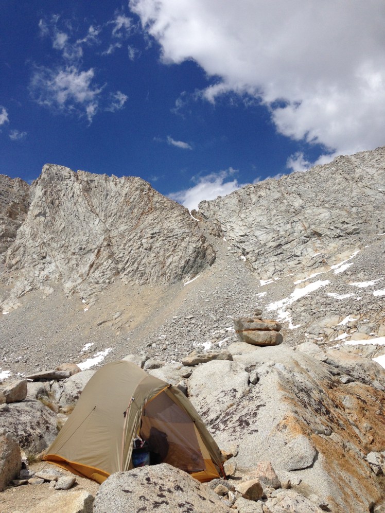
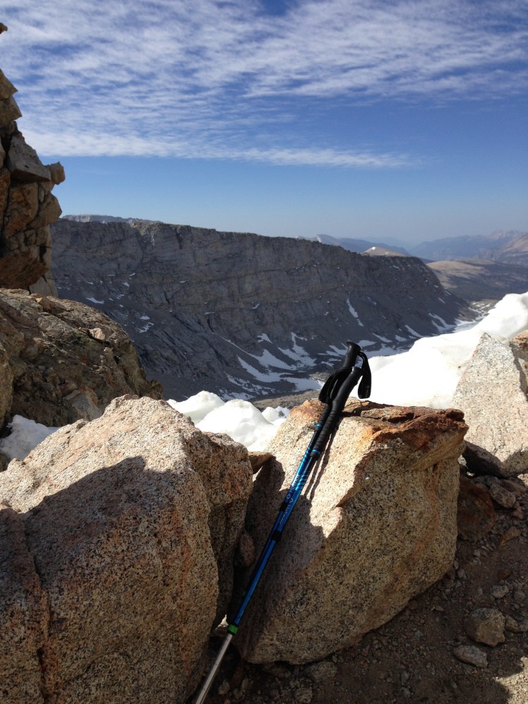
My rock island
It was confusing which notch in the granite wall was actually Forester Pass. From the various tracks in the snow, I could see this had been a problem for previous hikers. It took observation before I was able to correctly discern which pass was Forester.
Several hikers passed my campsite, stopped to chat and ask the best way up Forrester. I pointed to the pass directly ahead and watched as they continue, post-holing from my island to the granite rocks beyond. By watching others, I was able to observe the best route to get through the snow to the trail.
The switchbacks up to the pass were blasted into the side of an almost 90-degree rock face. I watched as each group slowly made their way up the switchbacks. I gauged the time it was taking each hiker to reach the top to know when I needed to leave camp in the morning.
As hikers reached the summit, hoots and hollers of celebration echoed down.
I shared my campsite with friendly marmots. They seemed unafraid. I suspect they were expecting food.
Before sunset, I fetched water from a nearby partially frozen lake. I could not tell where the edge of the lake actually began because of the ice and snow. I started for the lake wearing flip-flops. Every time I post-holed, my flip-flops came off. Finally, I removed the flip-flops and continued barefoot in the snow sinking with each step. When I got back to my island I was relieved I had not broken through the ice while acquiring water as the lake edge was obscured by snow and ice.
Sitting on my rock island filtering water, I watched the sunset and enjoyed the vastness of the wild around me. It felt as if I had landed on the moon so removed was I from anything familiar.
In the growing darkness, as I was resting in my sleeping bag, a hiker passed my tent. I thought perhaps he was going to camp at the next outcropping of rocks at the beginning of the switchbacks. I got out of my tent to see where he was camping. Instead, he stopped, put on his headlamp and started up. One brave soul. I noticed he was carrying an ice ax and crampons and appeared dressed for the harsh weather. Still, Forester Pass at night. I was impressed and stunned and felt silly that I was sitting there worried to go up in the morning. I wished I had not been lying in my tent looking out the door when he passed so that I might have asked his name.
Day 71:
As planned, I left my campsite around nine in the morning allowing approximately an hour to reach the top of the pass. I was set to arrive at the optimal time.
Each step I took on the narrow trail of switchbacks blasted out of the wall, I repeated a mantra, “I’m okay, I’m okay.” as I made my way upward. I kept one hand on the wall to steady myself. Halfway up, I looked down and saw Buttercup starting up below and felt instantly more confident not being alone on the wall.
The infamous ice chute before the top of Forester had been traveled since the last snowstorm, and luckily the chute ice had footprints to step in. Crossing the chute took my full concentration and focus. I was truly terrified. I had no ice ax for self-arrest should I fall down the vertical snow chute. I could hardly breathe. Each step had to be slowly and thoroughly planned and executed. When I reached the far side of the chute, I stopped, clinging to rock.
“I’m okay, I’m okay,” I repeated waiting to catch my breath.
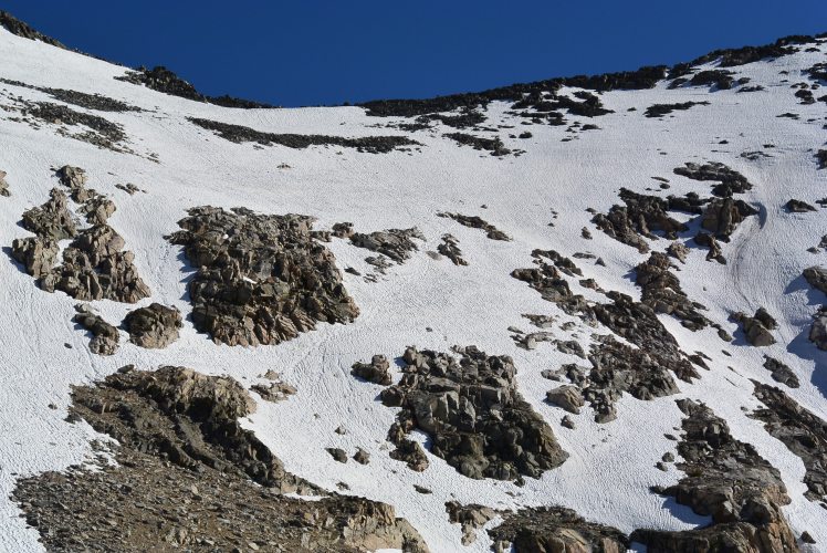
On top of Forester I took photos and was able to capture a video of Buttercup’s arrival just behind me. Forester Pass is a challenge and an adventure, and I was gratified to finally be at the top. At 13,200’ Forester Pass was the highest point on the Pacific Crest Trail.
Looking back from top of Forrester Pass.
Buttercup arrived a few minutes after me.
I wanted to glissade down the glacier. Since I was hiking alone, I decided it was best to stay in the footprints crossing the glacier. This was not easy in running shoes. Two guys ahead of me had slid their shoes like skis along the line in the snow making a slippery slide. It was too steep to step outside the track. I slowly traversed across the glacier and down across the ridge one slippery step at a time attempting to grip my running shoes into the snow. My shoes were too flimsy to make kick stepping workable.
Once off the glacier, there was no sign of the trail. In fact, I could not determine where the trail came out of the snow. It was too steep to see any sign of the trail below. Taking a guess at where I might likely regain the trail, I rock climbed down on all four. This was not easy. Climbing down the rocks was time-consuming and dangerous. Sometimes the snow between the rocks gave way under my footing leaving me uncertain where my foot would end.
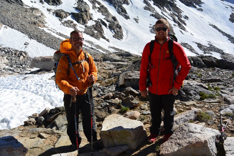
Once down off the rocks and on the trail, I was both euphoric and relieved to have made it over Forrester. Buttercup caught up with me. We stopped to celebrate, and we each took additional photos.
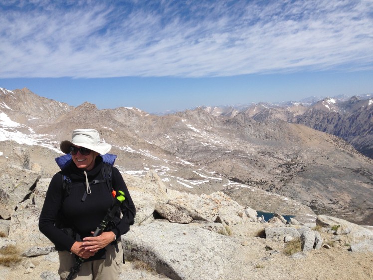
Happy to be back on Trail after Forrester Pass
Shortly after our photo break, I was walking along looking up at the beauty of Kings Canyon when I became off balance and fell. Luckily, I was able to quickly turn and land partially on my backpack against the edge of a rock. The wind was knocked out of me, and for a moment I thought I might be seriously hurt.
Crockpot ran back up the trail to check on me. Crockpot helped me up and waited while I caught my breath and to make sure I could walk again.
Soon Crockpot and Buttercup hiked out of sight.
I was alone in the Gothic beauty of the cathedral-like spires of rock encircling the canyon. It was as if I had stepped inside a magnificent church. It was a feeling of awe and euphoria to be surrounded by the natural beauty.
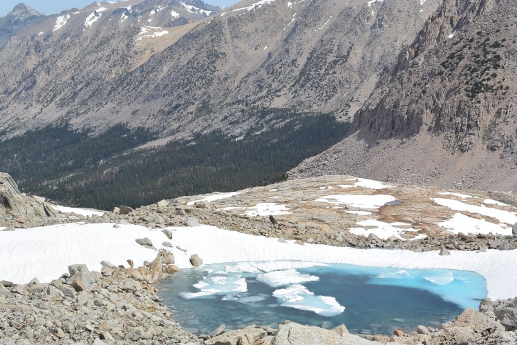
I kept looking up at the massive rock walls as I passed along several small clear azure blue alpine lakes.
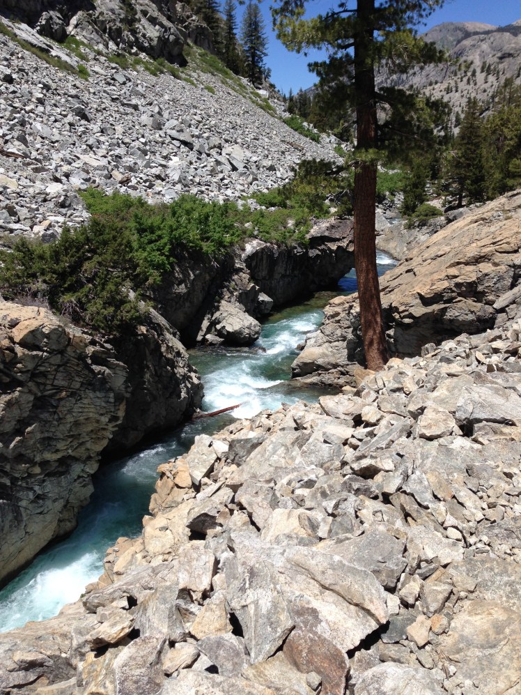
As the day wore on, I descended slowly into the forest. The creeks were rushing, bubbling and cold. I looked about at the abundance of water, stunned by the quantity of water now available for the taking after finding a water source had been the primary goal of every day in the desert section.
It was very pleasant and restful to sit beside a fast moving creek and watch the sun dance on the water while I enjoying lunch.
I did not see another hiker until near evening. I had the walk in the canyon all to myself, to enjoy at my leisure.
Water !
I was not planning to go out Kearsarge Pass since I had resupplied at Lone Pine. However, late in the afternoon clouds moved in and immediately a thunderstorm materialized. It began to drizzle.
With lightning striking all around, I considered my trekking poles. Is it okay to hike with poles in a thunderstorm? Is it better to attach the poles to my backpack? Were the poles more likely attract lightening sticking up from my pack or in my hands? Do titanium poles attract lighting? I had no idea.
I decided to sit down by the turn onto the trail to Kearsarge Pass and wait out the thunderstorm. I weighed the pros and cons of going out versus continuing on in the rain and storm. If it kept raining, I decided to exit over Kearsarge Pass.
Presently, the rain stopped, and I was preparing to continue when around the bend came Snowman and the two sisters from Minnesota. The group included a section hiker with the trail name of Ginger*. I guessed his age to be in the late 30s. Both guys were apparently quite taken with the sisters who were young and beautiful with dark hair and long slender legs. The girls were a couple of years apart in age but easily could have been mistaken for twins. They had open and friendly personalities. I surmised the two lovely sisters were likely to receive an abundance of attention from the guys on the trail.
I contemplated how their parents must be feeling having not one, but two daughters out on the trail. How worried they must be.
The group was headed out over the Kearsarge Pass, planning to camp just before the pass, going over and out in the morning.
They invited me to join them. I was happy to agree. We set out hiking in a line toward the pass. The sisters set a fast pace. I brought up the back end. After a few miles, we came to an open field by a stream, and everyone agreed this was the perfect spot to stop.
While we were enjoying our dinner, Solstice and Aussie came by and joined us. Solstice shared the wild onions she had gathered, and we each added the onions to our food. Afterward, we pooled our hot chocolate packets. The sisters prepared a big pot of hot chocolate for everyone.
I noticed Solstice utilized her PCT handkerchief for cleaning out her Jetboil and then neatly folded it to stow inside the pot. Since Solstice had previous thru-hiking experience, I thought this a clever idea and I immediately adopted this method of clean up to help cut down on the amount of water required.
From this point on I would rinse the pot and spoon with a small amount of water to get most of the food off, then wipe each with the handkerchief, fold the handkerchief up neatly and stow it inside my Jetboil. Boom, cleanup done.
Day 72:
The next morning I got an earlier start for the climb over the pass, leaving camp before the others. Along the trail, a man stopped me offering peanuts accompanied by a religious rant I did not fully understand. I smiled and thanked him and hurried on uncertain if the peanuts were safe to eat. I decided it was best not to find out and placed the peanuts in my pocket.
Kearsarge Pass (11,771 ft) is stunningly beautiful. The view from the top is breathtaking back into Kings Canyon and forward down the Onion Valley. A series of lakes hung beautifully in rocks could be seen looking down the valley.

I stopped to rest and test for cell reception. Bingo. It was a relief and elation to be able to catch up on emails and call home. I texted my daughter to let her know I was safe and read my emails.
On the hike down into Onion Valley, I ran into three separate parents hiking resupply food over Kearsarge Pass to the PCT to meet up with their thru-hiking children. Lucky kids.
On the descent were many day hikers. I took every opportunity to chat with the day hikers just in case someone offered a ride to Independence.
Snowman, Ginger, and the two sisters passed me shortly before arriving at the trailhead. Right near the end of the trail, Solstice and Aussie ran past me. As I hiked into the parking lot, all six were loading their gear into an SUV and invited me to join them for the hitch down to Independence. Ginger sat in front with the driver. Solstice sat on Aussie lap in the backseat. I sat on Snowman’s lap. The two sisters sat in the middle of the backseat, one on top of the other. It was a crowded, smelly ride down the mountain.
Ginger tipped the driver for the hitch. Since he had sat in the front on the ride down and rest of us had squished up in the back, no one offered to pay Ginger back for their part of the tip. I thought about it for a minute.
At Independence, we went our separate ways. The other hikers wanted to go to Lone Pine. I had already been to Lone Pine and decided I would hitch the forty miles northward on Highway 395 to Bishop.
First, I stopped at the Chevron to pick up my resupply box. The Chevron station had a surprisingly good stock of resupply options so I need not have sent a box.
I purchase a large Corona. The man behind the counter informed me as he snapped the top off the beer that it was illegal to drink beer seated at the tables outside his station. He proceeded to put the bottle inside a brown paper bag.
“Here, drink it inside this bag.” He offered, as he handed it to me.
I was hot and thirsty. The beer tasted refreshing. I never thought I would see the day I would be drinking beer, much less beer out of a bottle in a brown paper bag, in front of a Chevron gas station. It was surreal.
The last bus to Bishop had already departed Independence. Standing beside the busy Hwy 395, the primary north-south highway on the East side of the Sierras, made thumbing a ride risky.
I decided my best bet was to observe the cars pulling into the station going northbound and ask for a ride, choosing the vehicle myself. I finished the beer and approached a middle-aged couple. No way. Next, an older Mexican man stopped and went into the Subway shop next door. When he came out carrying a sandwich, I ask for a ride. He was taken by surprise but agreed.
As he drove north, I learned he was an insurance investigator going north beyond Bishop. He spoke of his daughter. She had finished college, had a good job, and had recently purchased her first house. He smiled with parental pride.
He asked about my trip. He had many questions about my gear and about the PCT. As with most people, he was unfamiliar with the trail.
Dropping me at a motel in Bishop and he would not accept money for the lift. He waited to see if a room was available before he drove off.
I showered, cleaned my gear up, and climbed into bed. Apprehension slowly subsided. I was safely inside four walls.
Day 73:
I decided to take a zero. I wanted the feeling of being safe one more night.
I had the worry of Glen Pass on the trail ahead. It was known as the most challenging pass because of the sharp cornice at the top. I studied and asked around Bishop for other options of getting back on the trail further north to avoid Glen Pass. In the end, I decided it was best to stick with the PCT and go up and over Glen Pass.
Day 74:
I caught the bus to Independence arriving around nine in the morning. I sat outside the Chevron station again. This time I was looking for anyone appearing to be heading up the mountain for hiking or camping. It was Friday, this should work. The first person I asked was headed up to camp at the Onion Valley campsite at the trailhead and agreed to take me along. One and done. He was a mailman from LA going on a weekend campout.
It was a late start for the day of hiking. Because I had to make it over Kearsarge Pass, it was late in the day when I started up Glen Pass (11,947 feet). It was a chillingly cold bright day. I passed small crystal clear blue alpine lakes surrounded by rocks and snow on my way up Glen Pass.
It was well past my planned optimal time for going over high passes. Because of the bitterly cold wind, post-holing was not a problem getting down off the glacier. Several trails of footsteps traversed high across the glacier.
I took a deep breath and made my first step into the footprints ahead and tried not looking down.
“I’m okay. I’m okay.” I repeated over and over again with each precarious step forward. One misstep and I would fall down into the rocks below. It was here I convinced myself if I was safe at the moment, it was best not to concern myself with what “might” happen in five minutes or an hour or a day in the future. Being safe in this very moment was all I need concern myself.
Once across, I sat down on a rock to plan the best route down the pass, looking for anything that might determine the trail ahead.
I knew from the map I generally needed to be on the left side of the lake below, but could not visually see an indication of a trail. As I sat looking at my map, I made out two hikers coming up along the lake. By observing their path forward, I was able to see how I should best descend through the rocks and snow to the trail.
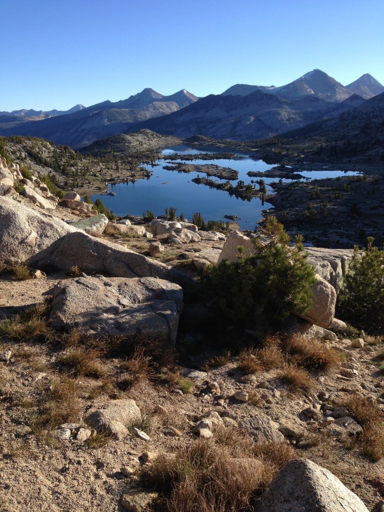
By the time I rocked climbed down and located the trail, it was late in the day. I made camp at mile 794 along Rae Lakes. I found a spot with a lake view. By locating my tent up against a small tree, I sought coverage from the raw wind blowing directly off the lake. It was scenic. Beyond the icy blue water, jagged mountains outlined the horizon.
I sought immediate refuge in the tent and my warm sleeping bag. It was freezing cold.
Day 75, Saturday, June 14:
I had been lucky with Glen Pass. It was a cold day, and the snow had not softened. I did not want to push my luck with the snow on Pinchot Pass. I was on the trail before dawn. It was a frosty morning as I made my way in the early morning light.
I was pleased with my extra early start. About a mile or so down the PCT, I was stopped by a log crossing. The crossing was located over a stream where an upper lake emptied into a lower lake. Three small diameter logs placed side by side formed a bridge. Usually, this crossing would have been relatively easy. However, at this hour of the morning, the thin logs were covered with a sheer glaze of solid ice.
Wading across was not appealing. I could not tell the depth of the fast-moving water. I looked around for other material to add to the logs to stabilize my footing. After adding brush and several small tree limbs to the bridge, I tried crossing again and found it still too precariously icy.
Locating a small log in the surrounding debris, I realized this log could help me cross. I struggled to drag a log forward to add to the bridge. It was too heavy.
I had wasted an hour of the precious morning trying to get across. I sat down, upset and frustrated. I wanted to cry. I felt defeated and vulnerable. I fought back tears. I had no time for this. I must find a way forward.
Contemplating circling around one of the lakes seemed the best option. I was trying to determine which body of water would be most accessible to bush wack around when suddenly Ginger came along the trail. Together we pulled a log forward and heaved it across the water next to the other logs. As the log flew forward through the air Ginger’s glove flew into the water. We watched the glove float quickly downstream twirly in the water, too far out to rescue.
The log landed next to the other logs. It was a small log, however an extra log free of ice gave stability to our footing to cross over. Ginger crossed over first. I followed slowly.
On the far side, I hefted my pack up on the rocks above and crawled up and out of the ravine and watched Ginger in his orange jacket disappear down the trail.
Later in the morning, I came to the suspension bridge over Woods Creek. The sign said simply: “One person at a time on Bridge.” At the far side of the bridge, a sign marked mile 800.

After the bridge, the trail ahead was the 3,600 foot climb up Pinchot Pass (12,139’). It was a long slow climb through timbered forest. Just when I thought I knew the direction the trail was headed, the trail turned, and I realized I knew nothing about the direction to Pinchot Pass. I was unable to determine the exact direction to the pass until I was on the final approach.
When I made the top of the pass, it was much later than anticipated. I had a harrowing climb down through the soft snow. Each step sank into the softening snow making it difficult to get one foot out before the next foot went down into the snow. I post-holed off the pass.
Just as I reached the rocks below, Snowman and Ginger glissaded off, sailing up to me. It was a joyful scene. I wished I had felt carefree enough to glissade down. I stopped to take photos of their happy smiles.
Ginger and Snoman
After getting down over the pass and descending back into the forest, there were several stream crossings which took time to scout out the best places to cross over. At one point, I heard screams, splashes, and laughter. Someone had fallen into a creek behind me. I stopped to listen. Hearing several voices, I guessed my assistance was not required.
Shortly, I was leapfrogged by Spirit Fingers, Apple Butter, Jambo and Mountain Spice. I had met Spirit Fingers and Jambo at Warner Springs and again on the hike out of Whitewater. They were hikers one noticed. He hiked with his guitar, and she had a banjo. They were longtime friends who had hiked the AT (Appalachian Trail) together. The group had also been at Hiker Trash Mikes place the same night I stayed and I had listened to their music as the younger crowd gathered at the campfire after I had gone to bed.
Today they were hiking quickly and were out of sight in a few moments.
Later, I came to a fast moving river with no visible, easy crossing. There were several large boulders in the river too big and high for me to jump up on top with my backpack. I was assessing my options when Apple Butter returned on the trail across the river.
“There’s a big log upstream,” he shouted over the roar of the water pointing in the direction he wanted me to walk. I cut through the dense underbrush and made my way upstream several hundred feet to find the large diameter log across the river. He waited for me to cross over.
“Thank you so much,” I was out of breath. “Thank you!”
“I didn’t want you to fall in all by yourself. I fell in,” Apple Butter smiled and motioned back down the trail. “And was happy I was not alone.”
It was a thoughtful gesture, so polite, for a young man not yet twenty.
Very soon after the crossing, I camped with Spirit Fingers and the group along the Kings River at mile 812.
Day 76, June 15:
The next morning I slept in, not wanting to prematurely wake the others. Somehow I still managed to get a head start on the day. The others were hanging out their sleeping bags to dry the condensation in the morning sun as I departed.
Each member of the group passed me early in the morning. I caught up with Mountain Spice right before the top of Mather Pass (12,096’). It was early morning. The pass was solid ice. Mountain Spice stopped and put on crampons. I followed behind trying to use her footsteps for footing as I did not have crampons or an ice ax for cutting steps. It was slow going and below freezing. I was happy to have a baklava and a muff for extra warmth. Glissading down was not a good option as there were rocks visibly peaking out of the ice.
As we neared the bottom of the glacier, a hiker came glissading past, hit a rock causing her to flip over and gear to go flying through the air. Water bottles, flip-flops, and other items were strewn about over the rocks and ice.
“Yard Sale.” I turned to Mountain Spice as we looked down, happy we had decided not to glissade down. “That’s likely to leave a big bruise on her backside.”
After the descent of the pass along a series of small alpine lakes and streams, Mountain Spice and I stopped at a stream crossing from one lake to another. We found a grassy area out of the sharp cold wind near a rock and watched Spirit Fingers catch fish with his hands. In the protection of the rocks and out of the wind, I warmed up.
In the afternoon we hiked down multiple golden granite cliffs inside steep rock canyon walls. It was a long descent before arriving alongside a meadow and less steep terrain.
I camped again with the same group at mile 828. We were joined at the camp by other hikers, including a young man named Happy Feet.
In the evening we gathered around the campfire. I learned Mountain Spice was given her name on the AT by accidentally knocking embers into one of her fellow camper’s dinner. The camper, without pause, quickly responded, “No problem, it’s just mountain spice.”
I had lost weight. By this time, my pants were much too large for me. The oversized hiking pants were causing chafing on my inner thighs. Even the Glide in my medicine bag was not helping the chafing. Time to make a change.
Day 77, June 16:
The next morning I opted to hike out in yoga pants. I had packed the yoga pants for wearing on town visits when my hiking clothes were being washed. I was hoping the tightness of the pants might not rub on the chafing on my inner thighs. Also, these pants could possibly dry more quickly after stream fords. It turned out to be a propitious decision. The pants worked well and I ended up hiking in the yoga pants all the way to Snoqualmie Pass in Washington State.
The approach to Muir Pass (11,973‘) was snow covered. I looked up and saw nothing but snow ahead. There was no discernable trail. Footprints in the snow headed in several directions. It was intimidating and unsettling.
Apprehensively, I passed onto the snow wondering what I was getting into. Most of the footprints headed up the mountain to the left. Following the footprints, I headed upward cautiously making certain to step in the existing footsteps. After some distance, I checked the GPS and found I was off the trail. Slowly, I retrace my steps back down until my GPS again indicated I had found the trail under the snow.
I had to guess again which footprints to follow and hoped for the best checking my GPS frequently to make certain I stayed on the trail. It was a gray, cold, windy morning.
The same creek had to be crossed several times, wading through the water over and over from one side to the next following along the best I could. Sometimes there was a cairn along the creek marking the crossings. Other times, I had to look for the foot traffic wear at the water’s edge. In several places, I clambered over snow bridges completely covering the creek. I was afraid a snow bridge might give way under my weight. It was unnerving listening to the rushing water below the snow.
My feet, shoes, and socks were soaking wet from the constant stream crossings.
A fast-moving hiker overtook me headed upward to the mountain pass on my left. According to my map, he was going in the wrong direction. Studying my map, I saw a few feet of exposed trail along the edge of Helen Lake on the right and knew I needed to head toward the lake.
“Hey! Stop.” I shouted up to the man and pointed dramatically to the trail and pointed to my map.
At the lake, I noticed Mountain Spice ahead and hurried to catch up.
The last mile was slow going trying to get our footing in the snow without slipping backward. There was no trail to follow. Fog encased the mountain top making visibility poor.
When we caught sight of Muir cabin through wind and clouds at the top of Muir Pass, we both let out happy yelps. We had found the correct pass. We had made it to the top of the Muir pass.
Mountain Spice and I went inside the cabin to warm up and take a much-needed food break. The rock cabin provided protection from the wind; however, the darkness inside the cabin felt cold and damp.
While we were in the cabin the clouds lifted.
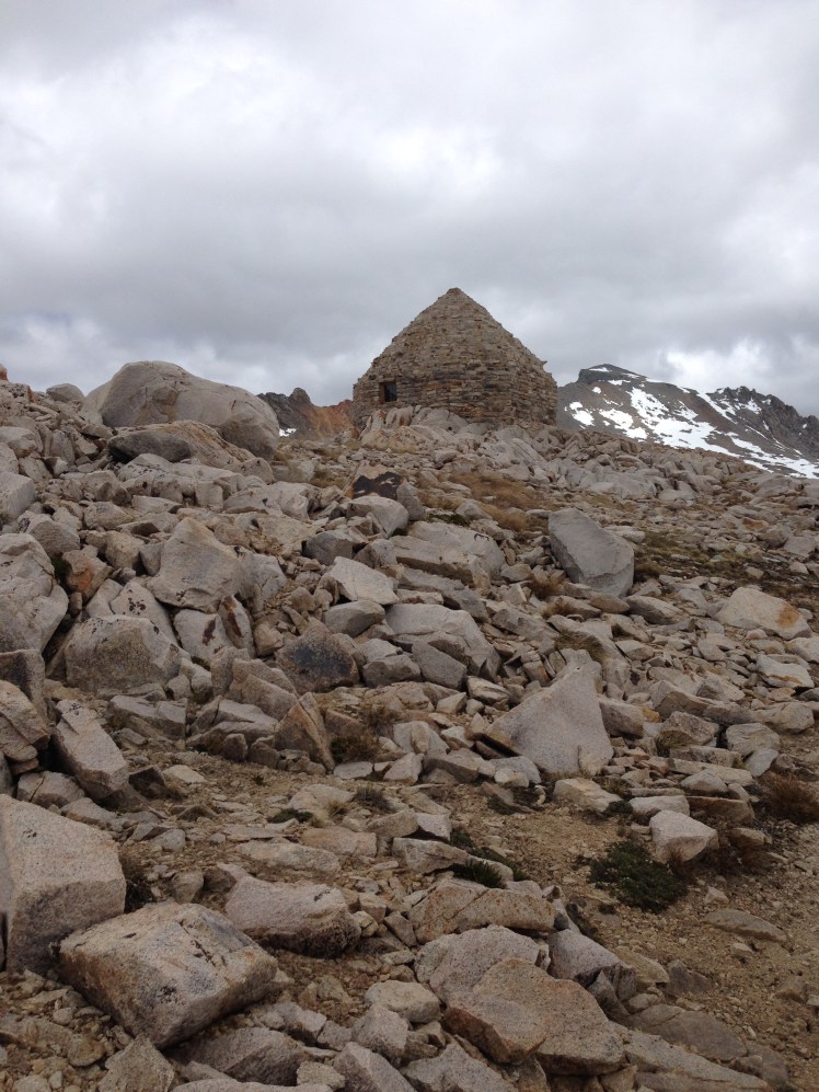
Looking back at Muir cabin after starting down. Luckily there was no snow on the descent.
Muir Pass was the only pass in the Sierras harder to climb up than to climb down because of the amount of snow on the approach. The trail down the pass was clear. It had been a harrowing day. Mountain Spice and I camped at mile 846 and waited for the rest of the group to catch up. We were surprised no one else in the group arrived by the evening, nor as evening turned to night.
Day 78, June 17:
The next day, there was no sign of the others. Mountain Spice was worried about her group. I was worried as well, mitigated by the realization I needed to cross Evolution Creek in the morning while the water was at it lowest for the day. Creek waters generally rise as the snow melts during the day. The increase in the temperature during the day makes water levels rise. Creek fords are safest in the early morning hours.
While Mountain Spice waited for her friends, I hike out worried about fording Evolution Creek (mile 850) alone. The crossing can be treacherous in high snow years.
I unsnapped my backpack in case I fell in and slowly waded across making sure each foot was stable before proceeding with the next step, my trekking poles added stability. Facing upstream, legs bent to meet the oncoming rushing of water, I crossed over to safety. The water had reached above my knees. After worrying all night, I had crossed safely. The swift, cold water was challenging but not dangerous.
Evolution Valley is stunningly beautiful. It was a lovely day surrounded by breathtaking scenery. It was also a pleasantly relaxed day. First I passed through a broad valley with open meadows. Then the views changed to rushing rivers cutting through timbered canyons. There were two crossings of the South Fork of the San Joaquin River across first a wood bridge, then a steel bridge. Next, a steel bridge crossed the Piute Creek. Because the hiking was easy, I was lulled into deciding to leave the trail and check out the Muir Trail Ranch. I had read about the Ranch and was hoping by chance it was now open for guests.
I arrived at the ranch while the owners were busy getting ready to open for the season. They graciously offered to let me recharge my cell phone, which took almost an hour. I waited, resting in the shade of a tree, stretched out on grass. I had not seen anyone all day. Staff members occasionally passed by and stopped to ask about my hike. In my loneliness, I was eager to engage in conversation.
The Ranch is a popular stopping point for John Muir Trail (JMT) hikers, and these hikers make up the bulk of their summer business. Since the camp was not yet open, I considered stopping for the night at the nearby hot springs but decided against it when I learned I must ford a stream over to the hot springs and then back again first thing in the morning.
Around six in the evening, I left Muir Trail Ranch and started the hike up Selden Pass (10,910’). My plan was to go up and over the pass before stopping for the night.
It was getting dark before I made it to the top of the Pass. I stopped somewhere between mile 862 and 864 and put up my tent in the growing darkness near a lake. It was a cold night. I slept with my baklava, gloves, and muff on. I zipped my sleeping bag up around me. It was too cold to sleep. I tossed and turned. In the middle of the night, I ate a candy bar to refuel my body. It was a long night. I slept little. I slept poorly.
Day 79, June 18:
In the morning I found the water inside my water bottles frozen. I was happy I was in the habit of sleeping with my water filter in my sleeping bag as freezing the filter cartridge ruins the filter causing it to no longer safely filter water.
I hurriedly got underway, not taking time for breakfast. I could not make coffee with ice. At the top of the pass, I saw a young man cowboy camping. He had smartly camped high above the lakes where it was warmer than my lakeside campsite.
This morning I passed along several lakes making the time scenic and enjoyable. My morning break had a view of Marie Lake. Coffee and an energy bar refreshed me. I immediately felt warmer.
Hiking off Selden Pass
I knew I had the Bear Creek crossing ahead of me. According to the map, “Bear Creek can be a difficult ford”. I knew not what to expect. But I knew I wanted to be there in the morning hours.
When I arrived at Bear Creek (mile 869), four JMT hikers had just crossed over and were changing from water shoes into hiking boots.
“So where’s the best place to cross?” I asked looking out across Bear Creek, “How deep is it?”
One of the men stood and pointed out where the water changed depths causing a ripple in the fast current.
“Just there. We cross just there.” He pointed, “The water is not above mid thigh.”
I thanked them for the information and unsnapped my pack. The four men watched from the shore as I sloshed through the water in my shoes and socks and continued on the trail, slowing only to re-snap the belt and chest straps of my pack.
The JMT hikers were easy to identify from the PCT thru-hikers. The JMT hikers most often carried huge backpacks, hiked in boots, smelled like soap, and camped early at wonderfully scenic locations. PCT thru-hikers carried small packs, hiked in running shoes, smelled like sweat and urine, and camped wherever they happened to be at the end of the day.
There was a shortcut into the Vermillion Valley Resort (VVR). However, I was determined to have the full Vermillion Valley Resort experience by hiking to mile 879 and taking the ferry to the resort.
Around noontime, I slipped on a mossy rock in a small creek crossing as I was jumping from rock to rock. The stream was only a foot deep. I laughed and guessed I could use this unexpected mini bath.
After I had hiked up the mountain to get into the valley on the north side of Lake Thomas A. Edison, there was a sign at Bear Ridge Trail Fork (mile 875) indicating the ferry was running once each day first thing in the morning due to the low water depth of the lake. Not wanting to wait overnight for the morning ferry, I started down Bear Ridge Trail. It was another added 7.3 miles to the VVR.
Getting to the VVR was very confusing. Many of the hikers who opted for the shortcut got lost and called the resort to be picked up. The map directions were confusing. Luckily, I could see the resort in the distance when I arrived at the lake.
I decided to climb over a gate and walk along the dike, then walked along the lake shoreline. By the time I arrived, I was hot and more than a little upset over the confusing directions of the map. I was also irritated no notice about the ferry closure was posted at the shortcut turnoff trail I could have taken saving the climb up Bear Ridge. I arrived at the VVR in bad humor.
The pleasant welcome and free beer quickly changed my sour attitude.
Free camping was available in front of the store but the tents all crammed together appeared to me an uninviting place to stay. I was relieved a tent with a cot and a wood floor was available for rent. My tent ‘hotel room’ had a bear box, a picnic table, and a fire pit, plus a full views of the lake from the front deck. I collected my resupply box and settled into before I queued up for a shower. The shower tokens allowing three minutes of hot water.
Unfortunately, the sign-up sheet for the laundry was very long. I decided to wait for morning to wash my clothes.
The food at VVR restaurant was excellent and the servers efficient and friendly. I was happy I had planned a zero day to look forward to.
After eating a tasty dinner and chatting with other hikers, I retired early. I had made it through the High Sierras! The desert and the High Sierras were behind me! My two biggest fears of the trail were over. It was a satisfying feeling. I had made it through the desert by being willing to cut back on pack weight and foregoing hot food. I had made it through the High Sierras by learning to consume my food each day to lighten my load.
I learned to stop worrying about what might or could happen in the future. If I am okay right now–I am okay. This moment is all that should matter.
Through the High Sierras of the Pacific Crest Trail, it is estimated more than half the hikers have quit in any given year. I was happy to still be standing, or hiking in this case.
Day 80, June 19:
During my zero at the VVR Happy Feet, Mountain Spice, and Spirit Fingers arrived. It was good to see them again.
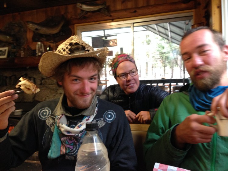
Breakfast with Spirit Fingers, Mountain Spice, and Happy Feet
On the trail, I became very attached to the hikers I spent time with. Most of the young hikers hiked in groups of two or more people. Either they started as a group or fell in together. Not many of the younger people hiked alone. Early on the trail, I had met hikers I could have fallen in with for the rest of the trail, however, because I had taken so many breaks from the trail I had lost contact with those few persons hiking at my pace.
The first three hours of each day I can keep up a three mile an hour pace. Otherwise, I hike at two miles an hour, including breaks. This is a slow pace.
Older men I spoke with on the trail were typically annoyed at being passed on the trail by young hikers. It was something I accepted early on, indeed had anticipated when planning the trip. I had to make certain I started earlier in the day and took advantage of every daylight hour. It was a matter of keeping my ‘running shoes’ on the ground for more hours each day to make up for my slower pace.
