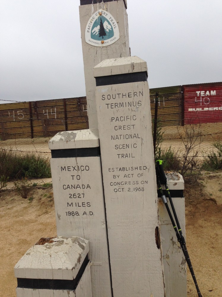
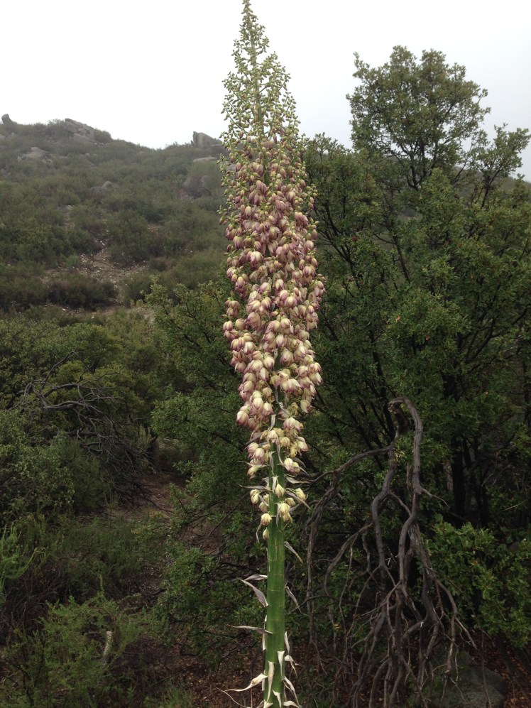
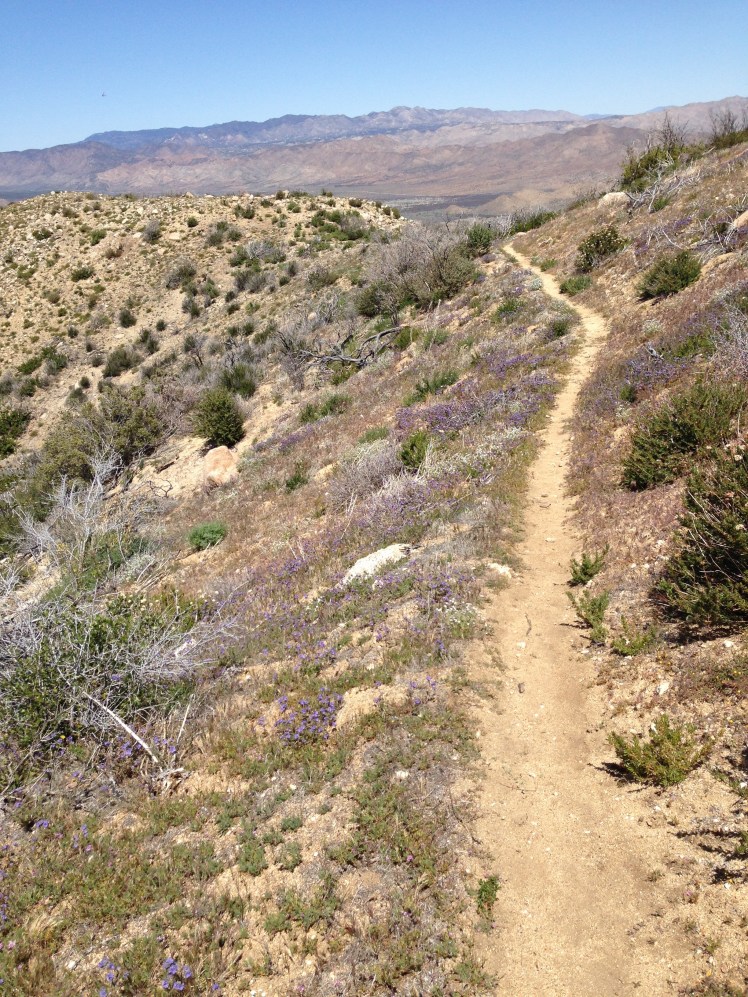
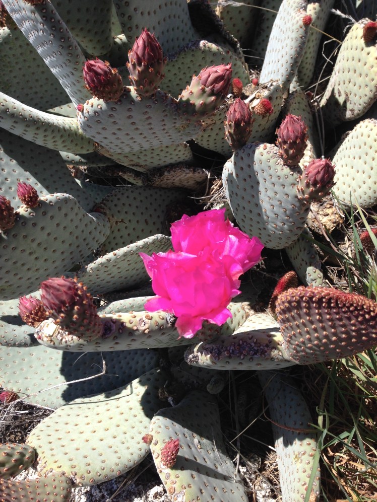
PCT EIGHT

CHAPTER EIGHT     (KENNEDY MEADOWS MILE 702 TO VVR MILE 879)

LESSON LEARNED: Worrying about what ‘could happen’ is pointless.

DAY 65 (June 4th):

Jim and I started the four-hour drive back to Kennedy Meadows in the early morning. I wanted Jim to return home safely before dark. To avoid hiking in the early afternoon heat, I planned to hang out at Kennedy Meadows until late afternoon and hike out 10 miles or so, making it a nero (partial day—instead of a full day of hiking).

My ice ax and micro spikes were left at home to save pack weight.

Seated at a table on the large shady patio, I was once again behind the hikers I knew.

I pushed the paper basket containing a hamburger away and drank the soda.

At a table next to me two sisters from Minnesota were talking about beginning their hike of the PCT from Kennedy Meadows and were also waiting for the abatement of the heat. Seated at the table in front of me was a hiker named The Animal.

The port-a-potties across the yard overflowed.  The areas surrounding the store and café were hot and dusty. The store was poorly lit and dark inside.  Hikers had cleaned the stock from the store shelves.

The patio was the only place to hang out. For a store catering to thru-hikers, it was unwelcoming. Resting up at home instead of camping at Kennedy Meadows had been a wise choice.

I started hiking earlier than planned, leaving around three in the afternoon.

I was on my own. There would be no other location along the trail where Jim could drive up and back home in one day. Going home again was now no longer an option.

I was thrilled to have completed the desert section of the PCT.  The challenge of getting through the mountains of the High Sierras lay ahead. Before departing on the hike, I had flown to Palm Springs from Seattle on a flight path above the High Sierras. It had taken the plane 40 minutes to fly over the Sierras and looking down at the snow covered mountains left me fearful and intimidated by the trail ahead.

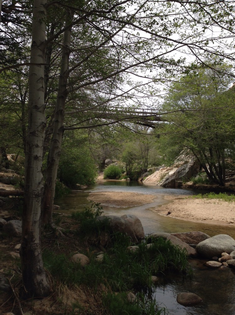
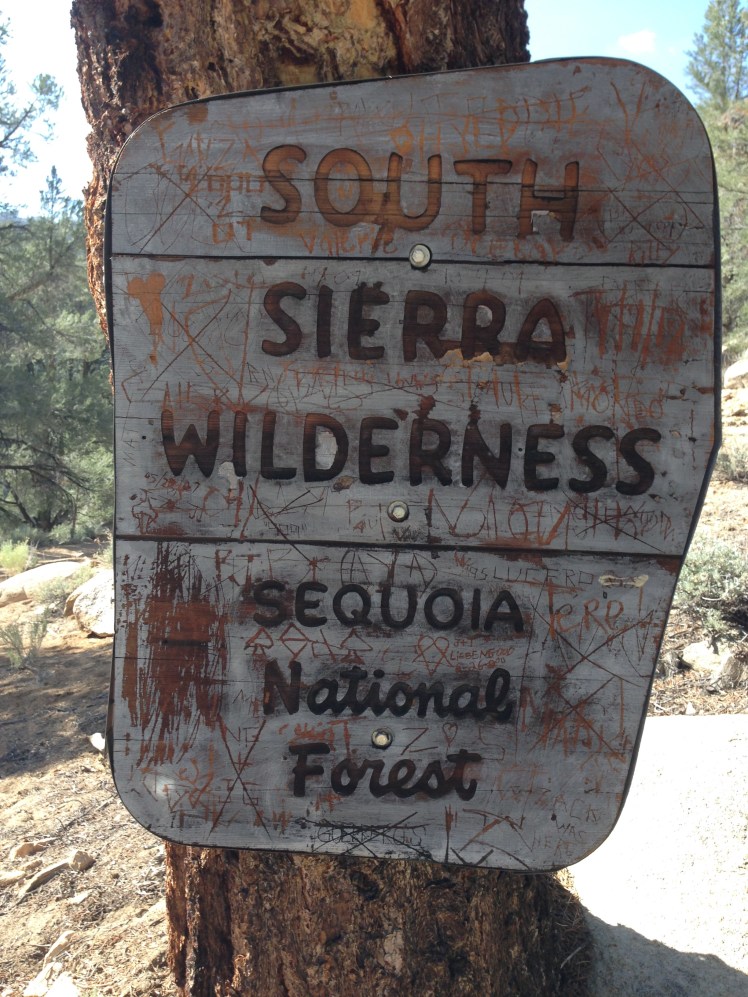
I passed along the edge of the empty Kennedy Meadows campground following the South Fork of the Kern River. It appeared to be a pleasant place to camp and a much better option than camping around the Kennedy Meadows store.
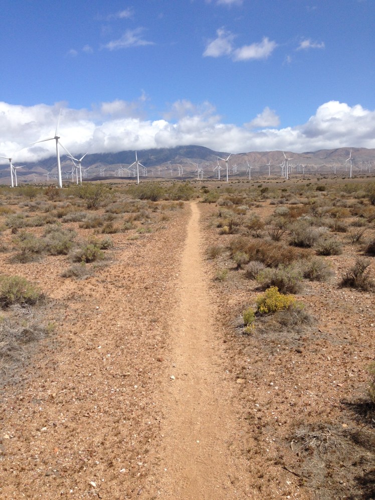
IMG_0848

Shortly, I passed the two Minnesota sisters camping by the bridge crossing the River. A beautiful site for their first night on the trail.

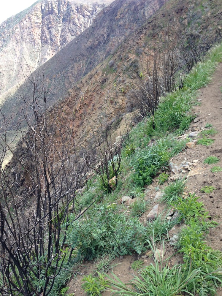
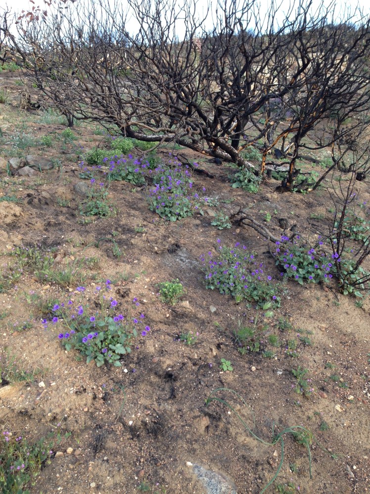
The pathway was relatively flat. As the trail turned Northward, the climb out of the valley entered the South Sierras. In a burn area at mile 709, I noticed I had somehow dropped my reading glasses. The glasses had been stowed in my waterproof Loksak belted wallet around my waist. The items in the Loksak were my most valuable:  reading glasses, iPhone, small Swiss Army knife, money, credit cards, and drivers license.

Earlier I had referred to the map and returned the map to the side pocket and assumed I had replaced the glasses inside the belted wallet. Somehow the glasses must have accidentally dropped. I was in a panic. I could not read my maps, the water report, or see anything on my cell phone (GPS) without reading glasses. I dropped my backpack at the edge of the trail and hurriedly retraced my steps back 5 miles searching the trail as I descended. No luck.

When I made it back to my pack, it was growing dark. I pitched my tent in a dry ravine just short of mile 710.

It was now necessary to exit the trail at Trail Pass (the next exit) and go out via Horseshoe Meadows to hitch a ride to Lone Pine to buy reading glasses. It was a stop I had not planned. Until Trail Pass, I would be hiking without references to my maps or the water report. Scary thought.

Day 66:

It had taken almost 800 miles to get my feet calloused and trail ready. From this point, I no longer developed blisters on my feet.

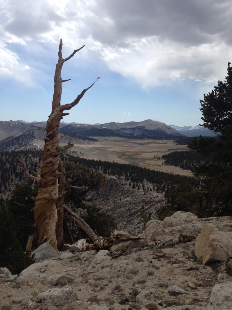
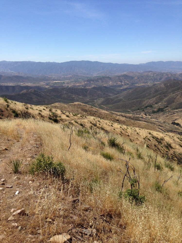
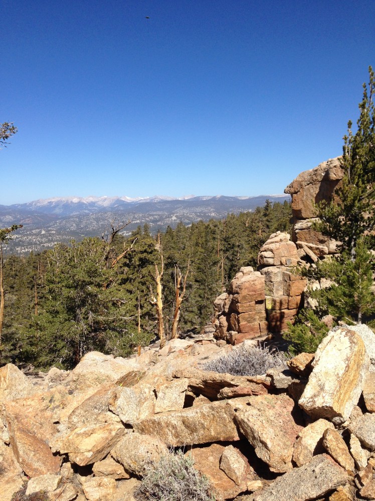
I began the steady climb acclimating hikers to higher altitudes. For most of the day, the trail remained over 10,000 ft. It was my first glimpse of the open meadows common in the Sierras. I passed through the beautiful and scenic Beck Meadow, Monache Meadow, Bear Trap Meadow, and Brush Meadow.  It was a spectacular day.  It was sunny but crisply cool.

Mid-Morning I met two young cousins hiking together who wrote out the balance of the water report in large print for me. (The water report has available water information up to the Sierras.) Their act of kindness was greatly appreciated.

I lunched at mile 716. Seated on the edge of the Kern River, I fired up my Jetboil to prepare hot soup for lunch. I had missed hot food on the trail between Interstate 10 and Kennedy Meadows.  A hot lunch was a soothing luxury.

In the afternoon, walking a few miles with Apache, we made tentative plans to try to hitch a ride together to Lone Pine should we arrived at Horseshoe Meadow at the same time.

At dusk, we stopped at mile 731, Death Canyon Creek at a large open area among monster rocks surrounded by sparse stands of pine trees. In the early evening, we were the only other hiker in camp.

It was a small creek and I had to capture the water with my cup and pour it in the squeeze bag.  In order to avoid getting grit and debris in the bag it took some time to collect sufficient water to fill the bag for filtration.

By the time we collected water from a spring and set up our tents a large crowd of hikers swarmed around for the night. I kept asking incoming hikers if anyone had found a pair of reading glasses on the trail. Finally, someone mentioned one of the military hikers, called 45, had found a pair of glasses.

I heard a noise.

“Hello,” A booming voice came from outside my tent door.

“Hi,”  I unzipped my tent and stuck my head out.

“Did you lose a pair of glasses?” a large man loomed overhead.

“Yes,” I was very excited to get my glasses back.

“What color are they?”

“Pink reading glasses,” I replied turning my head to get a better look.

“Okay, here they are,” he sounded disappointed at locating the owner.

“Oh, thank you…thank you…I love you,” I gratefully replied and quickly asked, “What’s your name?”

“45.” He replied and stomped off. Later down the trail, he told me he had wanted to keep the glasses as a backup to his own reading glasses, and I understood his reluctance to part with my reading glasses. I made a mental note that an extra pair of glasses would be a good thing.

Four hikers built a small fire and began reading aloud from a book. When this group had finally gone off to their tents, there was much collective snoring and crinkling of Neo-air mattresses. I was awake most of the night.  I slept poorly. I was beginning to appreciate solo camping.

Day 67:

I was up and out of camp quietly, not wanting to disturb the others. As the trail climbed upward, I passed the campsite of a young couple, Solstice and her Australian boyfriend. They had smartly sought higher ground, meaning less condensation for their tent and sleeping bags.  Also, they had the added advantage of less collective camp noise.

When the two overtook me later in the day, Solstice had a slushy made from snow and flavorings. It looked wonderfully refreshing.  Note to self, try making one sometime.

I had my glasses but had decided to keep the plan of going out to Lone Pine to purchase a spare pair.
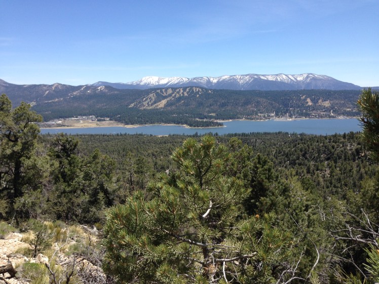
IMG_0849

Along the trail, I met a German couple, day hikers, who warned me to stay on the PCT until Trail Pass as the Mulkey trail to Horseshoe Meadows had washed out and was now overgrown and not passable.

When I arrived at the point of the PCT where the Mulkey Pass trail headed down (mile 745), I cut off downhill despite the warning. As predicted the route turned out to be impossible to follow. I ended up blue blazing down the mountain, climbing over logs and rock falls. I stumbled onto a trail near Horseshoe Meadows and immediately came upon a hiker headed up to Trail Pass (the next trail exit from the PCT to Horseshoe Meadows) to help a fellow hiker in her group with a possible broken leg.
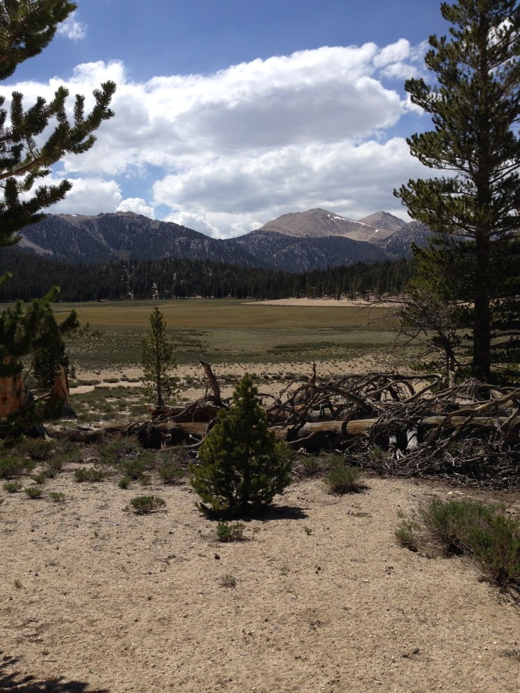
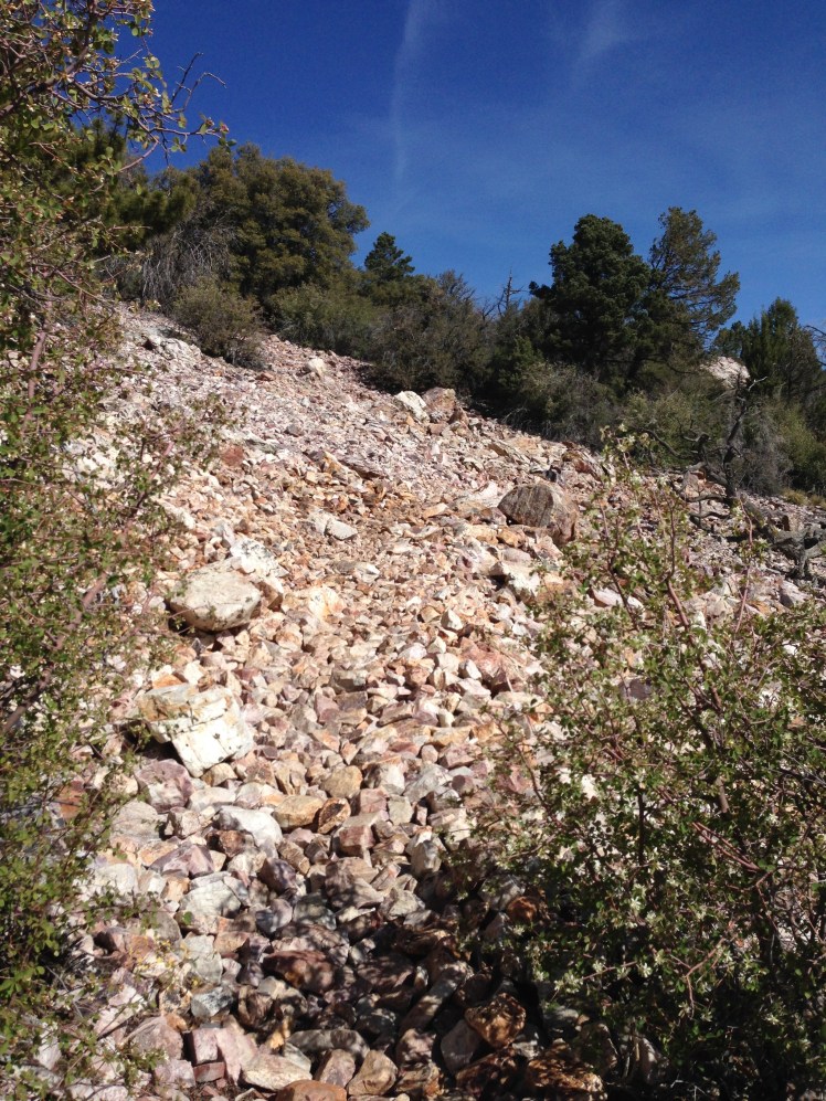
IMG_0851

Horseshoe Meadow.

“Hello, hello.” I caught up with 45 and Crockpot, two of the four military hikers.   We walked on together in search of the road to Lone Pine. 45, a tall and burly middle-aged man with balding blond hair cropped to the scalp, had a forceful manner. Crockpot, a thin tentative young man, walked along with us and said little as we chatted about our hikes.

We walked along the right side of the meadow, and upon reaching the road, we realized we had overshot the campground and had to backtrack.

45 and Crockpot had an arranged lift into Lone Pine. I was on my own to catch a hitch. I was contemplating what action I should best take to catch a ride when a white pickup truck pulled up.

“I’m taking these two hikers down, if you wait, I can drive back up for you.” The driver called through the open window of the truck.

“Oh, no, we’ll squish up and take her with us.” Solstice offered. Aussie jumped in the front seat and l climbed into the back seat of the cab with Solstice. The driver circled back around to tell the three guys he had earlier promised a ride that he would deliver us and return from Lone Pine for them.

Among the three hikers seated in the dirt next to the road was Apache. I waved to let him know I had a ride.  It was the last time I saw Apache.

“We’re waiting for our friend who’s hurt, so go ahead.” One of them called up with a wave.

The drive from Horseshoe Meadow into Lone Pine took thirty minutes down a long steep, curvy road. It was a scary ride. The driver was familiar with the road and drove through the curves at high speed with ease, but my eyes were on the steep cliff drop off outside the truck window.

“We can put you up at our house. We live just on the outskirts of Lone Pine.” The driver generously offered.

“That’s sweet of you to offer. But at my age I need privacy. You can drop me off at the nicest hotel in town.” I called up from the back seat through the rushing wind from my open window.

After the heart-stopping drive down off the mountain to Lone Pine, he dropped me at the Historic Dow Hotel and graciously waited to make certain there was a room available before he drove off. I offered to pay for the hitch. He refused my money.

It was early in the day. I shopped for supplies and purchased an extra pair of reading glasses. I ran into Cheetos at the laundry mat. He had already crossed over Forester Pass and came out Kearsarge Pass to Independence and had hitched back down Highway 395 to Lone Pine.

“Where are you staying?

“Hiker’s hostel.” He pointed across the street.

“How was crossing Forester?”

“Scary. Trouble was we got down late in the day and camped right at the bottom by the lake. All of us had very wet shoes. Mermaid and Meg* didn’t enjoy wading the creeks before the pass. We made camp too late for our shoes to dry overnight.” He spoke with animation, and I was an apt listener trying to glean information about the trail ahead.

He spoke at length about crossing Forester Pass as we waited for our clothes to dry.

Day 68, June 7th:

Early the next morning I dropped my pack beside the road to hitch a ride back up to Horseshoe Meadows. I had anticipated this might be a difficult hitch, luckily, it was only a few minutes. A young woman driving a green Subaru pulled alongside the road and asked if I was headed for Horseshoe Meadows.

A journalist, she had been interviewing hikers along the trail. She had already been to Kennedy Meadows interviewing thru-hikers and was going up to Horseshoe Meadows to locate additional hikers to speak with.

“I am planning to hike the trail myself next year,” She smiled happily and added, “Do you mind if I interview you on the drive up?”

“Sure,” I was happy to oblige.

“What made you want to hike the PCT?”

A question I had been asked numerous times.

“My family camped and hiked when I was growing up. I believe hiking is something one learns to love when young.”

I looked out the window of the car and continued.

“As a child hiking with the family, we sometimes ran into thru-hikers on what was then the Pacific Cascade Trail in Washington. We were always curious about their hikes and when I asked what they ate on the trail most hikers mentioned Snickers.” I laughed at the memory and thought of the many times over the years I had hoped to hike the Pacific Crest Trail. She did not say anything. I continued.

“My husband doesn’t hike.  When I married, it was something I had given up.   Then, while my daughter was in middle school, her school arranged weeklong backpacking trips each Spring and each Fall for her class. Getting her geared up each year got me wishing to be outdoors hiking again. When we retired, I took up backpacking.”

“Did your daughter go to Lakeside?” she asked, totally off the subject.

“Oh, my gosh, are you from Seattle?” I turned to the young driver. I was astounded and excited at the possibility of meeting another person from Seattle as that is where I lived all my adult life.

“No, but several of my friends at Princeton attended Lakeside.”

“You’re kidding. My daughter went to Princeton. What year are you?”

Our conversation veered off to Princeton University, and we never revisited the PCT interview.

As I started up to Trail Pass, I saw the German couple I had met the day before. Every year they traveled from Germany to spend several weeks day hiking sections of the PCT. After a pleasant conversation about their family and past holidays, I resuming my hike up the trail.
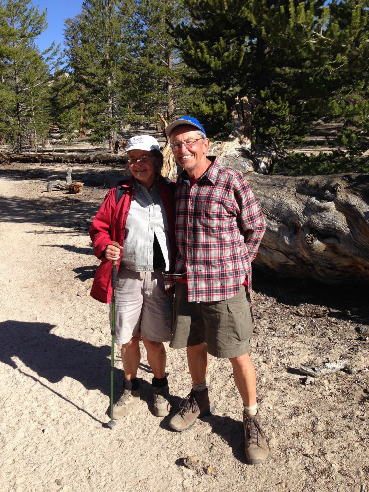
IMG_0853

The day hikers from Germany.

After getting up to Trail Pass and back on the PCT, I was overtaken by Coppertone. This time he was wearing clothing. He stopped, and we spoke for a few minutes before he ran on. He was in the habit of trail running each day and picked spots along the trail where he could both offer trail magic and run the trails.

IMG_0854

Coppertone tanned and fit at age 65.

Mid-morning I took a break at Chicken Spring Lake. It was a small lake in a wet, spongy, open meadow. One of the other hikers stopped there was a young blonde girl with the trail name of Blueberry. She was hiking with a group including a young fireman from Alaska called Snowman.   Snowman was tall and a bit pudgy. He had a habit of leaning slightly forward.

As I climbed up Cottonwood Pass, I leapfrogged a few times with Blueberry and then did not see her again.

I hiked with Snowman until he stopped, complaining of suffering stomach problems.

“I’m going to have to rest a bit.” Snowman sat hunch over on a rock beside the trail.   I left him worried he would be forced to turn back to Trail Pass.
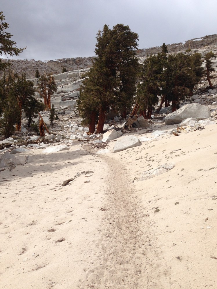
IMG_0856

The sandy trail.

IMG_0857

The trail was sandy. It was as if I was hiking on a beach only at 10,000 feet above sea level. I was up and over Cottonwood Pass and a few miles later started the descent down to Rock Creek. I camped along Rock Creek at mile 760. The camping area had bear boxes.

After leaving Kennedy Meadows, thru-hikers are required to carry a bear canister which was not easy to stow in my backpack and added two pounds of pack weight. My bear canister turned out to be difficult to remove the lid on cold mornings and required the use of the tip of the screwdriver of the mini Swiss Army knife to pry the lid passed the locking tab, an added annoyance.

As I set up camp, two section hikers built a campfire in their fire ring and invited me over. We three ate our dinners around their giant crackling bonfire.

Near dusk, Snowman arrived. I was relieved he had recovered. He said he was feeling somewhat better. As dusk turned to night, a few other hikers made camp under the trees along the creek.

The section hikers, returning from a weeklong camping trip to nearby hot springs, had many stories to share. I enjoyed hearing of their adventures. They offered to let me burn my paper trash in their campfire before I went off to bed. Waste of toilet paper, maps pages no longer necessary, other paper garbage (all of which hikers are required to pack out) is something I was happy to be rid of and burn in their campfire.

Day 69:

It was amusing to see the bear canisters lined up on top of the bear boxes when I hiked out in the morning.

I waved goodbye to my campfire mates as they prepared to leave in the opposite direction. Snowman was still sleeping.

In the morning, I arrived at the spur to turn off for Mount Whitney at mile 766. Most of the hikers along the trail were excited and making plans for the side trip to climb Mount Whitney. Many were planning to camp at Guitar Lake for an early morning ascent. I was planning to camp by the ranger station, rest for the day and starting climbing during the night.

It was a lovely day. I found the ranger station camping area at the far end of Crabtree Meadow. In a sunny spot at the edge of the meadow, I put up my tent and took a long, restful afternoon nap.  There was no one around.
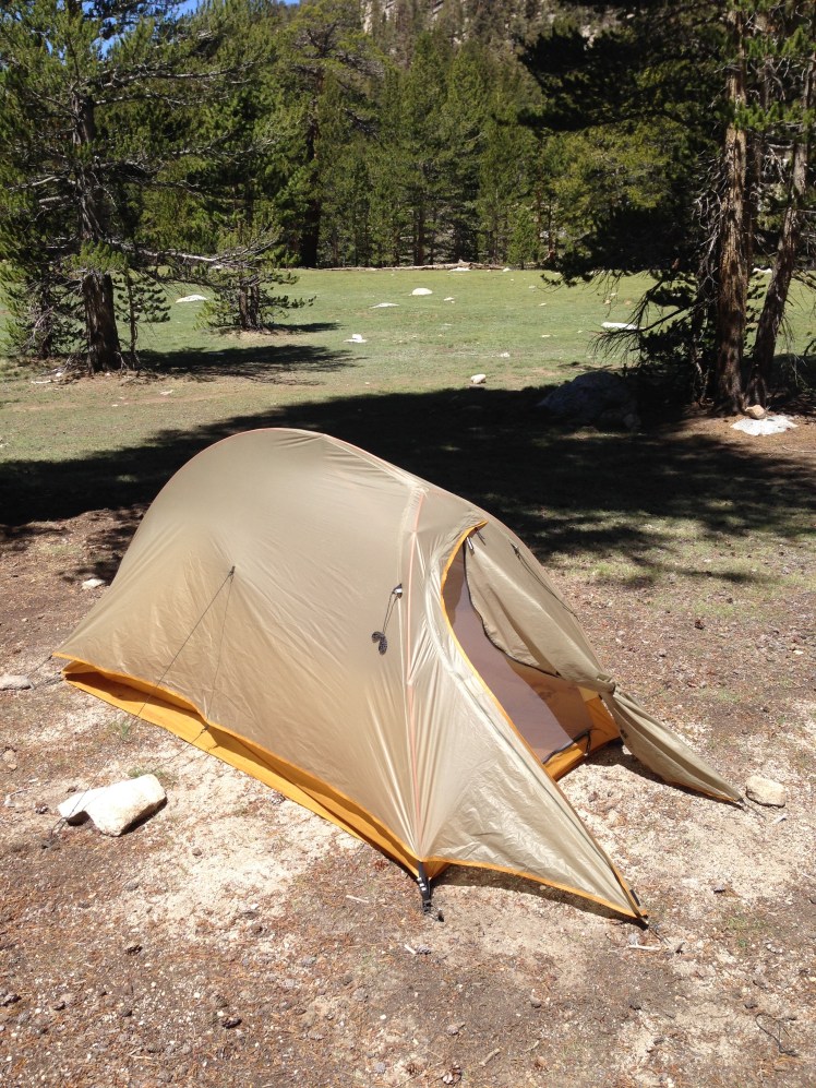
IMG_0864

Camping at Crabtree Meadow

While I was resting, I decided the bragging rights of climbing Whitney was not worth the chance of getting hurt and not finishing the PCT. I decided I should stick to my purpose. I could return to climb Whitney at a later date.

In the evening several hikers, including Buttercup, came back from Whitney and camped nearby. Each person was exhilarated but exhausted from the climb. I felt guilty about my decision to skip the Whitney attempt.

Day 70, June 9th:

In the morning, instead of the climbing Whitney, I, with feelings of disappointment, hiked back to the PCT.  Hiking the PCT had been on my bucket list too long to chance being distracted by side trips.

At mile 766, the PCT and the John Muir Trail (JMT) share the same path all the way to Tuolumne Meadows in Yosemite, except for one short section.

During the morning, I forded across Wallace Creek and then Wright Creek. Both were swarming with mosquitoes. As I did not want the weight of packing extra water shoes, I waded through the creeks in my shoes and socks. Because it was a sunny morning, the crossings were not uncomfortably cold.  My shoes and socks dried relatively quickly.

I gained ground and looking back down to a green meadow below, a large buck with a multi-pointed rack stood watching me, head aloft. It was a brief magical moment.
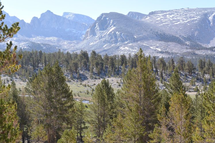
DSC_0066

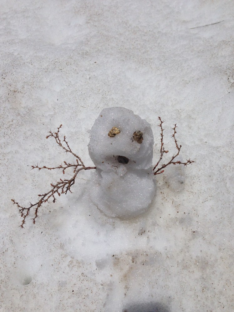
As the trail climbed higher, snow covering the trail. At one stretch of snow, I stopped to build a small snowman to greet the hikers behind me. I was feeling elated and eager to be heading into the high Sierras; although I knew it would be a terrifying challenge.

As timber area gave way to rocky, snowy terrain above the tree line dozens of marmots scampered about. The marmots watched me from on top of rocks and from the entrance to their cubbies.
IMG_0874

Before I started on the PCT, I knew my two most significant challenges would be the desert and the high Sierras. I had made it through the desert section. Now I was heading into the mountain passes of the High Sierras, I thought with both exuberance and fear. Looking forward to the challenge I tried to keep my thoughts positive to keep my fearful feelings in check.

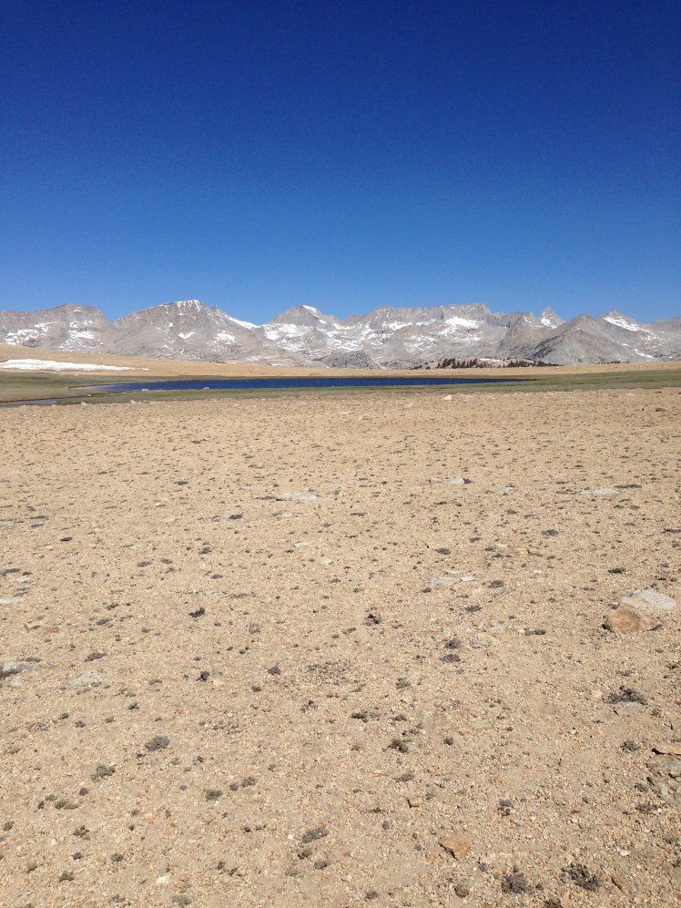
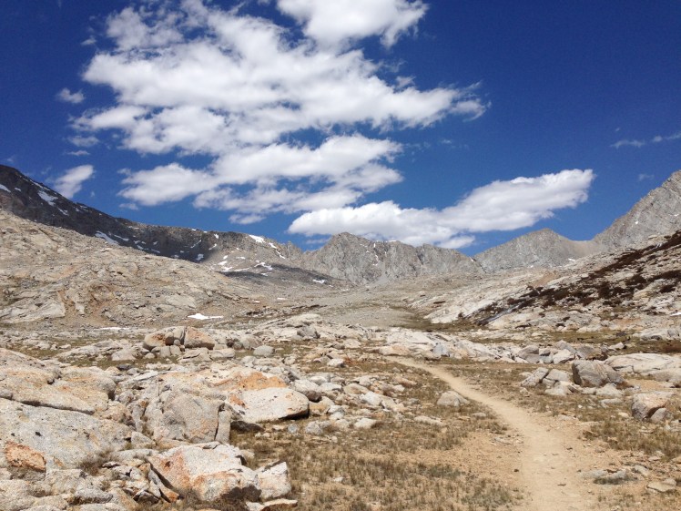
According to all I had read, the optimal time for crossing up and over each pass is late morning. If you arrive too early in the day, the snow will be hard ice. If you are up and over much after lunchtime, you will find yourself post-holing through soft slushy snow where you take a step sinking up to your hips. Post holing is time-consuming and tiring. I planned to reach each pass between ten in the morning and noon. On this day I was headed for a small exposed campsite below Forester Pass to have the optimal time tomorrow to cross over in the morning.
IMG_0870

IMG_0877

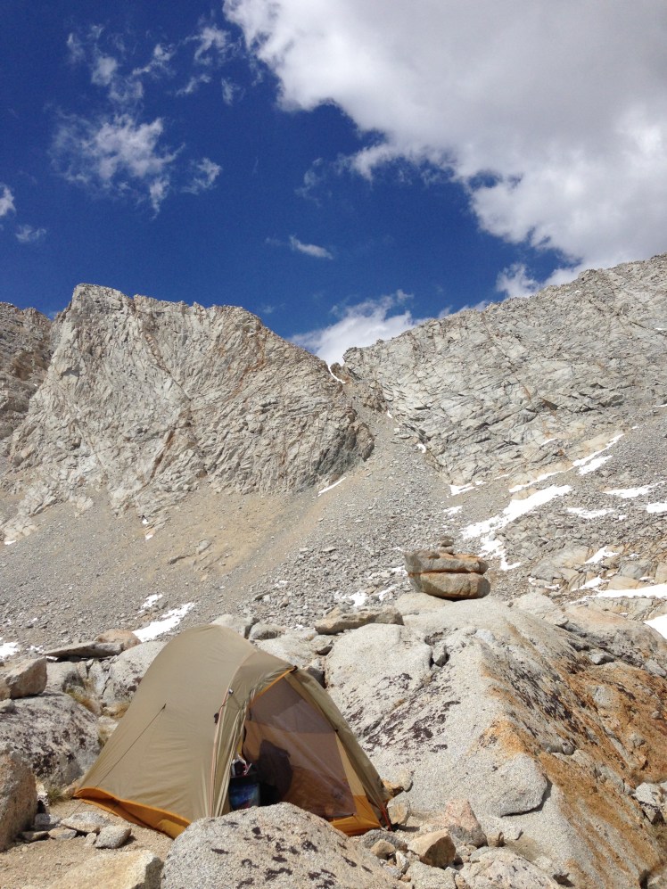
I arrived mid-afternoon, too early to camp, but decided to stay anyway. I had been post-holing my way through the snow to get to the outcropping of rocks forming an island surrounded by snow and partially frozen lakes. The campsite had room for one tent.
IMG_0884

My rock island

It was confusing which notch in the granite wall was actually Forester Pass. From the various tracks in the snow, I could see this had been a problem for previous hikers. It took observation before I was able to correctly discern which pass was Forester.

Several hikers passed my campsite, stopped to chat and ask the best way up Forrester.  I pointed to the pass directly ahead and watched as they continue, post-holing from my island to the granite rocks beyond. By watching others, I was able to observe the best route to get through the snow to the trail.

The switchbacks up to the pass were blasted into the side of an almost 90-degree rock face. I watched as each group slowly made their way up the switchbacks. I gauged the time it was taking each hiker to reach the top to know when I needed to leave camp in the morning.

As hikers reached the summit, hoots and hollers of celebration echoed down.

I shared my campsite with friendly marmots. They seemed unafraid. I suspect they were expecting food.

Before sunset, I fetched water from a nearby partially frozen lake. I could not tell where the edge of the lake actually began because of the ice and snow. I started for the lake wearing flip-flops. Every time I post-holed, my flip-flops came off. Finally, I removed the flip-flops and continued barefoot in the snow sinking with each step. When I got back to my island I was relieved I had not broken through the ice while acquiring water as the lake edge was obscured by snow and ice.

Sitting on my rock island filtering water, I watched the sunset and enjoyed the vastness of the wild around me. It felt as if I had landed on the moon so removed was I from anything familiar.

In the growing darkness, as I was resting in my sleeping bag, a hiker passed my tent. I thought perhaps he was going to camp at the next outcropping of rocks at the beginning of the switchbacks.   I got out of my tent to see where he was camping. Instead, he stopped, put on his headlamp and started up. One brave soul. I noticed he was carrying an ice ax and crampons and appeared dressed for the harsh weather. Still, Forester Pass at night. I was impressed and stunned and felt silly that I was sitting there worried to go up in the morning. I wished I had not been lying in my tent looking out the door when he passed so that I might have asked his name.

Day 71:

As planned, I left my campsite around nine in the morning allowing approximately an hour to reach the top of the pass. I was set to arrive at the optimal time.

Each step I took on the narrow trail of switchbacks blasted out of the wall, I repeated a mantra, “I’m okay, I’m okay.” as I made my way upward. I kept one hand on the wall to steady myself. Halfway up, I looked down and saw Buttercup starting up below and felt instantly more confident not being alone on the wall.

The infamous ice chute before the top of Forester had been traveled since the last snowstorm, and luckily the chute ice had footprints to step in. Crossing the chute took my full concentration and focus. I was truly terrified. I had no ice ax for self-arrest should I fall down the vertical snow chute. I could hardly breathe. Each step had to be slowly and thoroughly planned and executed. When I reached the far side of the chute, I stopped, clinging to rock.

“I’m okay, I’m okay,” I repeated waiting to catch my breath.

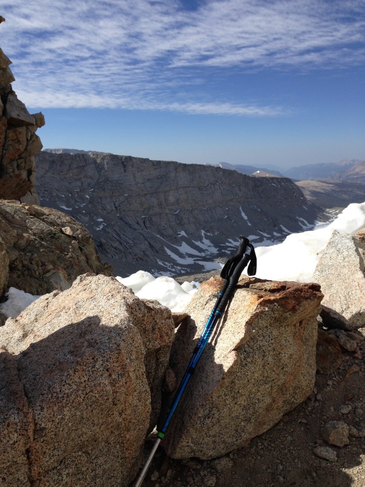
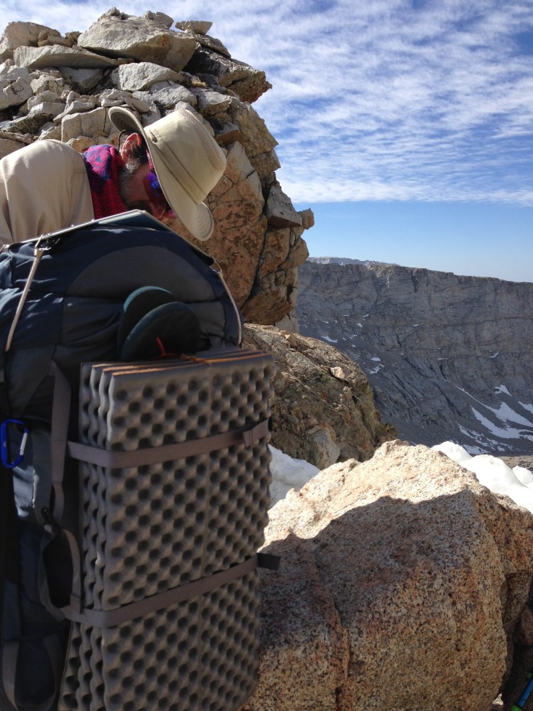
On top of Forester I took photos and was able to capture a video of Buttercup’s arrival just behind me.  Forester Pass is a challenge and an adventure, and I was gratified to finally be at the top. At 13,200’ Forester Pass was the highest point on the Pacific Crest Trail.
IMG_0895

Looking back from top of Forrester Pass.
IMG_0894

Buttercup arrived a few minutes after me.

I wanted to glissade down the glacier. Since I was hiking alone, I decided it was best to stay in the footprints crossing the glacier. This was not easy in running shoes.  Two guys ahead of me had slid their shoes like skis along the line in the snow making a slippery slide. It was too steep to step outside the track. I slowly traversed across the glacier and down across the ridge one slippery step at a time attempting to grip my running shoes into the snow. My shoes were too flimsy to make kick stepping workable.

Once off the glacier, there was no sign of the trail. In fact, I could not determine where the trail came out of the snow. It was too steep to see any sign of the trail below. Taking a guess at where I might likely regain the trail, I rock climbed down on all four. This was not easy. Climbing down the rocks was time-consuming and dangerous. Sometimes the snow between the rocks gave way under my footing leaving me uncertain where my foot would end.

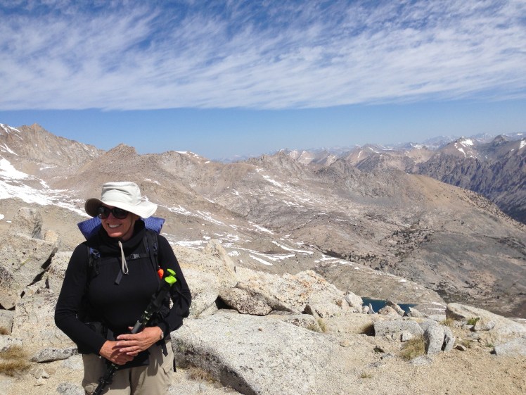
Once down off the rocks and on the trail, I was both euphoric and relieved to have made it over Forrester. Buttercup caught up with me. We stopped to celebrate, and we each took additional photos.
IMG_0898

Happy to be back on Trail after Forrester Pass

Shortly after our photo break, I was walking along looking up at the beauty of Kings Canyon when I became off balance and fell. Luckily, I was able to quickly turn and land partially on my backpack against the edge of a rock. The wind was knocked out of me, and for a moment I thought I might be seriously hurt.

Crockpot ran back up the trail to check on me.  Crockpot helped me up and waited while I caught my breath and to make sure I could walk again.

Soon Crockpot and Buttercup hiked out of sight.
DSC_0080

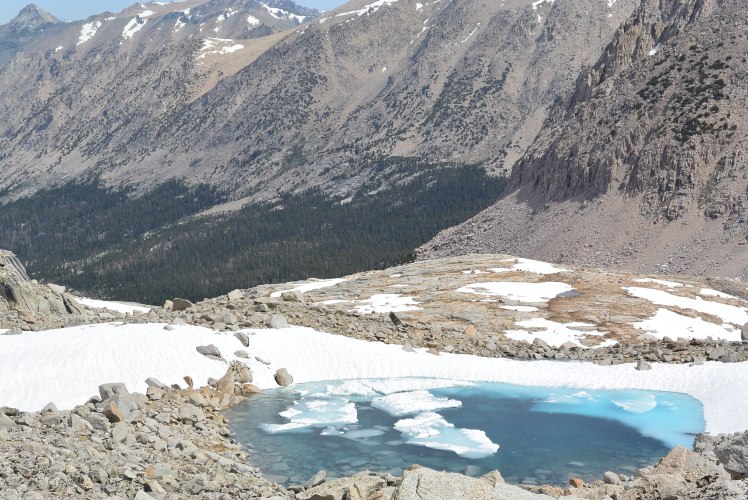
I was alone in the Gothic beauty of the cathedral-like spires of rock encircling the canyon. It was as if I had stepped inside a magnificent church.  It was a feeling of awe and euphoria to be surrounded by the natural beauty.

I kept looking up at the massive rock walls as I passed along several small clear azure blue alpine lakes. 

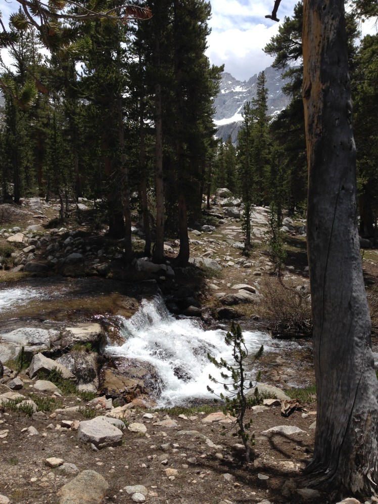
As the day wore on, I descended slowly into the forest. The creeks were rushing, bubbling and cold. I looked about at the abundance of water, stunned by the quantity of water now available for the taking after finding a water source had been the primary goal of every day in the desert section.

It was very pleasant and restful to sit beside a fast moving creek and watch the sun dance on the water while I enjoying lunch.

I did not see another hiker until near evening. I had the walk in the canyon all to myself, to enjoy at my leisure.
IMG_0902

Water !

I was not planning to go out Kearsarge Pass since I had resupplied at Lone Pine. However, late in the afternoon clouds moved in and immediately a thunderstorm materialized. It began to drizzle.

With lightning striking all around, I considered my trekking poles. Is it okay to hike with poles in a thunderstorm? Is it better to attach the poles to my backpack? Were the poles more likely attract lightening sticking up from my pack or in my hands? Do titanium poles attract lighting? I had no idea.

I decided to sit down by the turn onto the trail to Kearsarge Pass and wait out the thunderstorm. I weighed the pros and cons of going out versus continuing on in the rain and storm. If it kept raining, I decided to exit over Kearsarge Pass.

Presently, the rain stopped, and I was preparing to continue when around the bend came Snowman and the two sisters from Minnesota. The group included a section hiker with the trail name of Ginger*. I guessed his age to be in the late 30s. Both guys were apparently quite taken with the sisters who were young and beautiful with dark hair and long slender legs. The girls were a couple of years apart in age but easily could have been mistaken for twins. They had open and friendly personalities. I surmised the two lovely sisters were likely to receive an abundance of attention from the guys on the trail.

I contemplated how their parents must be feeling having not one, but two daughters out on the trail. How worried they must be.

The group was headed out over the Kearsarge Pass, planning to camp just before the pass, going over and out in the morning.

They invited me to join them. I was happy to agree. We set out hiking in a line toward the pass.   The sisters set a fast pace. I brought up the back end. After a few miles, we came to an open field by a stream, and everyone agreed this was the perfect spot to stop.

While we were enjoying our dinner, Solstice and Aussie came by and joined us. Solstice shared the wild onions she had gathered, and we each added the onions to our food. Afterward, we pooled our hot chocolate packets.  The sisters prepared a big pot of hot chocolate for everyone.

I noticed Solstice utilized her PCT handkerchief for cleaning out her Jetboil and then neatly folded it to stow inside the pot. Since Solstice had previous thru-hiking experience, I thought this a clever idea and I immediately adopted this method of clean up to help cut down on the amount of water required.

From this point on I would rinse the pot and spoon with a small amount of water to get most of the food off, then wipe each with the handkerchief, fold the handkerchief up neatly and stow it inside my Jetboil. Boom, cleanup done.

Day 72:

The next morning I got an earlier start for the climb over the pass, leaving camp before the others. Along the trail, a man stopped me offering peanuts accompanied by a religious rant I did not fully understand. I smiled and thanked him and hurried on uncertain if the peanuts were safe to eat. I decided it was best not to find out and placed the peanuts in my pocket.

Kearsarge Pass (11,771 ft) is stunningly beautiful. The view from the top is breathtaking back into Kings Canyon and forward down the Onion Valley. A series of lakes hung beautifully in rocks could be seen looking down the valley.

IMG_0904

I stopped to rest and test for cell reception. Bingo. It was a relief and elation to be able to catch up on emails and call home. I texted my daughter to let her know I was safe and read my emails.

On the hike down into Onion Valley, I ran into three separate parents hiking resupply food over Kearsarge Pass to the PCT to meet up with their thru-hiking children.   Lucky kids.

On the descent were many day hikers. I took every opportunity to chat with the day hikers just in case someone offered a ride to Independence.

Snowman, Ginger, and the two sisters passed me shortly before arriving at the trailhead. Right near the end of the trail, Solstice and Aussie ran past me. As I hiked into the parking lot, all six were loading their gear into an SUV and invited me to join them for the hitch down to Independence. Ginger sat in front with the driver. Solstice sat on Aussie lap in the backseat. I sat on Snowman’s lap. The two sisters sat in the middle of the backseat, one on top of the other. It was a crowded, smelly ride down the mountain.

Ginger tipped the driver for the hitch. Since he had sat in the front on the ride down and rest of us had squished up in the back, no one offered to pay Ginger back for their part of the tip. I thought about it for a minute.

At Independence, we went our separate ways. The other hikers wanted to go to Lone Pine. I had already been to Lone Pine and decided I would hitch the forty miles northward on Highway 395 to Bishop.

First, I stopped at the Chevron to pick up my resupply box. The Chevron station had a surprisingly good stock of resupply options so I need not have sent a box.

I purchase a large Corona. The man behind the counter informed me as he snapped the top off the beer that it was illegal to drink beer seated at the tables outside his station. He proceeded to put the bottle inside a brown paper bag.

“Here, drink it inside this bag.” He offered, as he handed it to me.

I was hot and thirsty. The beer tasted refreshing. I never thought I would see the day I would be drinking beer, much less beer out of a bottle in a brown paper bag, in front of a Chevron gas station. It was surreal.

The last bus to Bishop had already departed Independence.  Standing beside the busy Hwy 395, the primary north-south highway on the East side of the Sierras, made thumbing a ride risky.

I decided my best bet was to observe the cars pulling into the station going northbound and ask for a ride, choosing the vehicle myself. I finished the beer and approached a middle-aged couple. No way. Next, an older Mexican man stopped and went into the Subway shop next door. When he came out carrying a sandwich, I ask for a ride. He was taken by surprise but agreed.

As he drove north, I learned he was an insurance investigator going north beyond Bishop. He spoke of his daughter. She had finished college, had a good job, and had recently purchased her first house. He smiled with parental pride.

He asked about my trip. He had many questions about my gear and about the PCT. As with most people, he was unfamiliar with the trail.

Dropping me at a motel in Bishop and he would not accept money for the lift. He waited to see if a room was available before he drove off.

I showered, cleaned my gear up, and climbed into bed. Apprehension slowly subsided. I was safely inside four walls.

Day 73:

I decided to take a zero. I wanted the feeling of being safe one more night.

I had the worry of Glen Pass on the trail ahead. It was known as the most challenging pass because of the sharp cornice at the top. I studied and asked around Bishop for other options of getting back on the trail further north to avoid Glen Pass. In the end, I decided it was best to stick with the PCT and go up and over Glen Pass.

Day 74:

I caught the bus to Independence arriving around nine in the morning. I sat outside the Chevron station again. This time I was looking for anyone appearing to be heading up the mountain for hiking or camping.   It was Friday, this should work. The first person I asked was headed up to camp at the Onion Valley campsite at the trailhead and agreed to take me along. One and done. He was a mailman from LA going on a weekend campout.

It was a late start for the day of hiking. Because I had to make it over Kearsarge Pass, it was late in the day when I started up Glen Pass (11,947 feet). It was a chillingly cold bright day.  I passed small crystal clear blue alpine lakes surrounded by rocks and snow on my way up Glen Pass.

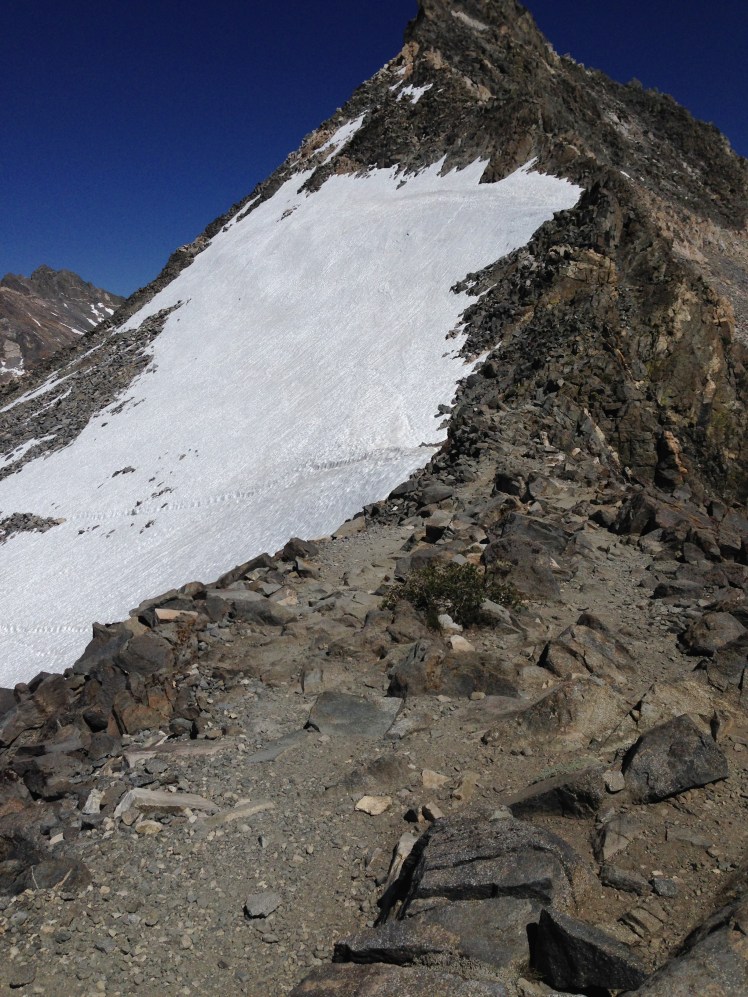
It was well past my planned optimal time for going over high passes. Because of the bitterly cold wind, post-holing was not a problem getting down off the glacier.  Several trails of footsteps traversed high across the glacier.
IMG_0908

I took a deep breath and made my first step into the footprints ahead and tried not looking down.

“I’m okay. I’m okay.” I repeated over and over again with each precarious step forward.  One misstep and I would fall down into the rocks below. It was here I convinced myself if I was safe at the moment, it was best not to concern myself with what “might” happen in five minutes or an hour or a day in the future. Being safe in this very moment was all I need concern myself.

Once across, I sat down on a rock to plan the best route down the pass, looking for anything that might determine the trail ahead.

I knew from the map I generally needed to be on the left side of the lake below, but could not visually see an indication of a trail. As I sat looking at my map, I made out two hikers coming up along the lake. By observing their path forward, I was able to see how I should best descend through the rocks and snow to the trail.

By the time I rocked climbed down and located the trail, it was late in the day. I made camp at mile 794 along Rae Lakes. I found a spot with a lake view.  By locating my tent up against a small tree, I sought coverage from the raw wind blowing directly off the lake. It was scenic. Beyond the icy blue water, jagged mountains outlined the horizon.

I sought immediate refuge in the tent and my warm sleeping bag.  It was freezing cold.

Day 75, Saturday, June 14:

I had been lucky with Glen Pass. It was a cold day, and the snow had not softened.   I did not want to push my luck with the snow on Pinchot Pass. I was on the trail before dawn. It was a frosty morning as I made my way in the early morning light.

I was pleased with my extra early start. About a mile or so down the PCT, I was stopped by a log crossing.   The crossing was located over a stream where an upper lake emptied into a lower lake. Three small diameter logs placed side by side formed a bridge. Usually, this crossing would have been relatively easy. However, at this hour of the morning, the thin logs were covered with a sheer glaze of solid ice.

Wading across was not appealing. I could not tell the depth of the fast-moving water. I looked around for other material to add to the logs to stabilize my footing. After adding brush and several small tree limbs to the bridge, I tried crossing again and found it still too precariously icy.

Locating a small log in the surrounding debris, I realized this log could help me cross. I struggled to drag a log forward to add to the bridge. It was too heavy.

I had wasted an hour of the precious morning trying to get across. I sat down, upset and frustrated. I wanted to cry.  I felt defeated and vulnerable.  I fought back tears. I had no time for this.  I must find a way forward.

Contemplating circling around one of the lakes seemed the best option.  I was trying to determine which body of water would be most accessible to bush wack around when suddenly Ginger came along the trail. Together we pulled a log forward and heaved it across the water next to the other logs. As the log flew forward through the air Ginger’s glove flew into the water.  We watched the glove float quickly downstream twirly in the water, too far out to rescue.

The log landed next to the other logs. It was a small log, however an extra log free of ice gave stability to our footing to cross over.  Ginger crossed over first. I followed slowly.

On the far side, I hefted my pack up on the rocks above and crawled up and out of the ravine and watched Ginger in his orange jacket disappear down the trail.

Later in the morning, I came to the suspension bridge over Woods Creek. The sign said simply: “One person at a time on Bridge.” At the far side of the bridge, a sign marked mile 800.

IMG_0913

After the bridge, the trail ahead was the 3,600 foot climb up Pinchot Pass (12,139’). It was a long slow climb through timbered forest. Just when I thought I knew the direction the trail was headed, the trail turned, and I realized I knew nothing about the direction to Pinchot Pass. I was unable to determine the exact direction to the pass until I was on the final approach.

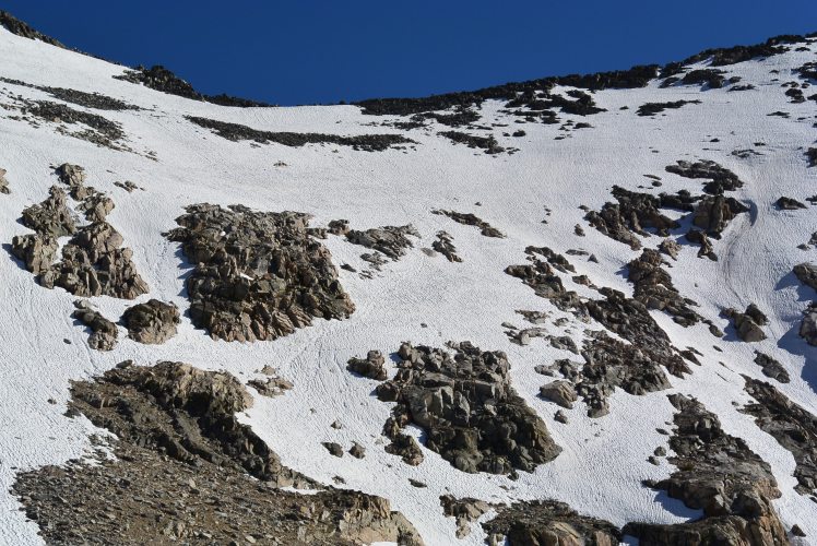
When I made the top of the pass, it was much later than anticipated. I had a harrowing climb down through the soft snow. Each step sank into the softening snow making it difficult to get one foot out before the next foot went down into the snow. I post-holed off the pass.
DSC_0085

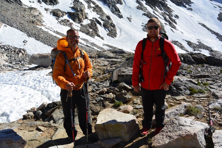
Just as I reached the rocks below, Snowman and Ginger glissaded off, sailing up to me. It was a joyful scene.  I wished I had felt carefree enough to glissade down. I stopped to take photos of their happy smiles.
DSC_0088

Ginger and Snoman

After getting down over the pass and descending back into the forest, there were several stream crossings which took time to scout out the best places to cross over. At one point, I heard screams, splashes, and laughter. Someone had fallen into a creek behind me. I stopped to listen. Hearing several voices, I guessed my assistance was not required.

Shortly, I was leapfrogged by Spirit Fingers, Apple Butter, Jambo and Mountain Spice. I had met Spirit Fingers and Jambo at Warner Springs and again on the hike out of Whitewater. They were hikers one noticed. He hiked with his guitar, and she had a banjo. They were longtime friends who had hiked the AT (Appalachian Trail) together. The group had also been at Hiker Trash Mikes place the same night I stayed and I had listened to their music as the younger crowd gathered at the campfire after I had gone to bed.

Today they were hiking quickly and were out of sight in a few moments.

Later, I came to a fast moving river with no visible, easy crossing. There were several large boulders in the river too big and high for me to jump up on top with my backpack. I was assessing my options when Apple Butter returned on the trail across the river.

“There’s a big log upstream,” he shouted over the roar of the water pointing in the direction he wanted me to walk.  I cut through the dense underbrush and made my way upstream several hundred feet to find the large diameter log across the river. He waited for me to cross over.

“Thank you so much,” I was out of breath. “Thank you!”

“I didn’t want you to fall in all by yourself. I fell in,” Apple Butter smiled and motioned back down the trail. “And was happy I was not alone.”

It was a thoughtful gesture, so polite, for a young man not yet twenty.

Very soon after the crossing, I camped with Spirit Fingers and the group along the Kings River at mile 812.

Day 76, June 15:

The next morning I slept in, not wanting to prematurely wake the others. Somehow I still managed to get a head start on the day. The others were hanging out their sleeping bags to dry the condensation in the morning sun as I departed.

Each member of the group passed me early in the morning. I caught up with Mountain Spice right before the top of Mather Pass (12,096’). It was early morning.   The pass was solid ice. Mountain Spice stopped and put on crampons. I followed behind trying to use her footsteps for footing as I did not have crampons or an ice ax for cutting steps. It was slow going and below freezing. I was happy to have a baklava and a muff for extra warmth. Glissading down was not a good option as there were rocks visibly peaking out of the ice.

As we neared the bottom of the glacier, a hiker came glissading past, hit a rock causing her to flip over and gear to go flying through the air. Water bottles, flip-flops, and other items were strewn about over the rocks and ice.

“Yard Sale.” I turned to Mountain Spice as we looked down, happy we had decided not to glissade down. “That’s likely to leave a big bruise on her backside.”

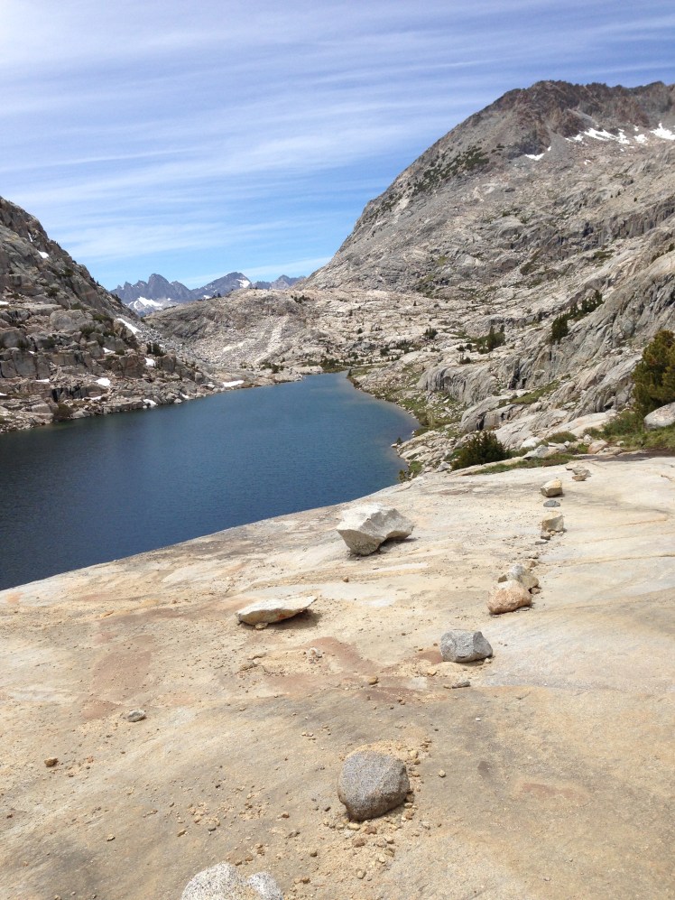
After the descent of the pass along a series of small alpine lakes and streams, Mountain Spice and I stopped at a stream crossing from one lake to another. We found a grassy area out of the sharp cold wind near a rock and watched Spirit Fingers catch fish with his hands. In the protection of the rocks and out of the wind, I warmed up.
IMG_0919

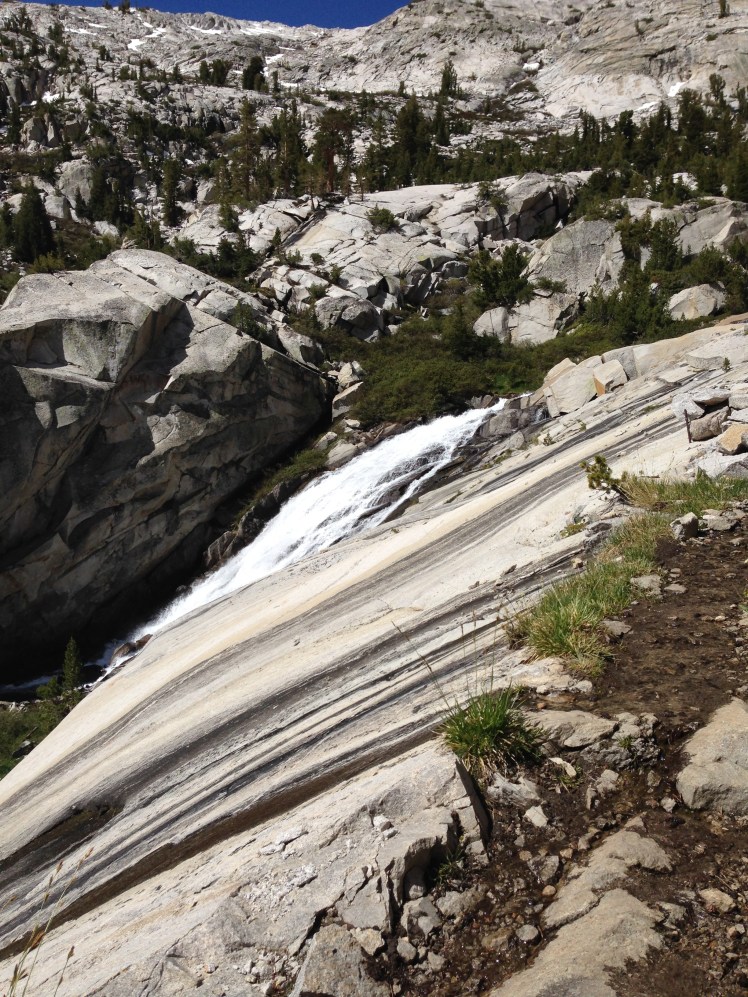
In the afternoon we hiked down multiple golden granite cliffs inside steep rock canyon walls.   It was a long descent before arriving alongside a meadow and less steep terrain.
IMG_0921

I camped again with the same group at mile 828. We were joined at the camp by other hikers, including a young man named Happy Feet.

In the evening we gathered around the campfire. I learned Mountain Spice was given her name on the AT by accidentally knocking embers into one of her fellow camper’s dinner. The camper, without pause, quickly responded, “No problem, it’s just mountain spice.”

I had lost weight. By this time, my pants were much too large for me. The oversized hiking pants were causing chafing on my inner thighs. Even the Glide in my medicine bag was not helping the chafing. Time to make a change.

Day 77, June 16:

The next morning I opted to hike out in yoga pants. I had packed the yoga pants for wearing on town visits when my hiking clothes were being washed. I was hoping the tightness of the pants might not rub on the chafing on my inner thighs. Also, these pants could possibly dry more quickly after stream fords. It turned out to be a propitious decision. The pants worked well and I ended up hiking in the yoga pants all the way to Snoqualmie Pass in Washington State.

The approach to Muir Pass (11,973‘) was snow covered.  I looked up and saw nothing but snow ahead.  There was no discernable trail. Footprints in the snow headed in several directions. It was intimidating and unsettling.

Apprehensively, I passed onto the snow wondering what I was getting into.  Most of the footprints headed up the mountain to the left. Following the footprints, I headed upward cautiously making certain to step in the existing footsteps.   After some distance, I checked the GPS and found I was off the trail. Slowly, I retrace my steps back down until my GPS again indicated I had found the trail under the snow.

I had to guess again which footprints to follow and hoped for the best checking my GPS frequently to make certain I stayed on the trail. It was a gray, cold, windy morning.

The same creek had to be crossed several times, wading through the water over and over from one side to the next following along the best I could. Sometimes there was a cairn along the creek marking the crossings. Other times, I had to look for the foot traffic wear at the water’s edge. In several places, I clambered over snow bridges completely covering the creek. I was afraid a snow bridge might give way under my weight. It was unnerving listening to the rushing water below the snow.

My feet, shoes, and socks were soaking wet from the constant stream crossings.

A fast-moving hiker overtook me headed upward to the mountain pass on my left. According to my map, he was going in the wrong direction. Studying my map, I saw a few feet of exposed trail along the edge of Helen Lake on the right and knew I needed to head toward the lake.

“Hey! Stop.” I shouted up to the man and pointed dramatically to the trail and pointed to my map.

At the lake, I noticed Mountain Spice ahead and hurried to catch up.

The last mile was slow going trying to get our footing in the snow without slipping backward. There was no trail to follow. Fog encased the mountain top making visibility poor.

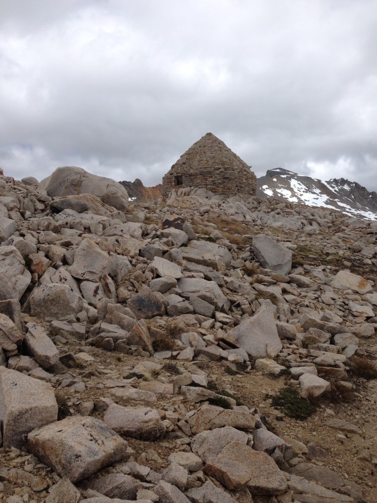
When we caught sight of Muir cabin through wind and clouds at the top of Muir Pass, we both let out happy yelps. We had found the correct pass. We had made it to the top of the Muir pass.

Mountain Spice and I went inside the cabin to warm up and take a much-needed food break. The rock cabin provided protection from the wind; however, the darkness inside the cabin felt cold and damp.

While we were in the cabin the clouds lifted.
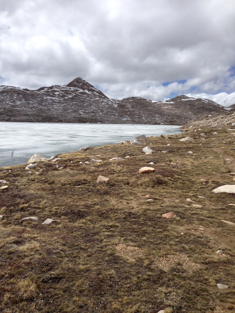
IMG_0924

Looking back at Muir cabin after starting down.  Luckily there was no snow on the descent.
IMG_0925

Muir Pass was the only pass in the Sierras harder to climb up than to climb down because of the amount of snow on the approach. The trail down the pass was clear. It had been a harrowing day. Mountain Spice and I camped at mile 846 and waited for the rest of the group to catch up. We were surprised no one else in the group arrived by the evening, nor as evening turned to night.

Day 78, June 17:

The next day, there was no sign of the others. Mountain Spice was worried about her group. I was worried as well, mitigated by the realization I needed to cross Evolution Creek in the morning while the water was at it lowest for the day. Creek waters generally rise as the snow melts during the day.   The increase in the temperature during the day makes water levels rise.  Creek fords are safest in the early morning hours.

While Mountain Spice waited for her friends, I hike out worried about fording Evolution Creek (mile 850) alone.  The crossing can be treacherous in high snow years.

I unsnapped my backpack in case I fell in and slowly waded across making sure each foot was stable before proceeding with the next step, my trekking poles added stability.   Facing upstream, legs bent to meet the oncoming rushing of water, I crossed over to safety. The water had reached above my knees. After worrying all night, I had crossed safely. The swift, cold water was challenging but not dangerous.

Evolution Valley is stunningly beautiful. It was a lovely day surrounded by breathtaking scenery. It was also a pleasantly relaxed day. First I passed through a broad valley with open meadows. Then the views changed to rushing rivers cutting through timbered canyons. There were two crossings of the South Fork of the San Joaquin River across first a wood bridge, then a steel bridge. Next, a steel bridge crossed the Piute Creek. Because the hiking was easy, I was lulled into deciding to leave the trail and check out the Muir Trail Ranch. I had read about the Ranch and was hoping by chance it was now open for guests.
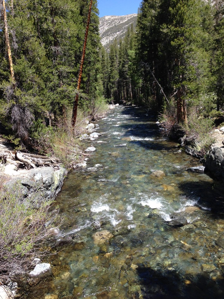
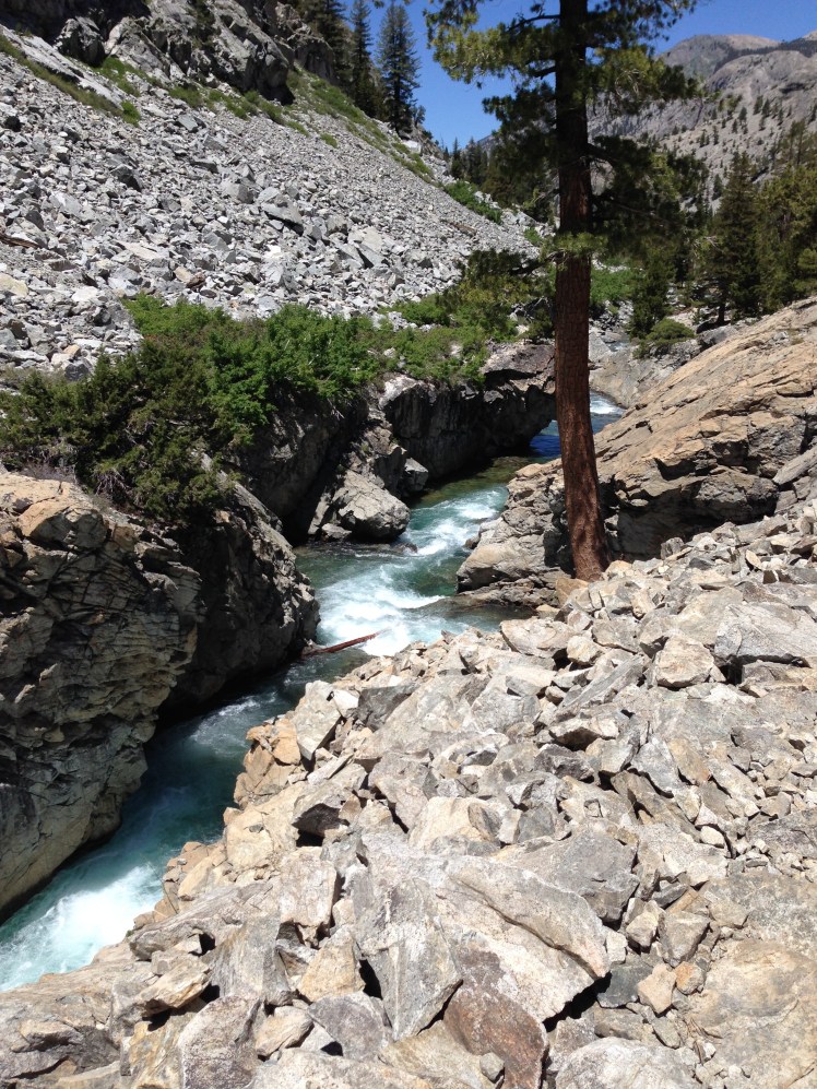
IMG_0927

IMG_0928

I arrived at the ranch while the owners were busy getting ready to open for the season. They graciously offered to let me recharge my cell phone, which took almost an hour. I waited, resting in the shade of a tree, stretched out on grass. I had not seen anyone all day. Staff members occasionally passed by and stopped to ask about my hike. In my loneliness, I was eager to engage in conversation.

The Ranch is a popular stopping point for John Muir Trail (JMT) hikers, and these hikers make up the bulk of their summer business. Since the camp was not yet open, I considered stopping for the night at the nearby hot springs but decided against it when I learned I must ford a stream over to the hot springs and then back again first thing in the morning.

Around six in the evening, I left Muir Trail Ranch and started the hike up Selden Pass (10,910’). My plan was to go up and over the pass before stopping for the night.

It was getting dark before I made it to the top of the Pass. I stopped somewhere between mile 862 and 864 and put up my tent in the growing darkness near a lake. It was a cold night. I slept with my baklava, gloves, and muff on. I zipped my sleeping bag up around me. It was too cold to sleep. I tossed and turned. In the middle of the night, I ate a candy bar to refuel my body. It was a long night. I slept little. I slept poorly.

Day 79, June 18:

In the morning I found the water inside my water bottles frozen. I was happy I was in the habit of sleeping with my water filter in my sleeping bag as freezing the filter cartridge ruins the filter causing it to no longer safely filter water.

I hurriedly got underway, not taking time for breakfast. I could not make coffee with ice. At the top of the pass, I saw a young man cowboy camping. He had smartly camped high above the lakes where it was warmer than my lakeside campsite.

This morning I passed along several lakes making the time scenic and enjoyable. My morning break had a view of Marie Lake. Coffee and an energy bar refreshed me. I immediately felt warmer.
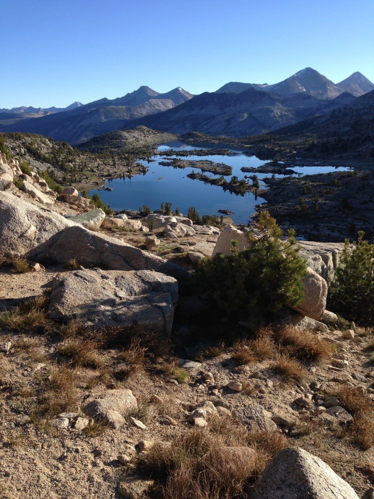
IMG_0933

Hiking off Selden Pass

I knew I had the Bear Creek crossing ahead of me. According to the map, “Bear Creek can be a difficult ford”. I knew not what to expect. But I knew I wanted to be there in the morning hours.

When I arrived at Bear Creek (mile 869), four JMT hikers had just crossed over and were changing from water shoes into hiking boots.

“So where’s the best place to cross?” I asked looking out across Bear Creek, “How deep is it?”

One of the men stood and pointed out where the water changed depths causing a ripple in the fast current.

“Just there. We cross just there.” He pointed, “The water is not above mid thigh.”

I thanked them for the information and unsnapped my pack. The four men watched from the shore as I sloshed through the water in my shoes and socks and continued on the trail, slowing only to re-snap the belt and chest straps of my pack.

The JMT hikers were easy to identify from the PCT thru-hikers. The JMT hikers most often carried huge backpacks, hiked in boots, smelled like soap, and camped early at wonderfully scenic locations. PCT thru-hikers carried small packs, hiked in running shoes, smelled like sweat and urine, and camped wherever they happened to be at the end of the day.

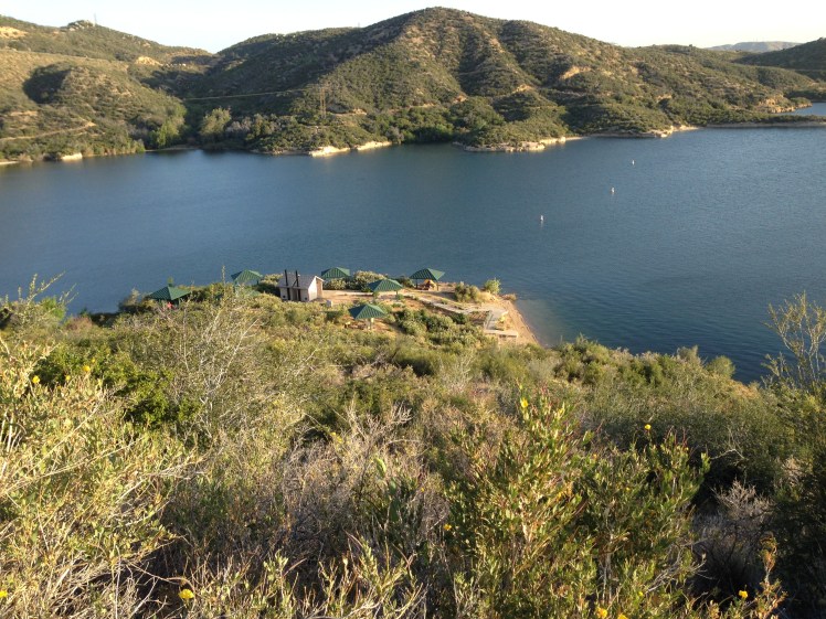
There was a shortcut into the Vermillion Valley Resort (VVR). However, I was determined to have the full Vermillion Valley Resort experience by hiking to mile 879 and taking the ferry to the resort.

Around noontime, I slipped on a mossy rock in a small creek crossing as I was jumping from rock to rock. The stream was only a foot deep. I laughed and guessed I could use this unexpected mini bath.

After I had hiked up the mountain to get into the valley on the north side of Lake Thomas A. Edison, there was a sign at Bear Ridge Trail Fork (mile 875) indicating the ferry was running once each day first thing in the morning due to the low water depth of the lake. Not wanting to wait overnight for the morning ferry, I started down Bear Ridge Trail. It was another added 7.3 miles to the VVR.

Getting to the VVR was very confusing. Many of the hikers who opted for the shortcut got lost and called the resort to be picked up. The map directions were confusing. Luckily, I could see the resort in the distance when I arrived at the lake.

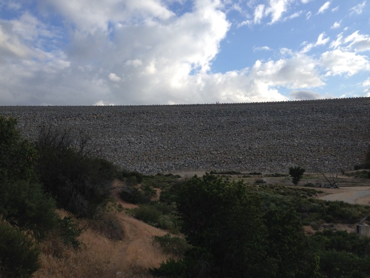
I decided to climb over a gate and walk along the dike, then walked along the lake shoreline. By the time I arrived, I was hot and more than a little upset over the confusing directions of the map. I was also irritated no notice about the ferry closure was posted at the shortcut turnoff trail I could have taken saving the climb up Bear Ridge.  I arrived at the VVR in bad humor.

The pleasant welcome and free beer quickly changed my sour attitude.

Free camping was available in front of the store but the tents all crammed together appeared to me an uninviting place to stay.  I was relieved a tent with a cot and a wood floor was available for rent.   My tent ‘hotel room’ had a bear box, a picnic table, and a fire pit, plus a full views of the lake from the front deck.  I collected my resupply box and settled into before I queued up for a shower. The shower tokens allowing three minutes of hot water.

Unfortunately, the sign-up sheet for the laundry was very long.   I decided to wait for morning to wash my clothes.

The food at VVR restaurant was excellent and the servers efficient and friendly. I was happy I had planned a zero day to look forward to.

After eating a tasty dinner and chatting with other hikers, I retired early. I had made it through the High Sierras! The desert and the High Sierras were behind me! My two biggest fears of the trail were over. It was a satisfying feeling. I had made it through the desert by being willing to cut back on pack weight and foregoing hot food. I had made it through the High Sierras by learning to consume my food each day to lighten my load.

I learned to stop worrying about what might or could happen in the future.  If I am okay right now–I am okay. This moment is all that should matter.

Through the High Sierras of the Pacific Crest Trail, it is estimated more than half the hikers have quit in any given year.  I was happy to still be standing, or hiking in this case.

Day 80, June 19:

During my zero at the VVR Happy Feet, Mountain Spice, and Spirit Fingers arrived. It was good to see them again.
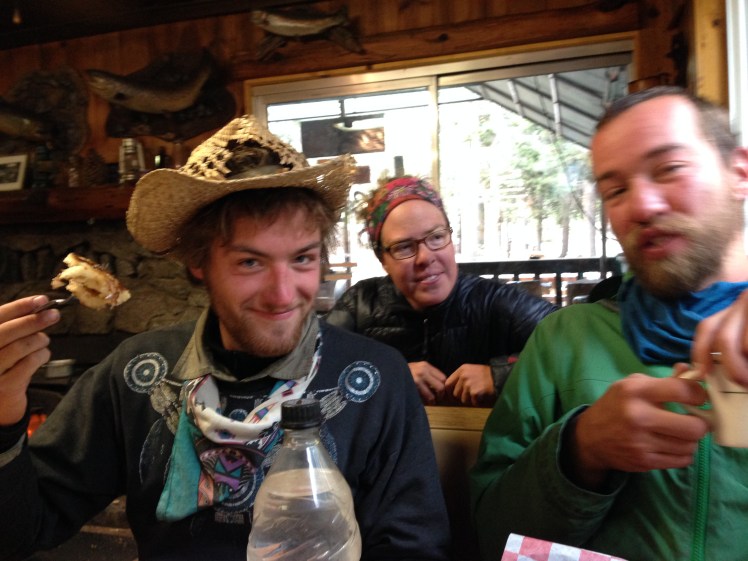
IMG_0936

Breakfast with Spirit Fingers, Mountain Spice, and Happy Feet

On the trail, I became very attached to the hikers I spent time with. Most of the young hikers hiked in groups of two or more people. Either they started as a group or fell in together. Not many of the younger people hiked alone. Early on the trail, I had met hikers I could have fallen in with for the rest of the trail, however, because I had taken so many breaks from the trail I had lost contact with those few persons hiking at my pace.

The first three hours of each day I can keep up a three mile an hour pace.  Otherwise, I hike at two miles an hour, including breaks. This is a slow pace.

Older men I spoke with on the trail were typically annoyed at being passed on the trail by young hikers. It was something I accepted early on, indeed had anticipated when planning the trip. I had to make certain I started earlier in the day and took advantage of every daylight hour. It was a matter of keeping my ‘running shoes’ on the ground for more hours each day to make up for my slower pace.
PCT SEVEN

CHAPTER SEVEN (TEHACHAPI PASS mile 566.5 to KENNEDY MEADOWS mile 702)

LESSON LEARNED: Hyperventilating leads to further anxiety.

The trip preparations and planning had taken six months before my departure in April. Research required scouring the web for lightweight gear, reading equipment recommendations, and studying other hikers gear lists.  I purchased the lightest gear possible fitting my comfort level after spending endless hours on the computer comparing products and weights.

Having no outdoor equipment stores in the Palm Springs area, I made many shopping trips to the REI store during trips to Seattle.  REI does not always carry the lightest gear available and many items were purchased online.

There had been fits and starts. Originally, I had planned to use a lightweight stove burning fuel tablets and/or alcohol.   In early 2014 open fires were to be banned along certain trail sections and I decided to switch to a JetBoil.   The JetBoil added extra weight but had the advantage of ease of use.

Having a history of breaking several trekking poles, carrying a tent requiring trekking poles to pitch seemed a disaster. The Big Agnes Fly Creek UL1 was my tent of choice.

I had ordered several sizes of Sawyer filters before I found a workable size to filter water without too much weight.

On the trail, I was thrilled with my choice of gear, my painstaking research paid off.

My pre-planning of food was less successful. It took several weeks on the trail before I settled on the food that worked best for me.

I had sent seventeen resupply packages to locations along the way. Meals planning required a spreadsheet of the trail, showing miles to be hiked and days between box drops.

The meals sent in the resupply packages did not work out as planned. Early on I found I did not wish to take time in the morning to prepare oatmeal or grits. It was easier and faster to eat an energy bar and have no cleanup. I had planned to eat two Gluten-Free Kind bars for lunch. I became allergic to these bars and had to purchase lunch items in towns.  When I picked up my resupply packages the oatmeal and Kind bars were placed directly into the hiker boxes. The hiker boxes were overloaded with oatmeal, as hikers became tired of oatmeal or changed their minds as I had.

My preferred lunch most often became a foil pack of tuna with individual packets mayo and mustard stirred in.   I made my own trail mix in town stops for morning break. In the afternoon I often ate cheese as a snack. Dinner was normally instant potatoes with freeze-dried vegetables along with some type of meat such as spam or a cut up pepperoni stick or freeze-dried chicken. Once or twice during each section, I varied dinner with a freeze-dried packaged meal. I did not want to carry packaged dinners for every day because of the weight of the waste after consuming these meals and the wait time required before the dinner could be consumed. I kept it simple. I was not interested in elaborate meals. I was on the trail partly for a break from meal planning and preparation. Instant potatoes were quick and easy.

My special treat was a daily candy bar, most frequently eaten after dinner. Since chips are lightweight, I left every trail stop with a bag of some type of chips in my pack. I got teased for eating Pirates Booty, but hey, they’re lightweight.

In town stops, I organized the food separating each day’s food into a large zip lock bag. Each morning I placed the bag of food for the day inside on top of my backpack for easy access. Many hikers munch as they hike. I preferred to stop and sit down to eat for morning and afternoon snacks and for lunch.  I do not enjoy eating while moving down the trail as it never seems filling.

Planning for, obtaining, and filtering water was a big part of each day. I left town stops with four one-liter bottles of Smart water.  I kept one bottle on the breast strap in front of my backpack attached at all times for easy access while hiking. The other three were in my backpack side pockets. At each resupply town I purchased Gatorade and after drinking the contents used the wide mouth Gatorade bottle to capture water from streams. The wide mouth worked well for this purpose. The Gatorade bottle thereafter stored unfiltered water. The Smart bottles were for filtered water only. I purchased new Smart water bottles in town as on the trail the bottles became gritty and dirty. I filtered all water along the trail except water from potable taps or at the source of a natural spring.

Day 55:

Highway 58 is a busy divided four-lane highway with heavy traffic between Mojave eastward and Tehachapi westward. Because of the length of time to drive from La Quinta, it was a late start getting back on the trail Sunday, May 25th. It was disconcerting for my husband to drop me off and say goodbye at the edge of a busy highway with nothing around. He questioned my going.

I stepped out of the car. Retrieved my pack from the trunk. Took my trekking poles off my pack. Signed into the PCT register and looked up the trail. The trail followed back along the highway for a couple of miles before disappearing steeply upward.

Jim was meeting me in a few days at Kennedy Meadows to switch out desert gear for mountain gear. Because I had already taken so many days off the trail, I was planning for him to bring my gear instead of my going home.   Before I had hiked out of Campo, I had sent a bear canister, micro spikes, and an ice ax to Kennedy Meadows.

Having hiked stoveless since coming out after the San Jacinto Mountains, I was looking forward to adding the Jetboil back into my gear at Kennedy Meadows. I had decided against taking an ice ax and micro spikes in the Sierras to save pack weight and needed to send these back home. I was exchanging the Zpad for the NeoAir. And I was adding a heavier weight Smartwool top to my clothing mix.

As the trail headed away from Highway 58, it became very steep. It was midday and well over 100 degrees. When possible, I took breaks under the few mesquite trees along the trail. Ahead of me lay a 2200’ gain in elevation.

Trees were few and far between. Halfway up the climb, I came upon two hikers under a tree. I stopped to talk. This is how I met Rubiks and Apache.

“Hi, I’m Rubiks.” A wide, stocky 24-year-old former rugby player with dark curly hair, Rubiks had a big happy smile. “What’s your name?”

“Lucy, well…Homegirl is my trail name.” I still had not become accustomed to using my trail name in introductions.   We exchanged the usual trail questions about where we were from. Rubiks was smart, friendly and articulate.

Further up the trail under the next tree, Apache and I rolled out our Zpads and both of us took an afternoon nap.

In his early twenties, Apache had feathers stuck straight up dramatically around the brim of his hat. He was slight and quiet. He had hiked the PCT in 2013 and had been snowed off the trail in the North Cascades 200 miles before the border into Canada and had come back this year to re-hike the entire PCT, determined to get to Canada before the snow started falling.

Stopped short of his goal just before the finish, he had started all over again. His determination and perseverance were stunning and admirable.

IMG_0812

Reaching the 6000’ level, a strong wind swept across the ridge making it difficult to walk. A mile short of the campsite at mile 574, I sought shelter from the wind and sun under a stand of mesquite trees and set up my tent. It was early, but I was worn out from the excessive heat.

Apache came by and hiked on. A gregarious hiker named Cheetos came by.

He was a leader of a group of five hikers headed for the campsite at mile 574. We talked as he was waiting for the rest of his team. Cheetos, a bartender from Honolulu, was enthusiastic and friendly. From the description of his fellow hikers, I gathered Mermaid was with him. We talked for a few minutes, and when none of the others of his group arrived, he eventually continued on.

Day 56:

In the morning I passed Cheetos’ campsite as the group began to stir about. A few more miles down the trail, I passed Apache asleep on top of a large flat rock.

The trail merged into a deeply rutted dirt road. On a downhill, I slipped on loose scree, lost my balance and fell. I was not hurt, just surprised. One moment I was daydreaming then, bam, I was down, flat on top of my backpack.

During the early morning, I saw several herds of Black Angus cattle grazing nearby as the trail passed over private grazing lands. Having spent my early life on a cattle ranch, I was unfazed by their presence. Fresh slippery cow pies dotted the trail creating a mess.

Soon the trail was high and back into pine forests.

In the early afternoon, the water source was Golden Oaks Spring, a small pipe with barely a dribble of water coming out. The water was not running with enough abundance to fill the nearby trough. The slow running water took time to collect and filter.  A group of hikers gathered around waiting their turn. Cheetos and others, including Dr. Dan, stopped to filter water.

IMG_0814

Further down the trail, under a shade of pine trees, I took a nap waiting for it to cool down before hiking onto the campsite at mile 593.

Dr. Dan was already camped at mile 593 when I arrived. The site was large and open and accommodating for many tents. Later, Mermaid came in and camped.

Day 57:

In the morning I was out of water and thirsty, so I rushed to Robin Bird Spring at mile 602 in the morning before the temperature rose.

IMG_0821

IMG_0823

As I was filtering water, Apache came in and hiked out.

Handbrake hiked in as I was putting my water bottles in my pack. Handbrake, a 60-year-old oil company engineer who had lived in Saudi Arabia for many years, was retired and making his home in Oregon. We talked, and each took out snacks to eat while resting against our backpacks, legs spread out on the ground.

IMG_0825

The afternoon was spent hiking through pine forests. It was a pleasant and beautiful walk through tall pine trees with sparse underbrush. I had not seen other hikers after the spring until I was gaining on Dr. Dan and occasionally caught glimpses of him ahead. He was ahead of me as the trail around the bend to the left when I saw a bear. The bear slowly ambling across a log towards me. Slowing unzipping the pocket on my waist belt to draw out my camera, I accidentally startled the bear with my movements.  The bear ran up the hillside at a fast speed before I could snap a photo.

Luckily, Dr. Dan was able to capture a picture of the bear from his position on the trail.

Further onward, Dr. Dan and I dropped our packs and took a 1.4-mile side trip to Willow Springs for water. Near the entry of the campground, a trough of cold, clear water looked refreshing, glistening in the afternoon sunlight. I longed to jump in. However, it is frowned upon to pollute water, so I refrained. In my memory of that day, I can picture the trough nestled in the tall green grass.

There were several hikers at Willow Spring. Dr. Dan and I filtered water and hiked out.

After the day of crossing through pine forests suddenly, I was out of the trees and from the mountain edge could see the desert sprawling before me in a vast barren valley cut with swathes of open washes. The trail descended into the desert valley and crossed several dirt roads. There was a water cache at one of the roads. I was able to fill up two more liters of water.

After the cache, I planned to camp at the first available space a mile or two from the road. However, there were no level areas to be found. I was forced to keep going. Eventually, I found a wash with a flat bottom at around mile 617. Rubiks had already set up his camp. I asked his permission to camp nearby and pitched my tent farther up the wash. It was almost dark when I arrived and dark when Cheetos came in with his group to set up camp. Several other hikers either came in or passed by in the darkness by headlamp.

Day 58:

Cheetos and another person started out at 3 am. Their headlamps flashed around lighting my tent and the noise created by their leaving made it impossible for me to go back to sleep. Since I was not sleeping, I decided to get ready to go. I left at four in the morning and waited until I was out of camp to turn on my headlamp so as not to create additional noise for those left inside tents trying to sleep.

I was worried about a steep climb ahead since I knew I would be required to climb up in the hottest part of the day.

Walking with the headlamp was slow as I could not clearly make out the trail. The cool of the morning was pleasant. Daybreak was a welcomed and beautiful time of day in the desert. However, on this day sunrise came with wind.  Thick dust clouds blew across several open stretches of the trail. The trail wound up over a mountain and occasionally dropped down out of the wind.

I arrived at the road and water cache at noon. A steep mountain of 1600’+ in approximately 1-1/2 miles, stood before me.   A large number of hikers had gathered at the water cache, sitting around eating lunch under a few giant trees. The best shade had already been taken. Under one tree, Cheetos and his companion were sleeping.

With Dr. Dan, I found partial shade under a small scrub tree and ate lunch and rested. I planned to wait until it cooled down to hike on, however, because my resting spot was not comfortable or fully shaded, I decided to proceed on up the mountain in the heat. A few of the other hikers started out as well.

When I finally neared the mountaintop, Cheetos came by to show me a photo on his iPhone of a rattlesnake under a rock on the switchback below us. I had walked passed the rattlesnake unaware.

I camped somewhere around mile 640 with Cheetos and Dr. Dan. I pitched my tent at some distance from the others as I was planning to depart early to arrive at Walker Pass in the morning. As I was coming to a water source early the next day, I washed my feet and cleaned up before crawling into my sleeping bag.  An act of extravagance in the desert.

Day 59:

The hikers had heard rumors for days that Yogi was providing trail magic at Walker Pass. I had dismissed this as not likely as many trail rumors were unfounded.

The trail was mostly downhill and the morning hiking easy. I passed by Handbrake’s tent.

When I made the turn that gave me a view of Highway 178, I could see a blue canopy tent in the distance and realized the rumors were true. I was elated at the thought of trail magic and hurried on.

Handbrake caught up with me, and we walked down to Walker Pass, mile 651, together.

2014-05-29 10.13.25

BearCub greeting us with soda and neckless.

2014-05-29 10.29.05

Yogi and me (flanked by two volunteers.  The volunteer on the left is BearCub’s mother.)

Hikers were greeted with whoops, hollers and applause. A young boy, BearCub, came running out with a cold can of soda. It was exhilarating to meet Yogi, the author of “Yogi’s Pacific Crest Trail Handbook.” I had read her book twice before the start of my hike. The portions of the book covering trail towns were in each of my resupply boxes.

After I had a chance to cool down and enjoy the offered refreshment, I headed down to the spring-fed cistern below the highway and took a shower by pouring buckets of water over my head. I washed my clothes in the bucket with the soap courtesy of Yogi. My clothing dried quickly spread out over bushes in the sun. It felt good to be clean and to relax in the shade of the Yogi’s tent.

“Here, have some lunch.” Yogi brought a plate with a tomato and cheese sandwich and a side of potato salad. I was near the edge of the tent. She motioned her head toward the backpacks on the hillside nearby. “Can you imagine the amount of money spent on gear in those packs?”

I looked out over the thirty or more backpacks lined up next to the tent. Many hikers had congregated making it a long line. Yogi had made a valid observation.

Cheetos and Dr. Dan came by, quickly ate lunch and hiked out.

In the early afternoon, Mermaid arrived looking dehydrated and tired.  Mermaid decided to stay overnight at the Walker Pass Campground. I eagerly took her to the cistern to show her where it was and where to get the buckets and soap. As we walked down the road together, we caught up on the news of each other’s hikes.

Yogi very generously invited me to stay overnight nearby in the campground and enjoy dinner and her famous pancake breakfast. As tempting as the idea was, I still had to make my 20 miles for the day.   After resting, Handbrake and I hiked out at mid-afternoon planning to get in 10 more miles for the day.

20140529-212819-77299913

Hiking up off Walker Pass

It was relatively hot, and gaining elevation was slow going. Finally, the sun descended, and I enjoyed the cooler temperatures. As the trail ascended, it became rocky. The rocks were large and sharp making footing uneven at times and jarring for my ankles.

As we lost daylight, it became time to find a place to camp. Unfortunately, we were hiking along the trail cut into a steep mountainside with overhanging cliffs on the left and a steep ravine on the right.   We were both concerned we might be forced to keep going into the night by headlamp. The map did not indicate flat areas for miles ahead.

“I think this is as good as we are going to get.” Handbrake had waited for me along the trail at mile 660. At the edge was a tiny outcropping with space for one tent. Since Handbrake’s tent required a more extensive footprint to pitch, he graciously let me put up my tent.   He cowboy camped along the side of my tent. It was crowded but workable. We spent the night perched precariously on the rocky mountainside.

A high wind kicked up in the evening. I was happy for the protection of several large rocks at the head of my tent.

Day 60 (May 30):

While Handbrake prepared his hot breakfast, I hurriedly packed up and left in the cold of early morning.

When Handbrake passed me later in the morning, we made plans to meet up for lunch and camp together at Chimney Creek. As it turned out, I saw him only once early in the day when I caught up with him filtering water at a sizeable shallow puddle containing green slime. It was the first crossing of Spanish Needle Creek. I decided to wait for a better opportunity to capture water as the map indicated we were to cross the creek several times.

Water opportunities became less appealing with every crossing of Spanish Needle Creek.   Finally, I had to climb off trail up the hillside to find water. I located a small amount of water trickling down a narrow muddy channel.   The debris in the water clogged my filter. I did not have sufficient clean water to backwash the filter. I was now without water.

There were two significant ascents and the last mountaintop afforded a spectacular ridge walk with views in all directions. I had lunch while enjoying the view. Unfortunately, I had arrived too late to meet with Handbrake. He had wisely hiked on. I had not seen any other hikers after seeing Handbrake in the morning.   It was a quiet day to enjoy the scenery.

IMG_0847.jpg

By four o’clock I was only a few miles from Chimney Creek.

Descending off the ridge tops, deep in thought I rounded a corner and came suddenly upon a naked man running toward me. He was carrying something that looked like an iPad. When he saw me, he stopped and covered himself with the device. Upon gaining the trail, he stepped aside, and I recognized him with relief.

“Hi, Coppertone.” I kept my eyes on his face trying not to make him feel uncomfortable, feeling very much uncomfortable myself, “Where did you come from?”

“I rode my motorcycle from Walker Pass.  Parked on the road below for my daily trail run.” He smiled, “You’re Homegirl. Right?

We talked for a few minutes. Coppertone explained he was looking forward to bagging a nearby peak. Eager to get to Chimney Creek Campground and water, I hurried on.

Luckily I had heard from Pakabear of Coppertone’s running naked on the trail. Otherwise, I might have maced him. Around the next bend, I saw fresh bear tracks. It appeared the bear had been running, perhaps the bear, too, had been frightened by the naked running man, I thought with amusement.

Right before the road, I crossed a small, sluggish, muddy creek. I stepped over the stream and decide it was not a suitable water source. On the sign beside the road, mile 681, Handbrake had left a note for me.

‘Homegirl–Gone on to Fox Mill Spring. Campground too far off the trail.’ –Handbrake

I studied my map, and it appeared the campground was 2/10 of a mile off trail.  Fox Mill Spring had a trough which sounded as if I would need to filter water and my filter needed to be back-washed with clean water before I could filter again. I decided to investigate the campground for potable water.

The Chimney Creek Campground had a sign saying there was potable drinking water at one of the campsites.   I started walking through the campground looking for the number. It turned out to be a long walk around a large campground. By the time I found the water spigot, I barely had time to collect water, backwash the filter, and set up my tent before dark. It was a huge campground, surprisingly empty of campers. One lone hiker camped at a distance.

Two RVs arrived during the night; otherwise, the entire sprawling campground remained empty which was surprising on Memorial Day weekend.

Day 61, May 31:

I wanted to make it to Kennedy Meadows before the store closed at 5 pm and according to the map, I had a 2,400’ climb ahead at the beginning of the day. I started with my maximum carry of 4 liters of water. A couple of miles up the trail, I passed Fox Mill trough situated down off the trail.   Several hikers had camped above the trail. I assumed Handbrake was sleeping there with the others.

In the crisp morning, the climb was pleasant.

By late morning it was sweltering. I had made it over the mountain and down again and was now in the long flat hike into Kennedy Meadows.   I found myself stopping under every pine grove to enjoy the shade for a few seconds before dashing to get out of the sun under the next pine grove.

About a mile from the Kern River, another hiker, an older man, asked me if I could spare water. I explained to him we were only a mile or so from the river. If he had been in poor condition, I would have shared my water, but he seemed okay. Anyway, it is bad form to rely on other hikers for water or supplies. I had hauled four liters of water weight up that mountain just to make certain I had water. He could have done the same.

When I passed along the Kern River, there was no time to jump in and enjoy the water as I planned because I was panic-stricken about arriving at the store before closing.   My anxiety caused me to start hyperventilating, and the rapid breathing only caused further anxiety.

The last few miles entered a flat open area of sagebrush. There were no trees for relief from the sun and the heat was suffocating. There was no breeze to mitigate the boiling sun. I drank the last of my water. I hastened along the trail at a fast pace filled with dread of not making it by closing time. I was breathing quickly but unable to get sufficient air into my lungs. It was a great relief to arrive at the paved road leading to the store.

As I rounded the corner to the Kennedy Meadows Store, the happiest sight was our car parked in front of the store. I was met with the clapping and hollers of “incoming hiker” all hikers are met with from the deck. I acknowledged the greeting with a wave and opened the trunk of the car, quickly threw in my poles and backpack and hurried in to retrieve my two resupply boxes.

After greeting the hikers I recognized, Luna and Handbrake, I asked Jim to drive me home for a couple of days. My running shoes were falling apart. The next pair of shoes had been sent in the resupply box to the Vermillion Valley Resort. I did not want to go through the High Sierras with worn-out shoes.

I was ahead of schedule. My master plan had been to arrive and leave Kennedy Meadows between the 10th and 15th of June.

DAYS 62/63/64:

Unfortunately, REI’s next day delivery does not count Saturday or Sunday.  The shoes I ordered as soon as I had cell service on the drive home Saturday, did not ship until Monday and arrive at our house until late Tuesday night.

Being home was good. I knew this was the last time I would see Jim until I finished the trail.

PCT SIX

CHAPTER SIX     (AGUA DULCE MILE 454.5 TO TEHACHAPI MILE 566.5)

LESSON LEARNED: Road walking sucks.

Day 47, May 17:

Before dawn I slipped out of Hiker Heaven’s side gate. Through the small town of Aqua Dulce, there were no PCT markers. Using my GPS, I was able to find the PCT as it left town about three miles from Hiker Heaven.

After finding the trail, a volunteer from Hiker Heaven rolled by in his pickup loaded with hikers to whom he had given a lift these three miles to the edge of town.

It was a bright morning for hiking and the higher I ascended, the better the view back into the valley. The wild buckwheat and small shrubbery allowed me to see far down the valley. At the top, I overtook Sprinkle who had stopped under a mesquite tree to make a cell call. I waved and hiked on. The mountain ridge had mesquite trees and juniper scattered around rocky outcroppings as the trail passed high through the brown desert.

IMG_0790

Looking back down to Aqua Dulce

After the climb of 1,500 feet, the trail began to descend again. The greenery along the paved road below stood in contrast to the barren brown rolling hills.

Unable to find Bear Springs, I  worried about running out of water.  Nearing noontime I cross over the Bouquet Canyon Road.  The road was lined with trees and I passed under a stand of trees.

I heard giggling and voices. Checking out the sounds, I found Detour, LapDog, Sprinkle and a couple of other hikers enjoying a stash of water protected from the sun in the shade of the trees. There was no water for another 15 miles. Luckily, I heard the laughter.

IMG_0791

Detour and Sprinkle

I took off my pack, loaded up with water and sat down to eat lunch.

In the heat of the sunny afternoon Detour, LapDog and I leap-frogged our way up the next mountain. It took longer than expected because of the hot weather. LapDog, a tiny woman with a portion of her head shaved in a chic isometric hairstyle, listened to books on tape. She said it kept her from being bored while hiking. Many hikers listened to music.

I preferred listening to surrounding sounds as I required all my senses. It is probably a generational thing.

We paused to rest when we could find a bush large enough to cast shade.

By late afternoon, at the crest of the mountain, we rounded a bend and found amazing trail magic.   The Andersons, trail angels ahead, had set up chairs and decorations under the protection of a cluster of overhanging mesquite trees. The trees circled to form a fresh and shady room.   Inside the chamber, we found a cooler of soda and a cooler of beer with a note saying we were welcome to take one of each. LapDog, Detour and I sat down in the chairs. The “room” had decorative items attached to trees. We drank and looked around with astonishment at our good fortune. Shortly, Sprinkle joined us.

IMG_0793

LapDog, Detour, and Sprinkle in the “room.”

As a joke, the Andersons had left a box of weights with a note to take one. LapDog took up the offer and hiked the rest of the trail with her ‘trophy’ extra weight.

Everyone was planning to camp at the only camp on the map for this stretch. The three German hikers left the ‘room’ ahead of me. I held back enjoying the coolness of the shade.

By the time I arrived at mile 471, tents filled all the flat areas. I hiked on. Surely I could find a suitable place to pitch a tent ahead. The descent was along a very steep mountainside into Green Valley.  There were no flat areas to be found. I kept going. As it grew dark, I put on my headlamp. It was past ten at by the time I arrived at the Green Valley fire station at mile 478. It was too late to try to hitch to the Andersons.

The map indicated there should be camping available at a picnic site. But I had trouble finding the picnic area in the dark. I walked around to look for a sign. I returned to the trail thinking I had missed signage. Nothing. I walked down the road past a storage area for road equipment. Nothing.

After hiking almost 24 miles, I had difficulty thinking sensibly. I walked up and down along the highway looking around. I found the picnic area only after hearing and following the sounds of voices.

Two young men were sitting at the picnic table making dinner.

“May I join you?” I asked, startling them both. I sat down, removed my running shoes and put on flip-flops. We each ate our dinners at the table. While we were eating, a car pulled up and asked if we wanted a ride to Anderson’s two mile SW down the road.

The Anderson’s are trail angels who welcome hikers to stay in their large yard. It is known to be a fun party place. Having already decided to camp at this spot, we reluctantly declined the driver’s generous offer.

The immediate area surrounding the picnic table was lawn densely covered in pine needles and next to the busy highway. I felt safer in the company of the two men.

As I was erecting my tent, I pushed my foot down on a titanium tent stake. The stake pierced my flip-flop and went through my foot between my big toe and the next toe. I was in agony. I jumped around to keep from crying out in pain. I did not want to bring attention to my idiocy in front of these fellow hikers.

Luckily, I was current on my tetanus shot. I swabbed the puncture wound with alcohol and poured what little I had left of hydrogen peroxide over my foot.

The PCT trail ahead was closed because of a Powerhouse forest fire in 2013.   Tomorrow would be a 20-mile road walk around the trail closure. Road walking is stressful on feet. I was concerned about tomorrow and worried my foot could not take the pounding of the pavement.

The nearby highway was busy, and I fell asleep listening to the speeding cars pass as headlights flashed yellow on my tent.   I tried not to think of the throbbing of my foot and what this might mean for my hike.  It took some time to fall asleep.

Day 48:

In the cold, windy, overcast morning, the three of us started off together just at dawn. I was busy trying to keep warm from the sharp wind, and it helped keep my thoughts from the throbbing foot. Following our maps and the instructions for the bypass, we made it to Lake Hughes in the early part of the morning.

The two young men continued walking. I was cold and looked for a place to go inside to warm up.

I walked over to the Historic Rock Inn, making my way through the line of parked Harleys into the rock building. The restaurant was dark despite the large windows.

“May I put my pack here?” I asked the waitress. “And recharge my phone?”

The waitress pleasantly told me I could. Unshouldering my pack, I dropped it onto the stage and found an outlet to recharge my phone.

I seated myself at a table in the bar next to the stage and ordered breakfast. The inn is a favorite motorcycle hangout.  Since it was Sunday, it was crowded with riders.

As I was finishing my large breakfast of eggs, bacon, and hashbrowns, Mandie and Josh arrived. I ordered a bloody mary and more coffee and talked with them as they ate breakfast.

The temperature outside warmed during breakfast. Mandie, Josh and I spent the day walking together on the road and made it to within 5 miles of Hikertown by about four in the afternoon.

Road walking for over 20 miles had torn my feet up. New blisters now covered the bottom of my feet. Between the puncture wound and the blisters, I was hobbling by the time we stopped.

We located a flat area away and out of sight from the busy highway and pitched our tents. I felt fortunate not to be camping alone.

Laughter and giggling could be heard coming from Mandy and Josh’s tent. In my loneliness, I felt how lucky they were to have each other.

The afternoon sun warmed my tent as I treated the blisters on my feet and cleaned the puncture wound. Laying back on my sleeping bag, I awaited darkness and sleep and rest.

Day 49:

With only 5 miles to go, I arrived at Hikertown at mile 517.6 first thing in the morning. Lapdog and Detour were already there. Josh and Mandie came in shortly after me.

IMG_0797

Hikertown

Prop buildings from old Hollywood westerns lined the street entry to Hikertown. Arriving was surreal. Passing stage fronts of a post office, store, and a hotel before I noticed a large open garage converted into a hiker’s lounge. Someone informed me I must go back to pick up my resupply package in the prop post office.

I placed five dollars in the post office jar and started back to the garage with my resupply package when I ran into a tall woman with a backpack. I motioned back toward the Post Office and helpfully suggested she could find her resupply box inside.

“I already have it.” She snapped in a forceful voice. All righty then, I thought and turned, walking back to the garage.

Following behind, the woman entered the garage demanding, “I need fuel for my stove.” She looked around, expecting someone to pony-up fuel.

Horrified, I hurried off to the shower. Gratefully, this was my only encounter with this hiker.

Off the back of the garage housed a washer and dryer. Past the kitchen, with signage saying it was not for the use of hikers, was the bathroom. The toilet was not working, but the shower was in high demand. The shower was disgustingly dirty with large dead cockroaches on the shower floor. As good as it felt to get clean, I was happy to have flip-flops to wear while showering.

There was a note posted on the garage area refrigerator indicating a store/café nearby willing to fetch hikers wishing to eat. I asked around and arranged for the store owner to come pick up Mandie, Josh, Detour and me. LapDog stayed back.

IMG_0800

Mandy, Josh and Detour waiting for cheeseburgers

10712611_10152809306604771_4989749915868659095_o

Detour, me, Mandy

We all order cheeseburgers.   The cafe was accommodating enough to make mine lettuce wrapped. Detour ordered a triple cheeseburger. I wish I had gotten a photo of that wonderfully huge stack of juicy meat and cheese. I dreamed about it for many weeks afterward. And the memory of Detour eating with sheer joy still makes me smile.

The impromptu lunch and the time required to wash my clothes made me late back on the trail. I had no plans to stay the night at Hikertown.

The next section was along a variety of aqueducts through the flat colorless desert. First I passed along an open aqueduct and then crossed over. Next, the trail followed several miles along and on a round metal aqueduct, half buried in the sand.

IMG_0802

IMG_0804

It was a hot afternoon. At some point, I found shade under a Joshua tree as LapDog and Detour hiked up and sat down.

“When I was reading about the PCT in Germany I mistakenly assumed Joshua trees were actual trees,” LapDog mentioned with an ironic smile.

We looked at the few Joshua trees nearby, which are a type of Yucca plant, and burst out laughing.

IMG_1565.JPG

This is a Joshua tree.  This photo was taken by me in Joshua Tree National Park.  The Joshua Trees along the trail were not this tall and grand.

In the afternoon the trail followed on top of an underground concrete aqueduct, sometimes the trail was actually on top of the aqueduct and sometimes the trail was a sandy dirt road next to the concrete.

IMG_0807

Later the trail veered off the Aqueduct and turned onto a sandy dirt road. Near dusk, a dark green pickup truck overtook me on the dirt road. The driver waved and smiled, when he had driven a little further down the road, he turned his vehicle around.   As the truck pulled alongside, the man rolled down his window and said something in Spanish with a leering smile.

I shook my head and indicated I did not understand and quickly continued walking down the dusty road. He turned his truck around again and pulled the truck slowly past. I watched the truck disappear down the road.

A quarter of an hour later, I saw the same truck coming back at some distance. Alone, in the middle of the desert, this could portend trouble.  I quickly left the road and ran through the scrub brush to get as far off the road as possible. Crouched behind a bush, I watched the truck pass hugging myself to calm my shaking. I waited as still as possible. My heart pounding with fear.

Minutes past. I tried to steady my breathing before started out again.  For safety I walked through the brush instead of on the road following in the same direction and yet keeping a safe distance. I kept a watchful eye for the truck. Luckily it was getting dark and the darkness would allow me to stay out of sight.

In the waning light, picking my way through the brush, I heard a muffled sound. I had not seen another hiker for hours, not since the LapDog and Detour passed me. I followed the voices.  It took me a few minutes looking around to come upon the campsite of Crusher and two other hikers.   It was a welcome sight. I asked Crusher if I could camp nearby. It was somewhere near mile 530.   It was with relief to find a group to camp with and a bonus to be hidden a distance off the dirt road.

Day 50:

Early in the morning I came upon a water tank and stopped to fill up. LapDob and Detour joined me. They had camped about a mile down the trail from where I had camped with Crusher. I had unknowingly passed their campsite in the early hours.

A strong relentless wind blew as the trail crossed through a wind farm. Wind farms are like walking through a runway of jets taking off. The whoosh, whoosh of the blades is deafening.

IMG_0811

As pathway started ascending into the bare mountain ridges, it was quiet again. I had left behind the farm but not the wind. Gaining altitude the wind grew colder. I missed being able to prepare something hot to eat and drink with my JetBoil.

When I finally crossed over a high ridge and headed into a valley with a creek at mile 542, I was exhausted.   I stopped to filter water. A group of hikers were resting by the creek but soon hiked on. Crusher came in and left saying he was camping right before the road to Tehachapi.

As I sat filtering water, LapDog and Detour arrived. We enjoyed the break from the wind in the protection of a few trees and the steep ridge above. I decided to find a flat spot along the creek to spend the night as there was no water for the next 16 miles. They both thought it was a good idea and decided to do the same. It was two o’clock in the afternoon.

I was soon sound asleep in my tent. By nightfall, the wind changed direction and started blowing up through the creek valley. The wind battered my tent. The fly flapped noisily during the night.  I was too tired to be much bothered by the sound of the wind.

Day 51:

In the morning I was surprised to find twenty-five tents pitched up and down the creek around my tent. I had heard nothing. I had slept from the afternoon through the night with only the sound of the wind ripping and pulling at my tent.

Eager to make it to the road to hitch a ride to Tehachapi, I spent the morning hiking as quickly as possible. The trail weaved along the sides of mountains, up and down and around. I kept up my quick pace and did not see any other hikers all morning.

In the mid afternoon as I began the descent into Oak Creek Canyon, I came upon Luna taking videos of hikers as they passed for posting on YouTube.  It is on YouTube under ‘We have walked 500 miles’ RK-PCT accompanied with the song by The Proclaimers “I’m gonna be (500 Miles)”.

About a mile or two from the road, I noticed Pakabear coming down behind me and was amazed at how easily he made his way down the hill. Pakabear was loping along with effortless style. I envied his youth and vigor. My foot ached from being speared by the tent stake. I felt every step.

Most male hikers prefer to pair up with a female hiker to hitch rides because it is easier to get a ride. The female hiker is a “ride bride” in trail jargon.

“Can I be your ride grandmother?” I humorously asked Pakabear when he caught up with me.

When we arrived at the road to Tehachapi, Coppertone was there with trail magic, offering root beer floats.   Both Pakabear and I made time to enjoy a cold root beer float before we hitched into Tehachapi.

After checking into a hotel in Tehachapi, I called around to find a rental car to drive home to give my injured foot a few days rest. It made more sense to take a few days off at home instead of sitting in the hotel room with nothing to do.

Because it was Memorial weekend, there were no rental cars available. I called Jim and asked him to drive up in the morning a fetch me.

Day 52:

On Thursday morning, May 22nd, I returned home to rest and let my foot recuperate.   By my calculations, one more foot problem would end my hike. Luckily, I had started early at the beginning of the trail planning to allow for taking a two-week break at Kennedy Meadows before starting into the High Sierras. I had already used many of those planned zero days but was still ahead of my schedule having hiked more miles per day.

PCT FIVE

CHAPTER FIVE     (BIG BEAR MILE 266.1 TO AGUA DULCE MILE 454.5)

LESSON LEARNED: Beware of Bob from Berkeley.

DAY 34:

Arriving at Highway 18 near Big Bear in the early sunny morning of May 4th, I unload my backpack and trekking poles from the trunk.

Across the road, two fellow hikers climbed out of a car. Jim was relieved to see I was not starting off alone. He had been reluctant to leave me by the side of the road. The two hikers were Horrible and Terrible. I somehow got ahead of them early in the day and did not see them again.

The morning was easy walking as the terrain included no long climbs or descents. The first portion of the trail allowed panoramic views down to Big Bear Lake. I was elated to be back on the trail on this sparkling clear day with enough tree coverage and altitude to keep the day from being hot.

IMG_0711

IMG_0707

At lunchtime, I stopped with several other hikers. The group formed a full circle on pine needles in the shade under a grove of tall pine trees. I met Luna, Ryan, and Pakabear.

Hikers filtered water from a nearby muddy shallow creek with limited results. I took a look at the creek and decided this water source was not to suitable for obtaining water. None of us realized a trail angel had left bottled water only 100 feet up the trail.

IMG_0708

Hiker preparing cinnamon rolls for his friends for breakfast the next morning.

During the last four miles of the day, I changed from running shoes to flip-flops to give the new skin on my heels fresh air. The flip-flops slipped around on my feet on the downhill sections.  I was forced to tread carefully and took extra time.

At mile 286 I camped in a campground near a dirt road along with the hikers I had met at lunch. A couple of the hikers had slack packed from Big Bear. (Slack packing is arranging someone to bring your backpack forward to a prearranged destination.)  Smartly, Pakabear had requested a watermelon be brought in along with his backpack and graciously shared the watermelon with the rest of us. The cold watermelon was an unexpected and delightful addition to my dinner.

After so many days off the trail, I realized I needed to hike 20+ miles per day for the rest of the trip, calculating in a zero-day each week.

It became my habit to try to walk around twelve miles before lunch and try for a minimum of eight miles in the afternoon. Mentally, it helped to calculate I had only eight more miles to go when I resumed walking after my lunch break.

Day 35:

My target for the day was Splinter’s Cabin as there was no camping allowed within one mile of Deep Creek. It would be less than the crucial twenty-mile goal. I arrived at Deep Creek and the cut off to Splinter’s Cabin before lunchtime and decided I should keep going.

I climbed down the large rocks to the bank of Deep Creek to filter water. Spreading out the Zpad in the sand and gravel along the water’s edge, I enjoyed lunch and a brief rest.

IMG_0470

Deep Creek

After lunch, I crossed the bridge and walked along the adjacent trail. Shortly, I met a group of people returning from a day at the hot springs. One of the men had a large knife under his belt. It was creepy and unsettling.

The trail along Deep Creek was cut along the cliff edge with sheer drops down a hundred feet to the water. It was a spectacular walk along the cliffs high above the swirling black water. There were several areas where the trail had given way into the creek below making footing uncertain and passage arduous. Being aware a thru-hiker previously had slipped to his death on the section, I was extra careful with my footing.

As the day wore on it became apparent I was to have limited choices to get off the trail. I kept moving forward rounding each bend with anticipation of finding a possible camp place one mile off the creek as required.

The map also cautioned camping was not allowed at the Deep Creek Hot Springs at mile 308 so I needed to camp short of the hot springs.  As evening approached, I became concerned there was no chance of getting away from the creek the required distance as I followed the creek along the wall.

Finally, a section of the trail cut back into a gully and away from the creek at mile 305. I was one mile short of my twenty-mile goal.

My tent went up right next to the trail, separated only by rocks lining the edge of the path.  At dusk from inside my tent, I heard the voices of Luna and Pakabear’s group passing by.

Someone had previously discarded orange peels on the rocks near my tent. The faint scent of the orange hung in the air as darkness approached and I settled in for the night.

Day 36:

I arrived at Deep Creek Hot Springs in the early hours of the morning, not an appealing time of the day to swim in the deep dark pools. It was surprising to see campers along the edge among the boulders ignoring the ‘no camping allowed’ rule. Trash littered the camping areas. People had hiked in with dogs and had not cleaned up after their pets.  I had looked forward to the hot springs and was disappointed to find the area dirty and disgusting.

I dangled my feet in hot water for a few minutes and hiked on.

After Deep Creek Hot Springs graffiti covering rocks along the trail. An old graffiti-covered outbuilding could be seen just in the distance. A bridge across the river was slopped over with a rainbow of colors. A place of beauty and harmony had been sadly desecrated.

As I gained ground and wound out of the xeric scrublands, the surrounding terrain became a rocky desert.

IMG_0726

On the last couple of miles before the reservoir, I met many day hikers and trail runners.  Arriving at Mojave River Forks Reservoir Dam at lunchtime, I found a place in the sun on top of the large concrete structure to rest and eat.

In the afternoon the sky clouded over, and it rained intermittently. I leapfrogged with Luna and Pakabear and their companions. They stopped under trees to wait out the rain.   I kept pushing forward in the light rain. It was an annoyance.  Each time it started to rain, I had to stop and pull out my rain jacket. When the rain let up, it was immediately hot and I had to stop to remove my jacket.  The intervals of rain required many time consuming stops and starts.

The sky darkened and appeared foreboding ahead. However, nothing more developed other than the fine rain. I climbed upward toward the dark clouds. And then suddenly the sky began to clear.

The trail approach to Silverwood Lake was confusing. The trail passed through an industrial area with a series of trail-to-road and road-to-trail changes. At one point I looked up to see I was standing below a dam constructed entirely of rocks. I stood marveling in disbelief and wonder at the rock dam.

IMG_0477

As the trail rose up toward the lake, Pakabear’s group steamrolled passed me at a fast pace. For some time, I could see the four ahead gaining distance.
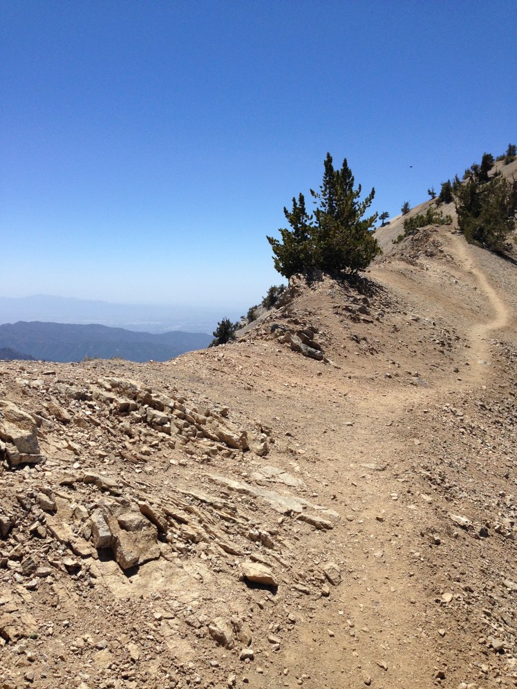
Cresting the top, I had a full view of the lake.  Silverwood Lake is a large reservoir created by the Cedar Springs Dam. Far across the lake, I sighted the picnic area I had targeted as my stop for the night. I hastened my steps.

I made it to the Cleghorn Picnic Area at sunset and camped together with Pakabear’s group on Silverwood Lake at mile 329. The picnic area was right at the edge of the lake. The campground was designed for day use by boaters including a dock and covered picnic tables. We each chose a covered picnic table and put our tents under the shelters fearing it would rain in the night.

From my tent, I had a view out over the small sandy beach and the water beyond.  It was a beautiful place.

Day 37:

When I hiked out in the morning, the other hikers were still sleeping. The young hikers could sleep well past nine and still manage to catch up and pass me in the afternoon.

It started as a lovely day of hiking. The trail passed up and out of the Silverwood Lake area with views back toward the lake. The morning air was fresh and inviting as the trail wound up and around a series of tree covered mountains. It was a beautiful day to be on the trail, I thought, as I made my way upward in the morning sun.

IMG_0730

Looking back down to the Cleghorn picnic area.

The trail came out of the trees and crossed a ridge looking toward the Cajon Pass and Highway 15. Crossing over the ridge, I found myself caught up in gusts of extremely high winds.

IMG_0732

The trail stayed up along escarpments with ravines falling away on both sides of the spine. The cross winds whipped at my backpack keeping me off balance and gripped by fear of falling.  It took every muscle in my body to stay upright.  Several times I had to brace my legs to keep from being knocked off the trail. I was shaking and relieved to make it down into Crowder Canyon and out of the wind.

Just off the trail at Cajon Pass is a McDonalds at mile 342. The walk from the trail to McDonald’s and the Chevron mini-mart gas station is along a section of the historic Route 66.

There had been much discussion among the thru-hikers about what to order upon arrival at the McDonalds as this was a favorite stop along this portion of the trail. All day I dreamed of different menu items. By the time I arrived in mid-afternoon, I was happy to eat anything. Just hand me food. I ended up with a cheeseburger and French fries. I wrapped the meat, cheese, and condiments in a napkin and holding it together with my hands consumed the entire bun-less burger in a few hasty bites.

Pakabear’s group arrived at the McDonalds shortly after me.

“So what made you decide to hike the PCT?” In the women’s restroom of the McDonalds Luna stood facing the mirror, smoothing out her short cropped brown hair. She was small and her sparkling smile made her cute. She was wearing a mini skirt, a sensible option for young female hikers.

“Been on my bucket list since the 1970’s,” I answered as I leaned forward to wash my face.  We talked for a few minutes.

After McDonald’s, I crossed over the overpass to the Best Western on the other side of the freeway for my resupply box. Luckily they had a room available for the night.

Once the door closed behind me and I was safely in the room, I quickly headed for the shower. I wanted to crawl into bed, but I had laundry to take care of and gear to clean up.

Day 38:

In the morning, I enjoyed breakfast at the hotel with the other hikers.   Sharing a table with Cat-Dog, a 62-year-old hiker from Bend, Oregon, I wolfed down helpings of scrambled eggs with sausage and bacon. I ate so many pieces of sausage and bacon it brought to mind Homer Simpson’s ‘butter your bacon, bacon your sausage.’

“My daughter is coming later to pick me up for a zero,” CatDog explained. I had met Cat-Dog briefly earlier on the trail when we had taken a brief break at the same location. She had hiked the Appalachian Trail 7 years earlier. CatDog was single with two adult children. She had moved to Bend a couple of years earlier to live closer to her children. When she had decided to hike the trail she had put her belongings in storage and given up her apartment. A friend was keeping her truck.  Hiking the PCT meant major sacrifices for many hikers.

It was a late start back to the trail.

Leaving Cajon Pass required walking under two sets of rails and over another two sets of railroad beds. I timed the trains as coming through every two minutes. I could see the trains passing and hear the train’s whistles for many miles as made my way across and out of the valley. I was fascinated by the train traffic and in awe of the amount of cargo passing through this mountain pass.

IMG_0740

Shortly after the rail crossings there was a warning sign indicating the crossing of the San Andreas Fault line.

I knew from the map I had a major climb ahead with the trail rising from 2,995 feet to over 8,300 feet.

Climbing upward, I met Mandie and Josh, a couple from San Diego full of life and giggles. We took several breaks together.  They were two peas in a pod as they sat laughing and eating snacks.

I met Buttercup, who was leading a group of war veterans on the PCT under “Walk off the War” by Warrior Hikers. We stopped to talk, and he said the other three vets were on the trail ahead. Buttercup, a handsome man in his fifties, hiked with a red checked shemagh wrapped around his neck.

Determined to get to the top of the climb before camping, my resolved faded as the sun disappeared below the horizon. As the desert scape turned to pine forest, I searched for a place to stop. It was steep terrain. When I finally arrived at a suitable spot, three tents of other hikers filled the flat space.
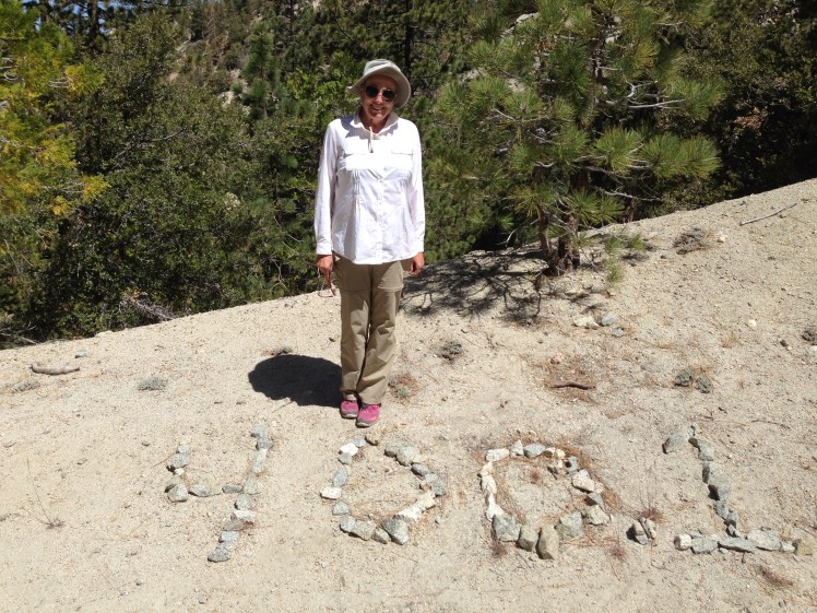
Up the trail a bit, I decided to cut into the hillside with a flat stick and pitched my tent in the soft dirt. Unfortunately, the cut I created was only the width of my tent. During the night the tent kept sliding off the cut and slipping down the slope. I had to get out several times during the night, replace the tent and reset the tent stakes. Lesson learned.

Day 39:

Early in the morning, I passed Mandie and Josh’s tent a mile up the trail. One of the other vets, Whiskey, had made it to the top and was camped in one of the many beautiful open flat areas. I looked around and wished I had kept going the extra mile last night. I stopped and ate my breakfast with Whiskey. Whiskey was a vet recovering from burns on his back and hands. We talked about the war and his service while we ate.

IMG_0757

Whiskey

It was a bright sunny day with high gusts of bitterly cold wind. The wind whipped at my face and hands. For the first time, I hiked with gloves and a baklava. The trail passed along the top of a couple of ski areas. Baden-Powell loomed in the distance.

I stopped at Guffy Campground for lunch. In the morning hours, I had been leapfrogging with two older male hikers. We arrived at Guffy’s at the same time and ate together at a picnic table. The sustained wind made it difficult to keep our food from blowing away. We dined hurriedly, holding down our food and gear as the wind wailed through the surrounding pine trees.

The two were brothers-in-law from the Bay area on their second attempt at thru-hiking the PCT. Our conversation was like staccatos in the wind.

“We each missed a section on our last attempt.”

“So here we are again.” Added the other.

They were not stopping in Wrightwood meaning I was unlikely to see them again.

In the afternoon as I stopped at a trail junction to plug in my phone recharger, I was passed by Josh and Mandie as they headed down the Acorn Junction trail into Wrightwood rushing to make it to the post office before closing time.

My own plan was to hike on six miles farther to Highway 2, mile 369.4, then hitch back toward Wrightwood giving me the better option to hitch back to this same crossing of Highway 2. Hiking up the Acorn Trail to get back to the PCT seemed an unnecessary difficulty.

I made it to Highway 2 at the same time as the four vets. They were expecting a pre-arranged lift into town.  I was on my own to hitch into Wrightwood.

IMG_0761

Trying to hitch a ride along Highway 2 (my backpack).

The vehicles whizzed passed as I stood by the road with my thumb out.  After 30 minutes, I decided on another tactic. Inspiration Point was nearby with a parking lot and lookout point. I waited for a car to stop at the look out area and then approached a young woman driver and asked if she would give me ride into Wrightwood.   She was traveling with her mother and her young daughter. She was interested in my trip and asked questions on the ride into Wrightwood and took me directly to the Wrightwood hotel I mentioned to her.

After her car had pulled away, I telephoned the hotel only to find there was no rooms available. The owner, to whom I spoke with on the phone, drove over and gave me a lift to another nearby motel with an available room. It was an amazingly friendly gesture and much appreciated.

Day 40:

I took a zero in Wrightwood, a charming small town with quaint local restaurants serving a variety of food options.

The other guests at the motel were thru-hikers. Pakabear was there with his girlfriend. She was leaving the trail at this point to return to work. A Japanese hiker named Tin Cup was staying. A fifty-year-old man named Shamrock was there also taking a zero.

I was to see Tim Cup several times over the next few days. Each time, I tried to start up a conversation, but he seemed unwilling to talk. I was curious to hear his story since he had traveled from Japan to hike the PCT. Later, I learned he left the trail in Northern California because he was too lonely.

Loneliness on the trail is probably the most challenging aspect facing any solo thru-hiker. The younger hikers seemed to have no difficulty finding other young people to join with. After a certain age, this is tricky. Finding another hiker willing to hike the same miles per day and who happens to be compatible company can be challenging.

Late in the day, I ran into Shamrock as I walk toward the local pizza restaurant and we decided to eat dinner together.   While we were queued up ordering pizza, CatDog walked in. She had just arrived in Wrightwood.

IMG_0766

CatDog

“May I join the two of you?” CatDog looked exhausted as she placed her pizza on the table.

CatDog was planning to hike out on the High Desert Trail Alternate in the morning bypassing the trail up Baden-Powell and would not be hiking out with the rest of us.

Day 41:

Early the next morning, the owner of the motel delivered Shamrock, Tin Cup, and me to the trailhead at Highway 2, back at mile 369.4. It was freezing cold with temperatures in the low 30s. The wind chill brought the temperature much lower. After a mile of hiking, I was ready to put up my tent and crawl in my sleeping bag for relief from the cutting cold wind. For the first time, I seriously considered quitting the trail.

IMG_0769

After the trail had crossed Highway 2 again at mile 374, the ascent of Mount Baden-Powell began. It was an ascent from 6,582 feet to 9,390 feet in a little over four miles. Shamrock and Tin Cup soon were ahead.  I did not see them again until Little Jimmy Spring.

The chilling wind made climbing up the mountain bitterly cold. To keep my mind off the cold, I tried counting the switchbacks at each turn but soon lost track. It was a long climb. I leapfrogged Josh and Mandy a couple of times on the ascent.

By the time I made it to the top of Baden-Powell, I was too cold to enjoy the view for any length of time. A freezing squall caused me to quickly hurry on.

IMG_0770

The trail up Mount Baden-Powell.

As I started down along the ridge, it warmed considerably.  The wind dissipated.  I stopped to have a leisurely lunch in the sun. A large group of hikers gathered about sitting on the edge of the embankment resting and eating. It was a surprise to see such a large gathering after the mostly solitary hike up.

The first water on the trail for the day was at Little Jimmy Spring right before Little Jimmy Campground at mile 384. I had to make it there for the day to resupply with water. On the way to Little Jimmy, I met a young man named Wesley, trail name Crusher, who impressed me immediately with his tenacity. I had heard from Shamrock that Wesley had Cerebral Palsy. I was amazed he was out solo thru-hiking. It gave me the inspiration to keep going when all I wanted to quit and go home.

I made it to the campground early, around four o’clock in the afternoon. I found a camp spot with a picnic table in the sun. As the day wore on, it became a maze of tents as other hikers poured in tripping over my tent stakes and eating at my picnic table without regard for me or for my personal space. It was too noisy in the evening for sleep. I wished I had continued onward to find a quiet solo place for the night.

Day 42:

Because it was crowded at Little Jimmy Campground, I started out before first light. Early in the morning, I was joined by Shamrock. We decided together to hike the Endangered Species Closure ahead by a combination of road walking Highway 2 and taking trails where available as allowed by the map. The PCT was closed to protect the Mountain Yellow-Legged Frog on the endangered species list. We hiked together through the closure and ensuing difficulty trying to make certain we were on the correct detour trail. Once we were through the closures, Shamrock hiked on. I could not keep up. It was good news to be hiking back into warmer weather.

IMG_0771

At noon I stopped at Camp Glenwood, a Boy Scout Camp.   The camp appeared to be abandoned. There were water tanks and picnic tables. After obtaining water from the faucet of the tank, I took off my pack, sat it on top of a table and removed my shoes and socks. I placed my socks out to dry and spread out across the table top on my back warming myself in the mid day sun.

After a short rest, I unpacked my food and started eating lunch. It was such a pleasant day after the cold of yesterday. As I finished eating another hiker came by and sat at the next picnic table.

“Hi, I’m Bob from Berkeley,” he smiled and opened his pack.

“Hi,” I replied absentmindedly. I turned my socks over in the sun.

“Where are you from?” He asked without looking over.

“I live in La Quinta, in the Palm Springs area.”

“Do you golf?” a natural question.

“Yes. It’s a great place to golf. There are many courses,” I replied, “I enjoy being outside and the weather is perfect for golf all winter.”

“What’s your handicap?” we talked golf indexes and about the different courses in our area. It was a pleasant lunch conversation. After back and forth with the conversation, I pressed into another topic of conversation.

“The problem with our area is the valley sits on top of an aquifer and consumes more water than is accumulated back into the aquifer each year from the Whitewater River and a canal from the Colorado River. The Coachella Valley has been allowed to grow, allowing an unlimited building of houses and golf courses without considering where the water will be coming from. It is amazing the state and local governments do not better control development. Allowing additional development beyond the amount of water supply seems foolhardy.”

“Well, the lack of water is caused by global warming,” he sounded convinced.

“I’m not so certain I believe in global warming.” I started out tentatively, with a short laugh. “I lived through the 70’s when the media was trying to scare everyone with global cooling and the coming ice age. So I take this global warming stuff with a grain of salt,” I smiled, amused, and continued.  “We have hiked through many burned areas, and it seems California surprisingly does not replant the burned areas. I would think not replanting burned areas and letting formerly forest lands turned to desert would also lead to less rain and ultimately less water.”

“Well, I know global warming is a fact,” He flatly stated.

“Convince me then. Let’s hear your facts,” I countered with a shrug and a smile, wishing to be pleasant.

“I know it is a fact,” he restated, with emphasis, almost belligerently. “as I have a degree in Biology.”

Not much of a definitive argument. I stretched out my legs and started to put my socks and shoes on. It was apparent I was not going to learn anything from Bob from Berkeley. As I was climbing off the table, he stood suddenly, ranting, finger pointed at me.

“Well, you’re probably one of these religious types that think God is going to solve everything. You’re probably a racist on top of it. I bet you hate Muslims.” He was working himself into a state. I hurriedly packed up my backpack, feeling I had fallen into an MSNBC interview where personal attacks pass for facts. I left without looking back and left his wild rant unanswered.

By mid-afternoon, I had gotten off and somehow lost the trail and became uncertain how to locate the path again. I could see a stream in a valley below and knew if I was indeed lost I could at least have water. Pushing the heavy underbrush aside I bushwacked down the steep hillside. Losing my footing, I slipped and fell sliding downhill face first arms extended trying unsuccessfully to keep the brush from slapping my face.  I came to an abrupt stop at the bottom.  After I brushing myself off and looking around, I saw Shamrock setting on a stump making dinner under a tall pine tree nearby.
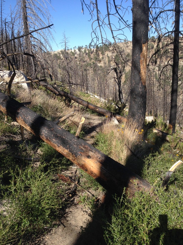
I had not planned to stop early. However, there was water nearby and a fellow hiker.

As I sat talking with Shamrock under the tree, I noticed I had pine pitch on the leg of my hiking pants.  I successfully removed the sticky pitch spot with Purell. This trick came in handy more than once on the trail.

Shamrock and I crossed the creek together and discovered an abandoned campground.

This was mile 407 by Sulphur Springs. It was a scenic camping area, and I was happy to have caught up with Shamrock. It was a relief to run into friendly hiker after my encounter with Bob from Berkeley. Hiking can be difficult without adding unpleasantness.

Shamrock had married his longtime girlfriend the day before leaving on his thru-hike.  It was an extraordinary story.
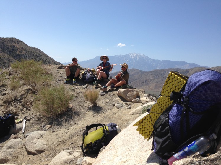
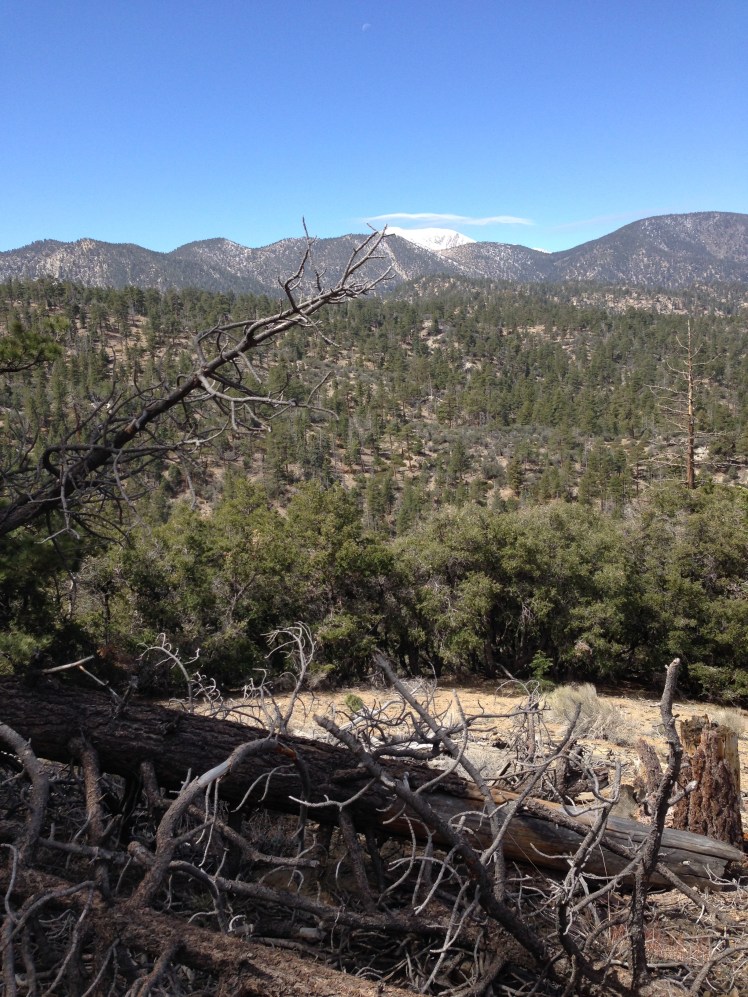
During the evening Mandie and Josh set up camp nearby. I did not actually see them, only heard their giggling from my tent as I fell asleep.

Day 43:

Shamrock was headed for camp at Messenger Flats Campground mile 430, and I was going to a campsite at mile 425. I said goodbye.

Most of the day was spent climbing over blow down and avoiding Poodle Dog bushes as the trail passed through previously burned areas.  It was windy all day. On the ridge lines facing extremely strong wind, I pushed my way forward.

There were many fallen burned and blackened trees across the trail. My pants and white shirt turned black from scrambling over the blow down. Where several trees lay across the trail together, I was forced to take off my pack and throw it forward before scrambling over the tree trunks.

The worst was the fear of Poodle Dog bushes.

IMG_0772

Poodle Dog

IMG_0774

blow down

Touching Poodle Dog can cause severe skin blisters, rash, and respiratory distress. There can be a delay of symptoms from two hours to two days after exposure. Exposure may also cause anaphylactic shock from the toxins. It can take up to a month to heal. With this in mind, I went to great lengths to avoid my body and clothing contacting the bushes. The oils can get on your clothing and then cause a reaction when transferred to your hands.

Many of the thru-hikers opt to road walk this section to avoid the Poodle Dog. As I planned to stop to camp at mile 425, I hiked the trail which was in poor condition from lack of foot traffic and lack of maintenance.  In some places, the sandy trail slid off the steep mountain sides leaving no trail at all.

When I arrived at mile 425, I could not find the camp area. It was too steep of an area for improvising a place to pitch a tent. I hiked on.

In the evening, I summited a high ridge and looking down into the distance and saw a forest island completely surrounded by acres of burned land and guessed it to be Messenger Flats. By the time I made it off the ridge to the campground it was nine in the evening and completely dark.

“Hey, HomeGirl, you’re here,” it was Shamrock, sitting in his tent without the fly, looking up through the screening.

I put my up tent quickly and in a rush did not bother to add the fly. It was a warm night. I enjoyed looking up at the moon and the stars as I went to sleep. I was too tired to make or eat dinner.

Day 44:

In the morning I lost a tent stake in the heavy covering of pine needles and was unable to locate it. Each time I broke camp I counted my tent stakes as a precaution. It was distressing to lose the stake; however, luckily, I carried an extra one.

The trail stayed on ridgelines and along the steep sides of desert mountaintops. On high open trail corners, the wind caught my backpack, and I had to grip the rocks to keep myself from being blown off the trail into the steep ravines.

The rumor on the trail was that Hiker Heaven (AKA The Saufleys) in Agua Dulce was turning away hikers because the number of hikers exceeded their capacity. There were no hotels in Agua Dulce and most hikers, including myself, had sent resupply packages to the Saufleys. Hearing Hiker Heaven may not be able to allow all hikers to stay, I planned to stay at Acton KOA campground at mile 444, wash my clothes and get a shower at the campground just in case I arrived at the Saufleys and was unable to stop overnight.

It was a long hot, dry descent into the road leading to the campground. As I came out onto a parking lot in the heat, sweating and tired, an older man jumped out of his truck. He was shirtless, wearing only swim trunks.

“Can I offer you a root beer float?” He smiled “I’m Coppertone. I thru-hiked of a couple of years ago. Now I meet hikers at trail crossings to offer trail magic.”

I was hot, tired and almost out of water. Coppertone’s offer was welcomed. I dropped my pack beside the camp chair and sat down to enjoy the treat in the shade of his truck. He handed me a crème soda and ice cream in a large cup. As I scooped the ice cream into my mouth, he kept up a lively conversation. As his trail name suggested, he was well tanned. In the summer months, he followed hikers along the trail by parking along major roadways crossing the PCT. He waited out the winter months by parking his truck in areas with warm weather, living full-time in his truck.

I finished the float, and he directed me to the KOA campground.

At the campground, I purchased a beer, a Gatorade, and a Coke and drank all of three while still standing in line waiting to pay in the small store.

Pakabear and Shamrock were already at the campground when I arrived. In the afternoon I met three German women. LapDog and Detour were hiking together. Sprinkle just happened to also be there at the same time. All three German women were in their early thirties, extremely friendly and outgoing.

I sat down at the picnic table just in time to hear Pakabear relate a story.

“As I was hiking down into the valley this morning, I was met by a man running toward me completely naked, well, except for his shoes and his iPad. I mean, why an iPad?”

“Oh no, who was it?” several of us wanted to know.

“Coppertone, the root beer float guy.” Pakabear chuckled, “I actually first met him right after the Mojave River Forks Reservoir. He came running up the trail towards us naked, root beer floats in hand.”   Pakabear shook his head again. “I mean, who runs with an iPad?”

Nice to know, I thought to myself as I listened to Pakabear switch the subject and begin another humorous story.

The campground featured an open flat lawn with trees shading most of the area. I sat up my tent in the shade and went to bed early. Shamrock and I planned to get up and hike out at 3am in the morning by headlamps so that we could arrive early to Hiker Heaven. I had another reason. Having seen the dark red rocky cliffs of the mountain out of this valley, I knew I probably could not make it up and over in the heat of the day. I sat the alarm on my cell phone and went to sleep looking up through the mesh of my flyless tent to the stars above.

During the night I could hear the howls of the big cats, including lions and tigers, from the Shambala Preserve nearby. It was an extraordinary experience. Luckily, I had known the preserve was nearby. Otherwise, I might not have known what it I was hearing in the distance.

Day 45:

In the morning, I was surprised Pakabear had already packed up and left camp. He must have had the same idea. Shamrock and I were underway by 3 am. Shamrock hiked along with me until daybreak shortly before we crossed the Highway 14 freeway. Once it was light, I encouraged him to go ahead at his own pace. He had been holding back and waiting for me to keep pace.

Just north of the freeway, I passed slowly along through the Vasquez Rocks County Park featured in many Hollywood films. The morning sun and shadow on the various rock formations made me wish to slowly take it all in. Trails intertwined through the rocks. The signage was confusing, soon I was headed in the wrong direction. A local woman, out for a stroll, sent me back to the right trail. Luckily, I had not gone far in the wrong direction.

I arrived at Agua Dulce in the morning and was happy to hear “Hiker Heaven” had space for me to stay the night. I collected my resupply package from their well-organized garage and was invited to pick out whichever unoccupied sleeping cot I wished among the cots spread out over their large backyard. I located an empty cot in the back portion of the yard for privacy and pulled it under mesquite trees for shade and placed my gear on top.

Shamrock had arrived an hour ahead of me and had chosen to sleep in one of the screened shelters. He had signed up to take the van in the morning to the bus stop to catch a bus to Los Angeles. He was planning to take a week off the trail to spend time with his new bride.

Saufley’s Hiker Heaven is an amazing place.   In addition to allowing hikers to stay in their yard each hiking season, the Saufleys rent a van to make two trips each day to the REI store in Santa Clarita allowing the hikers an opportunity to purchase needed gear. It was a well-oiled operation.

For hiker’s use, a row of blue port-a-potties lined the end of the backyard before the horse pasture. A kitchen, bathroom, and gathering room separate from the Saufley’s house was available for hikers.   A line of bikes were available for riding into the town of Agua Dulce to eat at the restaurants or shop at the store. It was hiker heaven. Generosity bestowed upon the hikers with such unselfishness. I was in awe of the Saufleys and the volunteers who helped run the place washing and folding the laundry and driving the van.

Upon arrival, hikers handed over their laundry to be washed and returned before the day was over. The shower sign-up sheet already had an extensive list of hikers. I added my name and found a chair in the shade of a tree to wait my turn.

Staying at the Hiker Heaven was No Go who had been there several days nursing blisters on his feet. I avoided him not wishing to hear another lecture.

Mandie and Josh arrived, collected their resupply boxes and hiked out. Approximately fifty hikers stayed at the Saufleys each of the two nights I was there.

Trina, one of the women I passed at the very beginning of my hike at mile one on the very first day was staying there. She had hurt her ankle on the trail into Warner Springs and had taken a week off. Afterward, Trina hitched rides up the trail and was now waiting for a lift to Kennedy Meadow. She had been hitching rides (yellow blazing in trail lingo) all the way up the trail from Warner Springs.

As Shamrock and I sat resting at the shaded table, Trina pulled up a chair and joined us.

“It’s a shame I am having such trouble with my ankle as I was getting in 25 mile days until I got hurt.” And she was off talking, this time about her 25 mile hiking days. After listening for some time, Shamrock and I politely excused ourselves.

“How was she getting in so many 25 miles days when Warner Springs was only a little over 100 miles on the trail?” Shamrock wondered aloud with a laugh. I rolled my eyes and suggested we walk down to the store in town.

I purchased supplies at the store to augment my package.

Later Shamrock and I rode bikes down to have dinner at the Marie Bonita Mexican Restaurant.

That night I was happy under the stars on my cot far away in my corner of the yard. I could hear the partying of the younger hikers. Let them have their fun, I thought to myself with a smile. All I wanted was sleep and rest.

In the middle of the night, I was awakened by gasping and heavy breathing. I sat up and looked around confused.  Right next to my cot, a couple were having sex on the ground. I had purposely sought privacy. I rolled over annoyed, covered my head with a flap of my sleep bag and tried to sleep again.

Day 46:

In the morning, I biked down into town and ate breakfast at Mon Ami, a quaint local coffee shop which I found made excellent omelets. There was a small outdoor eating area in back the shop, and I shared my table with a couple of other hikers.

On my zero day at Hiker Heaven, I took the van into the REI store in Santa Clarita. I didn’t need anything, but it was something to do that did not include hiking. Shamrock rode as far as the bus station on his way to Los Angeles to be with his wife. I did not see Shamrock again on the trail.

On the ride in the van, I was seated next to Pakabear and learned he was an emergency room doctor from Bellingham, Washington.

“Look at what I found.” Pakabear happily displayed the nailbrush he purchased at Walmart, one of our shopping stops. I certainly was not concerned with the dirt under my nails. Doctors, perhaps, are trained to be more fastidious with their nail hygiene.

Pakabear, in his mid-30s, was tall with blue eyes and a mass of light brown hair the sun was beginning to turn blonde. He was a cheerful person, always ready with a good story.

On the return van ride, Pakabear was telling of his experiences hiking the Appalachian Trail. One evening he had taken up an offer to stay overnight at a trail angel’s house. After dinner, the trail angel droned on for hours about his own youthful hiking experiences to the point the hikers listening felt they were hostages. The trail angel was trying to recapture his youth by taking in hikers who had no choice but to listen to him reminisce.

“I guess it was his way of extracting payment,” I suggested.

“Exactly.”  he laughed and continued, “It’s like having to sing for your supper.”

We were seated directly behind the driver who evidently may have over listened our conversation. I was surprised when shortly afterward the van drive made a request all the hikers riding in the van learn the lyrics of “Hail to the Bus Driver” and sing it to him. The irony was too much for me. I giggled.  Soon Pakabear and I both succumbed to fits of suppressed laughter.

In the early evening, I biked down to eat dinner alone at the Sweetwater Café. I already missed Shamrock although I had spent little time with him. Shamrock was good company.

That night I was awakened again by noise. I sat up and rubbed my eyes. A very drunk young man stood facing the fence a couple of feet from my cot singing and peeing through the wire. For-goodness-sake, I thought. I should have placed my cot in the middle of the yard.

PCT FOUR

CHAPTER FOUR (INTERSTATE 10 MILE 209.5 TO BIG BEAR 9 MILE 266)
LESSON LEARNED: Never become separated from your pack.

Day 20:

Before sunrise, Jim pulled the car over onto the sandy edge of the road where the PCT crossed from Snow Creek just west of Palm Springs. A short wooden post knocked askew with a PCT emblem tacked on the edge confirmed the way westward on the dirt path.

Unloading my trekking poles from the trunk, I was pleased to notice a car pull up with another hiker. The young woman and I spoke for a few moments before taking off for Ziggy and the Bear’s a trail angel’s house about three miles across the valley on the other side of Interstate 10.

It was a flat section of trail crisscrossing washes and winding through scrub trees. I was soon out of sight of the two cars and the other hiker. The morning sunrise turned the rocky mountaintops golden while the valley remained a shady gray.

A cougar crossed in front of me, there was an electrifying moment as I watched the lean, graceful animal leap soundlessly out of sight. It happened quickly; too quickly for me to react in fear.

A cooler filled with ice and cans of soda had been placed underneath the Highway 10 freeway as trail magic. I stopped to quickly drink a can and the tall, attractive black woman hiker I had met on the road joined me. She indicated she had gone home to rest and her father had returned her to the trail. She introduced herself as Moxie.

Moxie and I talked a few minutes as we stood drinking. When we left the cover of the overhead freeway, I expected I would not see her again. It was unlikely I would be able to keep up her hiking speed as she was young. As it turned out I ran into Moxie again and again at various places along the trail all the way to Stevens Pass in Washington State.

Ziggy and the Bear are the trail angels near Cabazon where most hikers send resupply packages and spend the night. I stopped only to put my name in the PCT register.

Out front of Ziggy’s I waited to meet up with friends, Anne and Jim, as they were planning to accompany me on a portion of the trail for a day hike. As it turned out, I arrived at Ziggy’s before seven in the morning, at the arranged meeting time. They arrived well after nine in the morning. It was eight miles to the Whitewater from Ziggy’s. The cold morning hours had been wasted waiting. I could not continue hiking onward as Anne had offered to pick up my pack and bring it to me to save my carrying the backpack for these three miles. I was without my gear and had to wait.  Big mistake.

Jim and Anne balked at hiking the barren eight miles under the wind farms and preferred to drive over to the Whitewater where they could have a more scenic day hike. I reluctantly agreed, knowing I could comfortably hike these eight miles when I returned home in the fall.

Hiking up the Whitewater, I was surprised to see how little water ran in the Whitewater River. We crisscrossed the creek several times making our way upstream before eventually seeing the PCT sign signally the trail out of the canyon.

As I climbed out of the Whitewater, I realized I had made a mistake by wearing boots. My feet were hot; my socks became soaked with sweat. In the heat, my feet began swelling, making the boots too tight. Too late I realized the boots were not going to work in hot weather and desert hiking.

Anne, Jim and I stopped for lunch on top of the ridge looking back down into the Whitewater Valley. Seated on rocks in the distance, Spirit Finger’s guitar and Jambo’s banjo music filled the air. A light breeze kept us cool as we ate.

IMG_0694

We enjoyed Anne’s lunch of apples and cheese slices.

After our goodbyes, I waited and watched Jim and Anne descended back into the Whitewater Preserve before continuing along the ridge toward Mission Creek.

The afternoon became hot under the unrelenting sun. The cool breeze from earlier had ceased and I hid from the sun under my umbrella each time I stopped for a break. The trail stayed high all afternoon weaving along the top of the ridge.

Late in the afternoon, I descended into the valley along Mission Creek.

An open area scattered with an outcropping of low sparse willow trees edged Mission Creek. I was happy to stop and take off my boots. Blisters covered my feet. There were blisters on my heels, between my toes, on the outside edge of each foot and covering the bottom of my feet.  The blisters causing the most pain were on the bottom of both feet. After observing the condition of my feet, I pitched my tent in the gravel wash at the edge of the creek at mile 226. It was a relief to soak my feet in the cold, clear water.

There were three other hikers camped nearby. As the evening progressed, several more hikers arrived and staked out tent areas. Some of the hikers were late from taking the wrong trail out of the Whitewater. Most of the other hikers knew each other. I listened to the laughter among the hikers as I sat inside my tent and carefully broke open each blister with a needle to make the fluid drain out. I swabbed the blisters with alcohol wipes before applying Neosporin and bandages.

In the evening I ate dinner with a couple of hikers seated on a fallen log and listened to the dancing water of Mission Creek flowing in front of us.  It was relaxing and cool following the hot afternoon of hiking.

A women hiker stood in the middle of the creek washing out her socks with soap.  I was appalled at this lack of hiker etiquette which includes not polluting water sources along the trail.

Moxie and Raspberry camped in the general area for the night.

Day 21:

Lying in my tent in the evenings, I studied the maps for the next day. I also looked at the water report. Planning water stops and the next camp destination helped keep my mind focused on the day ahead. Considering the entire trip was overwhelming. It was easier for me to plan for the next day and to look ahead only to the next resupply stop, keeping my mind focused on short-term goals.

I was up and hiking predawn, the first person to break camp. Before the morning was over, the other hikers camped along Mission Creek that night had all passed me on the trail.

The 5,000’ elevation gain took the biggest portion of the day. At each creek crossing, I filtered water and refilled my Smart water bottles to keep my total water at a maximum of 4 liters, not wanting to chance running out of water on this long hot climb.

By mid-morning, the heat was exhausting. Mission Creek changed from creek to a small stream. Occasionally a cluster of deciduous trees grew beside the creek. When I found trees large enough to cast a shade, I sought momentary respite from the sun.

In the late morning, a section hiker, Joe*, caught up with me.  He had left his truck up ahead on a dirt road and drove his motorcycle south to find the trail.

Joe and I took several breaks together, seated under trees, our feet resting in the shallow water. He had spent time section hiking the Continental Divide Trail (CDT). Each year Joe completed sections of the PCT. When we continued up the trail, it was at different speeds, and we leapfrogged each other meeting up when one of us stopped to rest and the other caught up.

As the morning passed and the trail gained elevation, the creek diminished in water flow until finally it became a dry creek bed.

In the later afternoon, I was the beneficiary of the most extraordinary kindness. As I lay spread out and resting under a large sagebrush, Joe came by. I knew he was low on water. I had a water report and he did not.

“There’s water up ahead in one mile.” I meant this as encouragement as I knew he was low on water and also struggling with the heat.

“Okay,” He replied and hiked on. I watched him disappear up the trail, trudging slowly, his large body bent forward taking short steps in his heavy boots. I stayed in the shade for a short restful nap stretched out on my zpad, managing to keep my head and shoulders in the shade of the sagebrush.

Joe returned shortly with water. He thought I was out of drinking water and had hiked up one mile and back one mile with sore feet, at the point of utter exhaustion to bring water to me. His generosity and kindness brought me close to tears.

Late in the afternoon, I reached the section of steep switchbacks. Looking down I saw Joe stop at a campsite below. I guessed he might have stopped for the night.

Just prior to reaching the top elevation, Poodle Dog bush lining the trail making hiking more difficult. I took great pains to avoid contact with the Poodle Dog Bush as I passed up the switchbacks.

I wanted to make it to the top of the mountain and was planning to camp at mile 246. During the last stretch upward, I was passed by an odd-looking person I had first seen while putting up my tent the night before.

He had walked passed our group of tents just at sunset shirtless wearing frayed cut-off jeans and sneakers. Instead of a backpack, he carried a blanket slung over one shoulder. His sun-bleached blond hair stood up in spiky clumps. I guessed he might be a homeless person with possible mental problems.

As he approached, I stepped off the trail to allow his passage. He swept silently by without a word and climbing quickly upward.

Nearing the top of the climb just as the desert gave way to tall pine trees, I caught up with Raspberry, one of the hikers from the night before. He had passed me in the early morning. Raspberry had recently sold his business and retired. He explained his motive for thru-hiking was because if he were at home, he would be in a Bark-a-lounger in front of the TV.

Raspberry was a large gregarious man in his fifties from Sacramento. He was at ease in the outdoors and said he loved to camp, a passion his spouse did not share.

Raspberry and I decided to camp at around mile 244 next to a small stream on top of the mountain because neither of us had the energy to make it the last two miles where the rest of the group had planned to camp. We pitched our tents on each side of an enormous fallen tree trunk near the trail.

As we completed the task of putting up our tents, the homeless person cowboy camped about a hundred yards down the trail from us. He had passed me, and I had not seen him again. Suddenly he materialized out of nowhere, to camp along the trail a short distance below us. It was unnerving. I was frightened of being stabbed in my sleep.

After dark, Joe passed our campsite, hiking with his headlamp. I invited him to camp with us, but he wanted to make it to his truck parked on a dirt road ahead. As he trudged on, I watched his headlamp bob along in the darkness and disappear around the bend.

My feet were in bad shape. The constant uphill climb in the heavy boots had worn the skin off the back of my heels. The layers of skin ripped from my heels left open, bleeding wounds. I disinfected the wounds and kept my feet out of the sleeping bag during the night hoping exposure to air night might help dry the wounds and stop the bleeding.

Day 22

I was on the trail faster each morning now that I was traveling a few pounds lighter. The extreme pain of putting on the boots and walking kept my focus on moving forward and away from the discomfort of not having coffee first thing in the morning.

After filtering water from the small cold stream, I was out of camp before Raspberry.

At this altitude, the air was refreshingly cool after yesterday’s oppressive heat. I made fast time on the trail in spite of the searing pain of each step.

At lunchtime, I found a sunny spot above the trail and laid out my pad to enjoy the territorial views of several surrounding mountain peaks. I took this rest time to dry out my socks and re-bandage my heels. The bandages from the morning application were not staying in place. Desperate to keep the wounds covered, I wrapped duct tape around my feet and ankles over the new bandages.

I am not certain when in the morning or during my lunch break, Raspberry passed me on the trail as I did not see him go by.

Shortly after lunch, I left the trail to check out the three historic cabins at Coon Creek Campground. From the 8000’ elevation, I was able to enjoy the stunning view back down into the Coachella Valley.

As I looked toward home, my mind wandered over of the simple pleasures of visiting with friends, playing golf, or drinking a margarita around the pool. I wanted my life back. I acknowledge this to myself. Then I repeated the words aloud; a soft plaintiff cry of loss and loneliness.  I stood looking down in the valley for a few minutes then turned and hiked northward.

At mile 250, the trail passed a grouping of caged animals containing exotic animals for the film and television industry. It was sad to see the grizzly bear in a cage. At least at this high elevation (8,148′) it was lower temperature for the animals. There was no one about, only the cages. It felt eerie, and I quicken my steps to get away from the discouraging scene.

I saw no other hikers throughout the day. Mentally, I forced myself to concentrate on anything but the pain of walking.  I could not afford to be distracted by anything but getting to the next out tomorrow.

The trail stayed high, and there were many locations with grand vistas of valleys and mountains beyond. As the day lost sunlight, I found myself on a windy ridge. In the strong wind, my hands and face became chilled as I made my way along. I began to worry if it was possible to locate a flat place suitable to pitch a tent.

Turning a corner, I spotted an open space and I was happy to recognize a tent. I asked Raspberry’s permission to camp nearby. I found a flat area under tall pine trees nearby and brushed away some of the pine needles and rocks.

It was dark by the time I succeeded in getting the tent up and securely staked out. It was my first time to pitch the tent in a high sustained wind. I was too cold and exhausted to prepare dinner. I crawled into my sleeping bag and tried to go to sleep.

The wind blew all night. I slept fitfully as the wind caught the fly and whipped it against the tent. The slap of the fly frequently woke me. I kept checking the time and wished for morning.

Day 23:

My feet were now extremely swollen and much too large to fit in my boots. I had to force my feet into my boots trying not to scream out loud.

It was a stressful day with each step agonizingly painful as I crept along the trail.  I had no choice. I had to make it out to mile 266 where the trail came to highway 18. It was a matter of survival. I could not stop and stay put.

Luckily, it was a scenic section of the trail and mostly downhill. After losing elevation, the trail passed through horse country with tall pines and open undergrowth. The last few miles, I viewed a ranch house in the distance.

IMG_0701

Raspberry passed me right before the highway and telephoned for a taxi. He and the taxi were waiting to take us both to the hiker hostel in Big Bear.

On the ride down the mountain into Big Bear, Raspberry mentioned he was hungry, noting he was out of food. He should have said something earlier as I still had several days of food in my pack which I would have happily given him.

Raspberry went off in search of a place to have lunch. I yogied a ride to Motel 6 as the Big Bear Hostel, as welcoming as it was, did not offer a private room.

After two long showers to clean off, I realized nine of my toenails had turned black. There was no way my swollen feet would fit back into the hiking boots. I called Jim and asked him to bring my running shoes to Big Bear in the morning.

Day 24:

When I woke in the morning, I was disappointed to see the heel of my left foot infected despite having washed it with hydrogen peroxide and wiping the wound with alcohol wipes. I knew I had no choice but to return home until the infection healed. When Jim arrived with my shoes, I loaded up and went back home. I felt defeated and depressed.

It had taken me four days to hike to Big Bear. It had taken Jim two hours to drive up to fetch me.

I spent my days soaking my feet in Epsom salt baths and hanging my feet into our saline swimming pool. As much as I enjoyed the rest, all the hikers I knew were hiking on, and I would now be left behind again. It was depressing.

I re-read ‘Emma’ to keep my mind engaged in the light-hearted banter of Jane Austen’s book.

It took ten days for a new layer of skin to begin to form over the open wound.

*Joe is a pseudonym

PCT ONE

CHAPTER ONE     (CAMPO 0 MILES TO MT. LAGUNA 42.8 MILES)

LESSON LEARNED: Toilet tissue is best sealed in a plastic bag.

April 1, 2014

In the early morning hours, we traveled south by car and turned westward toward Campo, California. Raindrops splashed the windshield. Rain, the least expected weather for my first day on the Pacific Crest Trail (PCT). The car bumped down the dirt road toward the wall separating the USA from Mexico, I remained elated, excited to finally begin the hike after so many months of preparation. Eager to be on my way, I touched the wire fence, looked across the dirt no-mans land to the wall, signed the register behind the monument, and bid my husband a hasty goodbye.

IMG_0618

A mile down the trail at the edge of an open field, I encountered two women I recognized from photos on the PCT Class of 2014 Facebook page. For the last several months both Trina* and Tess* had posted daily comments. Clearly, they were in the middle of a crisis as their gear was spread about getting soaked by the rain. I introduced myself and quickly hiked on not wishing to get caught up in whatever drama was taking place.

After passing Highway 94 and crossing railroad tracks, the trail ascended into the hills. From reading blogs I expected this first stretch to be boring. Unexpectedly, despite the light drizzle, it was beautiful.  The trail was frequently edged with colorful spring wildflowers and flowering yucca. White popcorn flowers, yellow desert pincushion, and orange poppies dotted small spots of color among the serpentinite rocks strewn across the hillsides as the trail wound upward.

IMG_0627

An hour or so later looking up at a steep section of switchbacks I could follow the trail disappearing among gray boulders.  Through the drizzle and fog I caught a momentary glimpse of what appeared to be a woman in an orange poncho struggling slowly along.

A few switchbacks up I came upon the person lying across the trail under the poncho.

“Are you okay?” I quickly and cautiously jumped over the person onto a flat rock.  It was slippery. Thrown off balance, I reached out for a boulder to steady myself.

“Just resting,” came the reply. Surprised to hear a man’s voice, I turned and saw an overweight man huddled under the poncho.

“What’s your name?” I inquired, concerned.

“Santa’s Helper,” he sounded exhausted. His white beard did look a little like Santa’s. After his assurances that he was only resting and indeed fine, I continued upward.

My footsteps were quick and eager. How different this day unfolded compared with my anticipation. I had imagined struggling through the desert hot and dry. Two liters of Gatorade and four liters of Smartwater remained almost untouched in my pack keeping my backpack heavy on this chilly morning.

Mid-day the sun made a tentative appearance. As it began to warm, I stopped to shed my rain jacket.

On top of a large rock with a territorial view back down-valley, I paused for a lunch break. In what was to become a habit, I removed my shoes and socks and set them out to dry in the sun while enjoying the break.

Lake Morena, at mile 20, is the common goal on the first day for most thru-hikers. I planned to stop at Hauser Creek, mile 15. At this point of the day, I was secretly hoping I could miraculously make the twenty miles all the way to Lake Morena.  I ate my lunch with feelings of high expectations. I had Halfmile maps and the Halfmile GPS on my iPhone. I felt confident and prepared for my adventure.

Mid-afternoon, cresting the highest point of the day, a wide, deep canyon spread out before me. On the opposite wall, steep switchbacks wound up and out of the valley. Immediately, with sharp disappointment, I knew I lacked the energy to hike down and back up out of this steep valley. There was just no way. I must be satisfied making it to Hauser Creek.

Passing under power lines, I arrived at the unpaved South Boundary road and started down the sandy dirt road according to my map. For safety, I checked my GPS: ‘not on the PCT.’ I turned eastward looking for indications of the trail leaving the road down into the valley.

My heart quickened to see the sun glinting on three tents set up in a copse of trees below along the dry creek bed of Hauser Creek. I felt a surge of relief I would not be camping alone on my first night.

From a distance, I noticed a white border patrol truck, trailing dust, moving quickly up the road.  The truck pulled up as the officer rolled down his window.

“What are you doing out here, Miss?”

“Hiking the PCT.”

“Alone?”

“Yes.”

“Why?” He queried.

I shrugged my shoulders. “Wanted to.”

“Where are you headed?”

“Canada.”

“Alone?”

The questioning continued for 15 minutes. The officer indicated I had set off a heat sensor detecting activity with the border patrol investigating all tripped sensors.

When he finished grilling me and seemed satisfied I was not an illegal crossed over from Mexico, he directed me to where the PCT trail cut back downhill in an obscure turn at the road edge. I thanked him, and he shook his head and drove away. I might have missed the trail had he not pointed it out.

Descending into the valley along steep switchbacks I heard a noise.  Startled, I let out a yelp. A fast-moving hiker managed to walk up directly behind me before I heard his footsteps.

“Sorry. Didn’t mean to frighten you.” He apologized with a smile. We spoke briefly and hiked down to the campsite together. It was early, around 4:00 in the afternoon. The other hikers had already claimed the choice campsites, so the young man and I settled into the only open area remaining and set up our tents. I had practiced setting up my new tent at home and executed the tent erection without revealing clumsiness.

Placing my gear inside my tent, I sat down on a nearby log. The man sat down beside me. He was spending three weeks section hiking on holiday from Germany. He was tall, thin and athletic with short neatly trimmed dark brown hair. His black eyes lit up as he spoke. He had traveled to California on business and had extended his stay to section hike. Since his English was excellent, without much of an accent, I guessed he had visited the U.S. frequently. His compact back-pack and smart gear led me to believe this was not his first rodeo. He had gotten a late start on the trail today, and when I mentally compared his start time with mine, I realized he had covered the 15 miles in half my time.

Nearby our camp, a small blonde woman, Ghost Angel, was eating dinner with tall lanky Zen Blue Sky. We exchanged hellos over the low growing bushes between our campsites. Zen’s hair was pulled into a short ponytail, and he already had a couple of days of stubble on his chin. I assumed they were a couple and not wishing to be intrusive made no further conversation.

In the opposite direction, under a tree, a chubby man with dark curly hair and large luminous blue eyes began his dinner preparations.

As we sat resting on our log perch, Bright Eyes accidentally overturned his Pocket Rocket stove and started a fire in the surrounding debris. He jumped around wildly stomping out the blaze. We were too surprised to react. Luckily, Bright Eyes trampled the fire out before our help was required. It was a humorous situation.  Nobody laughed.

Too tired to make my own dinner, I crawled into my tent, inflated my Neo-air and spread out my sleeping bag.

It was early. The air mattress felt narrow for my body and the sleeping bag much too warm. Tossing and turning, I lay awake worrying what I had gotten myself into.

Finally, it was dark. The temperature dropped as it began to rain. A couple of hours later, I put on my lightweight down jacket and snuggled further into the sleep bag and checked to make certain it was fully zipped up.

Later, still cold, I added my rain jacket, hat, and gloves.

As the night wore on, I pulled over me the foil emergency blanket I had packed thinking I might need it in the snowy high Sierras. By morning, every piece of clothing in my backpack was on my shivering body. I was tired from lack of sleep.

It was still raining.

Day 2:

I decided to pack up quickly and dash for Lake Morena, foregoing breakfast. The German hiker must have had the same plan as he was packed and already on the trail by the time I got out of my tent. I watched him ascended with his small pack and correctly guessed I had seen the last of him.

As I made my way upward out of the canyon tiny bits of sleet and rain hit my face as I leaned inward toward the rocky side of the mountain in the strong frosty wind. It was cold. The rain and sleet tore at my face and bare hands. Far below, another hiker, Ghost Angel, starting upward. Wearing her white Cuben Fiber rain-gear, she appeared as a ghost rising through the mist. It was thus Zen bestowed on her the trail name, Ghost Angel.

By the time I was out of the canyon, the rain and sleet abated, and the sky brightened.  The harsh chilling wind remained.  I kept my thoughts on making it to the small grocery store and café at Lake Morena. The anticipation of a warm breakfast kept me moving forward quickly over the wet and rocky terrain. I covered the five miles rapidly.

I planned to eat breakfast at Lake Morena, warm up and hike on.

Coming out at Lake Morena, I bee-lined straight down the paved road to the store.

Dropping my pack in the seat opposite, I slid into the booth by the window.

It felt warm and pleasant to be inside out of the cold.  I took my time eating eggs and slowly savored several cups of coffee.

It was a small cafe and store combination.  The booths for the cafe were in the front of the room along the windows.  Packed shelves and narrow aisles of the store took up the rest of the space.

Approaching the counter to pay my bill, I asked the man if he had pens for sale.

“30 dollars,” he handed me a glass object.

“For a pen?” I was incredulously looking at this strange object and wonder how I would write my notes with it. It must be some type of drug paraphernalia. I was still turning the strange object over in my hand.

“Here, take my pen.” He said kindly, handing me his ballpoint pen.

“Well, let me pay for it.” I exchanged the glass object for the pen he had been writing with.

“No, no, no.” responded the middle-eastern man with a friendly smile.

Reluctantly I left the warmth of the café, slung my pack over my shoulders and headed back down the road toward the park to catch the trail.

Stopping at the ranger station, I inquired where I might find the trail onward.   The thoughtful and unassuming ranger interrupted his work and stood up to approach the counter.

“The PCT ahead is covered in snow all the way to Mt. Laguna. I suggest you wait for the snow to melt before hiking on.” He paused, considered my gear and added, “There is an area here for hikers to camp.”

I paid for a camping spot, bought a packet of firewood, and located the thru hiker’s camping area. The area was across the interior road from the lake and slanted slightly downward toward the water. Directly in back of the site, the PCT continued onward. As I unpacked, I noticed my small roll of toilet paper had disintegrated inside my side pocket. I had not thought to protect it from the rain by placing it inside a protective plastic bag. Luckily, I carried an extra roll stashed inside the trash compactor bag lining my pack.

It was disappointing to camp after hiking only 5 miles on the second day. I was the first hiker to arrive. Throughout the day, other hikers came and stayed.

Zen Blue Sky, Ghost Angel, and Bright Eyes were the next to arrive. I learned that Zen Blue Sky and Ghost Angel had met at the trail angel’s house in San Diego where many hikers stay before heading out to begin the trail. They were, in fact, not a couple. He was a section hiker planning to hike only as far as Wrightwood.

Tall and blond, the arrival of Mermaid, a former model and actress in her mid-fifties, did not go unnoticed.  Her beauty was amplified by sparks of charisma. She was a person everyone noticed and remembered. She spoke amicably with the hikers gathered around the two picnic tables.

Mermaid was the soubriquet she was given later on the trail at Deep Creek Hot Springs. She introduced herself by her given name. We had the same backpack, ULA circuit, in the color purple haze; however, her backpack was almost twice the size as mine. I silently speculated she must have a kitchen sink in it.

She looked at our packs and turned to me, “Well, you seem like you know what you are doing. Have you backpacked before?”

It was an innocent question, and my answer just came out without thinking. “Yes, I hiked around Mt. Rainier on the Wonderland Trail and have done a trek in Nepal.”

It made me sound experienced. Our conversation turned to the discussion of gear. Mermaid’s husband had helped with her gear, and he had thought of everything. Nearby Ghost Angel sat listening.

I was to later learn Ghost Angel had climbed Mt. Rainier and Mr. Baker with her mountain guide husband.  Her niece, having hiked the PCT in 2013, had advised her on gear. She was a more experienced hiker. Had I known, I would have referred Mermaid’s gear questions to her and kept my own big mouth shut.

Mermaid and I were deep in our gear conversation when suddenly a pair of trekking poles slammed the edge of the table with a loud thud.

A woman in a red rain jacket hastily yanked off her blue knit cap to reveal short curly blonde hair.

“I am leaving the trail. I called my husband to pick me up. I miss my husband. I want to go home.” She announced to the assembled group. There were general and polite wishes of sympathy offered up by those who wished her well. I was too stunned to know how to respond to her announcement.  It was early on a thru hike to already be giving up.

In the twilight, Trina and Tess arrived. Trina kept up a loud running monolog dominating the fireside conversation.

“Tess tumbled right over like a reg’lar tumbleweed. Ha, ha. I asked the man at the store if he sold underwear and he gave me these Ha, Ha. Free. Ha, ha. ”.  Trina slapped the long white underwear she was wearing underneath her print polyester dress and without drawing breath in her rough voice continued, “I think I am goin’ ta hafta stay here a couple days to rest up. Ha, ha.” She rattled on.

I broke away from the gathering around the fire and headed for my tent.  Evidently, the store owner was now out a pen and long underwear.

Day 3:

It was a frosty night. Camping near the lake made the night air damp and cold. By morning a thin layer of ice covered my tent. I spread out the tent and fly in the sun to dry out before packing up.

I regretted not sticking to my plan to hike onward yesterday, away from the crowd of general chaos of everyone milling about in the morning. Fifteen Jetboils lined the table as many prepared breakfast. Another hiker mistakenly tried to pack up my tent fly. Luckily I kept an eye on my gear and was able to quickly reclaim it.

The dark, grimy shower at the campground was unappealing. I had not yet learned to take every opportunity to clean up and passed on taking a shower.  I thought of the missed shower later in the hike with regret.

By the time the tent dried and I had loaded my pack, it was past nine in the morning.  Late in the day to be starting. A mile up the trail, I realized I was overdressed and had to stop to take off my base layer, another unwanted delay.

Late morning crossing along a stand of cottonwood trees, I came upon Ghost Angel, Bright Eyes, and Zen Blue Sky taking a break on the bank of a small brook. Mermaid waded ankle deep in the stream.

“Stop and join us,” she happily called out, waving toward the grassy creek bank beyond.

“Yeah, take a break,” welcomed Bright Eyes as I jumped over the water using my poles for extra leverage.  Ghost Angel and Zen Blue Sky sat nearby talking quietly together.

When the four hiked on, I made a reason to stay behind sensing Ghost Angel’s reluctance to admit me into ‘her’ group. I watched the four disappear up the trail.

It was a pleasant sunny day. Warm, but not hot. I climbed up along scenic Kitchen Creek. Occasionally looking down to the creek as it tumbled over large flat granite rocks, I yearned to take a nap on the flat rocks lining the water’s edge. Unable to locate a suitable path down the steep drop off to the creek, I reluctantly kept to the trail passing along the hills among the big Berry Manzanita and chapparal.  I took my time and enjoyed the warm clear day.

I saw no other hikers along the way except the four hikers I had joined for the morning break.

I planned to camp at Cibbets Flat at mile 32. Mermaid and Bright Eyes were planning to continue on to Mt. Laguna. I anticipated Zen Blue Sky and Ghost Angel to be headed there as well.

In the afternoon, I arrived at the cut off to Cibbets Flat. The campground offered tables, toilets, and a fire ring. Heading down off the trail toward the campground situated in a glade of cottonwood, willow, and oak trees, it felt unsafe camping alone in a campground with road access. My fear of two legged animals was greater then fear of four legged animals.

I covered the extra mile down to the campground slowly, apprehensively. To my delight Zen Blue Sky and Ghost Angel were sitting up their tents.

In the early evening, Pacman arrived.  Pacman, Zen Blue Sky and I sat around the campfire talking late into the evening. Ghost Angel stayed in her tent.

Pacman, in his early twenties, tall, thin, with dark hair and a full beard, had the look of a Roman soldier with his regal nose and imposing height. He had hiked the Appalachian Trail (AT) the previous summer and relayed tales of his AT experiences. His lively and adventurous spirit infused our evening conversation with energy and humor.

Day 4:

It took all day to hike the long 11 uphill miles to Mt. Laguna. The trail rose to 5,042’ into pine forests with snow frequently covering the ground. I did not see another person until I reached Mt. Laguna as Zen Blue Sky, Ghost Angel, and Pacman all hiked on ahead of me first thing in the morning.

Mt. Laguna was completely covered in four inches of snow.

The Mt. Laguna campground was completely white with snow. No one was camped there. Surveying the white frozen snow in the chilly afternoon, I decided to try to get a hotel room. Crunching across the campground, I made a hurried beeline for the highway.

Mt. Laguna is a tiny hamlet at the high point along Sunset Highway. As I headed along the road toward the general store, I met Mermaid.

“You better hurry. There aren’t many rooms available.” She motioned toward the Laguna Mountain Lodge.

The room was small. The worn green and crimson printed drapes and bedspread added to the feeling of gloom. The dark brown carpeting had seen better years. A single little lamp stood askew on the small bedside table. The room was warm and offered a bed and running water and served as a much better alternative to camping in the snow.  I had rented the last room available for the night.

I spread out my tent to dry, washed the tent footprint in the bathtub, and cleaned up my backpack and gear. There were no laundry facilities. I hand washed my clothes in a bucket with the laundry soap provided.

I noticed Ghost Angel, Bright eyes, and Zen Blue Sky shared the room next door.

Later, Mermaid and I wandered over to Mt. Laguna Sports & Supply, an outfitter across the street. It was a small store loaded with an impressive selection of gear stacked floor to ceiling. Waiting my turn to purchase a small stuff sack and a lighter weight rain jacket, I witnessed hikers purchasing gear at an incredible speed. Dave, the owner, helped Mermaid go through and cull unneeded items from her backpack. An avid hiker, Dave advised me to load my sleeping bag in the bottom of my pack without the stuff sack to save space, then load everything else in for an even weight distribution.  It was good advice.  Henceforth, this is the how I stowed my sleeping bag in my pack.

“Hey, move over and let me sit here.” It was Pacman with his effervescent smile taking a seat across the rustic wood table.  Ten thru-hikers joined together at one large long table to eat dinner at the nearby Pine House Café, a rustic log building down the road from the lodge. We were a happy group. Mostly, we spoke of gear and food, hiker’s favorite topics. Bright Eyes, Ghost Angel, Zen Blue Sky, and Pacman were among the diners. I noticed Ghost Angel was wearing makeup. I marveled her pack must be light enough for her to stow makeup. Lucky woman.

*indicates it is not the actual name or trail name of person

PCT TWO

CHAPTER TWO   (MT. LAGUNA MILE 42.8 TO WARNER SPRINGS MILE 109.5)

LESSON LEARNED: Hand sanitizer is likely to spill all over everything.

Day 5:

Eager for an early start on the trail, I stepped out of my room into snow dropping straight down in soft fat flakes. I looked up and down the road in frustration. On the far side of the highway, the snow was already settling on the path. I retreated to the warmth of my room.

After hanging out in my room trying to decide what I should do, I wandered down along the highway to the Pine House Cafe and waited for the restaurant to open. By opening time, a cluster of hikers stood outside the door.  Most of the hikers were cold from camping in the snow.  I felt lucky I had slept in a room.

The hikers ate breakfast together at one long table.

After eating, the snow ceased. The sun broke through the clouds and quickly dissolved the white carpet. What a difference a few hours made. I was learning sometimes the early bird gets the snow, sleet, and rain.

IMG_0633

A section of trail running along an old roadway

IMG_0634

The path led through open grassy burn areas and then high on top of a series of ridges. Frequently steep cliff edges had to be negotiated.  The green grassy ridge lines offered vistas of brown desert in the distance.

Keeping a good pace, I wanted to be off the ridges before the end of the day as Dave warned me it could become frigid and windy at night on the ridge.

I walked into the evening.  As the trail descended, I pitched my tent in the moonlight at mile 61 amid a stand of burro brush. With the late start, it was still an eighteen-mile day. I had not seen any other hikers along the trail.

This was to be my first solo camp. It was quiet, and I was mindful of being alone but not fearful. I slept soundly.

Day 6:

The cold air felt refreshing as I broke camp just at dawn. Mermaid and Bright Eyes came along the trail just as I was loading my backpack.

“Hello.” It was Mermaids happy greeting. “We were just a few miles back at the campground up off the highway.” She motioned backward and up the ridge.

The three of us hiked on together. I was the slower hiker. By mid-morning, they were both ahead of me. We met again when they waited for me to catch up at a water cache.

Mermaid offered to wait for me at the end of the day at Scissors Crossings, where the trail crosses Hwy 78, for the three of us to hitch together into the small town of Julian. Bright Eyes had a resupply package to pick up in Julian. It was a generous offer, but not wanting anyone waiting around for me, I reluctantly told Mermaid and Bright Eyes to go ahead into Julian without me.   I had not sent a resupply package to Julian and was not planning a stop.

Soon they were far ahead and I was alone again.

The day was spent hiking out of the mountains into the desert filled with cholla cactus, barrel cactus, and pink flowering beavertail cactus.

IMG_0641

IMG_0635

IMG_0637

IMG_0414

At noon, I stopped for lunch seated on top of a large granite rock with views across the dry desert valley.

As soon as I settle in with my shoes off, the pop-pop-pop of gunfire echoed up from a shooting range below. The sound of constant gunfire was unnerving.  It difficult to enjoy my lunch break.  I finished quickly.

When I jumped down off the granite rock, a sharp edge caught the seat of my pants and ripped a L shaped hole. I quickly applied duct tape to the gaping hole before I started out again.

The trail did not wind down near the shooting range but instead veered sharply left as it came out to a dirt road in the valley. It was a relief to observe the gun range farther down the road.  There were two old pickup trucks parked at the gun range; but I could not see how many people were target practicing.

I crossed the dirt road and ascended up the trail again; the sun became suddenly boiling hot. As the temperature climbed, I began sweating profusely.  Dust from the trail filled my nostrils. Mid-afternoon, I crawled under my sun umbrella and took a short nap. I discovered short trail naps can be surprisingly restful.

Resuming the way along the dusty, rocky path, I daydreamed of eating ice-cold slices of cantaloupe as I stumbled along. I imagined how luxurious the cold sweet orange flesh would taste in my mouth. My imagination could almost smell the fragrance of the ripe fruit.

Daydreaming of icy cold fruit became a daily and constant obsession. In the desert section, daydreams of cantaloupe or slices of watermelon were interspersed with thoughts of cold orange soda. I had never cared for the sickeningly sweet taste of orange soda, however, during these hot days this was the drink I most craved.

All afternoon, the trail traversed along the sides of a series of mountains, I could see Scissors Crossings surrounded by cottonwood in the valley below. The trail, however, followed along the mountains south heading east circling before turning west where I knew I would eventually end up. By the time I made it back around and down to the highway, the sun was setting. According to the water report, there was a water cache under the bridge at the crossings.

IMG_0642

The trail followed along a series of mountain sides.

“Water…one mile. Water, water everywhere.” I encouraged myself aloud as I trudged along the sandy trail running parallel to the highway toward Scissors Crossings where County Road S-2 crosses Hwy 78. I was out of drinking water, hot, and exhausted.

Under the bridge, a cooler stashed with soda and beer welcomed me along with large jugs of water stacked along the concrete wall. This was my first experience of trail magic. Trail Angels leave soda and sometimes beer in coolers along the trail for thru-hikers as trail magic. It is such a heavenly sight for a hiker to come upon, indeed like magic. It is polite and customary to take only one and leave the rest for thru the hikers coming after. In this case, there was an envelope for donations; I left several dollars.

I was sitting in the dirt next to the cooler savoring the taste of the soda when Pacman and Mert arrived. I said hello, and after finishing my drink, I hiked out to locate the nearby campground. Stumbling along in the darkening dusk I could barely see the trail as it led up into the desert mountains away from the trees, I guessed I was headed in the wrong direction.  Suddenly, I realized I had left my trekking poles under the bridge.

Slowly, I picked my way along the trail back under the bridge. Pacman and Mert laughed at me and asked me to dance for my poles.

“I don’t have the energy to dance if my life depended on it,” was my honest answer.

As it was now completely dark, the three of us decided to spend the night under the bridge. None of us had any idea where the campground was and decided not to try to locate it in the dark.  Pacman and Mert decided to crash on the torn dirty sofa and chair someone had discarded under the bridge. I prepared to put up my tent.  They drank beer and passed a joint.

Two additional men hiked in just as I was getting ready to retire for the night. By the time I crawled into my tent, the four were passing a glass pipe.

“Don’t worry,” I offered, “You won’t keep me awake. Party on, guys.”

Listening to the cars and trucks intermittently rumbling across the bridge overhead, I began to think if only my friends could see me now. I am hiker trash.

Day 7:

In the morning Pacman, Mert, and I decided to hitch to a nearby RV park called Stage Coach Trails four miles east of the bridge. The guys wanted to go swimming in the pool. I wanted to take a shower and wash my clothes.

As we walked along the road waiting for a car to stop, Mert flossed his teeth.

We hitched a ride into the RV park with a local fireman who made an insightful comment.

“When I give rides to the thru-hikers here in Southern California the hikers are excited about their hikes. Later in the Summer, when I travel up to Oregon and Washington to fight forest fires and give rides to thru-hikers, all the hikers want is for the hike to be over.” Hiking and camping in Oregon and Washington I was to remember this sentiment.

We sat around drinking soda on the front porch of the store at the RV park while charging our phones. After a while, we decided to take a zero (a no miles day) and rented a camp spot.

Between Pacman and me there was a constant stream of conversation. Mert only grunted occasionally. I am not confident he completed an entire sentence in my presence.

We tried the swimming pool in our underwear. When the water turned out to be disappointedly too cold for swimming for any length of time, Pacman and Mert departed to hitch into Julian for the day.

I stayed and put up my tent. After showering and taking care of my laundry, I took a long afternoon nap. It felt good to lie still, flat on my back, arms and legs outstretched. A row of small trees provided shade. A light wind kept it from being hot. I felt warm and rested, occasionally slipping into a light slumber.  There were no other campers around and it remained a quiet day.

As the day drew to a close and the sunset glowed starkly outlining the mountains to the West, Pacman and Mert returned. They laughed about the fire burning in the fire ring.

“Everywhere we go, you always make it like home. Setting up your tent. Making a fire. We’re calling you ‘Homegirl.’ That’s your new trail name,” Pacman paused, “Okay?”

How could I turn down a trail name from Pacman who stood before me with a happy smile? I laughed.

“Homegirl it is.” I gave him a big hug.

He released my hug and added with hand and body gestures, “Remember, when someone asks your trail name, you must say: ‘Homegirl, ‘cause I’m fuckin’ DOWN….’”

Laughing and shaking my head I wished I could capture his verbiage and gestures and knew I would never be able to pull it off.

Pacman poured something in my cup. It was my first taste of Fireball. The whiskey was liquid cinnamon candy.

Over the campfire, Mert prepared steak purchase in town with fried mushrooms and onions for dinner for all three of us. I offered to share my instant rice, beans, and freeze-dried vegetables. There were no takers.

Day 8:

A woman, Sarah, working on the grounds around the camp the day before had asked about my hike. She was one of the several women of a religious organization preparing the park for a large church group scheduled to arrive some days later. The women wore long hair neatly braided and tightly encircling their heads. Each dressed in long skirts.

While I was washing my clothes, Sarah offered to give us a ride back to the trail in the morning. Promptly at 7, Sarah pulled up in a pickup truck, and we were soon returned to the bridge. During the ride, I explained to Sarah she was our ‘trail angel.’

I said goodbye to our trail angel, Sarah, and also to Pacman and Mert, who decided to hitch back to Julian for the day.

I began the long climb up toward the water cache at mile 91. At the first rise, looking back toward the bridge, I saw two hikers being delivered to the trail accompanied by a photographer snapping photos.

It was soon to become another hot, dry climb, crossing through burned areas blackened from forest fires.  There was stark beauty in the burned trees like black skeletons against the blue sky.   Occasionally, purple flowers grew in the blackened earth.

IMG_0629

The fire left little shade. When available, I found shade from rocks or ledges in the places where the trail cut steeply into the mountain. A couple of times I crawled up under burned out trees in the black soot and dirt; so desperate for a small amount of shade. My umbrella offered some shade but minimal relief from the stifling heat.

IMG_0652

I spent the mid-day leapfrogging with a woman called Rock Bottom. We were both struggling with the heat.  We exchanged a few words each time we passed.

Struck with the idea I would reach mile 91 and find the water cache empty, panic and fear kept me desperately moving forward and upward all day.  I took only quick rest stops; long enough to catch my breath.  It seemed I would never reach mile 91 and water. I consumed all four liters of water.

It was late in the afternoon when I reached the sign for the trail to the water cache. I descended the side trail quickly. In a small glen cardboard boxes were stacked high, each box containing multiple plastic jugs of water. I sat down in the single white plastic chair and drank and drank. It was hot water, but it was water. I wanted to pour water over my head. However, I did not dare waste one tiny drop.

As it was late, I located a flat area back uphill near the main trail. It was surrounded by scrub brush allowing my tent to be tucked away. No other hikers passed by and it was a quiet night.  Exhausted, with my last bit of remaining energy, I changed into my base layer.

I lay on my sleeping bag utterly fatigued. Yet again too tired to make dinner. Loneliness washed over me, an overwhelming sense of bitter loneliness. Loneliness as I have never experienced before made my heart ache.

I missed my husband.  I missed my friends.  I missed my life.

Day 9:

I woke with the daylight and sat up in my sleeping bag, pulling the plug on the neo air mattress.  The air hissed as it deflated under me.  I reached for the stuff sack of personal items.  From the travel size tube, I pushed a small amount of toothpaste onto the dry toothbrush and brushed my teeth.  Taking a towelette from the blue packet of face wipes, I washed my face and hands and made use of a Wet Wipe towelette to freshen the other parts of my body.  My hair, which I had grown out for the trip, was matted from salt and sweat.  I tamed my hair into a ponytail.  Next, I applied deodorant and added sunscreen to my face and the backs of my hands.

Finished with personal hygiene, I stripped off my base layer, which doubled as my pajamas and put on hiking pants and shirt.

Opening the tent door, I looked out at the day that was forming and reached for my kitchen, a bag containing the Jetboil, gas canister, cup, and spoon which I had left just outside the tent door with my water bottles.   My food was at my feet inside the tent and I reached down and pulled the food bag forward.

Still reclining, my feet tucked inside the sleeping bag for warmth in the cold morning, I prepared breakfast in the open tent vestibule.

The JetBoil began to gurgle as water suddenly boiled up.  Quickly, turning off the fuel, I pour a small amount of the hot water over a mix of oatmeal, powdered milk, and freeze-dried fruit.  I added Starbucks coffee grounds to the remaining water in the JetBoil and left it to percolate cowboy style.

After eating, it was time to put on my shoes, roll up the air mattress, pack up the tent and backpack, collect my trekking poles and get going.

On this morning, preparing for the day, I realized to make it through the desert section, I must start earlier in the mornings to be able to hike before the heat and take full advantage of the cool crisp morning air.

It was taking me about an hour after waking each morning to get on the trail. I needed to reduce the time by half.

In the future I must be up by 5:00 am and be on the trail by 5:30 am just as it became light enough to see the path without a headlamp.

I could cut morning preparations by eliminating eating oatmeal for breakfast. It was time-consuming to eat and clean up. Also, I decided to leave the Jetboil behind on my first out and exchange the NeoAir for a Zpad that folded away quickly. With the neoAir, I had to get the air out and roll up to stow each morning. At Kennedy Meadows, I would reclaim both for the additional warmth required for colder temperatures.

Underway with the zeal of the new plan and with thoughts of making changes in my gear, I kept up a robust pace in the cool of the early morning.

It soon turned into another sweltering hot day.

Ocotillo grew along with the desert cactus. The beavertail cactus added splashes of brilliant pink to the otherwise brown landscape.

IMG_0650

As I passed the 100-mile marker along a rocky section, I heard the distinctive sound of rattling. Slowing and listening carefully, I could plainly hear more than one rattlesnake. Having grown up in rattlesnake country, it was a familiar sound and I quickly hastened my steps to get away.

IMG_0654.jpg

The water source at mile 101 was a pipe from Barrel Springs into a water trough. It was a cattle trough containing dark green water in the shade of an overhanging tree. Tadpoles darted around in the water. After filtering water from the incoming pipe and wetting my handkerchief to cool my face, I looked around for a shady spot to rest in the welcome stand of trees. I laid down in the shade with my head on my backpack and stretched out my legs.  It felt good stretched out, resting in the shade.

IMG_0657

I was almost asleep when Pacman hiked in. I was elated to see him again.

“Did you know that’s poison oak?” he pointed to brush behind me.

“Well, I’m not touching it.” I turned to look. I had no idea how to identify poison oak.

We talked as we watched other hikers arrive.

Gradually, the area around the trough began filling up as hikers rounded the bend, parched and hot. Each hiker took off their pack, made for the water, and found a shady spot under the nearby trees. No one gave the impression of being eager to leave the shade. Some hikers began food preparations.

In my belt pocket, the opened flip lid of Purell hand sanitizer had spilled over my paper maps rendering the maps useless and everything in my side pocket a soggy mess.  Store the small Purell bottle inside a plastic baggie, I reminded myself.

As Halfmile and his wife Deb came around the bend, a photographer jumped up and began snapping photos to record their arrival. A general hush settled around as everyone turned to see who had arrived. “Halfmile” could be heard, passed around on the lips of the onlooking hikers. He is famous to PCT hikers. Many hikers, myself included, carried his Halfmile maps and utilized his Halfmile GPS.

I recognized the photographer as the same man I had caught a glimpse of at Scissor’s Crossings when I turned to look back.

Pacman and I lounged in the afternoon, waiting for the heat to abate. We munched on snacks while cameling up with water and attempted to nap.

Pacman and I decided to set off again in the late afternoon as the air began to cool. We were planning to make it to Warner Springs at mile 109.5; however, by the time we were a couple of more miles down the trail, Pacman suggested we stop for the night and I readily agreed. Dropping down the bank to a small creek in the middle of a cow pasture, we made camp under the spread of a large oak tree at the start of dusk. It was mile 105. We cowboy camped in the middle of a cow path.  I hoped no cows crossed along the path in the night.

As darkness descended, a young couple joined us. I met this couple first at Mt. Laguna when I sat next to her at the breakfast table. She was a photographer and carried heavy camera equipment. She had just purchased a new backpack from Dave at the outfitter’s shop. The couple met on the Appalachian Trail a few years back and were now married and hiking the PCT.

Her husband was tall with a youthful appearance. When she spoke about photography, her brightened eyes erasing her tired look.

Now, as they prepared to camp, I noticed she appeared to be pregnant. Under her turquoise smock was a visible baby bump. Pregnant with the first child at forty-one years old and hiking the PCT? I was alarmed and then remembered to be less judgmental.

The married couples were usually the happiest hikers; satisfied in the company of each other. This pair was no exception, and I envied their shared comradeship.

Day 10:

I departed quietly making an effort not to wake the couple, giving Pacman a quick wave goodbye as I headed up to the trail.

IMG_0660

The hike into Warner Springs was beautiful in the early morning light. The next couple of miles followed along more of a pathway than a trail.  The narrow path led through flat and open green grassy fields. I stopped at the famous rock formation called Eagle Rock and took photos from various angles making sure I had a good shot from the direction the rocks appears most like an eagle.

IMG_0662

It was still early in the morning when I arrived at Highway 79 and walked into Warner Springs, a mile off the trail. There was no need to hitch. The Warner Springs Resort was closed; but the local senior community center had set up to receive incoming hikers offering meals, outdoor showers, and laundry services for a small fee. I bought breakfast, put my laundry in the queue to be washed and took a shower.

The two outdoor showers appeared to have been hastily constructed with rough-hewn lumber offering some privacy, if not luxury. The water was cold and refreshing.

I was seated outside drinking coffee enjoying the crisp morning air when Pacman hiked in. Shortly, Mert arrived. Both had caught up with me. Inside the community center, a couple of hikers named Spirit Fingers and Jambo played guitar and banjo. Their music wafted out to us as we sat around outside resting and talking.

IMG_0665

Pacman in borrowed clothing from the community center while his own hiking clothes were being washed.

IMG_0667

Mert

IMG_0663

Spirit Fingers

As the morning wore on, many hikers came through. Most went off with Warner Springs Monty Tam, a local trail angel who invited hikers to stay at his home.

I opted to camp in the field behind the community center.   A visiting hiker’s spouse went off to the post office to fetch several of our resupply packages. It was a kind offer.  This saved my walking to the post office. It was my first resupply box.  I was happy to have new supplies of toothpaste, floss, hand sanitizer, maps, sunscreen, wet wipes and face wipes.

I was not in need of food because I had eaten so little of the meals in my backpack. The food contents of my resupply box went into the hiker box at the community center. Hiker boxes are kept at places hikers congregate. Hikers put whatever food and gear they do not need into the box, and hikers are free to take whatever they want or need out of the box. A sound system to avoid unnecessary waste.

PCT THREE

CHAPTER THREE   (WARNER SPRINGS MILE 109.5 TO INTERSTATE 10 MILE 209.5)

LESSON LEARNED: Best not to over-think your choices.

Day 11:

Pacman and Mert hiked out of Warner Springs in the evening. I waited until early the next morning. The day started easily enough, with the trail keeping to the valley across private property through pastures and skirting along a creek.  I came upon Mert’s campsite up against a tall rock wall across the creek as he was eating breakfast. I stopped to talk. I spoke, and he grunted. Mert never said much.

By late morning the trail began a relentless climb in elevation. The trail ahead and behind remained visible for great distances as I made my way over a series of boulder-strewn mountains with scarce foliage before arriving at elevation with trees.

In the afternoon I leapfrogged with Halfmile and Deb. They passed me during a break and introduced themselves. We discussed footwear.

“Are we ever going to get to the top?” I whined in frustration at one of our stops lying backward on the high side of the trail, looking up through the branches of a pink flowering desert ironwood tree.

IMG_0670

“I don’t think that’s the point,” Deb’s response was grudgingly noted. Halfmile, a short, sandy-haired man with a mild manner was polite and quiet.  His wife, Deb, small and frail had a ready smile. They both wore sun hats with neck protection popular with many hikers. He had recently retired and this was his first opportunity to thru-hike the PCT after hiking the trail in sections in previous years.

The sun was going down behind the mountains by the time I reached the water tank at mile 127. At the tank, a yell reached me from far back across the valley and I turned back to see Pacman’s arms outstretched, waving wildly. I shouted and waved back like a little kid.

“Hello…hello…hello.” Echoed across the valley.

Hiker Trash Mike’s place was just off the trail near the tank at the edge of a pine forest.  Trail angel Mike made his home available for thru-hikers to crash. I was happy to stay. In exchange for being allowed to stay overnight at a trail angel’s house, it is understood hikers are to donate $20 per person per night.

I took off my pack and dropped it with the other backpacks and found a seat at the outdoor table on the covered porch. Halfmile, Deb, and Pacman arrived shortly. Mert came later.

It was a bleak place. The main house had a deep porch where the hikers congregated. Across the yard, two small outbuildings were outfitted with bunk beds for hikers use. A work shed across the yard overflowed with junk strewn about. The house was off limits to the hikers. There was no accessible toilet.  The property owner was not around and the place was under the direction of a caretaker.  Despite the limitations, it was a welcome and pleasant stopover.  Hikers were happy to find water, companionship, and enjoy the meager hospitality.

Approximately twelve hikers stayed the night and the bunk beds had all been claimed by the time I arrived.

The heat of the day disappeared with the sun and the evening quickly turned frigidly cold.

The caretaker offered the hikers heated frozen lasagna for dinner. I helped the caretaker serve the food to be able to get in and warm up my hands a bit each time I fetched plates of food. It was a welcome opportunity to talk with the other hikers. I have an allergy to wheat, barley, and rye called Celiac disease and must be careful not to consume gluten, in this case, the lasagna. I enjoyed the aroma of the food as I passed plates around knowing I must be satisfied afterward with my own dinner.

It started innocently enough.

“Why aren’t you eating the lasagna?” An older hiker called No Go* asked. This is a subject I prefer to not discuss. Usually I just simply quietly avoided food I cannot eat without making a fuss.

“I have Celiac,” I explained and turned to change the subject.

“Well, you know that is psychosomatic. It’s all in your head. It can be cured with the right therapist.”

Helpful, very helpful, I thought. No use explaining Celiac disease is an autoimmune illness and not something wished on myself. I made no response but quickly started a conversation with another hiker while thinking to avoid this person in the future.

Later, I prepared my own dinner of instant potatoes and freeze-dried vegetables and pitched my tent on a small space of grass. I fell asleep listening to the music being played around the campfire by Spirit Fingers and Jambo.

Day 12:

Places along the trail make it easy for hikers to get caught up in a vortex with other hikers.  It becomes difficult to leave the company of fellow hikers and get back to the trail.  I had to sometimes remind myself to stick to my purpose.

On this morning I jumped up after breakfast of eggs and coffee and chided myself for taking so long to get going.

When I hiked out, Pacman and Mert stayed behind. I expected they would catch up. I was to see neither again.

It was a steep climb in the morning through the pine trees up out of the valley.

Rock Bottom had partnered up with two guys and another woman. I took my rests and lunch along the trail with the four. I was learning the younger hikers are fun to be around. Their exuberance became infectious. These four teased me about hiking in a white shirt. Three of the four hikers were later to quit the trail. I ran into the remaining young man in Oregon. He teased me again about my white shirt. He said the two women of their group were envious I appeared fresh and put together while they struggled along hot, dirty and tired.  I could not imagine anyone thinking I was not also struggling with the heat; hot, dirty and tired.

The trail was sandy and hot but not as much elevation gain as yesterday making the hiking less strenuous. The trail passed in and out of several arid desert canyons and over several dry and barren desert slopes.

Late in the day, I arrived at a water cache with jugs of water lined up on a wooden shelf. Hikers are told to not rely on the water caches, but in reality, they are a happy sight to hot, thirsty hikers.

As I stood drinking water with Mr. Green, several other hikers arrived. We were standing around enjoying the water when a man came up who did not appear to be a thru-hiker. He avoided inquiries to where he was headed. His unkempt hair stuck out under his baseball cap pulled low over his forehead as he avoided eye contact. He wore pants and shirt that were not normal hiking clothing. He carried no trekking poles, and his small backpack appeared to be army surplus issue. I suspected he might be a transient.

IMG_0671

Mr. Green

IMG_0672

Homegirl

The campsites on the map at mile 144 were situated on a hilltop surrounded by enormous boulders.  The ground was sandy with little vegetation. When I arrived, the area was overflowing with fellow hikers. Everyone hiking in this section must have had this campsite designated as the target for the night. Tents and bivies filled all available spaces.

A helpful young man offered to let me camp next to him. There was no room for a tent. By necessity, I cowboy camped. It would be my second and last cowboy camp. After this, I accepted I preferred the privacy of a tent each night. A tent might not add to my security in any meaningful way, it took time and effort to put up each evening and take down in the morning, but it did give me an added sense of privacy and personal space.

Day 13:

The day before, I had phoned my husband, Jim, to let him know to pick me up at Highway 74 at 10:00 in the morning. The PCT north of Hwy 74 was closed because of previous fire and flood damage to the trail. The trail was closed all the way to the intersection of the Devil’s Slide Trail and the PCT above Idyllwild.

Most of the hikers were planning to hitch to The Paradise Valley Café from Hwy 74 and then hitch on into Idyllwild to spend the night. Since I was near home, it made better sense to go the other way on Highway 74 and home. Eager to get to Hwy 74, I quietly departed camp in the dark, using my headlamp.

In the darkness, I noticed the transient man on the trail behind me. This was odd. It was uncomfortable hiking with him following. I hastened my steps trying to add distance between us.

As dawn was breaking, I came across trail magic. It was a well-organized setup with coolers of soda, fruit, and food. Two large garbage cans, one for recycling and one for garbage, stood nearby with rocks on top to keep lids secure.

2014-04-13 06.17.51

I stopped at the table provided and drank a can of rootbeer without removing my pack. As I wolfed down the drink, the transient man arrived. Neither of us acknowledged the other.

A few minutes later, when I resumed hiking, I felt a rush of relief as he stayed behind at the picnic table. I suspected he might be living off trail magic and hiker boxes.

In the early morning light, I could clearly see fresh cougar tracks on the trail. The cougar was headed nobo (northbound) same as me. I followed the tracks for several miles, cautiously not stopping to rest. Cougars usually attack from behind and often when a person leans over or sits down. I stood tall as a precaution.

IMG_0677

IMG_0675

IMG_0441

Trail closure sign at Highway 74

I covered the eight miles to Highway 74 in record time arriving hours ahead of the scheduled pick up.

I stopped short of the highway and cleaned up the best I could manage with wet wipes.

Seated by the edge of the road on the dirt bank, I waited for Jim.

Later, Rock Bottom and the three fellow hikers arrived and met friends waiting at the highway to give them a lift to Idyllwild.

About one year before the start of my trip I had asked my daughter to make no plans for me from April to September in 2014. My daughter thought I had absolutely lost my mind when I explained my plans. She could not understand my wishing to hike at all, much less hike for almost six months. Slowly and grudgingly she came around and had purchased the backpack from my Christmas wish list.  Instead of the camo color ULA Circuit on my list, she bought the backpack in color Purple Blaze. I teased she must have had my granddaughter pick out the color since it was purple. No, she responded sensibly. “If you fall off a mountain I want you to be visible to the search and rescue team.”

I had talked of hiking the PCT for several years. Jim assumed it was all talk. Early Fall before my hike I told him I was making plans. When I said I was going, the news had not been well received.

“Who’s going to take care of me?” he angrily asked. We were seated in a California Pizza restaurant just off El Paseo in Indian Wells having a late dinner after a movie.   He was upset. It might have been a louder fight in private. He insisted, “I won’t let you go.”

We were seated next to a wall of windows. I looked up at the red EXIT sign reflected brightly, repeatedly, in the windows. Loud music filled the air covering over our conversation. A large group next to us added to the general noise of the restaurant.

A moth fluttered briefly outside the window and flew away. I looked across the street to the brightly lit display windows of the Escada store and sighed, not because I changed my mind but because I knew it would be an uphill battle.

Over time, as I forged ahead with preparations, Jim realized I was actually going to make the hike. He slowly came around and began to be outwardly supportive.

Our friends, on the other hand, when hearing of my plans looked at me as if I had fallen from outer space and quickly changed the subject. The topic was an embarrassment to be quickly glossed over as not a proper conversation topic.  I finally started not to bring it up.

In the months leading up to my departure, Jim learned to pay bills online and go to the bank for money using an ATM card in the cash machine. He learned how to handle our rental properties. He took it all on. Having someone at home, looking after everything, was an advantage for me. I felt my good luck as I waited Jim’s arrival seated on the dirt bank along the edge of the road happy to be off my feet breaking up dirt clods and counting the marching ants.

I dipped my hand into the ice of the small red and white cooler at my feet in our car and brought out a cold orange soda. I had requested Jim bring a six-pack of orange soda; and not the diet kind. I drank all six cans on the 40-minute drive home.

Day 14:

A zero at home.

At home I had the opportunity to clean up my gear and order new hiking pants to replace the pants ripped in the seat on the rough granite rocks on the hike into Scissors Crossings. As much as I preferred the comfort of my NeoAir UL, I order a Zpad replacement for the balance of the desert section. Not only would the fold up Zpad allow for getting on the trail more quickly in the morning, but it was also easy and comfortable to unfold for a mid-day nap during the heat of the day. I ordered the new gear online to be picked up when I arrived at Interstate 10 (the 10— in California speak) for the next visit home.

I was not yet having trouble with my feet. I had started the hike with Salomon Ellipse GTX Hiking shoes I had trained in on day hikes around the Palm Springs area. Also, I had the Brooks Cascadia running shoes preferred by most thru-hikers but did not care for the amount of dirt these shoes allowed inside the shoe. I opted to start in the Salomon, however, on this visit home, I decided airflow was more important and switched to the Brooks Cascadia running shoes with Superfeet inserted footbeds.

Day 15:

In the cold morning air, the climb up Devil’s Slide outside of Idyllwild was pleasant. I spent the morning enjoying the views of Suicide Rock in one direction and towering Tahquitz Peak in the other direction as the trail wound upward through the forest. I felt enthusiastic about getting back on the trail and enjoyed the sun filtering through the foliage.

When I reached the top at Saddle Junction, the trail rejoined the PCT at mile 179.4 heading north at the end of the closure. Patches of snow covered the trail. The snow was slushy and brown making it easy to cross over.

IMG_0684

In the afternoon, I stopped to filter water at a small creek. Above the trail, the water cascaded down under an overhanging tree, right in the middle of the stream sat an extremely obese hiker. As we both filtered water, I asked him about his hike. He said he had decided to attempt the thru-hike for his fortieth birthday. I did not see him again, but I hope his hike was successful. It would take guts to attempt a thru-hike when one is in poor physical condition.

I left him perched like a Buddha in the middle of the shallow creek as he sat in the dappled afternoon sunlight, his large camera slung around his neck, water flowing around him.

As a treat, I stopped early and pitched my tent with breathtaking views westward. By four in the afternoon, I was resting inside my tent at mile 188. As there was snow on the ground surrounding my tent, I went to sleep with my coat and cap on.

Suddenly, I woke in the night, sweating.  Stripping off the coat and hat, I crawled out of the tent to cool down. The valley below was filled with distant lights possibly from the towns of Banning or Beaumont. The moon and stars filled the blue-black sky. It was magic. I stood looking up at the sky filled with bright stars, in awe of the beauty of the silent, cloudless night.

Day 16:

Knowing it would be a long hike down from the San Jacinto Mountains, I started as soon as I could make out the trail. In the early morning, the patches of snow were solid ice making it difficult to navigate across Fuller Ridge. In some places, I had to steady my foot against my trekking pole for footing on the hard slick ice patches.  Crossing steep stretches of ice felt treacherous.  My heart was in my throat several times; my hands shaking.

Happy to be off Fuller Ridge, I stopped at the Black Mountain campground to make breakfast.  My JetBoil would not light. At the time I did not realize the auto light does not function at altitudes above 7,000′. I thought the fault was with the stove or the fuel canister. Disappointed, I packed up and hiked on without coffee or breakfast. In time I would learn to light the JetBoil with a cigarette lighter at higher altitudes.

Halfmile’s map noted: As the crow flies, it’s 4.3 miles from the Fuller Ridge Trailhead to the Snow Canyon Rd Faucet (WR206). On the PCT it’s 15.2 miles. The trail descends 6,040 feet.

Mid-morning I overtook the camp of four college-age hikers.

IMG_0447

Wish the trail was always this well maintained

IMG_0688

IMG_0691.jpg

Sign on the descent

I hiked out of the trees in the heat of mid day.  Leaving the forest for the descent, I was soon surrounded by desert.  Scorched and charred remains of tree stumps stood above the grass, brush, and cactus with clear signs this area had once been forested before fire turned the area into dry desert.

In the afternoon I leap frogged with the four college students from Ashland, Oregon. At one point after seeing a rattlesnake on the trail, they thoughtfully left a warning sign. Each time I passed the group they kindly offered to share their water and snacks as they were concerned with my hiking alone. I declined their generous offers but was grateful for their concern.

The trail bed was made of large sharp rocks. Adding to the difficulty, low growing brush covering the trail in many places. Hiking through the prickly brush, each step went down into the unknown onto rocks below. I had no idea where I was stepping. Luckily, long pants protected my legs.  The college students were in shorts and not so lucky.

At four in the afternoon, I could see Jim’s car parked by the road below. However, the trail wound from one valley to the next in relentlessly long switchbacks. It took a couple of hours to finally arrive at the car. I was exhausted. The bottom of my feet hurt from the rocky trail. I was out of water. I was ready to go home.

Days 17-18-19:

Waiting for my new gear ordered on my last visit home turned one zero-day into three zero days.

Somehow the package containing the Zpad from REI ordered for two-day delivery was lost in transit. The pants had arrived from North Face, but no package delivery from REI. I waited.

It was difficult sitting at home thinking of missing out on all the miles I should be getting in each day. With too much time on my hands, I began to second-guess my choice of footwear.

I was planning to wear sturdy hiking boots for the high Sierras to be able to kick step in the snow. I began to consider perhaps I should start out from Snow Creek in boots, to become accustomed to hiking with the boots before reaching the Sierras.

The bottoms of my feet were sore from the beating they had taken on the rocks hiking down the San Jacinto Mountains. My boots might offer better protection for the bottom of my feet. I really liked my hiking boots. I had worn these boots on a trek through Nepal. I had backpacked around the Wonderland Trail with these boots. I had history with the boots. I decided to hike out in my boots instead of running shoes.

This was to be the first of my two biggest mistakes of my trip.

FORWARD

In the summer of 2014, at age 65, I solo thru-hiked the 2,668 miles that make up the Pacific Crest Trail (PCT).  The trail crosses the length of California, Oregon, and Washington from the San Felipe Hills in Southern California to the wild, dramatic peaks of the Pasayten in the North Cascades in Washington State.

My hike began at the border fence with Mexico, south of Campo, California, on April 1st and I crossed the Canadian Border at mile 2,660 at the northern terminus September 26th before hiking on to exit the trail at Manning Park, Canada.

This account is a daily record of my journey while highlighting the randomness of encounters along the trail. These posts include the many people I met and how the generosity of others restored my faith in the essential goodness of individuals.

Included are the boring bits as the hike is not always an adrenaline rush.  Without embellishment, this account covers the joy, the pain, the challenges, and the loneliness of the hike.

A long distance thru-hike is life changing. There is much to learn about oneself and of others. It is a mental challenge as much as a physical challenge.  Roughly one in four hikers make it to Canada. If one wishes to quit, the reason can always be rationalized.  A life lesson.

A hiker’s net worth is in your backpack, and it is a very small pack.