CDT FORWARD

The Continental Divide Trail (CDT):


The Continental Divide National Scenic Trail is a continuous ridge of summits stretching from the Mexico’s border with New Mexico (Crazy Cook Monument) through New Mexico, Colorado, Wyoming and Montana to Canada’s Waterton Lakes National Park.


This Continental divide separates the two main watersheds of North America. Rain or melting snow on one side flows west to the Pacific Ocean. On the east of the divide, the water runs toward the Atlantic Ocean and southeast to the Gulf of Mexico.


The trail will follow the spine of the Rocky Mountains. The trail remains between 4000’ to 14,000’ in elevation.


Portions of the trail are still in the planning stages. Approximately 70% of the trail is complete with 30% of the trail requiring road walking (both dirt and paved roads) and bushwhacking where there is no defined trail.


There are many alternate routes and the mileage varies from 2,600 miles to 3,100 miles depending on the routes taken.


Approximately 150 to 200 hikers attempt the thru hike in any given year; however, it is becoming more popular in recent years. For the long distance hiking community the CDT is one of the three trails for the “Triple Crown” of hiking.


I started the trail in April 2017.  On the fourth day of my hike while simultaneously bushwhacking and looking at my GPS I fell into rocks breaking my glasses and tearing the meniscus of my right knee.  I limped into Lordsburg bent over in pain and rested for two days.  After continuing on to Silver City under heavy medication, I made the difficult decision to leave the trail to return home to seek medical care and recover.

Surgery was not considered a good option as I already suffer osteoarthritis in both knees.  On the doctors advice I did not return to the trail in 2017 as expected.  This was a major disappointment for me.

On April 2nd, 2018, I will make the start of my second attempt to thru hike the CDT starting at the border with Mexico again at Crazy Cook.  As much as hiking in the boot heel of New Mexico was not my favorite place to hike, a “thru-hike” requires my start at the border.

I am not at all certain if the CDT is a realistic goal for me; however, I am going to give it a go.


PCT PACK LIST

Major Items:                                             Oz Weight

Back Pack ULA Circuit                          40

Waterproof Cover                                    3

Sleeping Bag Hummingbird UL         25

Sleeping Pad Neo Air                            16

Tent Big Agnes Fly Creek UL1            32

Foot Print                                                   4

Total: 120 oz/7.5 lbs

Bear Vault BV500 ( Added at Kennedy Meadows South)

Total: 2.56 lbs

Cooking:

Jet Boil + Fuel                                           18

Campsuds                                                   1

Sawyer Water Filter+2 pouches           4

Titanium Spoon                                         .5

Metal Cup                                                  2.4

2 Bic Lighters/mini                                   1

Total: 26.9 oz/1.68 lbs

Carry Clothes:

Flannel Bag                                                  1

(to carry clothing & also use as pillow)

Marmot Waterproof Jacket/hood         10

Mosquito Net                                                1

Socks/1 pr                                                     1.5

Underpants/1 pr                                           1

Down Jacket                                                   4

Northface base layer Top                           3

Northface base layer Bottom                   3

(For added warmth & pajamas)

Gloves                                                             1

Muff                                                                1

Baclava                                                          1.5

Dri Fit mesh Tank Top                             2.5

Total:  30.15 oz/1.88 lbs

Safety Kit & Repair Bag:                              6

ACR registered with NOA

Repair kit for tent poles

Super Glue

Needle & Thread

4 safety pins

Beauty Bag:                                                  6

Tooth Brush cut down

Tooth Paste/travel tube

Comb

Wipes

Deodorant

Lotion

Sunscreen

(Lotion and Sunscreen were put inside mini bottles)

Glide

Nail Clippers

Floss Precut to size

Purell/Deet Carried in mesh pocket           4

Total:  21 oz/1.3125 lbs

In Pockets of Pack:

Pepper Spray                                                      2

Shovel                                                                   2.5

Rope                                                                      2

Head Lamp                                                          2

PakLite                                                                 2

Toilet Paper                                                        1

Compass                                                             2

Total: 13.5 oz/ .843715

Phone Charger                                                 1.5

Bushnell Solar Charger                                 3.5

Total:  5 oz/.3125 lbs

Camp Flip Flops

Total:   7 oz/.4375 lbs

TOTAL PACK WEIGHT WITHOUT FOOD & WATER:  13.966 lbs

(not including Bear Vault from KM to Echo Lake)

Wearing:

Brooks Cascadia w/Super Feet inserts   24

Darn Tough Biking/running Socks           1.5

Yoga or Northface hiking pants                 8

Columbia hiking Shirt                                  6

Underwear (Bra & Pants)                             5

Hat                                                                      2

Trekking Poles                                                16

Hankie                                                                 1

Sun Glasses                                                      1.5

Reading Glasses                                              1

Watch                                                                 3

Total:  69 oz/ 4.3125 lbs

Loksak Belted Wallet                               2.6

Drivers License  w                                          1

(Credit Cards/Money)

Sm Swiss Army Knife                                   1

Cell Phone                                                       5

Total:  9.6oz/ .6 lbs

PCT FOURTEEN

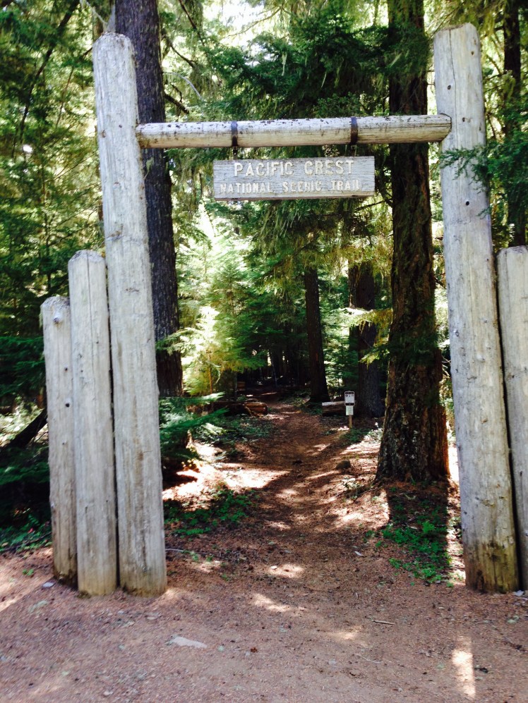
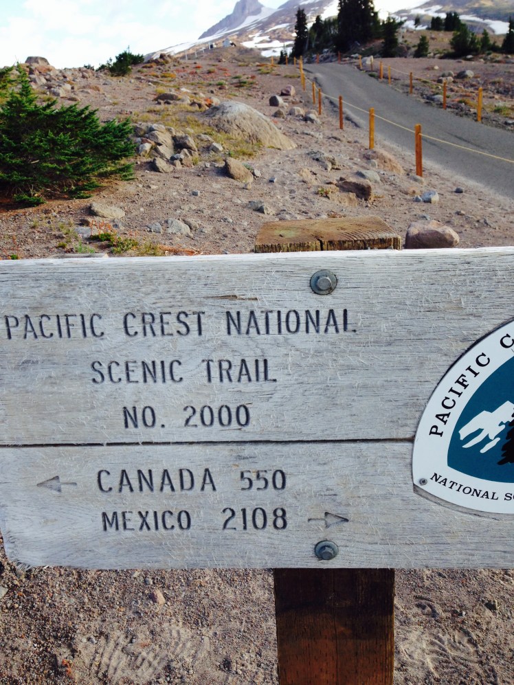
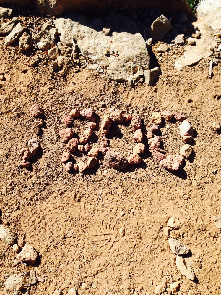
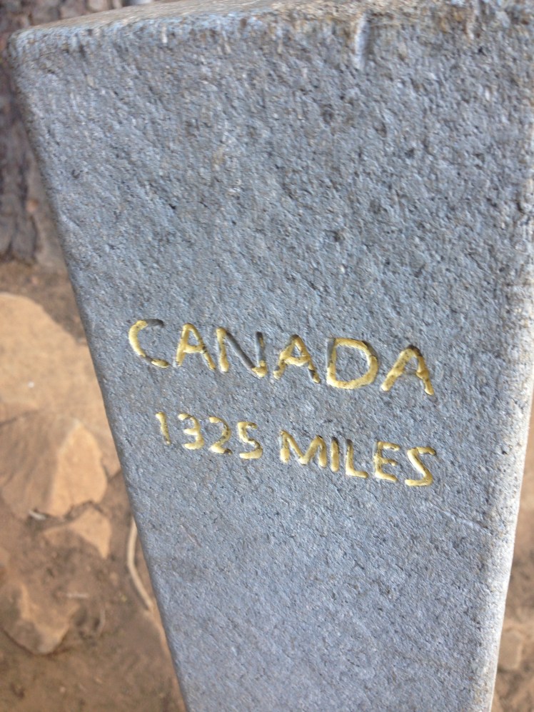
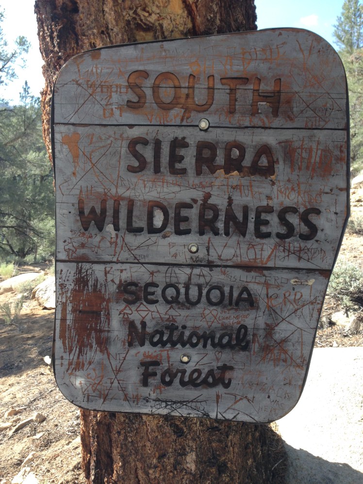
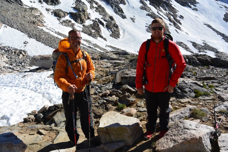
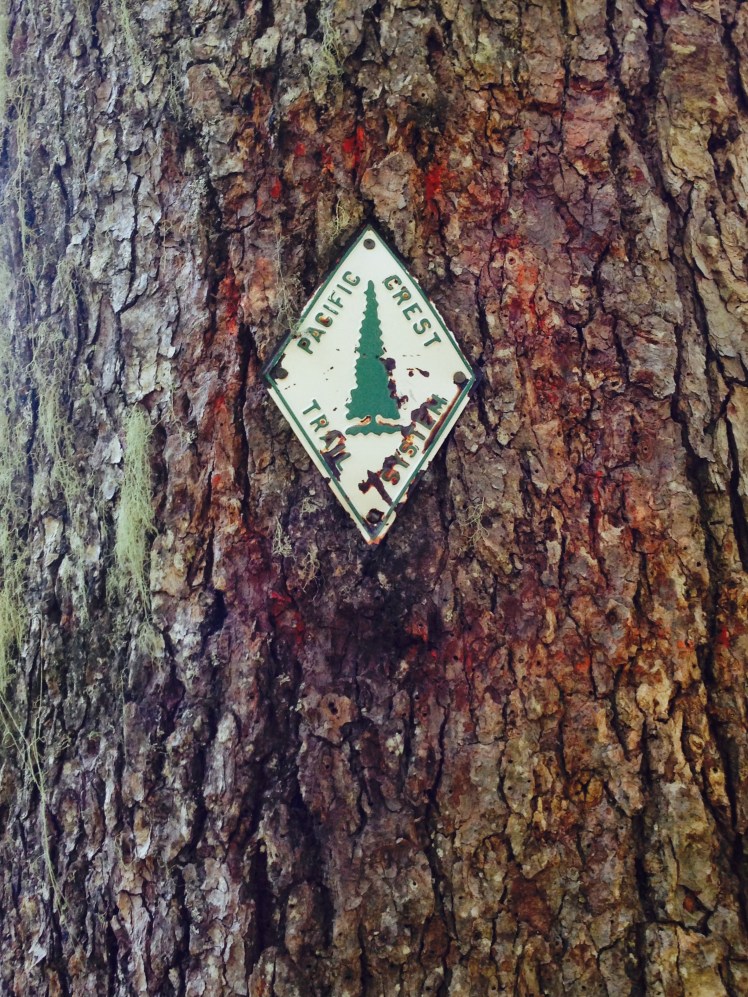
CHAPTER 14     (Bridge of the Gods mile 2155 to Manning Park, Canada, mile 2668.8)

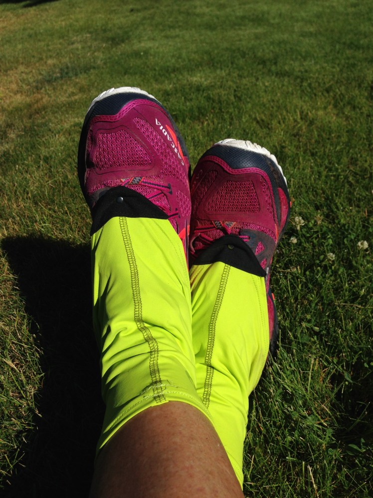
LESSON LEARNED: PACK WATERPROOF PANTS

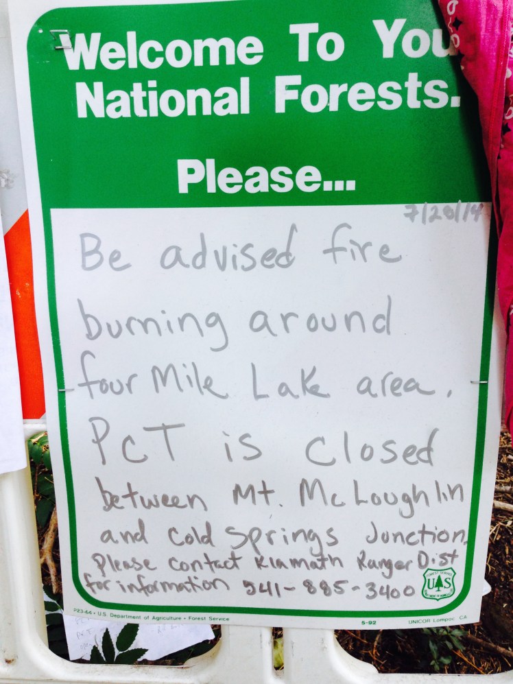
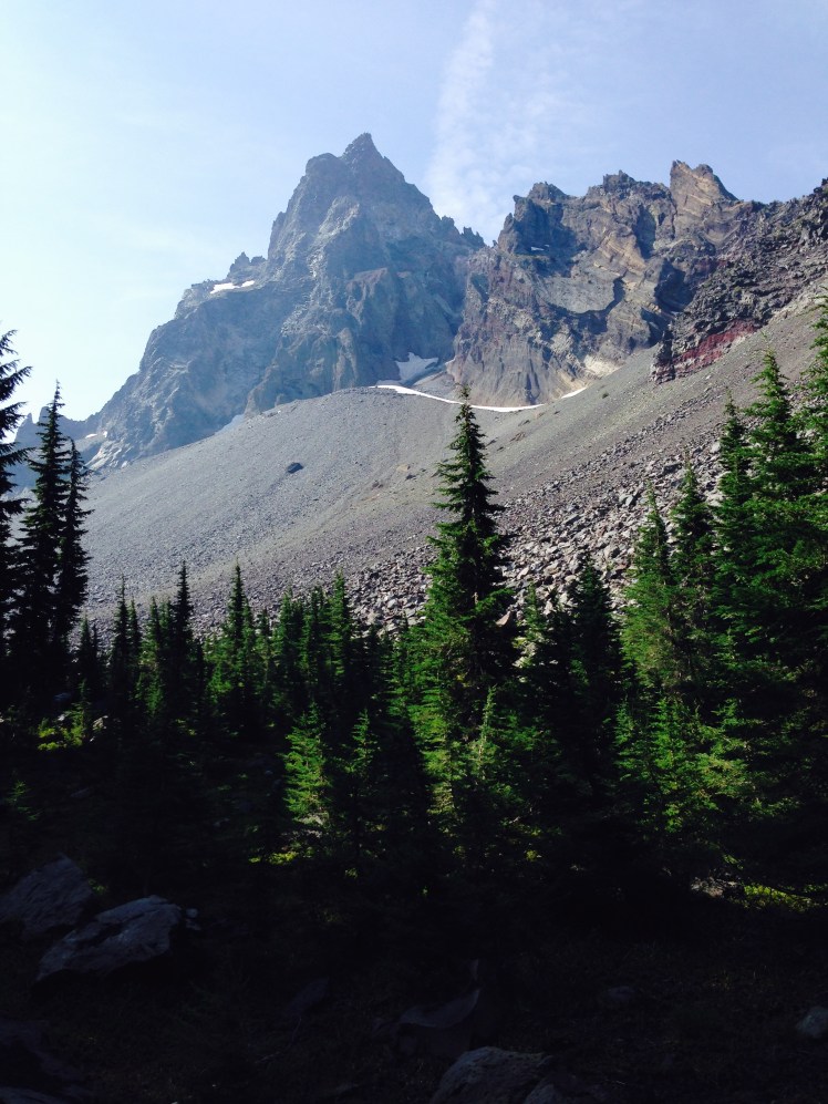
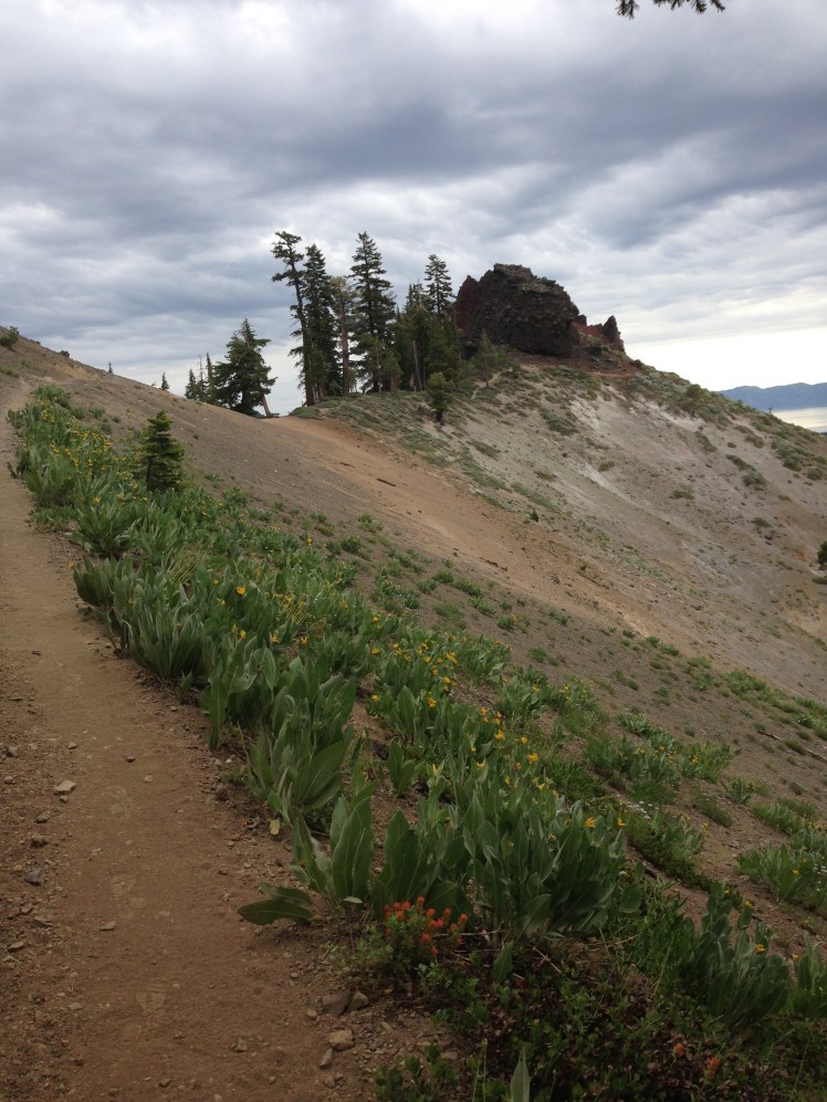
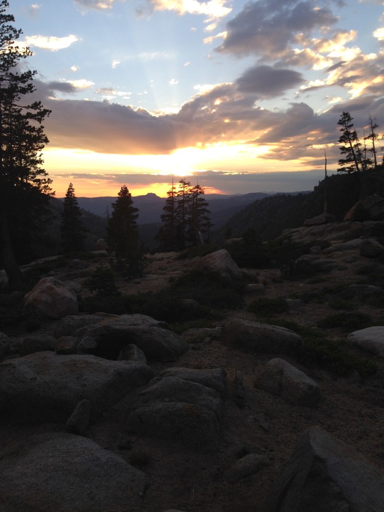
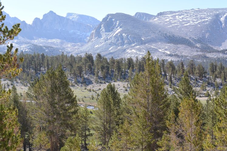
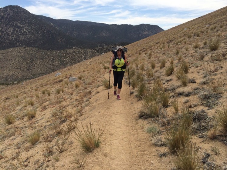
Arriving at the Bridge of the Gods, northbound thru-hikers are typically in their best condition, physically and mentally. Hikers in 2014 were mindful of 2013’s early snowfall of September 26th stranding hikers in the North Cascades. With this in mind, I hiked with a sense of urgency. The pull of the northern border was palatable with every step forward.  Each day felt like a mad dash northward.

Day 148, Tuesday, August 26

I was eager to cross the Bridge of the Gods and arrive into Washington State. But that had to wait, I spent the morning shopping for food and washing clothes.

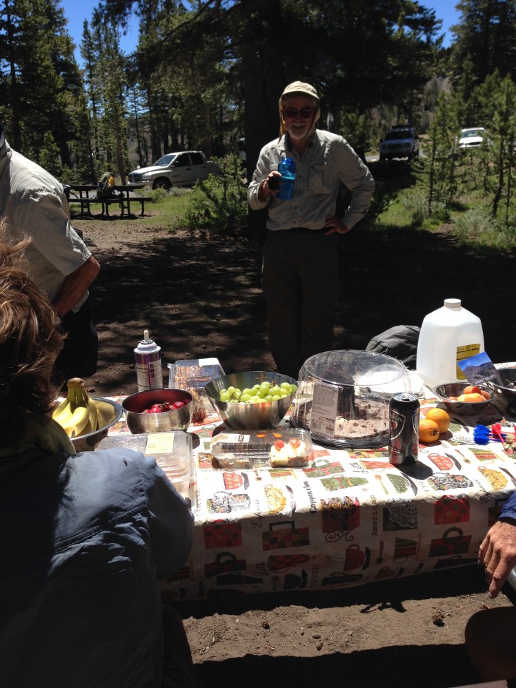
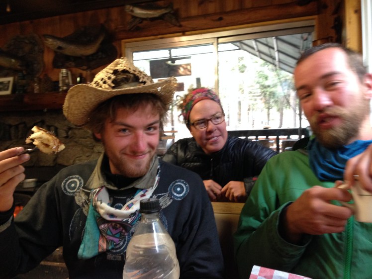
Mid-morning I ran into Pakabear who was taking a zero.   Cascade Locks was hiker-friendly with many hikers hanging around. I ran into hikers at the grocery store, at the Char Burger restaurant next door, and in the hotel. Many hikers planned to hitch into Portland and spend a few days. ET and Poison were staying a few days with Enduro in Portland.

Having lost 40 lbs with little body fat to burn necessitated carrying an increased amount of food. It was not ideal but had to be done, and I planned accordingly doubling my rations for breakfast and lunch.

In the early afternoon, I was finally prepared to get back to the trail. I climbed up to the bridge approach having readied my toll money. At the tollbooth the lady inside the waved me on.

IMG_1189

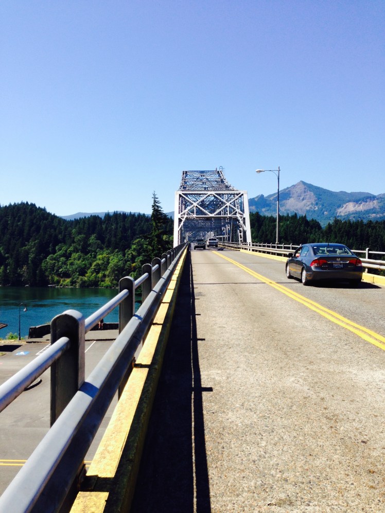
Bridge of the Gods over the Columbia River

“No Charge for hikers.” She smiled and waved from her small open window. She cautioned me.   “Walk on the oncoming traffic side of the bridge.”

“Oh, rats.” I thought. Now, I will have the weight of those quarters to carry.

As I reached the high point of the bridge, I wanted to take out my iPhone and snap a photo but refrained for fear of dropping my phone through the open metal grating of the center portion of the bridge into the fast flowing water of the Columbia River below.

IMG_1190

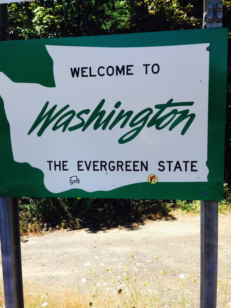
The “Welcome to Washington” sign was at the end of the bridge.

After almost five months I was finally ‘home’ in Washington State.

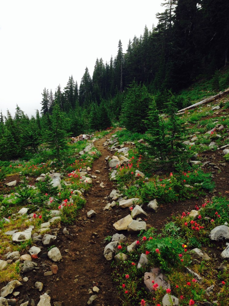
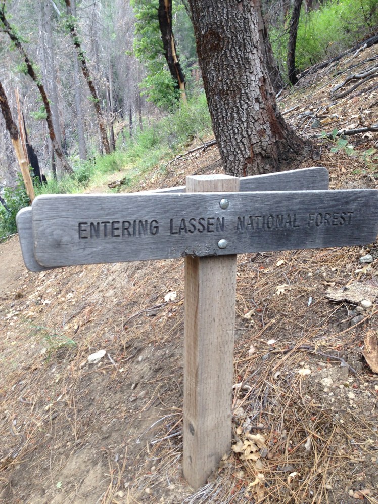
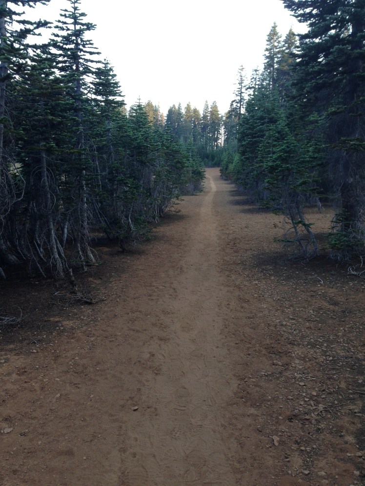
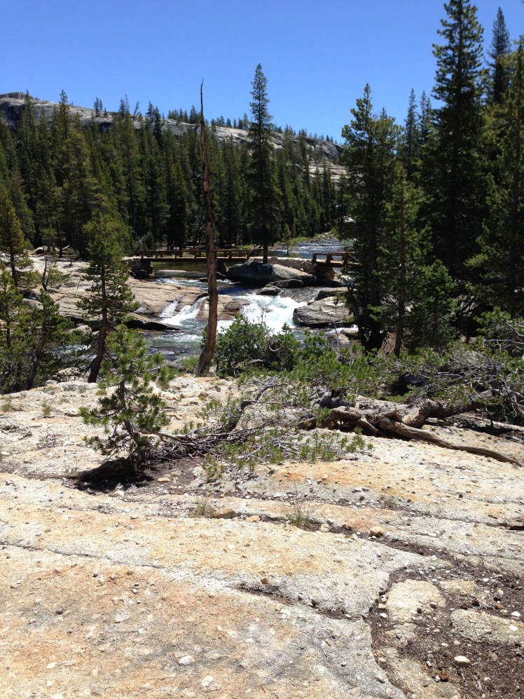
The trail up and away from the Columbia River followed along a paved road before starting the 3000’ climb up out of the river gorge.   The trail was disappointedly littered with garbage.  Furthermore, the sweltering day made the afternoon miserable.

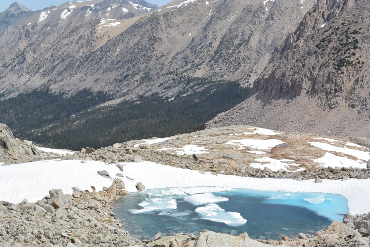
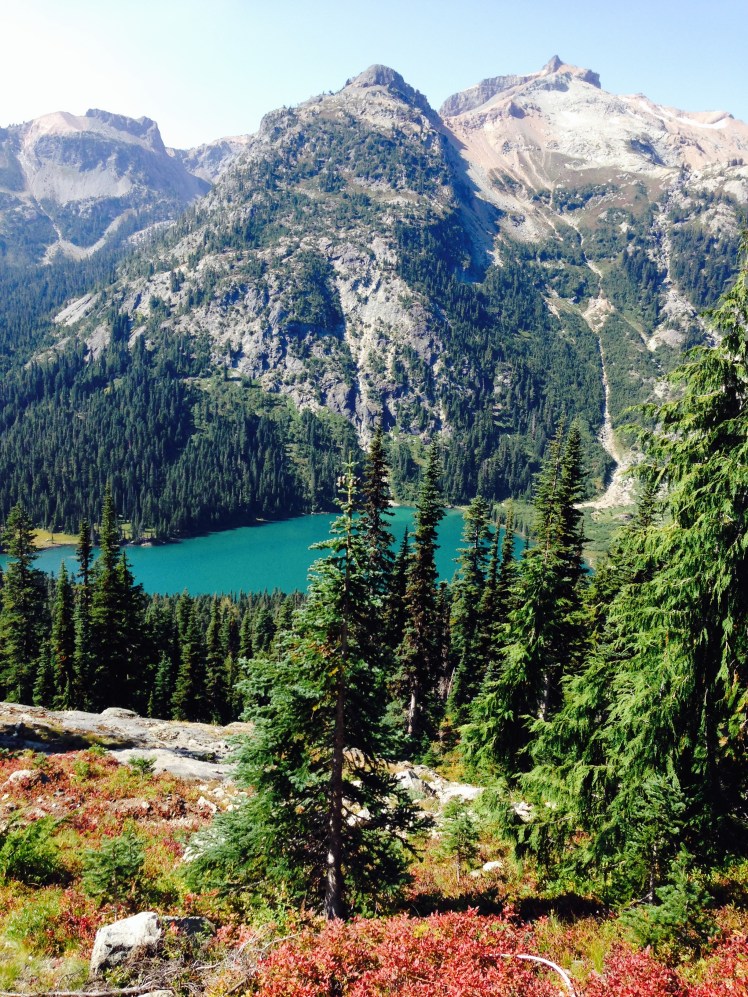
A brief stop at Gillette Lake was a pleasant break from the heat with the lake aglitter in the reflection of the afternoon sunshine.

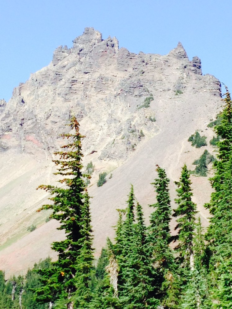
A little farther up the trail, I saw a slug on the trail and a salal hedge growing near the trail. Yep, I thought, I’m in Washington.
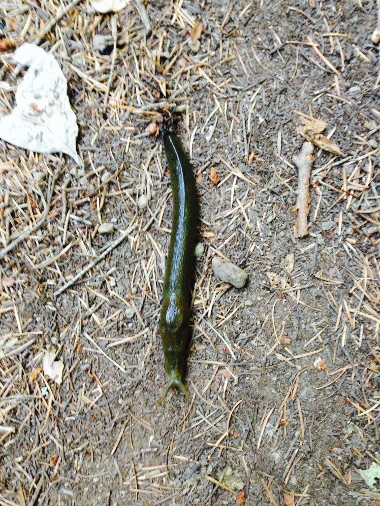
IMG_1193

Slug

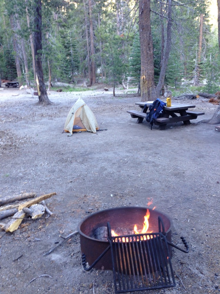
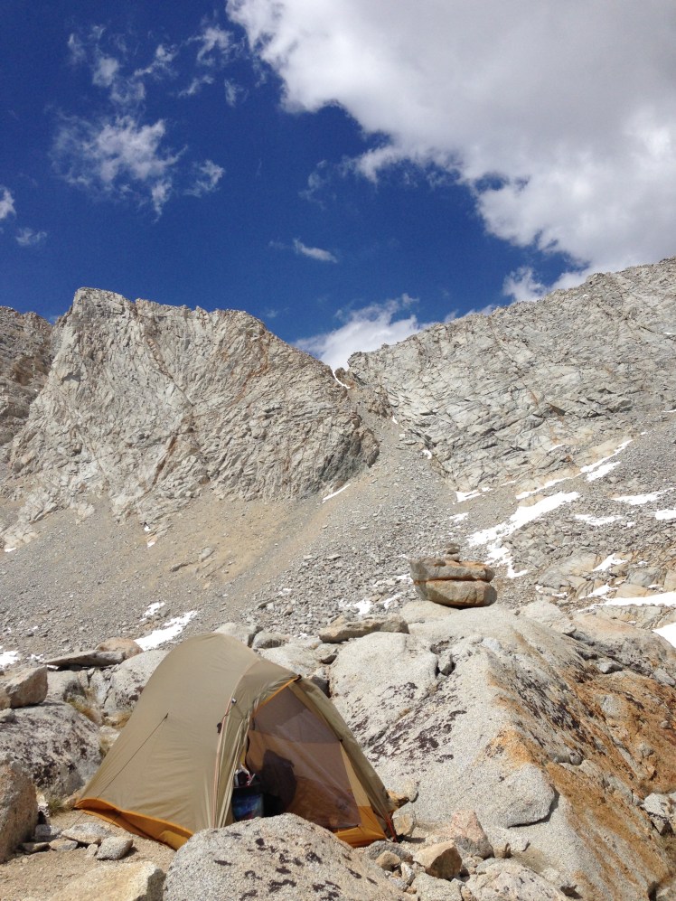
At a small opening up in the thick evergreen underbrush just off the trail, I made camp (mile 2162). It was early, but the hot weather had exhausted me. Many hikers had been in town.  There were no hikers on the trail during the afternoon.

I was a hot night. I had to strip down to my underpants to sleep comfortably.

Day 149, Wednesday, August 27

Midday I arrived at Rock Creek and rested along the edge, feet in the water, before crossing the wooden bridge to trudge on. I was determined to make it all the way to Trout Creek.

When I arrived at Trout Creek, it was under my headlamp nearing ten at night. The last few miles I was joined by a young hiker whose boyfriend had hiked on to Trout Creek leaving her behind, alone in the dark. We kept each other company as we struggled along the trail in the darkness.

At Trout Creek, her boyfriend had his camp set up in the only camping spot available. I reluctantly cross the bridge to find another place.

On the far side, I saw a hiker seated on the ground eating dinner next to his bivy bag.

“Hey, Real Time,” I called out. “Good to see you again. Mind if I join you?”

“Sure.” He smiled, welcoming me to share his space. Motioning to the creek, he added. “Just watch out when you go down to get water. It’s steep, I slipped on the rocks and almost fell in.”

I set up my tent a few feet away from his bivy. Unfortunately, our site was just off the paved road.

Logging trucks rumbled up and down the road all night.

Day 150, Thursday, August 28

About five miles across a broad valley around Bunker Hill, I came out on a paved road. Parked by the trail was a white car. I stood on the road trying to determine why the car might be parked there so early in the morning as a woman got out and came forward.

It was Deb, Halfmile’s wife, whom I had last seen in the desert.

“Hi, Deb. I don’t know if you remember me. I’m Homegirl. We met in the desert section. What are you doing here? Aren’t you hiking?”

“Had to quit in Ashland. Lost too much weight to keep going. Now I am following Lon and meeting him where the trail crosses roadways.” She was tiny when I first met her, now she was even more diminutive from weight loss. “He should cross the road here later today.”

“Did you sleep in the car?”

“Yes.” She smiled again.

After crossing the bridge over the Wind River, I began the switchbacks to higher altitude.

IMG_1194

In the afternoon, I headed off the PCT down to a spring for water. Seated close by the trail to the spring were two men, approximately 40ish, obviously not thru-hikers. They were tough guy types with their shaved heads and short stubble over scared faces. Spread out were several pots and pans as they prepared a rather large meal.

I was suspicious.   After a quick hello in passing, I kept my distance as I sat filtering water.

In the late afternoon, I camped at the Crest Horse Camp in the picnic area with Real-Time who arrived at the camp with me. We picked out a large flat camping area and set about preparing camp.

Three hikers came by and camped at a site across the trail.  Soon they had a big campfire burning.

“Hey, you guys want to join us?” One of the men called over to us.

“That sounds good.” Real Time hollered back. “Be right over.”

We quickly joined the three and relaxed around the fire, eating and talking. I had not met the three hikers before and did not see them again on the trail, but for one night on the trail, we were friends.

The two tough guys made camp nearby.  Could they be on the run? I asked myself. A long trail might be the ideal place to hang out if you were on the run. Nah, my imagination was getting the best of me.

Day 151, Friday, August 29

It was overcast most of the day with raindrops falling off and on. I became wet from the water off the brush along the trail rubbing on my legs and shoes. I had not packed waterproof pants or waterproof glove covers as these cuben fiber items were very pricey and I was reluctant to spend the money.  I was beginning to rue the fact I had been pound foolish.

I was planning to overnight at a camp icon spot shown on the map just past Big Mosquito Lake. When I crossed the footbridge and spotted locals in the campground, I kept going.

Shortly, I found a small clearing close to a steep fast flowing creek and decided this would be a good enough place to stop. As I put up my tent around mile 2228, it started to rain again.

It rained off and on throughout the night.

Day 152, Saturday, August 30

Ten miles ahead at Road 23, I had arranged for friends to pick me up at 2:00pm to take me to Trout Lake.

It was a wet rainy morning. I kept up a fast pace to keep warm.

“Homegirl!” It was Rubik’s booming voice just as I turned a corner. “I’m rushing to meet friends at Road 68.” He called out as he headed down the trail. We ran along together keeping up a steady conversation between us as we jogged.

At Road 68 Rubik met up with friends. I hurried on toward the next road crossing.

Parked on the edge of Road 23 was Deb waiting for Halfmile.

She climbed out of her car. “Hello.” She seemed happy to see a familiar face.

“Did you sleep in your car?” I asked.

“Yes, and I had a rather scary situation last night. I was already asleep when a stranger knocked on my car window.” She began telling me a scary story about a stranger coming up to her car during the night when I saw a blue car approaching up the highway. I wanted to hear her story, but I also wanted a hitch into town. I put my thumb out, and the car pulled over.  Hearing Deb’s story would have to wait. I climbed into the blue Toyota.

The young man drove me into Trout Lake and dropped me at the service station and café. Across the street was a small general store. Standing out in the rain, I called Judy and Mike, to let them know I had already hitched into town and they could pick me up at the café in an hour. I wanted time to eat.

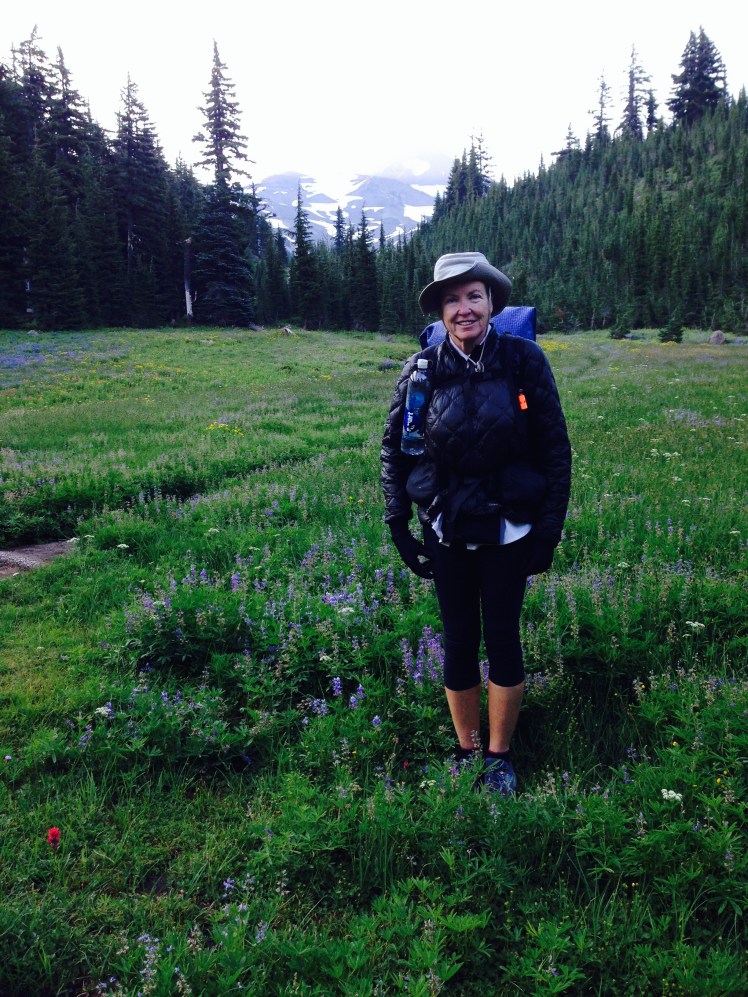
Judy and Mike’s summer home is on acreage a few miles from town. Staying for the weekend was his daughter with her two children.

Thanks to Mike’s help, I strung my tent, fly, and footprint up in their garage to dry. He propped my wet shoes in front of a fan to help the shoes dry out. There were comments and observations about my worn and falling apart running shoes.

Mike and his daughter took me back into town for supplies at the general store. I ran into ET and Poison who were staying in rooms above the store.

Judy is an excellent cook. We had a special family dinner of salmon, salad, quinoa with green beans, and huckleberry pie.

Day 153, Sunday, August 31

Early in the morning after Sunday breakfast, Judy and Mike dropped me back up to the trail on Road 23. Thanks to Mike and Judy, I was dry, rested and ready to hike.

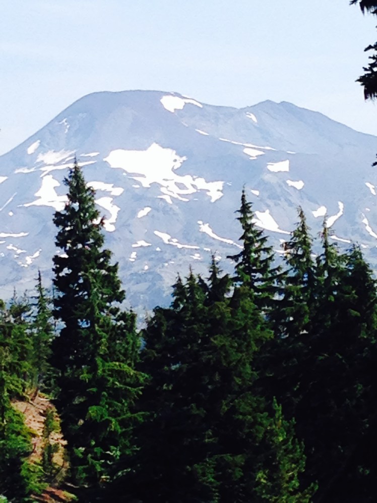
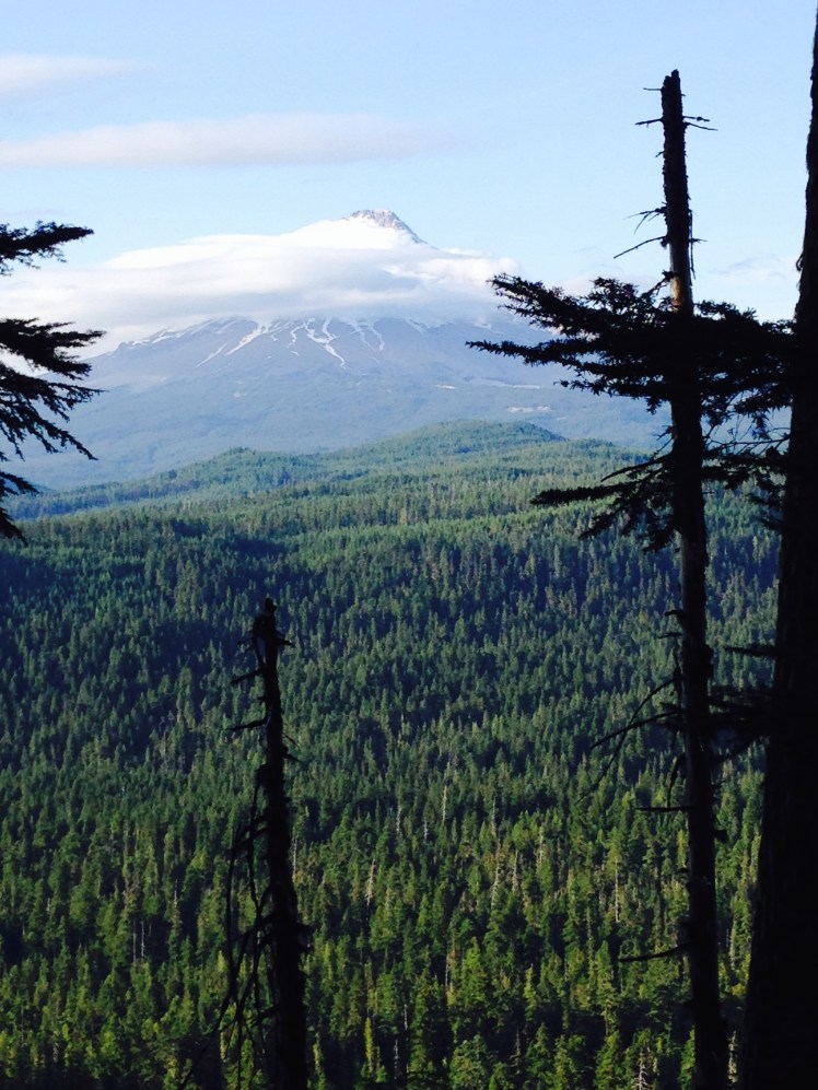
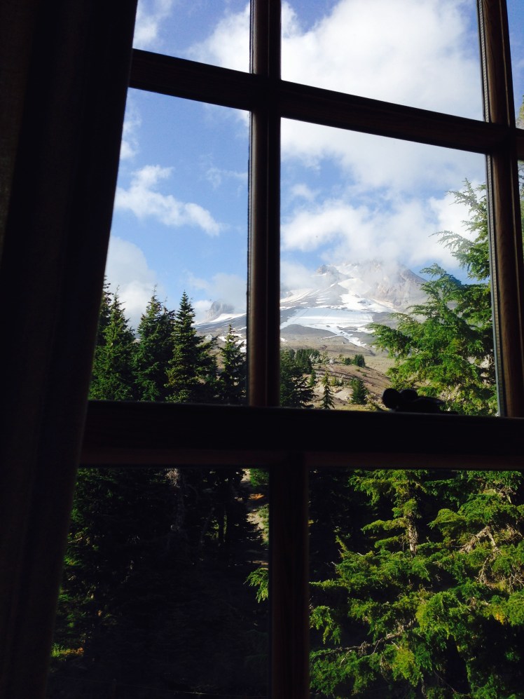
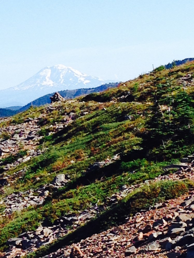
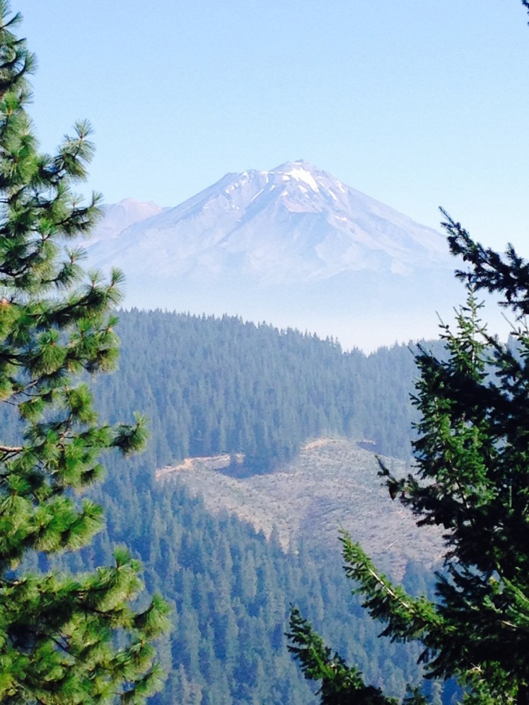
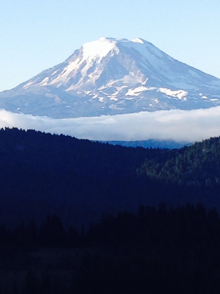
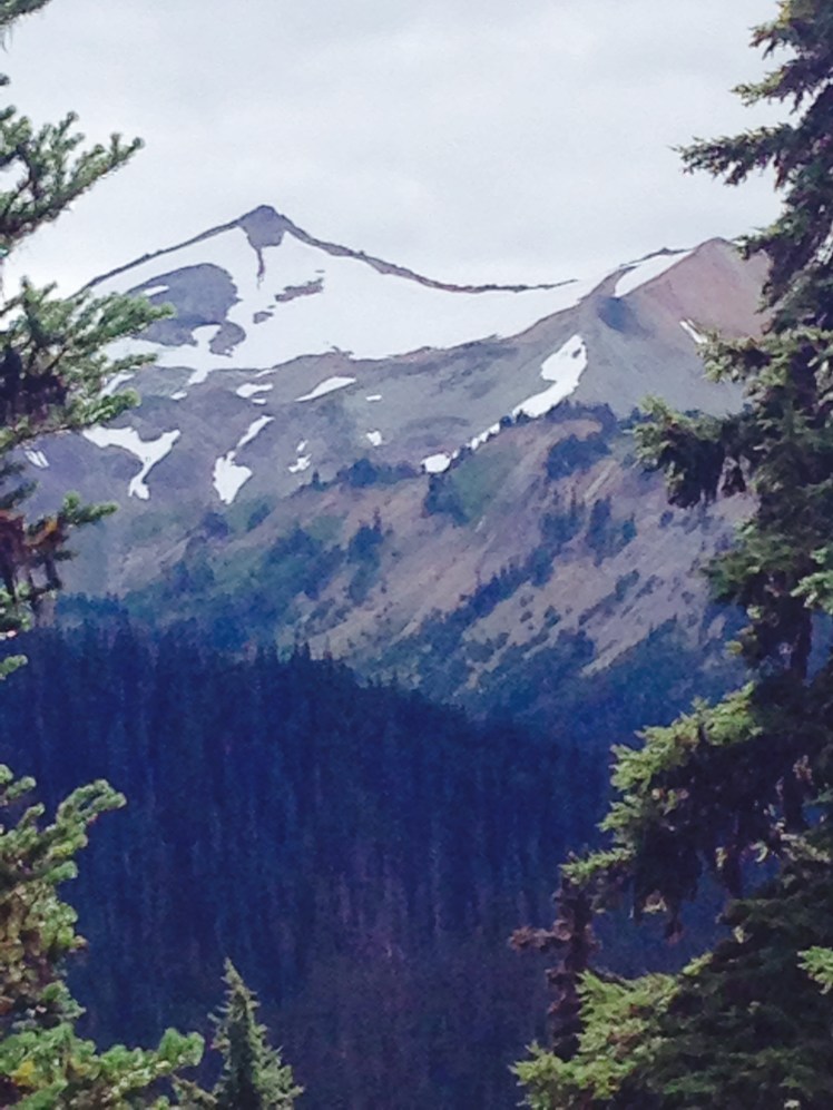
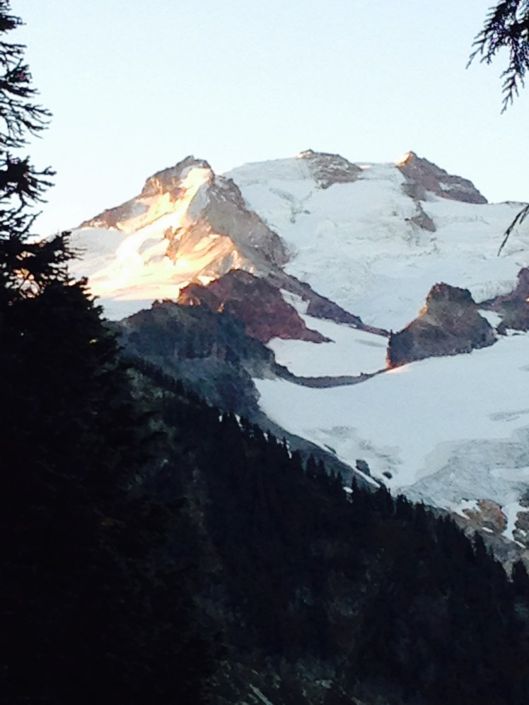
The trail headed toward Mt. Adams. It was a chilly sunny morning, with a few clouds but no rain. The trail passed up and over the flanks of Mt. Adams with extensive down valley views. The many glaciers of Mt. Adams glistened when the morning sun made an appearance.

After I had gained altitude, I decided to check for cell service. I sat down on a large log at the edge of the trail with a full view of the jagged glacier covered mountain before me and caught up on emails and text messages.

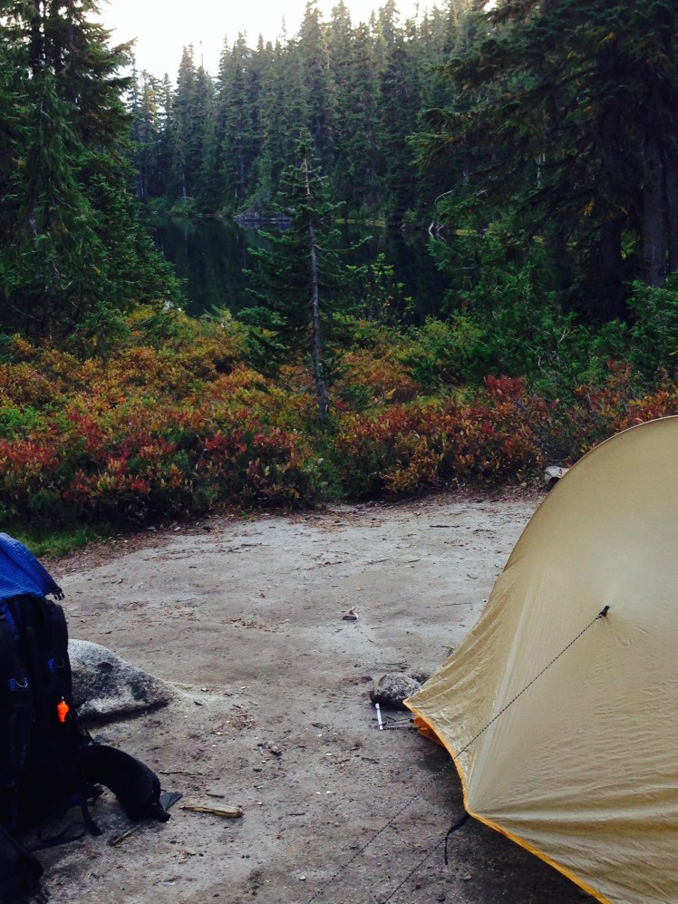
That evening I camped at Lava Spring (mile 2258) among a grove of young trees. Several other hikers camped among the trees. Because of the amount of open space, we kept at some distance from each other and it was not crowded.

Day 154, Monday, September 1

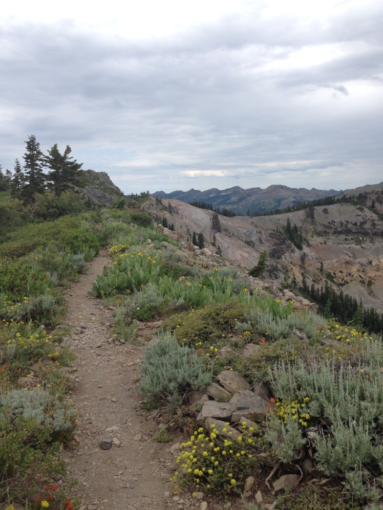
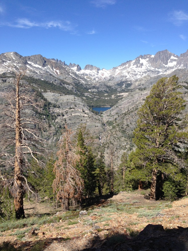
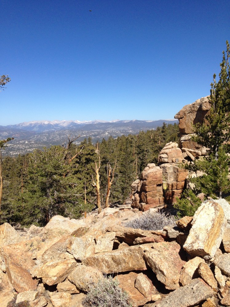
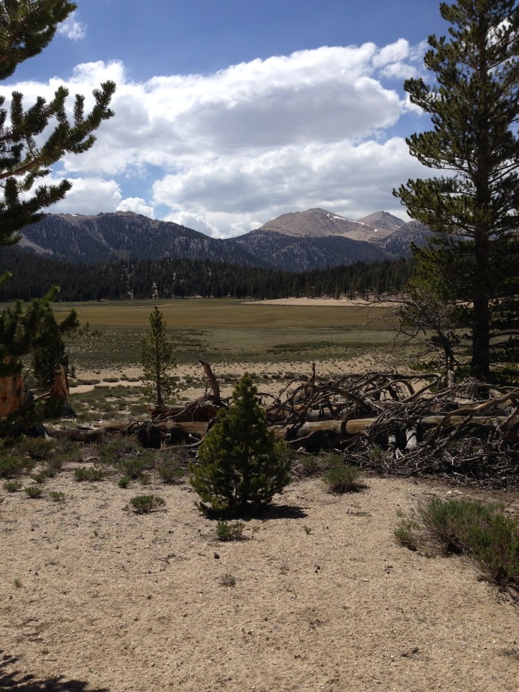
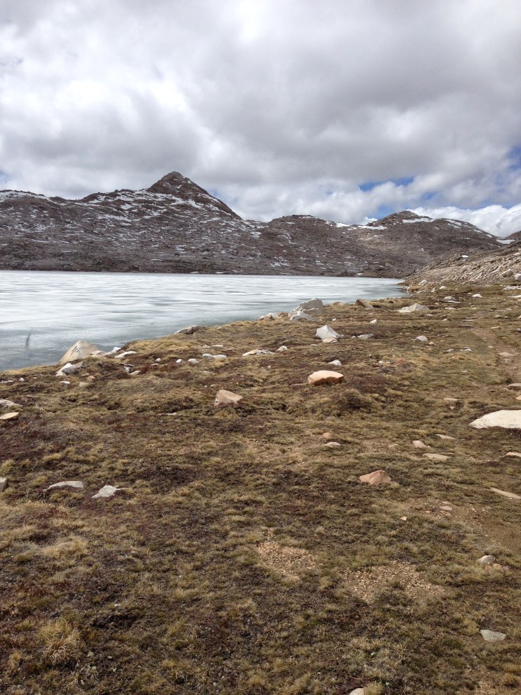
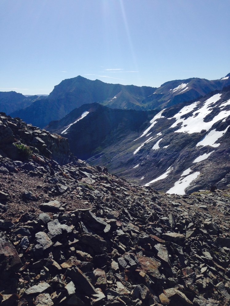
The trail stayed above tree line on mountain ridges. Once I was in the Goat Rocks Wilderness area, the trail followed along ridgelines. At one point I was able to look across to the other side of the mountains and see little white dots of wild goats. Late in the day, I arrived at Cispus Pass.   From the pass, the trail traversed just under the ridge. It was rough hiking through the washouts where steep dirt chutes cut downward obliterating the trail.

IMG_1203

At dusk, a chilling wind blew across the mountaintops, I camped at mile 2281 on the edge of the mountain surround by stunted alpine trees. I made a fire in the circle of rocks and burned my paper trash. I wanted my pack weight to be as low as possible as I headed across Goat Rocks. Unfortunately, in the dark, I mistakenly burned tomorrow’s maps as well. Once the coals were cold to my touch, I went to bed. It was late. From my mountain perch, I enjoyed views in almost every direction with no evidence of another soul on earth. I was alone.

Day 155, Tuesday, September 2

A few miles upward on the next ridge the two tough guys were camped at Snowgrass Flats.

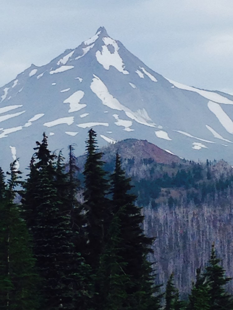
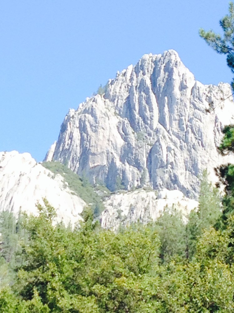
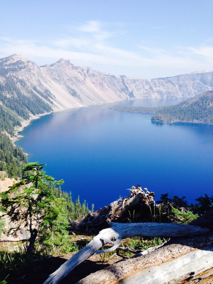
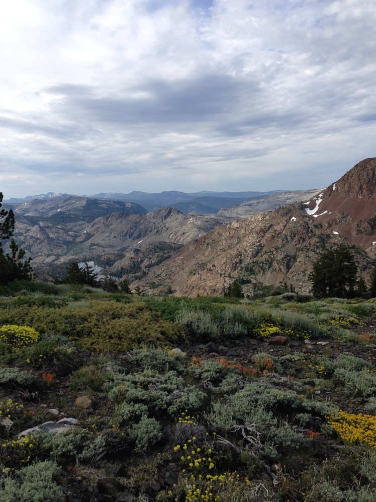
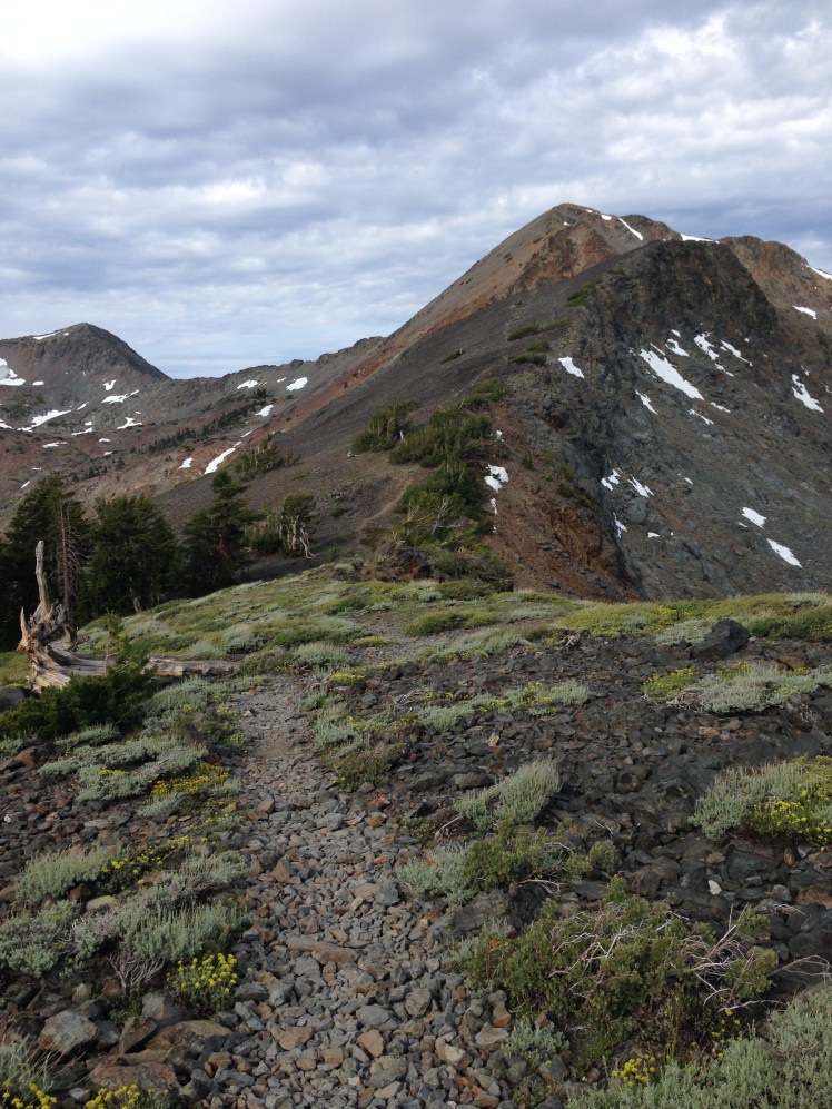
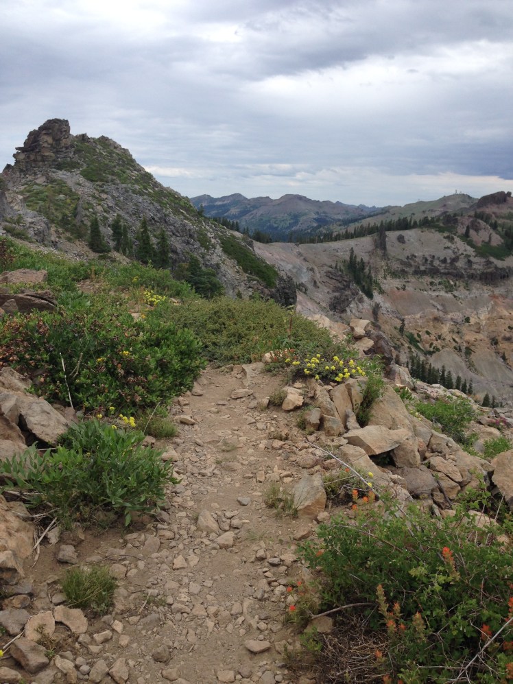
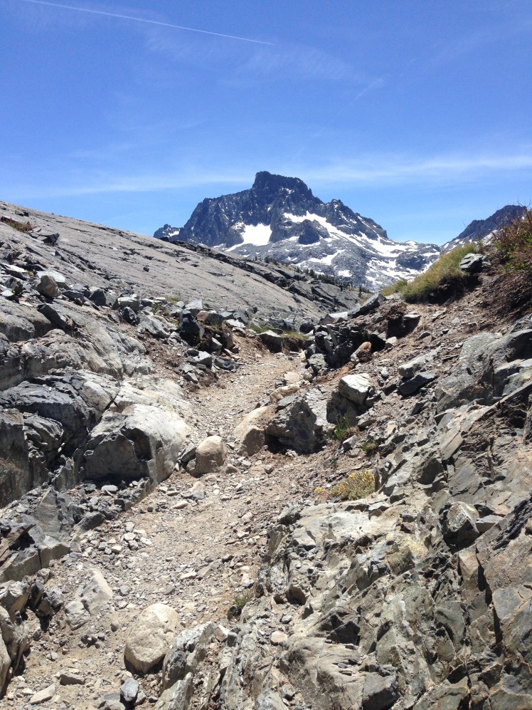
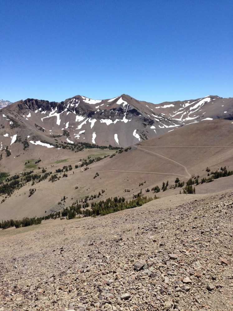
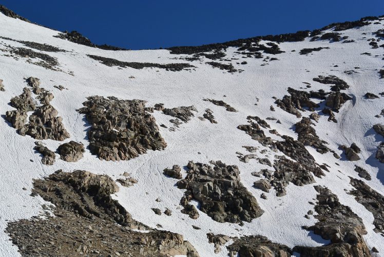
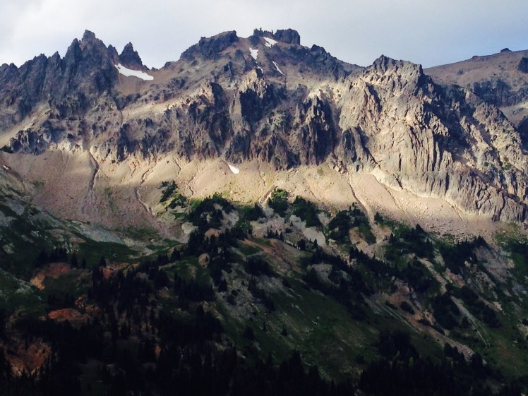
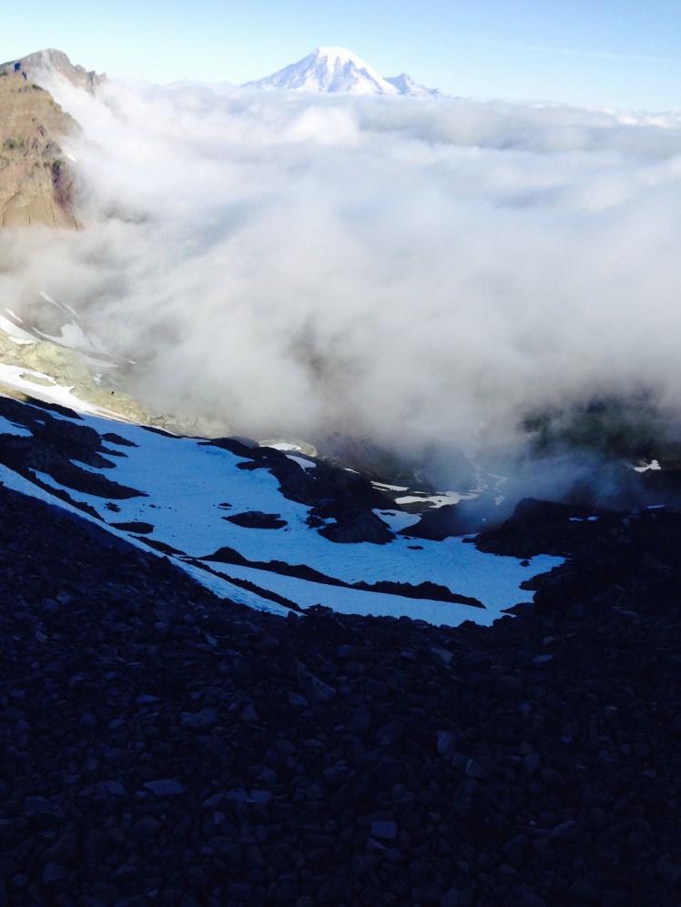
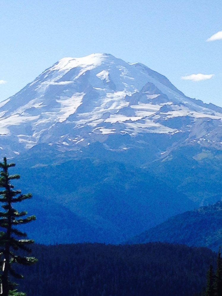
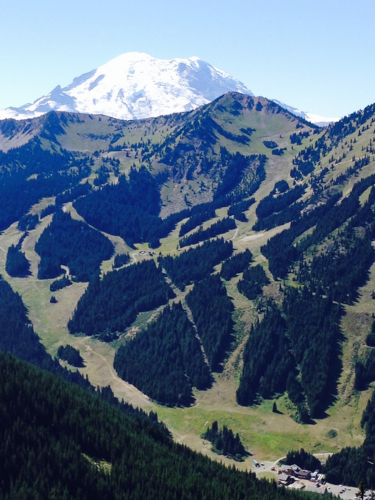
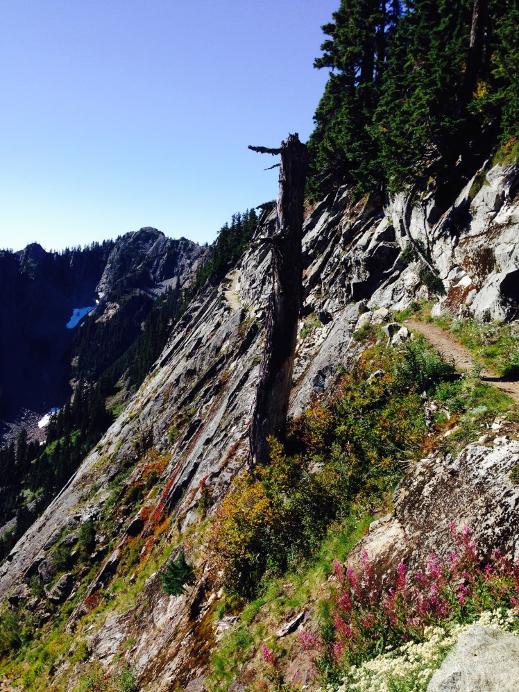
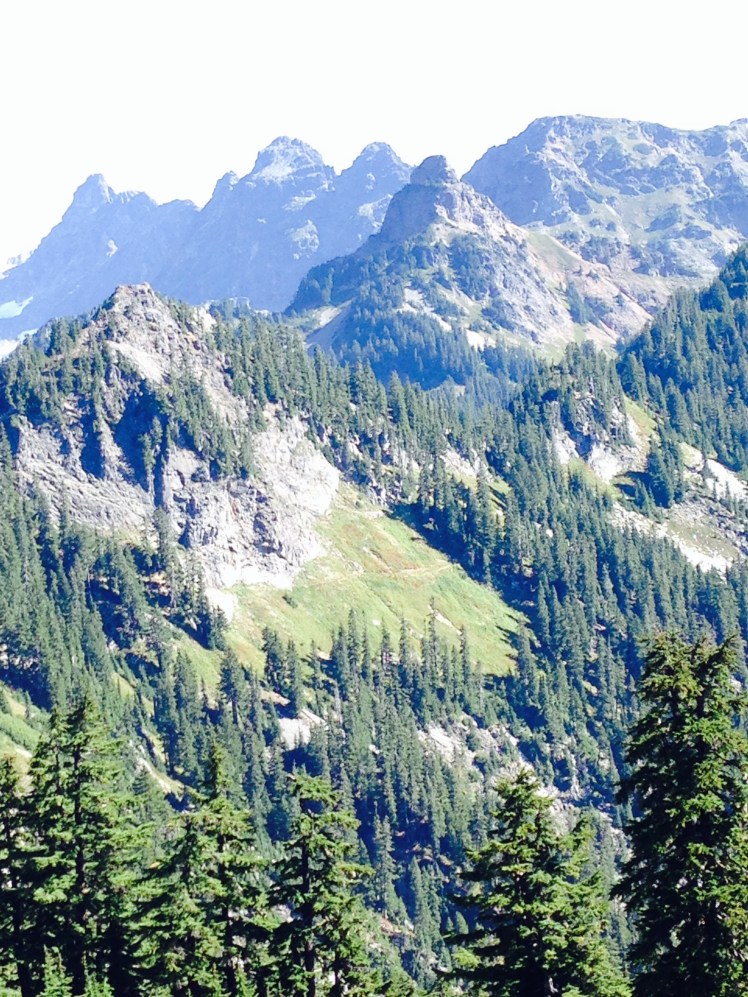
Shortly after Snowgrass Flats, the trail crested the ridge. Standing at the ridge was a spectacular 360-degree view. Mt. Rainier stood ahead and to the south, Mt. Adams. Both peaks loomed large and impressive. Looking ahead the trail followed the top of a series of sharp rock edges. I was about to start across Goat Rocks.
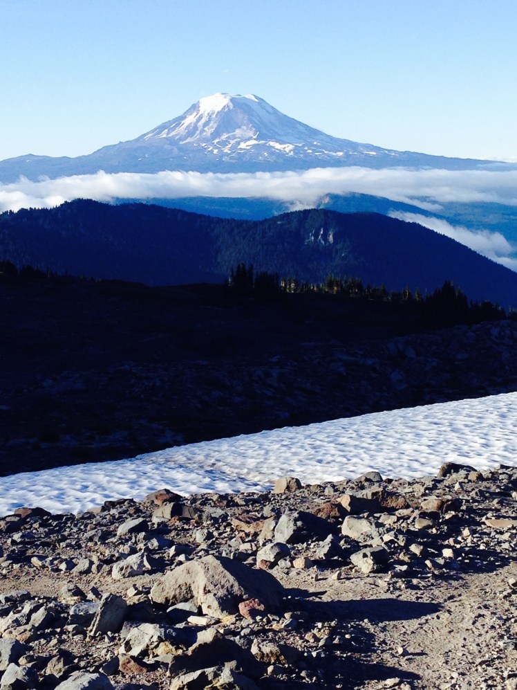
IMG_1209

IMG_1213

Mt. Rainier ahead

IMG_1215

Mt. Adams looking back

IMG_1216

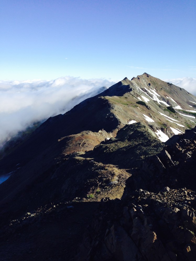
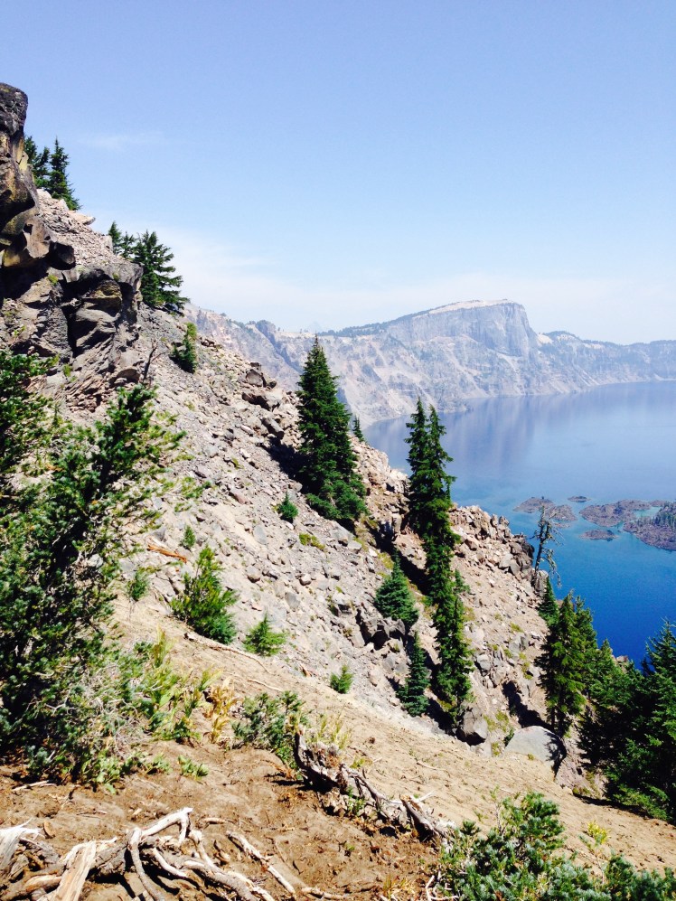
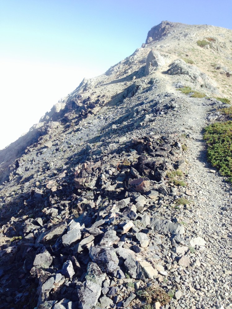
Looking ahead to the start of Goat Rocks

IMG_1217

IMG_1219

Nearing end of Goat Rocks

img_7093-2

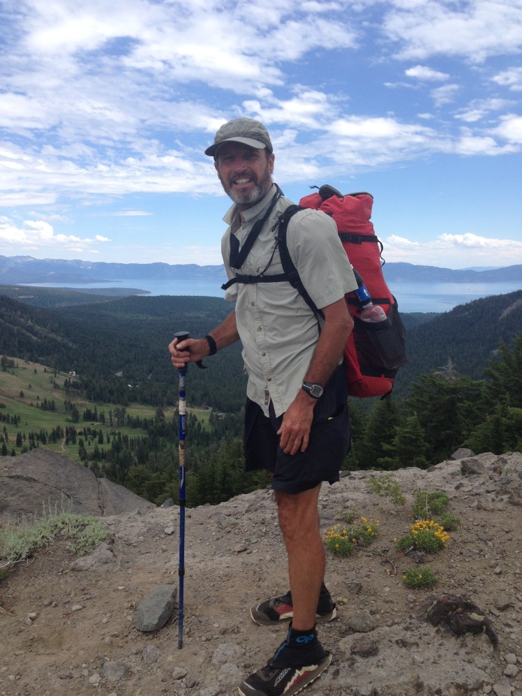
Rubiks with Mt. Rainier in the background.  (Photo provided by Rubiks, I did not actually see him at this point of the PCT)

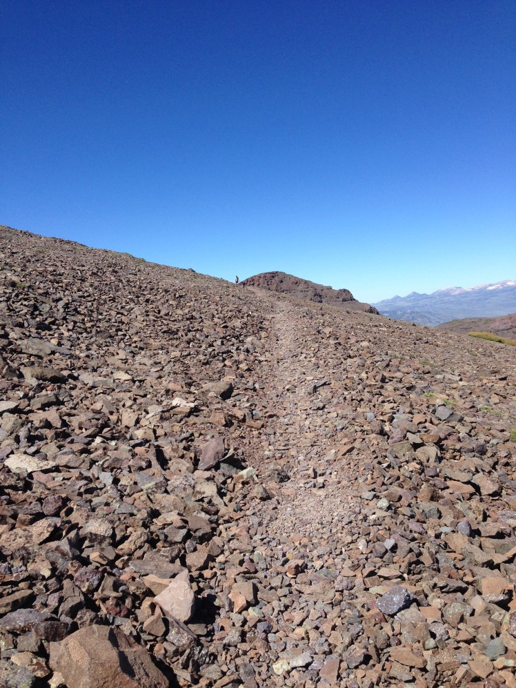
I made my way along the rocky trail. In some places, it was too steep to hold my footing on the scree making me slide forward. Both sides of the rocky spine dropped down steep ravines. I was walking on a knife’s edge. I made my way along, glancing over from one side to the other. The Goat Rocks walk is five miles. I walked slowly and cautiously. I had to stop to catch my breath at several points, holding onto rocks.   As I slowly made my way along, I was passed by the two tough guys and later another thru-hiker. The thru-hiker stopped to say one word, “Epic!”

He had summed up Goat Rocks with one word.

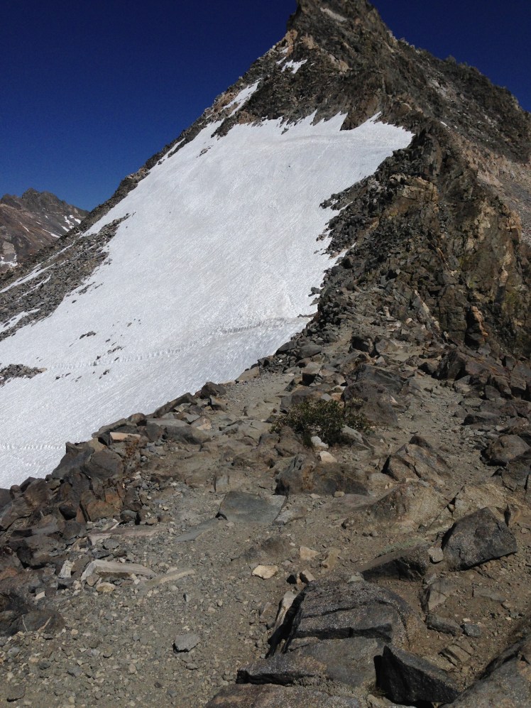
After Goat Rocks, the trail crossed high on Packwood Glacier. At this early morning hour, the glacier was solid ice. I kept my steps inside the frozen footprints made the day before when the snow had been slushy. I felt a pulse of fear not wanting to make a mistake and find myself several hundred feet at the bottom of the glacier. Within a few feet from the far edge, I slipped on the pocked marked ice and fell backward  My backpack dug into the ice and helped stop my slide. I was on my back, my feet below the ice footprints of the traverse. I could not regain my footing on the steep solid ice.

I pulled myself along from one frozen footstep to the next with my hands, sliding sidewards on my bum until I was off the glacier to safety.

Once back down in the basin, I had caught up with the two tough guys. This time, I took the time to stop. We each filtered water by the edge of a creek. It was sunny. The sun glittered on the creek. We sat and chatted as we waited through the water filtering process.

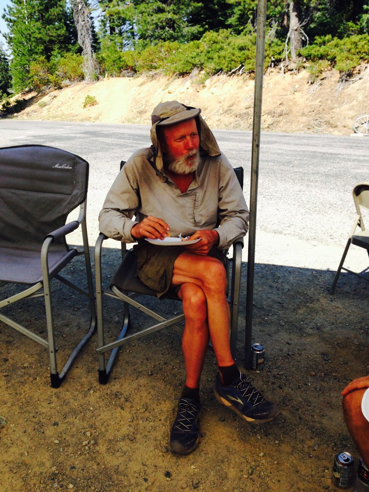
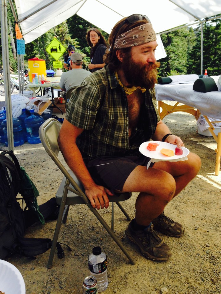
They said they were firefighters from the Las Vegas area. Every year they hiked a section of the PCT. This year they were headed for Stevens Pass. Their trail names were Gimp and Shorty*.  Gimp had a previous leg injury that caused a slight limp when he walked. I spent the rest of the early afternoon leapfrogging with them along the trail and forgot I had once felt wary.

IMG_1222

At the next ridge, looking back at the Goat Rocks walk along the ridge tops shown here against the sky

Toward the end of the day there was one last climb up and over a high ridge and then down toward the White Pass ski area. Just before the top a few feet off the trail stood a herd of wild white goats. I waited not wanting to scare them off. I stayed and watched until the goats walk on around the steep rocky mountainside out of sight.

Overhead the sky darkened. It started to rain.

As I reached the top of the ridge, I was almost knocked over by a strong gust of billowing wind. I was forced to hunch forward to keep upright. Gimp and Shorty passed me and hurried off the summit and were quickly out of sight. We were rushing to get to the store at White Pass below before closing to pick up our resupply packages.

As I started the descent, the rain turned to snow. Pelts of frozen ice drove into my face, hands, and exposed legs. I stopped and put on my rain jacket. I made the mistake of not taking the time to layering up underneath the rain jacket. I underestimated the severity of the weather and length of time it would take me to get down.

The first part of the descent contained a steep section of switchbacks crisscrossing a rocky face. I hiked as fast as my footing would allow trying to lose elevation quickly to get out of the snow.

Little did I realize the extremely icy wind and snow froze my water filter cartridge which was in the outside mesh pocket on the back of my pack. Once the cartridge of a Sawyer filter freezes it no longer works correctly. I had cautiously slept with the filter each night in my sleeping bag and never considered the filter might freeze in the daytime.

Descending into the trees, I was out of the snow.  Fog and rain swirled around. I soon lost the trail. I had accidentally burned the pages of the map and now my GPS did not work in the fog. I remembered the instructions said to follow the first ski lift to reach White Pass. I saw a chair lift and cut back down towards it. The ski slope wound through heavy brush and steep rocky sections crossing in and out of the forest areas broken by swaths of clearings. As I crossed a clearing, four elk bolted through the opening and disappeared into the woods. It was a magnificent sight to see the elk a few feet away.  They crossed so near to me, I was overwhelmed by their pungent odor.

Under the rain jacket, I had on only my wet shirt. My yoga pants were wet and offered little warmth. I was shaking from the cold. My shoes and socks were soaking wet making my feet cold.

When I arrived at the bottom of the ski lift, I realized I had followed the wrong lift. I needed to walk out the service road until I found the pass. I stumbled along the service road barely able to put one foot in front of the other. I was ready to stop and start putting up my tent for shelter and warmth when I rounded a corner of the muddy road and saw the day lodge below.

I arrived just minutes after the Kracker Barrel store closed. I stood at the door, pounding on the glass, hoping someone was within. I gave up. Obviously, no one was around.

My plan was to hitch into Packwood and find a hotel room to stay the night. Now I realized I was too cold to stand by the road to hitch. There was little traffic on the highway. Not one vehicle had passed since I arrived.

Adjacent to the store was a small condo complex. I climbed the stairs up to the level of the condo to look for a rental office. The square buildings were sited on a flat graveled parking lot overlooking the highway below. At the far end of the buildings, I located the office.

An “OPEN” sign stood in the window. However, no one was inside. I tried the door. It was unlocked. I went in, dropped my pack in one of the chairs by the door and sat down on the other. I was shaking uncontrollably.

A quarter of an hour passed before I was able to get out my trail town notes and use my cell phone to call the office number. A man answered my call just as a heavy set man in sweats holding a cell phone to his ear opened the door and stepped into the office.

“It’s me.” I motioned to my phone. “Do you have a room available for tonight?”

“Yes.” He reached across the desk and handed me a form to fill out. “It’s a studio. $85 for the night.”

I stood up and took a couple of steps to the counter and handed him my Amex. On the form, I printed in my name with shaking hands. My name was barely legible. I looked down at the next line requesting my home address. I could not remember my home address. I could not remember my home phone number. I stood shaking, looking down at the form, not lucid enough to complete the information.

“Never mind.” He said kindly and handed me a room key. He gave directions to the condo.

In my cold, mentally confused state, I had trouble locating the unit.

Once inside, I hurriedly stripped off my wet clothing and jumped in the shower. After a long hot shower, I donned the robe in the bathroom and made a cup of hot chocolate in the small kitchen.

I pulled down the bed coverings and propped myself against the pillows and slowly drank the hot chocolate.

It was several hours before I had the strength to get out of bed and take care of my wet gear.

I had made it to White Pass, mile 2303.

Day 156, Wednesday, September 3

I woke to a sunny day. In the Kracker Barrel Store, I collected my resupply box and purchased additional food items. The store had a laundry for hiker’s use. I went back to my room to fetch my clothes to wash. There was a line up of hikers waiting for the washer and dryer. I visited with Deb, who was waiting for Halfmile. Shorty and Gimp were there waiting for the laundry. Shorty asked to use my cell phone to call his wife. My phone was back in my room recharging. We both walked back to my room for my phone. Firefighter or fugitive, I was no longer frightened of him.

Deb was able to finish her scary story.  While she was sleeping in her car, a man had tapped on her car window.  She rolled down her window just a bit to see what he wanted.  He asked to borrow matches or a lighter. She passed the matches out the crack in the car window.  When he asked for help starting a fire, she had been too frightened to get out of the car. She kept her doors locked and did not sleep.  In the morning he was gone.

Rubiks and Mountain Spice came in with several other hikers. It was good to see many familiar faces.

It had been my intention to check out and hike onward once my clothes were washed, and gear cleaned. I looked longingly at the sun covered mountains surrounding me and wanted to hike, but I was mentally exhausted. I went to the office and rented the condo for another night. I spent the rest of the day in my room napping and staying warm.

Mental exhaustion was not something I experienced prior to the hike.  I felt profoundly mentally exhausted at several points along the trail. I had expected to experience the physical exertion and exhaustion; however, the contant exposure to unpredictable conditions and danger wore on me mentally.

Day 157, Thursday, September 4

While at White Pass, I made plans to arrive at Snoqualmie Pass in four days, arriving Sunday. If I shopped for supplies on Monday morning in Seattle and did a nero out of Snoqualmie Pass, I could be at Stevens Pass Thursday evening. Which would allow my daughter to pick me up at Stevens Pass and I could return back to Seattle area for my dentist appointment Friday, September 12. It meant hiking 25 mile days to reach Snoqualmie Pass for this plan to work.

On the trail early, I turned a corner to find a buck with a large rack standing ahead at a summit silhouetted in the early morning mist.  The mist caused starburst morning sunlight behind the antlers. He was there for one heart-stopping moment and then silently vanished.

Later in the morning, as I was jumping from rock to rock crossing Bumping River, I slipped on a wet mossy rock and fell into the river. I scrambled to grab my trekking poles before the fast flowing water washed the poles downstream.  I was wet up to my neck.

I changed my shirt. I knew the yoga pants would dry quickly. Because I kept my backpack lined with a trash compactor bag, luckily nothing inside my backpack got wet.

It was here I realized my water filter no longer filtered water correctly. I must hope for the best until I reached Snoqualmie Pass. I had no way to purify drinking water.

My backpack dripped water as I hiked up the next mountain.

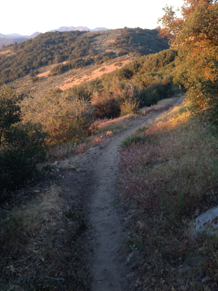
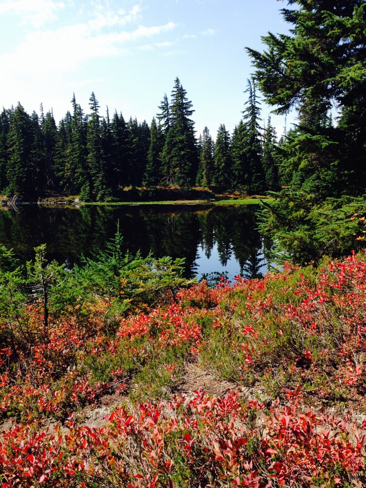
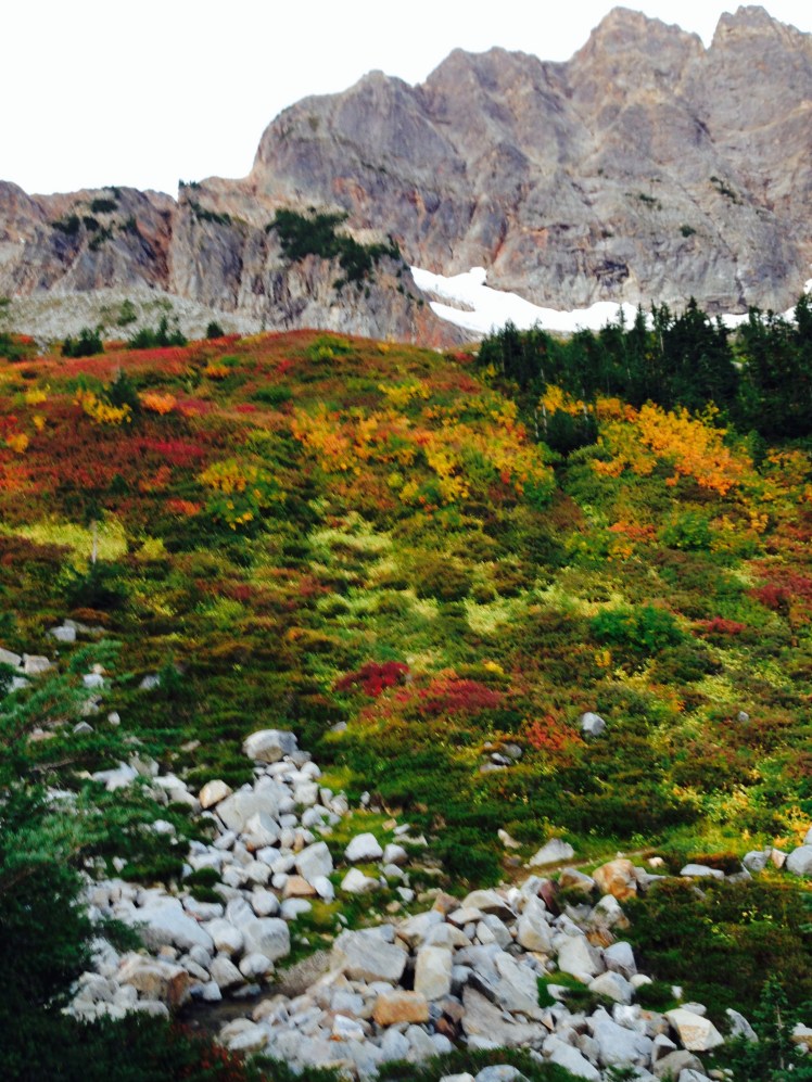
The huckleberry bush leaves were starting to turn red. Early autumn turned the undergrowth in open areas to swaths of red, orange, yellow against the dark greens of the forest.

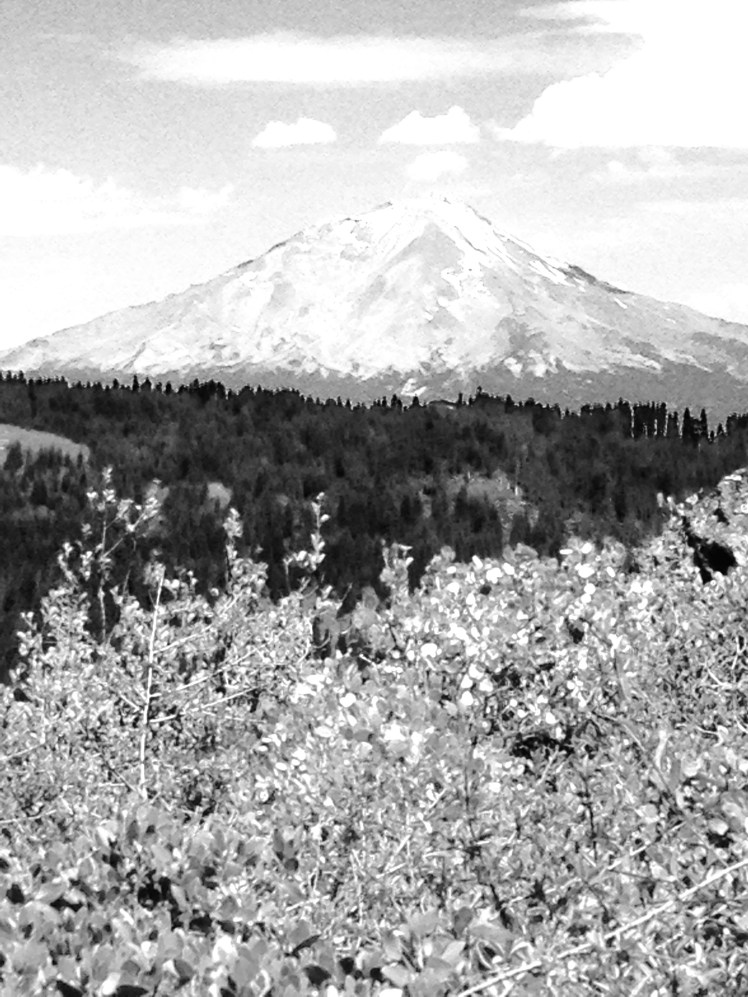
I ran into three groups of bow and arrow hunters along the trail. The only other hiker I saw was a young thru-hiker from Israel who overtook me as I picked huckleberries. At one high point of the trail was a spectacular view of Mt. Rainier. With this view, I stopped and made dinner before hiking on.

When I stopped at dark near Dewey Lake (mile 2329), I found the young Israeli hiker, Mr. JT, camped nearby. I struggled to get my tent up in the darkness since my headlamp was no longer working. I was making a lot of racket trying to set the tent up when Mr. JT came out of his tent to shine his headlamp for me.

Day 158, Friday, September 5

In the early morning, I arrived at Chinook Pass and crossing Hwy 410. The rest stop along the road was a welcome sight. I stopped at a picnic table to have a morning snack so I could take advantage of the nearby garbage receptacle.

IMG_1225

It was a spectacular day of hiking. The trail crossed through a corner of Mt. Rainier National Park. The morning ascent was among the finest hours spent in the forest.

Right after leaving the park, I met a pack train with hunters. I have nothing against hunters, and I wasn’t frightened of the bow and arrow hunters as I knew they had to be up close to take a shot. However, hunters with guns gave me pause. I certainly did not want to be accidentally shot by some random trigger-happy hunter.

IMG_1227

The views of Mt. Rainier were breathtaking. The trail reached a ridge top, weaving in and out around the rocky outcroppings circular around the Crystal Mountain Ski area.

IMG_1233

Having skied at Crystal Mountain frequently in earlier years, it was interesting to look down at the lifts and be fondly reminded of many happy ski days. After making it around to the far ridge, I looked back across the valley. Above Crystal Mountain, stood Mr. Rainier. As skiers unload at the top of the mountain, Mt. Rainier is right in front of you (on rare clear days).

I camped along a creek at mile 2350 in the dense, dark, and gloomy forest. As spectacular as the day had been, this was a dark, dreary and unremarkable place to camp. Later in the evening, Mr. JT came by and joined me.

Day 159, Saturday, September 6

In the early morning, passing Urich Cabin, I saw Gimp and Shorty again. They had spent the night in the cabin on the edge of a meadow. It was a choice place to camp overnight. They gave me a tour of the cabin. These two tough guys are now my new BFFs.

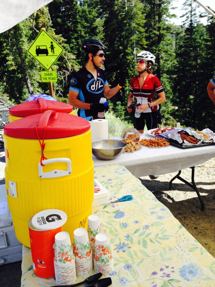
Later in the morning, I ran into an older couple providing trail magic where the trail passed close to a dirt road high along a ridge. I stopped with Gimp and Shorty for a second breakfast.  We sat beside the trail angel’s RV in camp chairs and talked.

At lunchtime, I passed a trail angeling couple making sandwiches for hikers. She made up a delicious lettuce wrapped sandwich.

IMG_1234

My lunch trail angels

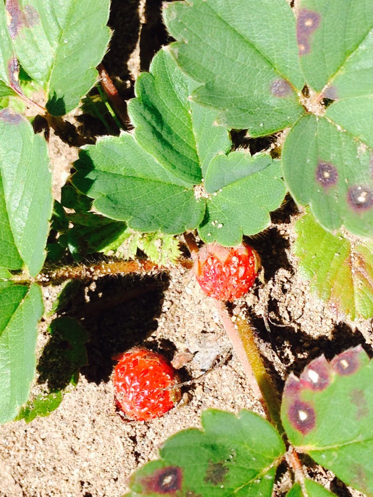
In the afternoon shortly after stopping to eat a few alpine strawberries, I met CatDog headed southbound. I paused to catch up with news of her hike and to wish her luck returning to Bend.

IMG_1235

IMG_1236

CatDog

IMG_1237

Vintage PCT sign

After dropping down to Tacoma Pass, I came upon more trail magic. This had been one lucky trail magic day. Two guys had set up a couple of large tents complete with camp chairs offering hot dogs and beans along with soda and beer.   I stopped and ate dinner.

Gimp, Shortie, and Mr. JT came to Tacoma Pass at about the same time and the three decided to camp nearby. It was very tempting to put up my tent and call it a day. Reluctantly I kept going a few miles to try to get in the full 25 miles. I camped alone at mile 2376. It was a large open grassy spot on top of a high ridge with views in every direction.

I sat my tent looking toward Mr. Rainier from the tent door and did not put on the fly to be able to enjoy the streaming moonlight as I fell asleep. During the night I was awakened by the sound of foxes. I looked around by could not catch a glimpse of my mountaintop companions.

Day 160, Sunday, September 7

As I was hiking along in the morning dreaming of scrambled eggs, I came out onto a road and another trail angel. His name was Stumbling Norwegian, a former thru hiker, offering scrambled eggs and bacon along with a shot of homemade Kahlua. It was an incredibly welcome second breakfast.

For me, it was a rough hike into Snoqualmie Pass. The tread had worn off the bottom of my shoes, and the shoes were now unable to grip the rocks on the trail. Frequently, water spilled across making the rocks on the trail extra slippery.

After Mirror Lake I started encountering day hikers.

I met a father and two young children.

“Where does this trail go?” he stopped and enquired as I came toward them.

“Mexico,” I answered with a smile.

I was panic stricken I would not get to the pass before dark as I had no working headlamp for night hiking.   I ran the last few miles. When I crested the top of the Snoqualmie Pass ski area, I blue blazed down the ski hill toward the Chevron station I could see in the distance.

My son-in-law, Edward, picked me up just at dark. He and my daughter had flown in from a tenth-anniversary weekend trip to Napa just as I called to say I had arrived.

I had made it to Snoqualmie pass on schedule but was completely exhausted. I knew there was no way I could possibly make it to Stevens Pass in 3-1/2 days to return by my Friday appointment. I must somehow try to get the dentist appointment, to replace my temporary crown, changed and moved up to earlier this week.

Day 161-164, Monday to Friday, September 8 to September 12

It was a gorgeous sunny week in Seattle. I knew from forty years of living in the Seattle area the first two weeks of September are usually sunny weather. Then the unrelenting rain starts.

Each day I woke to sunny skies, I knew I should be out on the trail. Each day I called and hoped the dentist would have a cancellation and squeeze me in. Each day nothing happened. I was forced to wait for my Friday appointment.

To fill my days, I helped the nanny with the kids and cleaned my gear. I washed and waterproofed my tent. I washed my backpack. I washed my sleeping bag and down jacket. Instead of buying a replacement water filter, I purchased Potable Aqua iodine tablets and taste-neutralizing tablets at REI. I was surprised REI did not sell Aquamira water treatment preferred by most hikers.

On my shopping trip to REI, I took my two-year-old grandson along. I was holding his hand looking at gear, when he looked up at me with big blue eyes and ask, “Grammy, why are you always hiking?”

I was stunned into silence. I thought about it, I had been out on the trail for almost a quarter of my grandson’s life. To him, it must have seemed like ‘always.’

I prepared a resupply package for Stevens Pass and drove it up to the Cascadia Inn in Skykomish and made a reservation for staying the night at the inn upon my later arrival at Stevens Pass.

It was nice to have the break to see the grandchildren again. It was difficult returning to the trail.

Day 165, Saturday, September 13

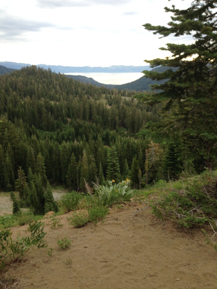
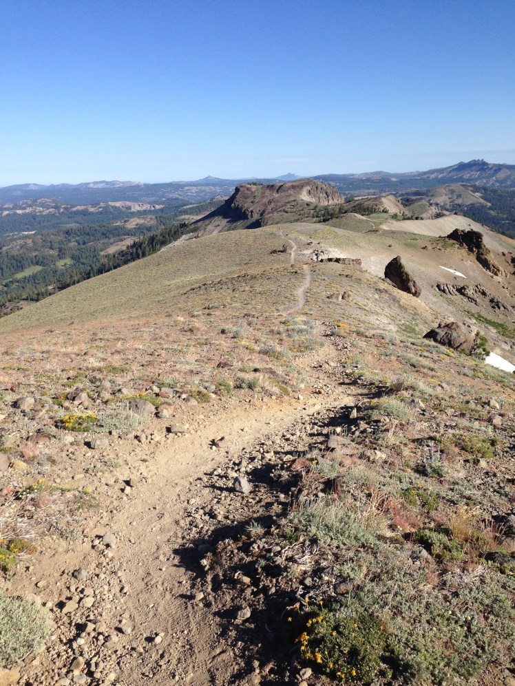
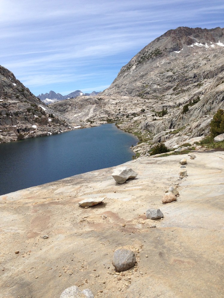
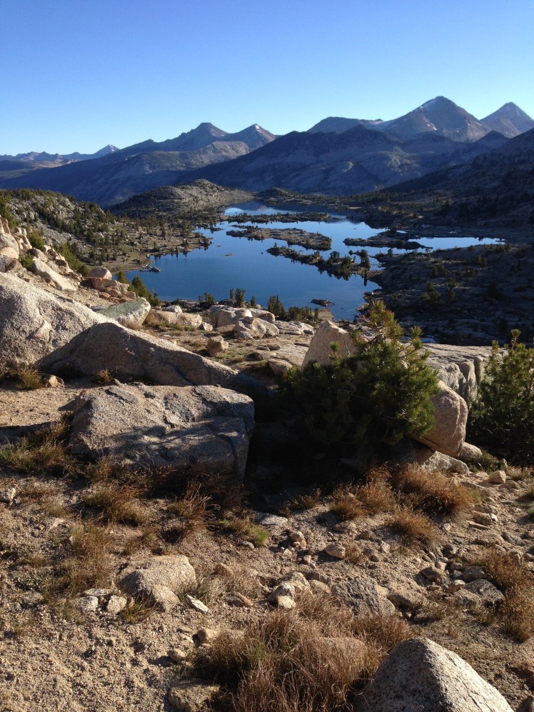
My daughter delivered me back to Snoqualmie Pass at seven in the morning. Hiking up off I-90 was heavy-duty climbing into the alpine areas with fantastic views south to Mt. Rainier. It was a cloudless day. I felt my luck the weather was still holding. For the next seventy-five miles, there is no road access to the PCT as the trail wound northward through the Alpine Lakes Wilderness Area.

10499385_10153153259814046_5884517218339619775_o

Leaving Snoqualmie Pass

Five or six miles on the trail is the beginning of Kendall’s Katwalk where the trail is blasted out of the rock cliff face of Mount Kendall. Another five miles the trail passes between the alpine lakes, Ridge Lake and Gravel Lake. Up to the Kendall’s Katwalk section, I saw a few day hikers. At the lakes, there were a couple of local backpackers. After this, I ran into no other people on the trail for the rest of the day.

IMG_1246

In the afternoon the trail crossed through massive rock slides.  The trail itself had slid down the steep mountainsides in sections. It took extra time to traverse these slide areas. The rocky slide crossings were made up of good sized rocks on which one could easily turn an ankle. Awkwardly stepping among the rocks, I was extra cautious with each step.

I planned to make it twenty miles but camped at mile 2418. It had taken twelve hours to walk sixteen miles.

Day 166, Sunday, September 14

I ran into Coke Man a couple of times on the trail. He said hello and answered my questions about his trail name, but otherwise made no effort at further conversation.

It was a long day of switchbacks.

IMG_1247

IMG_1264

Deep Lake

At one point climbing switchbacks up to a ridge, I had a fantastic view down to Deep Lake.

I camped at Waptus Lake (mile 2438). It was early, but I had already walked 20 miles. Nearby a young man on a weeklong backpacking trip made his camp.  We visited as we each ate our dinners. I was curious about his hike and peppered him with questions.

Day 167, Monday, September 15

I camped at mile 2458 on a sandy bridge between two lakes. I had to walk across logs to get over to the sand bar. The lakes were rimmed with tall Douglas Fir Trees and the two lakes hidden in the forest. It was a beautiful spot.

IMG_1266

Lake is barely visible

Day 168, Tuesday, September 16

The weather was still holding. It was a warm sunny day. I had lunch seated at the edge of Mig Lake looking out over the small pristine lake surrounded by waves of red huckleberry bushes in the open meadows around the lake. The fields were broken with groves of fir trees dotted along the edge of the water.

IMG_1270

It had been a warm day, and when I arrived at the top of Stevens Pass Ski area, I was hiking in my mesh sports tank. At the top of Steven’s Pass, I sat down on a rock to check my cell service and was hit by a strong chilling wind. Suddenly cold, I had to quickly change into a warmer top.

I called a friend, Fred, about one hour before arriving at Stevens Pass (mile 2476) to see if he was available to give me a ride into Skykomish. While I was waiting in the parking lot for my ride, 45 hiked out of the trail into the parking lot. We talked for a few minutes before he left to get out on Hwy 2 to hitch a ride.

After being delivered to the Skykomish’s Cascade Inn by Fred, I checked in and picked up my resupply package. The small 14 room 1922 vintage inn was fully booked.  I was jubilant I had a room reservation.

In the worn hotel lobby I ran into Moxie. She said she was ‘so over the PCT.’ I wanted to talk with her further, but the owner was waiting to show me the finer points of staying at the inn and how to get my laundry done. I did not see Moxie again and later wished I had had a chance to visit with her.

After getting a shower, I started looking for eating options.  The casual cafe on the side of the hotel was closed for the evening.  I walked over to the Whistling Post Tavern next door for dinner.  It was warm and welcoming place with a large historic bar on one side and a row of tables on the other wall.  I chose a table. While I was eating, Happy Feet came through the door.  I jump up to greet him with a big hug. Seated at the counter of the bar eating was Coke Man. He turned to us.

“I didn’t know you were a thru-hiker.” He looked at me in surprise.

“Why didn’t you think I was thru-hiking?” I asked.

“You had all the right gear, you just looked too clean.” He laughed.

“That’s because I spent five zeros in Seattle!” I smiled. “And I bought new hiking pants.”

As 45, Whiskey, and several other hikers arrived for dinner we gravitated to the back room with round tables.  We sat together drinking beer and eating. Everyone was in a jovial, loquacious, and somewhat rowdy mood.  We were almost to the border.

Day 169, Wednesday, September 17

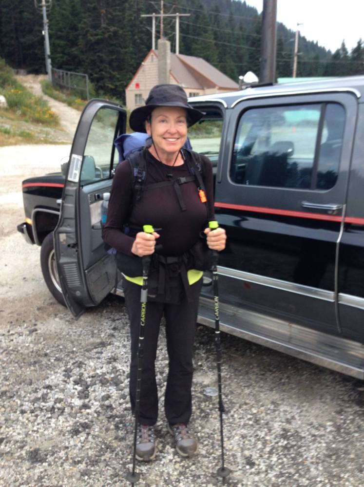
I woke to an overcast day. There were no restaurants or stores opened to grab breakfast or coffee. My friend, Fred, arrived at the arranged time of 7 am. Happily, Fred had brought coffee. The drive back up Stevens Pass did not take long. Fred talked about the history of the area. Once we were in the parking lot, it took a few minutes searching to find the trailhead as it was not signed in a prominent location. Fred and I took photos, and I hiked out.

10687307_796734163682391_7105205133242789306_o-2

I was now hiking the infamous ‘Section K”, the Stevens Pass to Rainy Pass section. It was for me to be both the most beautiful part of the PCT and the most agonizing. On top of everything else, Stevens Pass was the last connection to the world. From this point, I knew I would have no cell service.

A few miles in, I passed Lake Valhalla. It was a day of hiking beside beautiful alpine lakes, each lake passed inviting me to stop and enjoy the surroundings.   If only I were not in a rush to get in my twenty miles per day.

At higher altitudes, I started to see Pikas among the rocks along the trail.  They scurried about without fear of me as I walked along.

The only other person on the trail was a section hiker, Bob, going from Stevens Pass to Rainy Pass. His mother was dropping him off when I had started in the morning. He passed me early in the day and stopped to talk.  I found out he was from Olympia and this was his third hike of this section of the PCT.

In the waning light I arrived at the ridge above where I planned to camp for the night, I saw a couple of tents below. I thought, oh, I’m almost there. But the switchbacks down took so much time it was well past dark when I arrived. Bob was there and helpfully showed me where to obtain water in a nearby creek.

As soon as I retired inside my tent it began to rain. It rained heavily off and on all night as huge raindrops pounded my tent.

While in the Seattle area I had made the mistake of buying Gortex running shoes thinking in rainy wet weather these waterproof shoes would keep my feet dry. They worked very nicely up to this point as these shoes gripped the rocks on the trail. I was soon to find out what happens to Gortex running shoes once water gets inside.  The water stays inside.

Day 170, Thursday, September 18

Hiking up a steep grade of switchbacks in the morning, I met a long section hiker (the trail name for this is LASH—long ass section hiker) with the name Don’t Ax. He had started the trail at Mojave instead of the beginning at Mexico. He was a short and thin older man. We leapfrogged and each time stopped to talk for a few minutes.

I ran into The Animal as he passed me on the trail. He was very familiar with the area after previously participating in several searches and rescues around Glacier Peak.

When he took a zero at Snoqualmie Pass, he had spent his day off on a search and rescue for a missing person in the Olympic Peninsula. I was impressed with this guy. I was thinking, this is the type of person who should be out here hiking the PCT, not someone like me. The difference between us was not palatable. I had taken five zeros and had been thinking only of pampering myself, buying new gear and getting a pedicure. The Animal had done something, really done something meaningful.

It rained off and on all day. At Snoqualmie Pass, I had switched out my yoga pants for North Face hiking pants thinking this would keep the water off my shoes and socks. This did not work. The water ran down my pants making my socks and shoes continually wet. I now regretted not having waterproof bottoms to slip over my pants to keep the lower part of my body dry. Once the water was inside my Gortex shoes, there was no escape. The water sloshing inside my shoes as I hiked.

When the clouds lifted, I was treated to views of glaciers and Glacier Peak.

Most of the day I hiked above tree line through alpine shrubbery turning purple, red and yellow.

I made camp along Kennedy Creek (mile 2520) in a space suitable for one tent. I put the tent up in the rain under a large fir tree. During the night the tree limbs continually dropped water on my tent. Thhuud, thhuud, thhudd.  It rained all night.

Day 171, Friday, September 19

Somehow I managed to break the zipper of the fly in the morning. I had already had problems with the tent zipper not fully closing so that it gapped open along the top of the door.  Now the fly zipper did not work and was stuck in the open position.

The trail passed right up under Scimptar Glacier, Kennedy Clacier, and Ptarmigan Glacier as the trail followed the west side of Glacier Peak then circled north of the peak and headed east.

In the afternoon I began the switchbacks down into Milk Creek. In several places, the trail disappeared where the mountainside had given way in massive mudslides. I was happy it was daylight, and I was able to climb and crawl around as a way to detour each of these slides. Because of the difficulty of negotiating around the detours, the hiking down to Milk Creek took longer than expected.

My plan was to camp at the bottom along Milk Creek. Little did I know it was too steep in the canyon to find a flat place to pitch a tent. I now faced a five mile, 3000’ climb out of the canyon in the growing dusk in steep switchbacks along a very steep mountainside. My headlamp was not working, and I was climbing with the use of a small 9volt PakLite. I made it almost to the top when I ran completely out of energy.  It started to rain.

Desperate and completely worn out, I pitched my tent in a switchback bend and crawled in, wet and exhausted. The tent sloped sharply downward but I was happy to be inside and off my feet.  I had made it to mile 2538.

An hour later, a young man, Jack*, hiked by under headlamp light and stopped to inquire who was camped there. He said he almost walked right into my tent in the darkness.

Day 172, Saturday, September 20

Near the ridge top, I looked back at Glacier Peak to the south in the morning sun.

IMG_1285

Just over the ridge, I saw plenty of wonderful campsites available and wished I had pushed myself a little more. Don’t Ax, Jack, and The Animal were all camped there. I hiked around the corner into the sun and found a suitable spot to string my tent and sleeping bag over small trees to dry. I had a long, slow breakfast while I waited for the morning sun to dry my gear.

The top crossed several glacier fed streams. I filled up with water. The drop down into the Suiattle River canyon was difficult by the number of trees fallen across the trail. In a one-mile stretch, I counted forty trees to climb over.

IMG_1293

Nearing the Suiattle River, the trail passed through groves of magnificent old growth forest. It was a memorable section of the trail. The trees were tall and grand. It was a feeling of reverence to walk among these majestic trees.

Reaching the edge of the river, the PCT follows along the river up to the newly constructed bridge across the river.

I stopped for lunch just after the bridge. I hung my socks over a log to dry in the sun. I had switched to waterproof Gortex shoes thinking this would keep my feet dry. Little did I realize once water gets in this type of shoe, it stays there. The water inside my shoes and the wet socks were causing my toenails to soften and disintegrate. The excess water combined with the grit from my socks rubbed the skin from my feet like sandpaper. My feet were red, raw and swollen. The stiffness of the shoes caused open cuts in the skin on the top of each foot. I decided to cut holes in the shoes to allow water to escape and allow air to get in.  I also hoped the holes would remove the stiffness of the shoes which were now causing the cuts on the top of my feet.

I was in the process of cutting large holes in the top of my new Gortex running shoes when Don’t Ax walked up. He stopped and joined me for lunch.

In the afternoon, the trail headed back down the Suiattle River until the trail crossed Miners Creek log bridge and then followed Miners Creek up out of the canyon.

In the late afternoon, I came upon Don’t Ax gathering water for the night. He had camped on the other side of Buck Creek Trail cutoff (mile 2558) and asked me to join him. He offered to try to help dry out my shoes.  (Even walking in the sun did not dry these shoes out.)

At camp, we raked back debris to clear an area for a fire. Keeping a large amount of water nearby, we built a small fire. Stacking the insoles and shoes around the fire, I waited to see if this would help. Later, we smothered the fire with water and waited until the coals were cold to our fingers before going to bed. It was a lengthy process with only marginal results. My shoes were still wet.

After dark, Jack hiked in and camped with us. Jack could identify the type of owl hooting in the trees above, an amazing skill.

Day 173, Sunday, September 21

Both Don’t Ax and I wanted to make it to High Bridge by noon to catch the down valley bus to Stehekin.

We were up at 3 am. It took me a little longer to get underway. By the time I was on the trail it was a little after 3:30am, Don’t Ax had already hiked ahead.

Luckily, my headlamp was working again as I started.  Two log crossings of creek tributaries to Miners Creek had to be crossed over in the heavy darkness. These were tricky crossings with a backpack in the dark. As I inched my way slowly across the first log one foot in front of the other, I peered down through the darkness with my weak headlamp at the boulders and rushing water below with trepidation. I couldn’t determine the strength or depth of the water.  I knew if I slipped and fell in the water and rocks below it wouldn’t be a good thing.  At the second crossing, I had somewhat more confidence in my footing as I crossed the log.

Further on I woke Animal with my headlamp. He had camped on top of a large rock in a barren area under Miners Ridge. He called down to ask who was passing. Then he shouted down he was getting underway soon as well.

Shortly afterward, my headlamp cut out again. I used my PakLite to pave my way until the morning light started to rise.

As the morning lit up the sky, I could see this was an especially beautiful section of trail. Rock cliffs cut with glaciers above looked down on lush forest below and on into the South Fork of the Agnes Creek and the valley beyond. The trail was lined with almost bare elderberry bushes hung with orange-red fruit. At the tree line, dwarf alpine Huckleberry bushes grew around rocky outcroppings.

IMG_1299

When I hiked down back into the forest, I stopped to boil up black coffee. The Animal hiked by. He was hoping to catch the noon bus as well and hurried on.

As the cloudless morning wore on, I noticed the forest foliage change from the lushness of the western Cascades to the foliage typically found in the dryer eastern Washington Cascades. The underbrush changed slowly as I walked. Later the trail followed along the edge of the Agnes Creek Gorge with thundering water rushing below.

IMG_1304

Where the trail conditions allowed, I jogged along. I made it to High Bridge (mile 2580) in the morning in plenty of time for the noon bus.

I had spent a week at the Stehekin Valley Ranch when my daughter was young, and I was looking forward to visiting the area again.

Stehekin is a small community on the north end of Lake Chelan accessible only by hiking in or by taking the ferry or boat up the lake from the small town of Chelan. There is no road access to Stehekin.

IMG_1306

Luckily, arriving early in the day, I was able to secure a room at the lodge at Stehekin Landing.  Stehekin was my favorite trail stop. The landing looked out over Lake Chelan across to the mountains beyond. It was a rustic, bucolic tiny village. No cell service. No road access. Even the post office was a quirky little place.

Mountain Spice, ET, and Poison arrived at Stehekin ahead of me. There were around 20 plus additional hikers staying either at the lodge or in the campground nearby. Jack and Don’t Ax stayed at the campground.

I took the bus up valley for dinner at the Stehekin Valley Ranch and sat with a group of thru-hikers I had first met during a lunch break just north of Big Bear in Southern California.

Day 174, Monday, September 22

After the Post Office opened I retrieved my resupply box and washed my clothes in the laundry. I stood in line for over an hour to use the satellite pay phone to call my daughter and reconfirm my pick-up date and time. She was taking the day off work Friday to pick me up at Manning Park.

At the ranger station I got the permit needed for camping in The North Cascade National Park. At the ranger station, I found Aqua Mira for disinfecting water and happily discarded the nasty iodine tablets.

Shortly after noon, it started raining. Mountain Spice invited me to take a zero with them and hike together with ET and Poison to the border. This was the perfect way to end the hike but I had already made arrangements for pickup with my daughter. I thought it best to keep to my schedule.

Several other hikers took the bus up valley, including Coke Man and Don’t Ax. When the bus left the landing it was overcast but not raining. By the time the bus stopped at the Stehekin Pastry Co. and The Farm, a local maker of fresh goat cheese, the sun was shining and our packs were heavier with the purchases of fresh local fare.

Upon our arrival at High Bridge, Ranger Jan was waiting to take the bus down valley. I was able to give him a big hug before he jumped on the bus.

My permit was for a campground just eight miles out. The North Fork Camp was on the edge of a mountain, divided into several levels. There was a young man already in the level beside the creek. Coke Man opted for the second level. I took the third and highest level, the last space available. We were required to hang our food from a high wire and the wire for hanging food was on my level. Coke Man hung all three of our food bags for the night. I was happy to have his assistance.

I woke to a wet tent. It must have rained in the night. As I hiked out I noticed Coke Man was wiping his tent down methodically. He was an accountant with one of the big accounting firms. Of course he was wiping his tent down in a neat and organized manner.

Day 175, Tuesday, September 23

This hiking day required crossing several bridges which were broken or had been partially washed away. It stayed cloudy and rained lightly. At high altitude it was foggy.   One bridge, crossing a torrent of a river, had simply given way in the middle and sat across the water in a V shape.   Another bridge had washed out and was in an almost a 90 degree angle to the water. I had to walk along the upturned side edge of the bridge to cross over.

IMG_1282

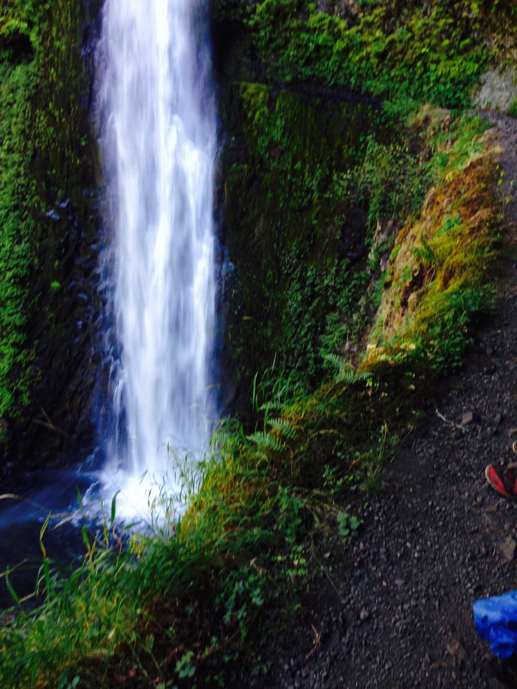
Before the thru-hike, I had always been excited to hear the rush of water ahead on the trail ahead and looked forward to discovering a creek or waterfall. Now the sound of water filled me with dread as I anticipated what might lie ahead to be crossed over.

At midday, I glimpsed Hwy 20 through the forest and decided to cut through the underbrush to the highway and save myself possibly another broken bridge crossing.

I came out and walked along the highway to a rest stop and assumed the trail would start north nearby but could not find the trail north. I sat down at the picnic table and ate my lunch. A young couple with an RV pulled in, also looking for the trail. Before they pulled out they asked if I need anything.

“A soda would be nice.” I suggested with a smile. The wife handed me an ice-cold soda. My yogying skills were improving.

I guessed the trail and Rainy Pass likely to be up ahead to the west and I walked westward along the highway. The trailhead was about a mile or so up the road. Just as I cut off the road to the parking lot, Whiskey came out to the road to hitch a ride. He was hitching to Mazama to wait out of the bad weather. I wished him luck on the rest of his hike and started up the trail. I ran into two groups of day hikers on the steep trail out of Rainy Pass.

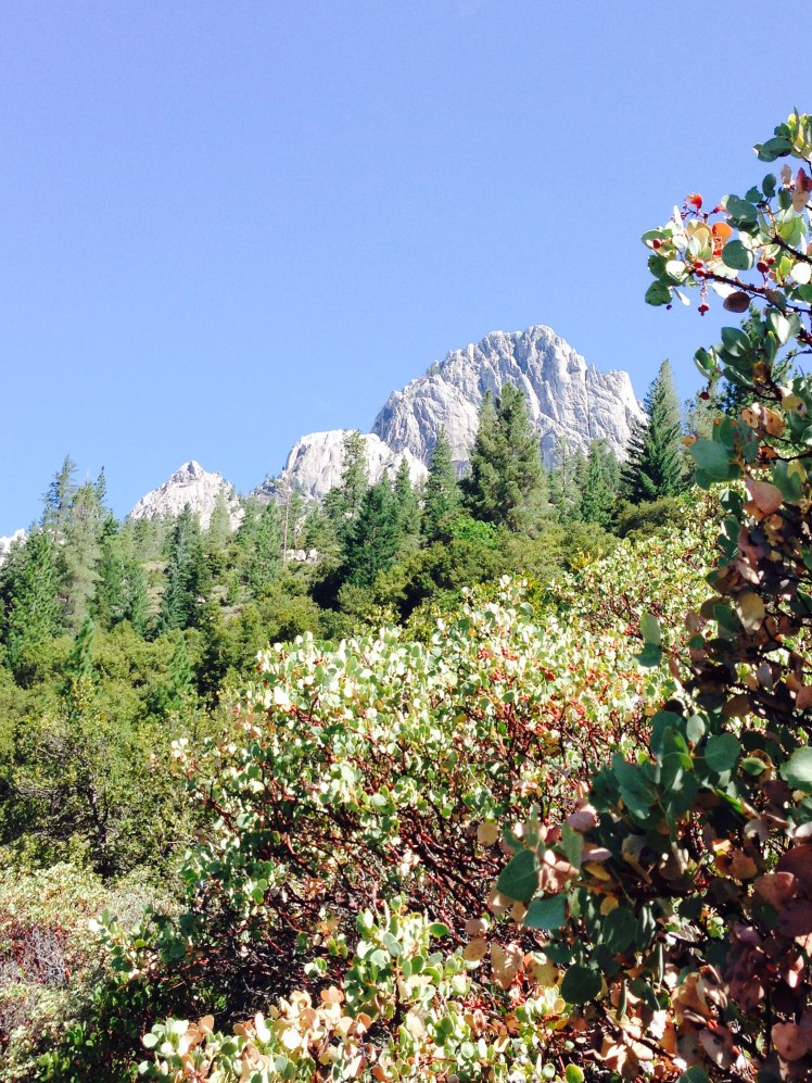
Once I reached Cutthroat Pass, I did not see anyone on the trail. This is a grand beautiful area. The clouds rose suddenly, and I could see the jagged rock formations reach up in peaks to the sky. The trail wound around and thru the steep rocks up through Granite Pass.

The days were getting shorter. It was getting dark earlier each day.

I pushed myself all day to get twenty miles in before dark. I came to the first flat area I had seen for many miles and decided I would make camp under Tower Mountain and Golden Horn. My campsite at mile 2609 was at the 6,200’ level.  As I rushed to get my tent up and get inside for relief from the cold, it started to sprinkle again.

Just as I was falling asleep, frantic rat scrambled up the screen of the tent door.   The sudden noise caused me to look up. I grabbed my PakLite and shined the light toward the tent door as the rat hurriedly disappeared. I was relieved the rat had not found the upper corner where the broken zipper gaped open.

Peering out through the broken zippers I saw what had frightened the rat. Beyond the opening of the tent and fly, stood a large bear just a few feet away. The bear walked slowly out of sight as it circled around.  Had I been thinking clearly, I could have attempted to scare the bear off with my Paklite. Instead, at this point of my journey, I was in my sleeping bag, cold and tired. If he was going to attack me, there was nothing I could do about it. My food was in my food sack inside at the foot of my tent. It had taken all my energy to gain 21 miles for the day. I could not summon energy to be frightened. It was only three more days to the Canadian Border.

With this train of thought, unable to be fearful, I snuggled back down into my sleeping bag. Live or die whatever was going to happen was going to happen.

It was now raining heavily, and rain splashed through the broken tent zipper openings onto the floor of my tent a few inches from my head. I fell asleep listening to the rain.

Day 176, Wednesday, September 24

The day was wet with thick fog and rain. Water ran down my pant legs into my shoes. My gloves were wet and offered no warmth.  The trail traveled up and over Methow Pass and with a high climb up and over Glacier Pass, staying on high plateaus for most of the day. There were a lot of huckleberries on the purple alpine huckleberry bushes. I grabbed huckleberries as I rushed along.

At times, the fog and clouds lifted and the surrounding beauty was visible.

I did not see another person on the trail all day.

When I made it to Harts Pass campground (mile 2630) I was looking forward to building a fire in a fire ring and getting warmed up and dried out. I knocked on the guard station door and ask if this was where I paid for a camp site. The man and wife staying at the guard station said the camp fee was $8.00 to be put in the drop box at the park.

I had only one $20 bill. I asked if they could make change. But no, they could not make change for me. They reluctantly invited me to come inside for a few minutes to get warmed up after I asked if I might. The couple said they were planning to close the guard station for the season and go home in the morning. The campground was completely empty.  They would not allow me to stay in the empty campground unless I paid.

While I was warming up, they suggested I hike on up the trail for a half-mile to a parking lot with a public restroom. Across the road in the forest beside a creek was space to pitch a tent at no charge.

I slung my wet pack over my shoulders and hiked out, thanking them for the information. The few minutes inside had warmed me only a little.  I was still wet and cold. I found a flat space of dirt a bit off the road, near the creek. There was just enough room to pitch my tent between two large logs. I was safely tucked away from the sight of the road by the surrounding trees. My tent was soaking wet but not leaking. My sleeping bag felt damp.

It rained during the night, and when it wasn’t raining, the large drops of water fell out of the trees noisily onto the tent. My sleeping bag picked up moisture.

I woke in the night and realized I needed to pee.  With my PakLite in hand, I scooted over the log by my tent and made my way across the road in the rainy mist.  I was surprised to see a tent in the middle of the parking lot.  Another hiker must have arrived after dark.

The metal door of the toilet rattled as I pulled it open.  A rat ran out before the door banged closed.

As I was leaving, I heard a noise coming from the men’s side of the toilet.  I walked around to investigate.  The flashlight swung around through the rain and fog before it lit up a hiker huddled inside a sleeping bag on the concrete vestibule of the men’s restroom.

Day 177, Thursday, September 25

My new size 6 NorthFace pants purchased during the zeros off Snoqualmie Pass were now hanging on me. I had to pull them up high and tighten my pack belt around the pants to keep them from falling off my hips. I thought I should write a diet book. Then laughed to myself.   The book would be very short. Three words: Hike the PCT.

Just as I reached a mountaintop, I came upon a group of hunters on horseback as they made their way onto the trail from their camp. The grouping and type of tents making up their camp appeared to be a commercial operation. I was unnerved by the thought of being mistakenly shot in the morning icy fog.

I walked among the horses along the trail and I was happy to see the group take a pack trail to the left and head down the mountain in the opposite direction I was headed.

It was a wet and cold. I kept a watchful eye on the sky for signs of snow.

I hoped to make a big push and camp right before Monument 78 at the U.S.A./Canada Border. The trail was high along ridge lines between 6000 to 7000 feet most of the day. In several areas, the trail crossed along the steep slopes of scree where parts of the trail had washed away. It is difficult to maintain footing crossing the wash outs. I fell several times. On one fall I landed on a rock breaking my tailbone. Luckily, it did not impede my ability to walk. It would take six months before I could lie down comfortably.

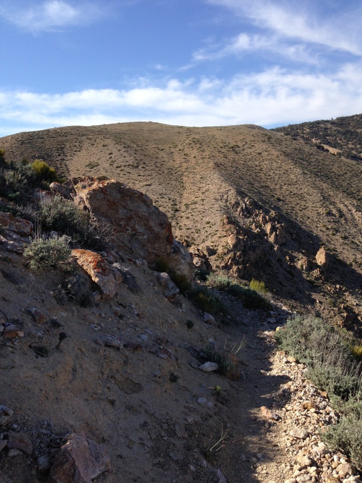
This portion of the PCT is in the Pasayten Wilderness Area. The trail follows the ridgeline of the Cascade crest north crossing seven passes along the way with deep drainage on both sides of the ridgeline. The trail crossed Buffalo Pass, Windy Pass, Foggy Pass, Jim Pass, Holman Pass, Rock Pass, and Woody Pass. The sheer vastness of the wilderness was astonishing to behold.  After five and a half months hiking I was still in awe of this mountainous and wild area.

At this high elevation, the vegetation existed in nearly bonsai form and size.

It rained off and on during the day. The temperature kept dropping. Somehow the rain did not turn to snow.

I had gotten in the habit in Washington of stopping between five and six in the early evening to prepare and eat dinner before walking a few more miles in to make camp. This allowed my feet and legs a rest and kept the smell of food away from my tent area. As a break from the cold, I stopped early to make dinner. Don’t Ax hiked by and stopped to join me.   When I started up the Jetboil, the flange around the bottom came apart.

I was able to make dinner by cautiously regulating the flame without the flange, but it was difficult. My tent zippers were broken, the zipper on my Loksak belt wallet no longer closed properly, my headlamp worked intermittently, now I had broken my Jetboil. My gear was falling apart.

Don’t Ax and I hiked on together after dinner. At one point Don’t Ax asked me if I wanted to hike alone since I was “solo” hiking.

“No,” I answered painfully and truthfully. “I am only solo hiking because I could not find anyone to make the trip with me. I did not choose to solo hike. That is not the point of my hike.”

Shortly after the Devils stairway, we decided it was best to look for a place to make camp and try to warm up. We left the trail just as it zigged back toward Hopkins Lake and made camp (mile 2654) below the trail. There was a rock fire pit left from previous campers. We gathered wood and made a fire to warm ourselves. We were huddled at the fire attempting to warm up and dry out when a hiker named Jim* joined us. He had been the hiker camped in front of the men’s restroom door the previous night. He said he was freezing. We tried with limited success to dry out our clothes and shoes by the fire.  Jim accidently burned a shirt. After wringing the water from my socks and placing them near the fire, the socks remained soaking wet.  We were a shivering cold threesome hovering as close as possible around the fire.

We kept an eye on the sky for signs of snow as the temperature dipped below freezing. Miraculously the clouds maintained a hold on the snow.

Neither Don’t Ax, nor Jim had permits to enter Canada. Both were hiking to the monument at the border and returning to come out at Harts Pass. For me, it was my last night on the trail. I was wet and cold and also excited.

After many days of rain without the sun in the daytime to dry out my tent and sleeping bag and clothing, everything in my pack was wet. The fire added only a small amount of warmth to the brutally cold evening.

It was a wet, cold night. I lay in my wet sleeping bag shivering, unable to sleep, too cold to sleep.

Day 178, Friday, September 26, 2014

I wrung the water out of my socks and tugged them on my feet. Ouch, it was cold and miserable.

It appeared to be a cold sunny day early in the morning with breaks in the clouds overhead. As soon as I was up and on the trail, dense, high clouds moved in.

It was downhill all the way to Monument 78 (mile 2660). I hurried along filled with the excitement of making it to Canada. Don’t Ax, Jim and I arrived at the Monument within minutes of each other in the morning rain. We each signed the ledger and took photos. My journey had ended the same as it had started, in the rain.
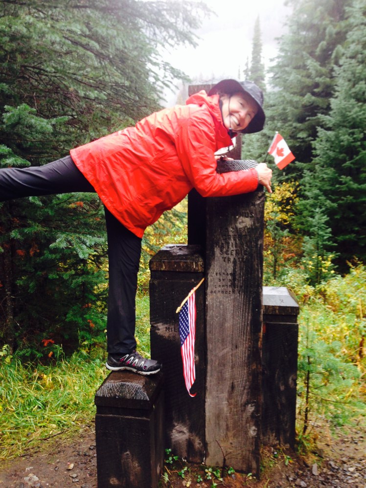
IMG_1316

IMG_1319

Don’t Ax and Jim*

Don’t Ax did not tarry or take off his pack, as soon as we snapped a few photos, he immediately headed back down the trail.

Jim hung back for a few minutes.   He wished he could continue to Manning Park as all his gear was wet and he said he was freezing cold. But he did not want to be caught entering Canada without a permit. I told him this was unlikely. But he was not inclined to take the chance and I was reluctant to encourage him further in case he actually did get in trouble for crossing over.

Jim’s headlamp had stopped working. He asked if he might borrow mine. I told him my headlamp only worked intermittently and was not dependable.   I took out my PakLite and handed it over.

“Take this.” I said, as I gave him a hug.

He waved as he headed back the way we came.

I was left alone at the monument in the middle of the wilderness with 8 miles yet to hike.

Beyond the monument, I passed a campground and began the climb up a mountain. I had looked forward to the border, I had not given much thought to what to expect after the border. Had I expected a unicorn to magically whisk me to Manning Park? Had I expected a straight wide path leading to Manning Park. I am not certain what I expected, what I was faced with was more hiking.

From the monument, the trail climbed up a thousand foot elevation as it crossed over one last mountain before dropping down the other side to Hwy 3B.

I was hiking without the impetus to keep me going. Each step forward an effort. I should have been flying but I wasn’t. When I thought surely I had hiked eight miles, I sat down to look at the map to make certain I was still on the correct trail.

The rain stopped and the sun came out from behind the clouds. Deciduous trees along the path were yellow and added a glow to the day.

Just when I thought I never was going to be out of the forest, I saw the roadway. From the road, I could see buildings in the distance. Manning Park! I arrived at Manning Park Resort at two in the afternoon and walk across the lawn straight to the restaurant to have lunch.

The restaurant actually closed at two pm, but the waitress was pleasant enough to make an exception. She said saw me cross the lawn with a big smile as I headed for the restaurant. From the first day on the trail to the last day, I had been met with generosity from strangers. It was reaffirming to realize most people are good, thoughtful, and generous.

I ordered lunch and called my daughter who was on the road to pick me up. That settled, I washed up the best I could in the restroom.

After eating, I was too excited to wait inside. I walked down the road to the entry of the resort to wait my daughter’s arrival.

I felt a mixture of relief, happiness, sadness, anxiety, and accomplishment.   I had set out on the journey and had not quit. I had faced the wilderness, alone. I had the strength to experience profound loneliness. I had learned to go on when every step forward was agony. Giving up had not been an option. Possibly, I would never know fear again.

I was going home.

1799081_10153184838549046_363376808571975254_o

At Manning Park

To all the strangers and trail angels who extended kindness and assistance along the trail, I would like to offer my profound thanks and gratitude.  No hike is accomplished alone.  Each of you strengthened and reaffirmed my faith in the basic goodness of people.

Lessons learned:

  1. Life can be lived with a lot less stuff.
  2. The trail is approached in the same manner as any challenge.  Break it into sections.  Identify what must be accomplished and then tackle each challenge one at a time.  In this case, one mile at a time, one section at a time.
  3. I learned how to pray and happily offer thanks for each day survived.
  4. I learned to like beer.

Aftermath:

Before the hike I did not understand the importance of understanding the problems associated with integrating back into normal life.

It took six months to learn to sleep in a bed.  I can only go to sleep on my stomach with my arms folded under me as I did for warmth on the trail.  I prefer to be scrunched up in this position at the edge of the bed.

Normal everyday activities seemed meaningless and unimportant, hardly worth my notice.  It took five years before I resumed sending out Christmas cards to friends and relatives.

Everyday I wish to be outside on top of a high mountain looking at the trail ahead even as age is limiting the duration of future hikes.

PCT THIRTEEN

CHAPTER 13           (Elk Lake Resort mile 1951.9 to Bridge of the Gods mile 2155)

LESSON LEARNED: Hitting a wall at 2000 miles

Day 138, Saturday, August 16

When CatDog made the offer to drive me back to Elk Lake Resort, I happily accepted guessing it could be an arduous hitch from Bend.

Saturday morning was clear and sunny, not yet hot. Fully rested, I enjoyed the scenery on the trip back to Elk Lake. It was a weekend morning. Many individuals along the road were actively enjoying the outdoors. We passed groups of bikers dressed in colorful biking attire and men with fishing poles over their shoulders headed to a favorite fishing hole. I thought with envy, they were returning to their comfortable homes tonight.  It was becoming weary to set up camp each night and crawl into the small tent only to take it down again in the morning.

I said goodbye to CatDog at the trailhead out of Elk Lake and started the climbing uphill on a bright sunny Saturday morning. At intervals, I caught a glimpse of the dollops of snow on the South Sister through openings in the forest.

IMG_1142

By text message Enduro offered to hike in from Mackenzie Pass, camp overnight with me, and hike back out on Sunday as his weekend hiking excursion.  This news brightened my morning and quickened my steps. I looked forward to seeing Enduro again.

Passing along a series of small lakes the trail went up and down without significant changes in altitude, staying in the 6000’ to 7000’ passing by the Rock Mesa at the base of the mountain. During the first part of the day, I had the trail to myself.

By afternoon I began to see other thru-hikers on the trail. By mid-afternoon, I was running into weekend and day hikers. Day hikers are noisy.

It was late in the day when I met Enduro on the trail. He hiked in with beers on ice and an apple, hiker nirvana. I immediately sat on the ground at the trail’s edge to enjoy the bounty.  I munched on the apple between refreshing gulps of ice cold beer.

We were seated at the edge of the trail when The Animal hiked by and stopped to talk with Enduro.  I avoided participating in their conversation while continuing to eat and drink. In Washington, I was to become better acquainted with The Animal.

We hiked through the Obsidian Limited Entry Area, a place of obsidian cliffs, lava flows, open meadows knee-deep in wildflowers, clear streams, and a few small waterfalls. After crossing the northern border, we had difficulty finding a place to make camp.   At mile 1980 we saw a little knoll above the trail. There was enough room for one tent on top. Enduro pitched his tent just where the hill sloped downward. We could hear neighbors in the distance, but I could not see any other campers.   I drove my tent stakes in with a piece of obsidian.

During the night several hikers passed bathing our area with light as they checked out possible camp areas with their headlamps. Evidently, we were not the only hikers having difficulty finding a suitable place to camp. We were lucky to have already claimed this space.

Day 139, Sunday, August 17

In the morning Enduro and I paused in a beautiful wildflower-strewn meadow to take photos. It was a lovely morning surrounded by beauty.

IMG_1149

The last several miles of hiking crossed barren rocky lava fields with no greenery in sight. Before noon we came to Mackenzie Pass (mile 1989.5) where Enduro had parked his car.

From Mackenzie Pass, Enduro and I drove into Sisters for lunch. Not wanting to offend the other diners in our smelly trail clothes, we chose a table on the patio of a local pizza place. To the astonishment of the young waitress, I ordered two lunches, a gluten-free pizza and a chicken taco salad and promptly consumed both.

IMG_1153

When Enduro dropped me back to the Mackenzie Pass, I still had ten miles of lava rock to hike through. I wanted to make it to the Big Lake Youth Camp before nightfall.

It was not as fast going as I had hoped.  In the late afternoonI got sick. Perhaps the pizza had not been gluten-free after all or I had accidentally eaten some of the tortilla shell the salad was served in, or I had simply eaten too much. It was necessary to leave the trail frequently.

IMG_1155

As I hiked along the edge of Mount Washington, my biggest concern was where I could get far enough off the trail and not be seen, when I met an oncoming hiker. He was clean-shaven, carrying a small pack, hiking at a fast pace. I recognized at once it was Scott Williamson, the famous yoyo hiker (start at Mexico, get to Canada, return to Mexico in one trip). He has made this type of yoyo trip at least six times. This year he was attempting to set the record for the fastest unassisted sobo hike. I did not dare stop him and just said “Hi” as we passed.

A mile out of Big Lake Youth Camp, I passed the 2000 miles sign someone had placed just at the edge of the trail.

It was around four o’clock when I arrived at Big Lake Youth Camp, owned and operated by the Oregon Conference of the Seventh Day Adventist church on the shores of Big Lake. I checked in at the office and was given the drill of where hikers were allowed to camp (not on their property for insurance purposes), the location of the laundry facilities, and the location of the showers. I was then escorted to the dining hall where pizza was available for hikers. Several of other hikers in the hall were speaking of seeing Scott Williamson confirming I had been correct in my recognition.

I made camp down by the lake just before the sandy beach at the edge of the forest.

Day 140, Monday, August 18

The services offered to hikers by the Big Lake Youth Camp were on a donation basis. I enjoyed a breakfast of scrambled eggs made especially for me and talked with one of the permanent staff about the camp. Their own camp sessions had ended for the summer. The camp was currently being rented by a community group. He said earlier there had been a wildfire in the Mount Jefferson area and the camp had taken several busloads of thru-hikers out around the closed burned areas to the PCT north of Mount Jefferson.

I made a generous donation, took an apple and an orange, slung my backpack over my shoulders and hiked out. On the trail, I caught a glimpse of 45 just ahead but soon lost sight of him.

The morning was spent climbing up to the base of Three Finger Jack. At the base, the trail swung left, circled to the back side and down a series of steep switchbacks.

IMG_1157

Hiking up the front of Three Finger Jack

IMG_1158

The backside of Three Finger Jack

In the afternoon, the sky clouded over as I made my way on top of a series of ridges. I had hiked up out of burned areas and into an alpine area high along a flat summit of ridges. A light rain began to fall intermittently as clouds moved in.

Except for seeing 45 ahead on the trail when I started, I saw no other hikers. At dusk, I camped at Rock Pile Lake. As the evening wore on, two other hikers came in and made camp. I had not previously met either hiker. We prepared and ate our dinners seated on the bank of the lake while watching a herd of deer walk slowly along the edge of the lake grazing.

Day 141, Tuesday, August 19

In the morning, I caught sight of a tent on the far side of the lake and saw 45 busy breaking camp. I waved and hiked on.

At the start of the day, I hiked along a series of ridges in fog. Occasionally, I could see Mount Jefferson rising above the early morning clouds.

IMG_1161

IMG_1160

Looking ahead to Mt. Jefferson

Late in the morning, Milk Creek proved to be a difficult crossing. The water was deep and violent as the water tumbled down the steep mountainside. I could see no easy crossing either up the mountain or down among the rocks below. The large boulders in the water were too high for me to jump up on top of with my backpack as I might if I were a few years younger. I had no choice but to ford the creek. Bracing myself against the onrush of boiling water I inched myself across hanging on to the larger rocks.   Gaining the far side of the creek I had to crawl out of the steep embankment on my hands and knees. I was happy no one was around to see my awkward struggle.

Shortly after I stopped for lunch and spreading out my tent over the surrounding bushes to allow the sun to dry the night’s condensation, 45 hiked by. We discussed how far we were planning to go for the day. I was planning to camp in Jefferson Park on the last ridge. He was headed for Breitenbush Campground.

Hiking over the flanks of Mount Jefferson offered extensive views of the mountain. Passing through Jefferson Park alpine meadows was magnificent. The flat basin, in a protected bowl, is a vast plateau of subalpine lakes and streams. The mystical earthly paradise made for a pleasant afternoon hike among lush coverings of heather, red paintbrush, and lupine.

IMG_1162

IMG_1167

After passing through Jefferson Park Meadows, there was a climb out and over a high ridge. The map indicated a campsite at the ridge top, and I looked forward to stopping for the day.

IMG_1169

Looking back toward Mt. Jefferson from the ridge

I made the steep climb to the top of the ridge only to discover a fierce bone-chilling wind blowing across the top. This was not a good option for camping. Looking down off the ridge, my heart sank. Ahead the trail was buried beneath snow. I hoped I had seen the last of the snow in the Sierras.

The next campground on the mapped was Breitenbush Camp Ground. If I was going to make it before dark, I must push hard. I did not have time to suit up for the cold wind blowing off the snow. Plunging down, one snowfield after another, jumping, sliding, rushing along I somehow staying upright as I made giant leaps.

Once below the snow, I began to see day hikers. I met a father and son carrying in soda to give to thru-hikers. The father had hiked the PCT in 2013 and was paying it forward. I took a can of root beer, had a few fast swigs and continued downward carrying the can with me as I hurried along.

I arrived at Breitenbush (mile 2047) right behind 45. We shared a flat campsite in the forward part of the campground.

“How’d you get your trail name?” I asked assuming it had something to do with a handgun.

“On the AT when I was asked how close we were to such and such point, I replied 45 minutes to each and every inquiry.” He smiled and laughed. “Eventually my hiking buddies started calling me 45.”

It was humorous 45 had acquired this scary trail name earned in such an innocuous manner.

That evening after dinner, 45 walked over to the two guys camped in an RV across the road and yogied a ride out in the morning. He was headed to Portland to visit friends for a few days.

Day 142, Wednesday, August 20

I had been hiking about thirty minutes when the rain started. The storm lasted a short time with high winds driving the rain sidewards.  Luckily it cleared quickly.

As the morning wore on I passed a series of small picturesque lakes as the cloud cover gradually lifted.

IMG_1170

By the time I reached the Olallie Lake Store the sun peaked out of the clouds.

I stopped to purchased hot coffee and sat on the porch enjoying the view. The lake, which does not allow motorboats, was peaceful.   Green rowboats lined both sides of the docks below. It was a tranquil setting.

Shortly after Olallie Lake the trail crossed into the Warm Springs Indian Reservation. Since timber is a source of revenue for the reservation, I saw frequent logged areas along the trail.

At intervals, I stopped to pick and eat huckleberries in the clearings. The ripening berries were delicious. I had gone off trail a few yards to glean berries when a hiker came by. He was a section hiker going as far as Timberline Lodge. He teased me about stopping to eat the huckleberries and hiked on. I watched him disappear up the trail in his heavy hiking boots. He was built broad and sturdy, but he struggled under the weight of his huge pack.

I leapfrogged this section hiker, Timothy*, several times during the day. Once he discovered I was a thru-hiker, he tried to keep up with me and even outpace me in a competitive way which is not difficult as my pace is slow.

At mile 2072 I stopped to obtain water from a spring downhill off the trail. The trail wound down through dense underbrush until it ended at a small pool under a stand of trees. The spring was a little slimy pool of water, not a flowing spring. I decided to pass on this water source.

Just above the spring was a level site in a cluster of fir trees out of view of the trail above. There were three small tent areas framed by fallen logs. I decided to stay. While I was pitching my tent, a female section hiker came down from the trail and camped by me. She put up a hammock between two trees.

She humorously told me about her life and her hike as we each made and ate our dinners. We were cleaning up, as Timothy hiked in and camped in the last remaining space. Later a couple of hikers came down to check out the area and had to head back to the trail since we three had taken all the available spaces.

During the night, I was awakened by the loud sound of crashing in the undergrowth near my tent. I lifted my head to listen to the noisy racket.

“A bear,” I concluded, listening to cracking brush limbs as the bear crashed by.

I was soon fast asleep again.

Day 143, Thursday, August 21

In the morning, I found a young man camped in the middle of the PCT trail. His tent was without a fly, and he was seated upright as I passed around him.

“Did you see the bear last night?” He inquired.

“No, I just heard it crash through our campsite. Are you okay?” He looked frazzled and rubbed his eyes with the back of his hands.

“The bear came up to my tent. The first time, I scared it off with my headlamp. But it came back again. I had to use my headlight, my poles and noise to scare him off.” He stretched and yawned and looked as if he had not slept. It must have been a terrifying experience, I thought.

It was an easy hiking day. At noon I left the trail at Hwy 42 and walked left on the paved road passing a horse camp.   To the left of the intersection was a small store with candy and soda. I bought a coke and a Rolo Carmel Candy roll to augment my meagre ration of Tuna and sat down in the shade at the picnic table in front of the store. I felt lucky I had gone to investigate what might be around the corner. The best part of stopping was the garbage can nearby for discarding my “carry out” waste.

IMG_1172

At Hwy 42

IMG_1173

Passing a meadow by Hwy 42

Back on the trail, I was overtaken by ET and Poison as they raced passed me.

“Can’t stop…..doing a 60 miler competition……been hiking since midnight.” I smiled at their energy and wished them luck.

The trail skirted the edge of Timothy Lake for four miles. Campers had boated in and made camps in the sandy coves along the lake. Children were swimming and playing in the water. The trail wove in and around the tall trees and I looked down from the path enjoying the view of the summer fun on the lake below.

After leaving the edge of Timothy Lake the trail crossed a wooden bridge. I saw a cut off to Little Crater Lake Geological Area and wished I had time to investigate.

The trail remained remarkably flat most of the day.

IMG_1174

Looking ahead to Mt. Hood

I made it to Hwy 26 at mile 2096 just as the sun was going down. There was a small camping spot next to the highway, but my map also indicated a campground a little over a half mile off trail. I decided it would take the safer option and headed down the road to the campground.

As I walked into the campground loop, looking around for a place to check in, I was hailed by Timothy, the section hiker. I was surprised he had made it this far on the trail with his heavy pack and ahead of me, no less. It had been a 24-mile day. He invited me to share the site.

We sat at the picnic table and made our dinners. Timothy had many questions about thru-hiking gear and wanted very much to learn how to go lightweight. He wanted to know about each piece of my equipment, why I chose the item and if I was satisfied with the function.

When I offered to pay for my half of the campsite cost, he declined my money saying the information about lightweight gear was payment enough. We talked late into the night. I went to bed while he remained seated at the campfire on a three-legged camp stool he carried in his backpack.

Day 144, Friday, August 22

While in Bend, I had called ahead to Timberline Lodge to make a room reservation for two nights. It had been a lucky precaution as I was arriving at Timberline Lodge on the day of the start of the Hood To Coast Relay Race. The race starting point, Timberline, was bustling.

It was an uphill climb all the way to Timberline. The trail itself was covered in thick grainy sand. I struggled. Several miles out the bullhorns blared from the race site starting point adding to the unpleasantness of the climb.

I hit a mental wall on the climb to Timberline.

IMG_1176

Timothy and I leapfrogged, and then he was ahead of me as I finally made it to the top and turned to cross over to the lodge area.   In the chaos surrounding the lodge, I lost sight of Timothy and the opportunity to say goodbye.

Timberline Lodge (mile 2107) is a place of splendid beauty. The lodge is situated on the south slope of Mt. Hood at the 5,960’ level amid clusters of alpine flowers and trees. The impressive and historic lodge was built by the WPA (Work Progress Administration) in the 1930s during the great depression. Throughout the years the lodge retained the original grandeur.

Even in my depleted mental state, I enjoyed the rustic beauty of the lodge and surrounding alpine wild.

I had hiked over 2000 miles and was in top physical condition.   Yet, I was mentally exhausted.  I felt it to my core.

My room had lovely divided light windows, and from the large windows, I had a full view of Mount Hood above. I chose the bed placed under the windows and dropped my pack on the other bed.

I went in search of Timberline’s famous brunch.

IMG_1177

View from my window

Timberline is famously known among hikers for having the best food on the trail. I ate and slept.

Day 145, Saturday, August 23

It was a wonderful, restful Zero day at Timberline Lodge.   I saw and spoke with Pakabear and several other hikers as they came into the lodge to eat. Most of the hikers were camped in the nearby trees farther up the trail as there were no rooms available for those without reservations.

The hikers and well-dressed hotel guests mixed together throughout the hotel lobby and restaurants, both groups equally welcome and both groups surprisingly fit in well together.

I sampled each of the restaurants and found the food delightful. The Cascade Dining Room had the buffet famous among the hikers. It was an excellent place to enjoy breakfast. The Ram’s Head Bar circled around on the top floor balcony with views in every direction served casual food. The Blue Ox Bar tucked away in the basement serving brew and pizza where I found most of the hikers hanging out. I ordered a gluten-free pizza with chicken and bacon topped with fresh arugula. The portion I could not eat, I took back to my room to finish later.

It was wonderful to spend a much needed zero day it in this beautiful and restful lodge.

Day 146, Sunday, August 24

In my resupply box at Timberline was a waterproof hat I planned to wear for the expected rain in Washington State. It was good timing as my hiking hat had become worn in places and now had fraying chin straps. The new hiking pants I had sent in my resupply box months earlier were too big to wear and had to be discarded.

I got an early start and hiked all day and still Mt. Hood loomed above each time I looked back. I felt I was never to be out of sight of the mountain. A large wash area was problematic for navigating across. It took several false starts to finally find the correct trail and locate the exit from the wash back onto the PCT as there were paths leading in several directions.

IMG_1178

Leaving Timberline lodge back on the trail after a zero

IMG_1180

Hiking around Mt. Hood

From Timberline, I planned to arrive at the Bridge of the Gods in two 25-mile days. I walked until dark and made camp in a small flat area next to the trail on top of a windy ridge. I had a view in both directions in the bright moonlight. According to my GPS, I was at mile 2132. It was a lonely camp. There were many hikers at Timberline, yet I had seen no one on the trail since leaving the lodge. I settled in for a cold, clear, windy night.

Day 147, Monday, August 25

In the morning I hiked for a couple of hours before stopping for breakfast. I found a large round rock in the sun with a view forward to Mt. Adams and backward to Mt. Hood. I sat high on the stones, my knees tucked up under my chin and enjoyed the view while I drank coffee and ate a breakfast bar.

Afterward, I crossed a high point along the trail and saw Mt. Rainier, Mt. Adams, and Mt. St. Helens all in one breathtaking panoramic view.   It was exciting to be looking ahead to Washington State.

IMG_1182

Looking ahead to Washington State.

I had made arrangements to meet a family friend at Cascade Locks. Warwick and his wife, Candy, were planning to hike in and meet me on the Eagle Creek Alternate route. Although, not the official PCT, this is the route most PCT hikers choose to take for the natural beauty of the trail and the novelty of hiking behind a waterfall.

The trail along Eagle Creek cuts into the rock sides.   At several stretches, chains are installed into the rock wall for gripping as you make your way along the cliff edges. The trail circles in behind the magical Funnel Falls where hikers are treated to fine mist while passing behind the falling water. After Funnel Falls I began to meet runners. Once past Punchbowl falls there were also many day hikers.

IMG_1185

I came out from the trail into the Eagle Creek parking lot at about four in the afternoon. I looked around for the restroom just as Warwick and Candy drove up. I was early.

“You’ll have to hike it another day.” I laughed as I slung my pack inside the back of their vehicle.

Candy said she was relieved to not be required to hike in. Warwick and Candy live on a gentlemen’s farm on the slopes of Mt. Hood just out of Hood River. When he retired, they had built a beautiful estate on the property with a large house, guesthouse and farm buildings.

Warwick and Candy took me to check in at the Columbia River Inn on the Oregon side at Cascade Locks. I showered quickly and dressed in my town clothes. Afterward, we drove across the Columbia River to the River Rock Restaurant at the Skamania Lodge and Golf Course on the Washington side of the river.

We sat outside and enjoyed an alfresco dinner with a view of the river beyond. We have known Warwick since our daughters were young. It was good hearing news of his two daughters.

As we walked back to their car, Warwick, a retired doctor, noticed my blackened toenails but politely said nothing. For me, it had been a welcome interlude back to my normal life.

PCT TWELVE

CHAPTER 12     (BURNEY FALLS STATE PARK MILE 1423.5 TO ELK LAKE RESORT MILE 1951.9)

LESSON LEARNED: Include Tyvek in your pack.

Day 120, July 29

Crossing the Britton Dam, I stopped in a clearing above the trail to pluck blackberries from the brambles for a fresh morning snack.

At the Rock Creek crossing, I topped up with water.

Soon after leaving Rock Creek, the trail climbed from 3000’ to 5000’ then stayed at the foot 5000’ level. The path led through stands of forests and a variety of several open logged areas.

In the late afternoon when I stopped at a spring to fill my water bottles and I ran into Yasmin and Robert. I had not seen anyone during the day so I was happy to stop. Yasmin and Robert invited me to stay and camp nearby the spring, but I decided to get in a few more miles.

Shortly afterward, I spotted a single cougar paw print in the dust on the trail. It served as a note of warning.  I cautiously looked around but observed nothing dangerous.

Refreshed after my short rest by the spring, I kept up a fast pace on this high flat stretch. Passing quickly along the trail at mile 1444 suddenly, from the thicket, a bear came barreling out grazing my knee almost knocking me over. I screamed.

I scared the bear as much as the bear scared me as it was out of sight within seconds traveling on all fours at a fast pace.

Shook up, I solo camped at mile 1445. The bear was likely many miles away at the speed he was traveling.

I could see Mt. Shasta ahead.

Day 121, July 30

It was wonderful to enjoy breakfast with a sepia view of Mt. Shasta in the early morning light before sunrise.

IMG_1077

I started the day high and descended in and out of open logged areas before making it back into the forest once again.

On these long days, alone, it became my habit to sing aloud.  I cannot carry a tune. No matter, I was free to belt out any song in my memory as there was no one around to hear.

With surprise, the songs I remembered best were hymns from my youth.

“When through the woods, and forest glades I wander,
And hear the birds sing sweetly in the trees.
When I look down, from lofty mountain grandeur
And see the brook, and feel the gentle breeze.

Then sings my soul, My Saviour God, to Thee,
How great Thou art, How great Thou art.
Then sings my soul, My Saviour God, to Thee,
How great Thou art, How great Thou art!”

-Carl Gustof Boberg

Toward the end of the day, I ran out of drinking water and was relieved to see a sign for a spring down off the trail. I took the steep cut off down. The water flowed slowly out of the mountainside and trickled down forming a small creek through the rocks. I stooped washing my face in the cold water and poured the refreshing water down my throat. I considered camping but decided to hike onward. I wanted to make it to the Ash Camp Campground. Reluctantly, I slowly made my way back up the steep incline to the trail.

In the growing darkness, it was evident I was not going to make it to my destination unless I hiked with a headlamp. I started looking for a place to stop. I had difficulty finding a suitable flat area as the trail traversed along the side of a steep mountain.

When I found a flat spot at mile 1468, I had difficulty getting my tent up in the tight space, it was at a sharp turn in the trail at Butcherknife Creek. My small tent was right below the waterfall at the creek’s edge. The small opening sloped downward toward the water. Not ideal.

I discovered, after putting up my tent, the area was swarming with carpenter ants.  Luckily, my tent kept the pesky ants at bay during the night.

Day 122, July 31

In the early morning, I came out to the McCloud River at the Ash Camp Campground. I made coffee and breakfast seated on a large stump in the dirt parking lot enjoying the morning sunrise. I expected to see other hikers camped here as it was still early in the morning.  There were no signs of any other hikers.

A fisherman and his wife camped in an RV were the only other people around. His wife had prepared breakfast burritos, and as I was leaving, the fisherman brought two foil-wrapped burritos over to me. I thanked him profusely.   Walking on down the trail I ate the insides of the burritos. It was messy but delicious. I am continually amazed by the generosity of strangers.

After leaving the river, each of the creek crossings were bone dry. At one point, I passed a sign on the trail saying water could be found one mile off trail. I passed up the water as my map indicated water ahead in two miles.

Two miles down the trail there was no sign of water. I hunted all around, breaking through the underbrush. It was wet under the heavy undergrowth, but no running water to capture. I dropped my pack and reluctantly walked back the two miles to the water source I had previously passed up. I could not chance continuing onward without water.

A good deal of my time on the trail was spent planning for, obtaining, and filtering water.

In the afternoon, I came upon another hiker, Ranger Jan. I gladly stopped to talk. I had seen him at Burney Falls State Park, but he had kept his silence.

Ranger Jan said he lived in Michigan where he had been taking care of his elderly parents. When his father died, he decided to take the hike as a respite from caregiving before returning to Michigan to care for his mother.

His hiking buddy had left him behind one day out of Burney Falls. Ranger Jan was a tall man with gray hair and a short gray beard.

We hiked on together, stopping when he needed to massage his feet as he was having feet issues.  Because it was a hot day, we took many breaks in the shade which allowed him to rub his feet and me respite from the sun.

When we reached Squaw Valley Creek (mile 1490), we were both hot and sweaty.  The creek was deep, wide, clear and cold; swiftly running through a shaded rock lined canyon. We decided to go for a swim and jumped in fully clothed.  I did my best to wash dust and sweat from my clothes while swimming around in the refreshingly chilly water.

We called it a day and camped at the edge of the creek stringing our wet clothing on tree limbs to dry overnight.

Day 123, Friday, August 1st

As soon as we made it up out of the canyon, we could smell smoke. Haze from the smoke surrounded us. As I looked up the trail, I could visibly see the hazy smoke but could not tell from which direction it was coming. Sunlight sifted through the smoke and foliage.

Later in the morning, we passed up over a ridge to the other side of a mountain and out of the smoke.

IMG_1079

Hiking out of the smoke

It was exciting to look down into the valley below and see Interstate 5 ahead. The semi trucks appeared as ants in a line.

IMG_1081

10411059_10203478396632126_4359300151569462958_n

Shortly before arriving at Castella, we passed the 1500 mile marker and stop for photos. I was planning to hitch into Shasta City from Castella. But Ranger Jan had friends from Ashland meeting him in Castella, and they were all planning to camp together at Castle Crags campground and drive into Shasta to shop.  He invited me to join them.

Ranger Jan was pleasant to hike with because he was mostly silent. He did not offer up any details unless asked direct questions.   His response was always to the point. I prefer hiking in silence making my time with Ranger Jan most pleasant.

When we hiked out to the road at Castella (mile 1506.5), his friends Gary and Wendy were waiting with cold sodas. Gary and Wendy drove a Mercedes Sprinter van customized into a camping RV.  This vehicle was fantastic.

IMG_1089

Ranger Jan on the right, with his friends Wendy and Gary

I found Gary and Wendy welcoming and friendly.  Their outgoing personalities were in stark contrast to Ranger Jan’s quiet nature.

We drove into Shasta City where I was able to purchase two pairs of new socks to replace socks with holes in the toes. During the desert portion of the hike, I learned my feet preferred thin socks for hiking. Luckily I found the preferred biking/running socks by Darn Tough in a small bike shop in Shasta City.

New socks!

Gary and Wendy hosted us to salmon burgers for dinner at the Castle Crags campground.

The campground had a shower, always a welcome perk.

Day 124, Saturday, August 2

After a breakfast of ham and eggs, Gary and Wendy dropped us back to the trail. We faced a five thousand foot gain ahead of us. At intervals, I observed bear scat on the trail. It was the first bear scat I had seen on the trail. I kept a lookout for bears but saw none.

Ranger Jan stayed ahead of me most of the day, and I caught up when he stopped to massage his feet.

IMG_1092

IMG_1091

It turned into a sweltering climbing up to Castle Crags. The trail wound upward along open rocky areas with the hot sun beat down mercilessly.   The trail wound up and then clockwise around the base of Castle Crags with spectacular views. By early afternoon the trail stayed high as it circled around under the top edge of the next ridge counterclockwise.

We came upon twin fawns. The mother eyed us suspiciously and shepherded the babies ahead until she found an escape from the steep trail. We tried not to frighten the babies as Ranger Jan took a video.

IMG_1099

Seen just after passing around under the ridge after Castle Crags.  I have no idea what this plant is.  My PlantSnap Ap called it a California Pitcherplant, but I am not certain this is accurate.

Smoke suddenly rose up ahead of us over the horizon of the ridge and turned the sun blood red. The temperature dropped suddenly under the red sun.  We could not see or tell how close the fire was to us.

IMG_1100

Ranger Jan and I held a conference on what to do about the fire ahead. We were reluctant to backtrack back down the steep trail to the campground. We had not seen any other hikers and had to consider this section of the trail might have been closed after we left because no other hikers had overtaken us.

As Ranger Jan stopped to phone Wendy to check on the fire situation, I went ahead to find a camp. I came to an open area around large rocks at mile 1524.   Dust Bunny was already camped there. I spoke with her a few minutes before I made my own camp below. Ranger Jan soon set up camp nearby.

Wendy was unable to supply any current information on the fire.

After I was in my sleep bag, I discovered I had cell service. I texted my daughter to check the wildfire situation for me. Her report came back, ‘Two Large fires. One behind. One ahead. Surround by six small fires. Get off trail asap.”  I texted my reply promising to leave the trail at the first opportunity tomorrow.

I checked the PCT website and saw no updated information on trail closures. It was the weekend and unlikely to have staff in the office available to update the website.

Day 125, Sunday, August 3

In the morning my tent was covered with ash. Dust Bunny was upset and crying. We were aware of the fire closure at Hwy 93, now Dust Bunny told us all her thru hiking friends in Shasta were taking the bus directly to Ashland to avoid the fires.

Despite the bad news, the morning was hazy, but I could see no open fires.

Down the trail a mile or two, I ran into Vocal’s camp.  From his campsite, I could see a fire burning in the distance.

Mid-morning I rounded a turn above Gumboot Lake and ran directly into trail magic. Just where the trail met a paved road, a bike fundraising event for a local skating rink was in full swing. The organizers welcomed me with a cold soda and offering to share their food.   Ranger Jan was already seated under the tent. Shortly, Vocal and Dust Bunny joined us.

IMG_1107

IMG_1108

Ranger Jan was already enjoying the trail magic

IMG_1106

Vocal

It was a pleasant unexpected break in an area devoid of any signs of smoke or fire. Sitting under the tent on this clear bright sunny morning, forest fires seemed not to exist.

This was the road I had promised my daughter I would exit the trail, however, with no visible signs of fire, I decided to continue onward. Reluctantly, I left the tent to head up Trinity Divide (7620’) and into the valleys beyond.

Ranger Jan arranged for Gary and Wendy to extract us at the Parks Creek Trailhead (mile 1546) at five in the afternoon. At this point, I thought this was unnecessary.

Later in the afternoon I turned a bend and could see a fire to the west of the trail and was immediately overcome with the smell of smoke. Occasionally, I could feel the heat from the fire. The smoke caused me to cough. I could see no firefighters or firefighting equipment. I decided Ranger Jan had made the right decision to arrange the pickup.

Ranger Jan and I were hurrying along when Gary and Wendy unexpectedly surprised us by hiking up the trail to meet us with cans of cold soda.

At the pickup road there was again no sign of smoke or fire.  It was very confusing.

It was a dismal drive north on I 5. The border fire left heavy smoke and poor visibility along the freeway. I was disappointed after all the miles hiked not to be able to cross into Oregon from California on the PCT.

Ranger Jan was planning to stay and visit with Gary and Wendy in Ashland for a few days. I would have preferred to have been taken back to the trail north of the fire closure but did not want to ask this of the Gary and Wendy.

There was additionally a forest fire just east of Ashland adding to the dense clouds of smoke in the area. Ashland was flooded with hikers escaping forest fires.

Wendy drove me to Hyatt Lake Resort where I had a resupply package waiting and a room reservation. The small fishing resort was near the Pacific Crest Trail and I would be able to hike out from Hyatt Lake without hitching a ride back to the trail.

Day 126, Monday, August 4

I took a zero at the resort. I was deciding if I should hike sobo (southbound) to the fire closure and then hitch back to Ashland or keep on the trail going northbound. From the posts on the PCT CLASS OF 2014 Facebook page, I could see most everyone was skipping to Ashland and hiking ahead. I could always revisit this section after completing the trail. I napped and watched TV most of the day, depressed over the turn of events. In the end, I decided it was best to keep going north. I was desperate to reach Canada before it began to snow.

Day 127, Tuesday, August 5

Replenished with rest, I hike northward.

In the early morning, I saw a fire camp near the resort with the activity of firefighting equipment and men.  It was a comforting to see the firefighting activity after seeing none in California.

The fire just to the east of the trail was now under control. Overnight rain had put out the fires around Ashland and cleared the air. I was looking forward to Crater Lake.

IMG_1109

After the ascent into the Rogue River National Forest, the trail became more uniform. I stopped for water at the South Brown Mountain Shelter (mile 1771). The shelter had a hand pump for obtaining water. I sat down at the picnic table and made dinner.  Stopped at the cabin was a section hiker with a gigantic heavy pack. He was the only person I saw all day on the trail.  He avoided any and all conversation while helping himself generously with the pastries left in the shelter.

I spent the afternoon hiking through jagged lava rock flows occasionally passing through outcroppings of trees.   I pitched my tent for the night around mile 1775 in one of the sections of the trail as it passed through a small island of trees surrounded by vast lava rocks.

Day 128, Wednesday, August 6

It was five miles through red lava rocks to Hwy 140 (mile 1780.5). I was not planning to stop at Fish Lake. At the far side of the Hwy was a sign in the middle of the trail:

IMG_1111

FIRE BURNING AROUND FOUR MILE LAKE AREA. PCT CLOSED BETWEEN MT MCLOUGHLIN AND COLD SPRINGS JUNCTION. Please contact Klamath Ranger District for information (541) 885-3400.

I turned around and headed for Fish Lake Resort 2 miles West of the PCT for breakfast, hoping to inquire about the status of the closure.

Fish Lake is a small quaint resort with a campground, restaurant, and small store. Unfortunately, I had not written down the phone number from the sign. No one at the resort had information or knowledge of the fire. I stayed and hung out around the lake for a couple of hours waiting to run into other thru-hikers.

Fish Lake Resort was a beautiful break. The restaurant served large portions of decently prepared food. Off the restaurant, a tiny store sold a small selection of items. I purchased extra candy bars to add to my pack.

With nothing resolved, I ate lunch and hiked out planning to call the number when I returned to the closure sign.

Back at the trailhead, I had no cell service. On the sign, there was no fine for entering the area and I noticed the sign was dated 7/28 which meant it was nine days old. Given those two points, I decided to go forward.

All afternoon I could hear and sometimes see helicopters transporting water from Four Mile Lake to the fire. It alleviated my concerns to see all the activity of firefighting going on around me.

I camped on a ridge with a full view of the valley below. At dusk, I could see the fire line approximately a mile below the ridge.   Flames could be seen in several areas along the fire line in the darkness. I slept with the fly off to be able to see what was going on around me during the night.

At 2 am I woke to find I was surrounded by thick smoke. Coughing, I got out to have a look. The flames were no longer visible. The heavy smoke may have been caused by the last flames being extinguished at the fire line. Seeing no flames, I went back to bed.

I woke at five in the morning to clear skies and no smell of smoke. A stiff breeze had cleared the air. What a difference a few hours made in air quality.

Day 129, Thursday, August 7

Shortly after starting in the morning I crossed over stones set in the path marking the 1800 mile point. The trail stayed high along a series of ridges with extensive views in all directions. At one point I saw another forest fire burning just west of the PCT.

IMG_1112

IMG_1117

At lunchtime, I met a hiker named Real Time. It was pleasant to finally run into another hiker. The trail followed along the ridge weaving in and around several mountain tops before finally starting a descent into a large previously burned area.

I camped a few miles short of Crater Lake in the only forested area I came upon after walking through many miles of blackened denuded areas scarred by forest fires.

Day 130, Friday, August 8

In the morning I arrived at Mazama Village south of Crater Lake. Because I had seen so few hikers (only Real Time) on the trail, I was surprised at the number of hikers lounging at the tables in front of the store. Rubiks, Sprinkle, Luna, Crockpot, and Pakabear along with many others were gathered together.

The park had a designated campsite for thru-hikers. I paid, put up my tent and immediately got busy with laundry and a shower. I ate breakfast for lunch at the national park’s restaurant. The restaurant turned out halfway decent breakfast food, something I had not expected.

Day 131, Saturday, August 9

I began the day early with the five-mile climb up to the south rim. The south rim was the last water available on the trail for the next 26 miles. I stopped for juice and water at the café. I loaded my maximum water of four liters. Leaving the cafe to start along the rim, I met Mountain Spice and Moxie who had hitched a ride up from the campground. We visited for a few minutes before I headed on along the rim trail.

As the trail followed the edge of the lake, it was difficult hiking for me. I had to face my very two greatest fears, fear of deep water and fear of heights. At one point, I had to sit on a rock and talk myself into moving forward. There was something very frightening about the trail drop off into the 1,943’ deep lake that took my breath away.  I was in no danger, just filled with inexplicable fear and foreboding looking down into the deep blue seemingly bottomless water.

IMG_1127

IMG_1130

At noon I stopped at a picnic table off trail toward the Rim Road and ate lunch.  While I was eating, Pakabear came by and joined me.  He sat on the bench and leaned back against the tabletop to take in the sun.

“I was so happy when I reached the halfway point of the PCT,” I mentioned.

He sighed, “It means I will be going back to work soon. I cannot believe the trip is to be over so quickly.”

It was curious to hear him speak of how he felt when he reached the halfway marker. He said he had been disappointed the trip was half over. I had felt only relief and happiness. He felt regret. It was interesting to hear from someone who had the opposite response.

In the afternoon I left the trail for the hike up The Watchman with stunning views of Wizard Island and the lake below.

Shortly after leaving the rim to continue northward, I came upon Rubiks seated on a large piece of Tyvek spread out under a tall evergreen tree in an expansive open grassy area.

“Join me.” He smiled up. There was plenty of room for us both. I took off my pack and laid back on his ground cloth. It was large enough for several people and made the stop pleasant. Note to self, next time bring Tyvek.

I looked up through the tree limbs to the bright blue sky and sighed.

“I never get tired of the hiking. It is so beautiful each day. The camping is growing old. Each night I long to be up and walking again.  It’s still exciting to discover what is around the next bend, the view from the next mountain top.

Rubiks laughed, he was seated with his legs crossed, “I am happiest in my sleeping bag. I find it difficult to get up and on the trail in the morning. I don’t let the air out of my pad until I hear the air coming out of everyone’s pad.”

Rubiks took a long draw on his smoke.  The sweet smell wafted over me. We spoke of the hikers who had left the trail in Northern California and talked trail gossip. The cross-generational camaraderie was one of the best aspects of hiking the PCT.

At dinnertime, Rubiks and I stopped to eat and then continued onward. We were planning to make it to Thielsen Creek and water.

In Mazama Village, I had heard one of the hikers say he had asked his parents to cache water at Hwy 138. But I did not know for certain how reliable this information might be. What if their idea of supplying water was a gallon? What if the hikers ahead took all available water from the cache? It was not a sure thing. We were mentally prepared to hike into the night to cover the thirty miles.

As darkness fell, I put on my headlamp. Rubiks hiked without a headlamp. He said he could see well enough in the moonlight.

Right before Hwy 138, we found the stash of water, a couple of dozen gallons of water next to the trail a few hundred feet from the highway.   A short distance later, we met Rubik’s friends already stopped for the night. Everyone cowboy camped. I put up my tent in the dark. It was late, but it was a relief not to be required to walk the remaining miles to Theilsen Creek.

Day 132, Sunday, August 10

I stopped for a morning break at the Mount Thielsen Trailhead and arrived at Thielsen Creek later in the morning.

IMG_1138

Mt. Thielsen

IMG_1137

Chipmunk eating the handle of my trekking poles, sweat on handles attracts critters.  At night I camped with the handles of my trekking poles under the tent vestibule next to the tent door to avoid my pole grips becoming a salty snack.

In an oddly open flat meadow, I passed the marker for the High Point for the PCT in OR/WA 7560’.

IMG_1139

In the afternoon as the trail wound along the edge of a mountain, the trail passed through a combination of extremely tall grand Douglas Fir trees interspersed with four feet tall Douglas Fir trees. The combination of the two extremes in the height of the forest appeared stunning in the filtered afternoon sun. It was one of those special moments. I regretted not taking the time to capture this magical moment with my camera.

Shortly afterward it began to sprinkle fine raindrops. I hurried on.

I arrived at Six Horse Spring around six in the evening. There were many hikers camped there because it was the first water in the sixteen miles since Thielsen Creek.  I had trouble finding a space large enough to put my tent. It was a quiet evening as the rain kept everyone inside their respective tents.

Day 133, Monday, August 11

With a long day hiking into Shelter Cove, I started early. I cut off onto the old Oregon Skyline Trail six miles into the day. This is a 20.5 alternate route to Shelter Cove. In the early morning, it was cold and raining. As the morning passed, the clouds cleared, and it was hot again.

Along a large creek near Crescent Lake, I took a lunch break. I should have delayed stopping as just around the corner was Whitefish Horse Camp with tables and water.

I arrived at Shelter Cover (mile 1912) before five having pushed myself to hurry along to make it before the store closed. Unfortunately, the store closed early. I would have to camp and wait until morning for my resupply package. Shelter Cove Resort is a large RV park and fishing destination on the shores of Odell Lake.

When I arrived, the front patio was filled with thru-hikers drinking beer. Someone handed me a bottle of Corona. We were seated on the front patio laughing and talking when the manager came up and warned us off the deck. Hikers were not welcome to hang out there. We were told we had to stay at a small table on the far side of the building.

Off in the forest, the resort had provided a small camping area for thru-hikers at a nightly rate. I got my tent up just as it started to rain. It rained heavily during the night. Realizing it was likely to rain, I had dug a trench around my tent and luckily had no water seepage inside.

Day 134, Tuesday, August 12

It was raining lightly in the morning as I walked over to the store to get my package. I ordered a hot latte to drink while sorted through everything. During my time at Shelter Cove, I saw many of the hikers including Mountain Spice, Moxie, Pakabear, Buttercup, and Luna.

In the gathering of hikers, there was talk about the hikers that had given up and gone home. Everyone who had left had a good reason for leaving the trail.   It was then I understand that if you wanted to quit, it was easy to come up with good reason. The reason to keep going was probably a little more difficult to clarify.

It drizzled all morning, I kept an eye on the weather as I showered and washed my clothes and waited for the weather to clear.

In the early afternoon, the sun suddenly appeared. Hurriedly, I said goodbye to Mountain Spice and Moxie before quickly getting underway.

As I crossed Hwy 58 near Willamette Pass, a thunderstorm moved in. Along the trail, I was passed by Buttercup. We stopped and spoke briefly in the rain. As I climbed upward, I was concerned about the lightning strikes.  After the brief thunderstorm, it began to rain heavily.

Eight miles after the highway, I saw a cabin through the rain. The water poured off my hat and down my neck under my rain jacket soaking me, I quickly ran toward the cabin.

It was an octagon shaped Nordic ski shelter, Maiden Peak, complete with a front door, windows, and a wood stove.

Inside, to my surprise was Mountain Spice. She had hitched to the highway and had gotten ahead of me. Moxie was there when I arrived but hiked on after warming up. Four thru-hikers plus Mountain Spice and I stayed the night. We built a fire in the stove to dry our clothing and sat up late talking and laughing.

Day 135, Wednesday, August 13

In the morning I was reunited with CatDog. We had lunch together on the shores of Charlton Lake with Pakabear and Mountain Spice.

I sat on the ground leaning my back against a log with Mountain Spice seated next to me.  She was slowing eating from a bag of Sour Patch Kids, separating out the blue ones.  I ate tuna from a foil packet and munched on crackers.

“What are you doing?”  I asked Mountain Spice as she sorted her candy.

“Don’t like the blue ones.” Mountain Spice smiled and looked my way.  “Want them?”

Mountain Spice gave me her blue Sour Patch Kids.  I was happy to oblige.

As we ate lunch Pakabear related a funny story that kept us entertained and laughing.

In the afternoon the trail passed into Three Sisters Wilderness boundary.  It began to sprinkle and a light fog surrounded us.

IMG_1141

In early evening it began to rain heavily. CatDog and I stopped at Brahma Lake and erecting our tents just above the lake in the pouring rain.

Day 136, Thursday, August 14

Rained fell heavily all night pounding steadily against my tent.  I felt snug and warm in my sleeping bag, safely out of the weather.  At about 5 in the morning, the rain let up. I rapidly packed up before the rain could start again and noticed CatDog had already hiked out.

It was a wet morning. It began to rain again shortly after I was underway.  In the falling rain with water dripping off my hat, backpack, and clothing I kept a fast pace. My legs, socks, and shoes were soaked from the water off the brush as I  hurried along the trail.

Water ran down into my shoes and socks.

Someone forgot to tell Oregon it was August.

It slowly cleared as the day progressed. I started to dry out. At one high point on the trail, I passed CatDog. She discussed her plans to leave the trail at Elk Lake to flip up to Washington and hike southbound into her hometown of Bend.

I took the trail down to Elk Lake Resort and Marina (mile 1951.9). On this day the small restaurant was busy serving burgers and beer to hikers. I enjoyed a beer while waiting for CatDog arrival. I visited with Spirit Fingers and several other hikers seated nearby.

CatDog had arranged for her friend to pick us up and take us to Bend. From Bend, Cat Dog was planning to get a ride and skip up to Snoqualmie Pass near Seattle, hike up to Canada, circle back to Seattle by bus and return to the trail at Snoqualmie Pass before hiking sobo (southbound) back to Bend. In the meantime, she was taking a break in Bend.

Day 137, Friday, August 15

I took a Zero Day in Bend, Oregon.

At the neighborhood laundromat, I ran into Moxie and her friend. The three of us sat outside and talked as we waited on our wash. She asked where I was staying. I said I had found it difficult to find a room and had finally taken a room at a place called the Rainbow Motel. She asked the time I checked in. I said around six because I had stopped at REI with CatDog and she had been held up visiting with co-workers. Moxie told me she had checked there for a room and had been turned away in the middle of the afternoon. She was upset they had turned her away and then rented a room to me. She speculated it was because she was black. Immediately, in my mind, I could see the brightly dressed Middle Eastern woman behind the counter sending her away and imagined how that must have felt for Moxie.

PCT ELEVEN

CHAPTER ELEVEN   SIERRA CITY MILE 1197.5 TO BURNEY FALLS STATE PARK MILE 1423.5

LESSON LEARNED: Advantages of at-home prepared food.

Day 103, Saturday, July 12

After a large plate of eggs and bacon at the hotel restaurant, I walked back up to the main street in the morning sunshine to wash my clothes in the laundry adjacent to the store. While hanging out waiting for my clothes to dry, Happy Feet hiked in. He had spent last night camped with Alison and benefited from the same trail magic I had enjoyed on my way into Sierra City.

Happy Feet was excited with his new bright pink nail and toe polish. We talked together over trail gossip. Light hearted and lively Happy Feet was delightfully funny company every time I saw him on the trail.

Freebird and Stephanie stopped to say they were leaving the trail at some point soon to hike along the Oregon Coastal Trail.

In the late afternoon, as Enduro and I road walked out of Sierra City, Rubiks drove by offering to take us to the trail. It was a stroke of luck saving us a couple of miles of road walking to get back to the trail.

We began the 2,800′ climb up to and around the Sierra Buttes just as the day cooled. It was a golden evening. In the view back down the valley the Sierra City main street buildings appeared as miniature from above.

Along the edge of the trail, wild lilies bloomed in profusion.

IMG_1035

As it began to grow dark, we were on a section of the trail traversing along a steep section of the mountain. We cleared away rocks and dead branches to make a spot on an area with barely enough room for our tents (mile 1204). We were forced to pitch our tents end to end on the one small flat area.

We had seen many hikers in town. Back on the trail, we saw no other hikers.

A pale lightness flooded my tent from the moon in the night.

Day 104, Sunday, July 13

The daytime temperature rose; it became a hot, dry day.

I came upon Enduro waiting at mile 1223. He wanted to camp there because there was a small stream nearby. It was not an ideal place to stop as a foot high of forest debris was strewn about on the ground under the trees.   We had spent a good deal of time picking up sticks and tree limbs and moving rocks clearing spaces for our tents.

As we were busy working, another hiker named Kathleen came by and camped by us. Kathleen had long thick blonde hair in one long braid down her back. Enduro had met her at the hiker hostel in Mammoth.

Enduro and Kathleen were talking together when I went to bed. During the night I got up to go to the bathroom and noticed Katherine was banging the sides of her tent. Her headlamp lit up her tent in the darkness. It was odd, but when I could not see anything unusual, I returned to my sleeping bag and was soon fast asleep again.

In the morning Katherine and Enduro excitedly explained an animal had walked up behind my tent in the night.   They scared it off by banging pots and pans and by flashing their headlamps. They claimed to have seen eyes but could not determine if it was a bear or a cougar lurking in the underbrush. I had slept through the excitement.

The animal was probably trying to find the water, same as us, this area is the only water around for miles.

I left Kathleen and Enduro talking together at camp and hiked onward.

Day 105, Monday, July 14

It was a hot day. On these long hot days of July, I began to daydream of Veuve Clicquot and prime rib. Thoughts of drinking stars while eating juicy red meat held tantalizing appeal trudging along the hot, dusty trail. Daydreaming helped pass the time.

By the time I arrived at a paved highway crossing at mile 1232, I was out of water.  According to my map, there was a creek at the junction. I hunted up and down the road looking for water. I was not certain if I should stay at the road or risk hiking on without water.

Seated on a log, I was eating lunch at the edge of the road trying to decide what to do when a truck slowly approached. I jumped up and wildly flagged the truck down.

“Do you know where the creek is around here?” I hoped he was local and would know the location of the stream.

“No. I was just scouting the PCT to see where it comes out on the road as I am following my son who is hiking.” He got out, walked around his truck and brought out a cooler. “I don’t have water, but I do have ice.”

He opened the lid and I eagerly started scooping ice into my Gatorade bottle.

“What’s your trail name?” He asked.

“Homegirl.”

“Oh, I heard of you last night.”

Taken aback, I responded. “Hope it wasn’t anything bad.” I raised my eyebrows in concern.

“No,” he replied smiling, “The young hikers in the bar in Sierra City were saying how they admired you consistently keep up on the trail. They told me you are determined, always wanting to get twenty miles in each day.”

I thanked him for the ice. Happy to have some water as the ice melted.

Three-tenths of a mile down the trail I saw, with relief, a sign pointing to a spring down off trail.

On this section, I learned to listen for the sounds of birds. When I could hear the chirping of birds, I knew I was within a mile or so of a water source. If no birds could be heard, it meant no water was available within the surrounding area.

In the afternoon I had to make many stops under the shade of trees for relief from the sun and the heat.  It was slow going with all the shade stops.

Enduro was waiting for me at mile 1244. I was a little surprised to see Enduro. He must have passed me while I was getting water from the spring.

Enduro wanted to cut off at a trail leading downhill to a spring on the map. We both dropped our packs and descended the steep trail to the spring. We crossed a dusty logging road with evidence others hikers had previously camped there. It was flat. We returned to retrieve our packs and set up camp along the edge of the road placing branches across on both ends of our tents just on the off-chance someone came roaring up the dirt road in a 4×4 vehicle in the night.

Day 106, Tuesday, July 15

From the map, I could tell the road was a shortcut to the trail ahead, but I decided to keep to the trail as thru hikers are required and hiked up to get back on the trail where we had left the PCT. Enduro was just beginning to stir when I left camp.

Shortly, I came to the Middle Fork Feather River. Right before the steel bridge, I made my way over large boulders down to the river. The water was warm, although I had made an effort to reach the river, I decided to wait for a creek crossing ahead to load up with water. This river water was too warm.

If I had been with someone I would have suggested swimming in the river; the water was warm and welcoming. I thought it best not to take the time and hiked on.

The trail ascended for the next seven miles. Happily I soon crossed a small creek cascading off the side of the mountain.  I stopped to filter cold water.

I needed to make up for the miles I had not hiked yesterday; I was planning a long day. Nearing the top, I met two young women section hikers headed sobo. They were the first people I had seen since leaving camp. They warned me a hiker ahead on the trail had seen a rattlesnake and a cougar. When I questioned them, the description of the hiker matched Enduro. He had somehow gotten ahead of me.

The two women also talked enthusiastically about trail angels they had stayed with last night at Bucks Lake.

When I stopped for lunch at mile 1257, I sat down against a tree and slipped my shoes off. I began eating tuna from a foil packet when a tall, thin young man ran up. On his back was a small pack.

“Hi,” He greeted me, and added quickly, “I’m StringBean. I’m trying to set the record for hiking the PCT northbound.”

“That’s a small pack.” I eyed the small daypack suspiciously.

“I have friends who meet me at road crossings, so I only carry what I need until I meet up with them.” He paused, “I wanted to ask if you have extra water you can share with me?”

“I have less than half a liter of filter water. But I have a liter of unfiltered water you are welcome to have.”

“If you can spare half a liter I’ll be okay.” Concerned about wasting time as I filtered the water, he offered to use his Steripen to sterilize my liter of water. In the process, I asked him several questions. How many miles was he making each day? (60). What did he carry in his light pack? (Water and energy bars). Who was assisting him? (friends, mostly members from his cross-country team at Boston College). Was he on track to beat the record? (yes). Do you fall while running? (yes, many times).

In a few minutes, he was off running again.

A mile down the trail I came to a small cold spring flowing out of a pipe. If I had known about this spring, I would gladly have parted with all my water. If Stringbean had known about the spring, he would have ran passed, and I would not have met him. He was to become the new record holder for an assisted northbound thru-hike of the PCT.

The trail stayed high and occasionally offered territorial views. At some point, I came across the sign for Nancy and Terry William’s trail angel stop called “Honkers Haven” two miles off the PCT near Bucks Lake. I had not planned to stay at Bucks Lake as it was only one more day hiking into Belden.

Based on the recommendations of the two young hikers, I reconsidered. I felt a little guilty because I had no way of letting Enduro know I was stopping.

At Lookout Rock, I checked for cell service per the William’s instructions. I had no cell service and was unable to call them for a trailside pickup. I descended into the valley.

At trail mile 1263, I took Big Creek Road two miles toward Bucks Lake to find the William’s house. It was a beautiful home with a huge deck overlooking the valley beyond. I was surprised and pleased to see Enduro there. No need to feel guilty.

The Williams put out their sign for trail angeling when it worked for their schedule. It was a special treat to catch them taking in hikers. I considered myself fortunate.

There was a casita with a bathroom and laundry for hiker’s use. Since I was the last hiker to arrive for the day, I was able to take a shower immediately. It felt good to be clean and sit down and enjoy a beer.

Terry offered sodas and beer and later a gin and tonic. Terry and Nancy prepared a dinner of grilled tri-tip steak, potatoes, green salad and grilled vegetables accompanied with wine. It was an incredible evening to be out on the deck enjoying fantastic food in the cool of the evening.

The other hikers at Honker’s Haven were Rorschach, Vocal, Enduro, and Curry. Kathleen, the blonde tent beater, who had been there when I arrived, had hiked out before dinner.

It was my first meeting of Rorschach, Vocal, and Currie. Rorschach, a tall young fellow from Florida, was quiet and unassuming. Vocal and Curry, on the other hand, both liked to talk.

As we enjoyed eating a wonderful dinner, Curry and Vocal kept up a lively stream of constant chatter.

At bedtime, pads were available for the hikers to use for sleeping on the deck. The casita had one bed. I claimed the bed after being voted off the deck by the other hikers due to my snoring. Enduro had been quick to mention my snoring to everyone as a thoughtful way for me to score the bed.

Day 107, Wednesday, July 16

I woke to the smell of brewing coffee. A large, lavish breakfast followed complete with biscuits and gravy, eggs, bacon, and fruit salad. Nancy took our photos to add to her bulletin board of thru-hikers hosted. I was happy to see the hikers still on the trail ahead of me.

Nancy generously drove us to where the PCT crosses the road at Bucks Summit (mile 1265).

The trailhead had a sign-in register for hikers. I saw Kathleen had written a rambling message about how frightened she was to be heading out alone on the trail in the evening. It was an odd message given she could have stayed the night at Honker’s Haven.

I was soon alone on the trail enjoying the solitude. After a short climb upward, the trail remained high, between 6000’ and 7000’. It was overcast and moderately cold making for pleasant hiking.

IMG_1039

In mid-afternoon, the trail dropped 4000′ over the last five miles into Belden.

I caught up with Enduro right before the long descent. We stopped and took photos.

IMG_1041

As I started down the mountain, two hikers overtook me running in leaps and bounds.

“Trying to get to Belden before the cafe closes!” both shouted over their shoulders as they ran past. It was a steep, challenging, relentless descent. From above I could see the North Fork of the Feather River cutting through the valley below.

I had taught myself to hike with my knees flexed and bent on downhill descents.   Saving knees from being jolted. The sustained downhill made it difficult to maintain bent knees as my leg muscles worked overtime. By the time I gained the bottom of the mountain my quads were bulging.

I caught up with Enduro again right before Belden. He had made the decision to leave the trail at Belden because of work obligations, short of his goal of the Oregon border.

Once we came out at  (mile 1289.5), Enduro called the Braatens of Little Haven (trail angels) to let them know we were there. She recommended we eat before she came to pick us up.   Her house, located one mile down busy Hwy 70, had no safe walking space as the highway lack shoulders.

We went in search of food and found a small restaurant and bar in an old rambling building with a red roof called the Belden Town Lodge.   The two trail runners, Poison and ET, were seated at the bar eating.

Enduro and I joined Poison and ET for burgers and beers. After dinner, we drank Fireball in celebration of Enduro’s completion of his section hike.

The hiker’s portion of the Braatens trail angel place was a small cabin with two bedrooms and a living room-kitchen area. The kitchen area was lined on one wall with all the resupply packages waiting to be picked up by hikers. I claimed mine and sat down to sort it out. Inside my package was a new white hiking shirt. It felt luxurious to slip into the new shirt. The old white shirt had developed worn spots and was beginning to rip in places.

CatDog was at the Braatens. She had arrived the day before and had taken a zero. I claimed the other bed in her room. ET and Poison took the back bedroom. All the other hikers split up between the floor in the living room and the deck just outside the door.

ET and Poison had met on the AT and were hiking the PCT together. ET video taped interviews with numerous hikers and filmed interesting sites along the trail. ET was a slender young man with slightly red cheeks. His small round glasses gave him the look of a bookish Russian Revolutionary. He reminded me of the laugh prone Pasha before he turned into the Strelnikov character in the movie version of ‘Doctor Zhivago.’

Poison, in her early thirties, had long brown hair pulled high in a ponytail. She was beautiful and friendly, guarded and restrained, but not aloof. I saw both, frequently, on the trail after Belden.

Day 108, Thursday, July 17th

The next morning, Mrs. Bratten took CatDog and me to the trail as it crossed the highway. Enduro and Curry came along as far as the trailhead. From there they planned to hitch together into Chico where Enduro was catching a bus back to his hometown of Portland and Curry was returning via Portland to her hometown of Honolulu.

Enduro and I said our goodbyes. I was going to miss his companionship on the trail. I had been lucky to hike for a couple of weeks with another person who walked the same miles per day and who remained kindhearted while maintaining a positive attitude.

I could not allow myself to dwell on how much I was going to miss Enduro, as the trail had immediate demands on my attention and energy.

It was a long hike out of the valley, thirteen miles of steep elevation gain. Mid-morning I got off the trail to pee and got stung by a wasp on my inner thigh.

IMG_1048

Early afternoon I stopped on top of the mountain for cell service, and while I was answering emails and texting, CatDog caught up with me. Cat Dog had a slower pace, but she was a grinder, always moving forward and usually was not far behind me.

High up on the mountain, we had our first good views of Mt. Lassen. After the climb, the last few miles of the day were downhill, a welcome break for my legs. We camped at Cold Springs just off Humbug Summit Road in an area that reminded me of a horse corral. A wood fence surrounded an open grass field.

At the Brattens, ET had given me a freeze-dried dinner of beef, broccoli  and Quinoa with a packet of instant lemon flavoring.   She had prepared the freeze-dried food and sent herself several meals in each of her resupply packages. As we were sorting through our resupply packages, she realized she did not need this extra dinner and offered it to me.

At Cold Springs I prepared half of the dinner and saved the balance for next night. It would be the two best dinners I was to consume on the trail.   It was an eye-opening experience on the advantages of home prepared trail meals.

I took an emergency Benadryl to take down the swelling from the wasp sting. I slept poorly trying to find a comfortable position for my swollen thigh.

Day 109, Friday, July 18th

It was an exciting day. Both CatDog and I were looking forward to arriving at the midpoint marker for the PCT today.

Around noon we had difficulty finding the spring that, according to our maps, was to be 3/10 miles down the hill off the trail. I hiked down about a half mile without finding the spring. CatDog had better luck. She came back with water and offered water to me which I had to decline on principle.

Back up on the trail, we met a hiker named Salt and Pepper. He was in his fifties from Montreal.  He had previously hiked the Appalachian Trail. He spoke with a charming French accent.

We arrived at the MidPoint Marker (mile 1326.9) in the afternoon. CatDog and I stopped to take photos and celebrate. At the beginning of the trail when I passed the 100-mile marker I had told myself I had only to do this for 25 more times. When I reached the ¼ marker, I told myself I only had to do this 3 more times.  It was my way to mentally break down the trail in manageable components.

IMG_1052IMG_1051

Now I had only to repeat the same amount of miles I had already hiked. It was a feeling of immense relief and an overwhelming sense of accomplishment.

All my life I have sought to challenge myself. This hike was my most difficult undertaking, both mentally and physically. From this day I was more confident I could make it to the Canadian border.

We camped early at a sharp turn in the trail around mile 1327. I found a tent space above the trail. CatDog found a tent space just below the path. There was a creek ahead according to my map, but we guessed it might be overflowing with the several hikers who leapfrogged us in the afternoon.

Day 110, Saturday, July 19th

We were eight miles from Hwy 36, the road hitch into Chester. CatDog and I got up early and were hiking with headlamps by four in the morning. It was a fast descent to Hwy 36 (mile 1335). We arrived at seven in the morning. We sat down on the wooden stair steps leading down to the road and prepared to hitch. While we were seated, ET and Poison hiked up. Since it is not easy for four people to get a ride together, ET and Poison graciously agreed to hide out of sight until after we caught our ride.

A young man driving a white Lexus stopped. I ran up and asked him if it was okay for him to take four of us. He agreed and started cleared out his backseat as CatDog went to fetch ET and Poison. When the driver set eyes on Poison, he seemed happy with his decision to let the other two join us.

The driver dropped us at Chester’s best, and possibly only, breakfast restaurant. We found a table outside where we were unlikely to disturb the other diners with our rank smell and dirty clothes. All four of us ordered two breakfast. I ordered two breakfasts of eggs, bacon, and hash browns. Our patio table was laden with coffee, orange juice, waffles, pancakes, cinnamon rolls, eggs, and bacon. We dug in with healthy appetites. There was little conversation, only the clinking of forks and the groans of satisfaction as we filled our empty stomachs.

After my phone charged, I called around to reserve a hotel room. Evidently, there were two weddings over the weekend and the better hotels were fully booked. CatDog and I shared a room in a small motel off the main street. I was a dreary place but did have two bedrooms and the owner let us check in early. We had the full day ahead to eat, do our laundry, and rest.

At dinnertime, we walked down to the same café. Shortly after we were seated, Salt and Pepper came in and joined us at our table. We were having a pleasant conversation about the hike and the trail.

I mentioned up ahead we were going to be forced to plan carefully as there were sections with limited water sources. Salt and Pepper seemed upset by this and exclaimed he was thinking of quitting the trail. This was a shock. We tried to convince him to sleep on his decision and maybe tomorrow he would change his mind.

I felt guilty mentioning the water situation. I had not meant to be discouraging and was only trying to pass on information.

Later, CatDog explained to me that although the Appalachian Trail is challenging with the trail going straight up and down mountains, hikers find themselves in towns frequently making it unnecessary to plan ahead for supplies of food and water. She thought many hikers are surprised by the amount of planning the PCT required. Since I had not hiked the Appalachian Trail and had no first-hand experience of the trail, I had to accept CatDog’s comparisons of the two trails.

We heard a few days later Salt and Pepper left the trail shortly after we met him in Chester.

That evening, a heavy rainstorm came through dumping inches of water all at once. Outside our motel room window, I could see the parking lot accumulating several inches of water. Close by the window, a lightning bolt struck through the sky accompanied by a simultaneous loud bang of thunder. I was grateful to be safely inside out of the downpour.

Day 111, Sunday, July 20th

We hoped to be out of town early but had trouble hitching out on a Sunday morning. CatDog and I tried everything. We tried hitching along the road together.   We tried hitching separately. We tried walking down the road and hitching at the same time. Nothing worked. All the passing cars appeared to be headed to church and not down the highway.

At a gas pump on the edge of town, I asked the young lady filling her car with fuel if she could give us a ride to the trail. She was not headed in our direction, but was familiar with the PCT and agreed to give us a lift the eight miles back to the trail. On the ride up she mentioned her daughter worked at Drakesbad Guest Ranch which was the reason she knew of the PCT.  I was amazed by the kindness of strangers.

It was an unremarkable hiking day until we crossed over the Lassen Volcanic National Park Boundary. The trail passed along Terminal Geyser, Hot Springs and mud pots, and Boiling Springs Lake. Lassen was a magical place.

IMG_1044

IMG_1067IMG_1064

CatDog and I met up shortly before the Drakesbad Guest Ranch. We arrived across an open field while guests and the employees were up at the restaurant for dinner. We helped ourselves to cans of soda from an ice-filled tub on the front porch.   On the wall was a price list, but there was no one around to accept our money.

We proceeded up to the restaurant to inquire about the possibility of purchasing dinner.   We were instructed to wait. After the guest had eaten, the hikers could buy dinner. Hikers were not allowed to order from the guest menu but were limited to lasagna.

While we were inquiring about dinner, the guests at the ranch stared and pointed our way.  I felt on display, part of the local wildlife.

Since dinner was to be pasta, which I could not eat, we decided to continue to Warner Valley Campground and make our own food.  After paying for our sodas and we hiked down the dirt road toward the campground.

At the campsite (mile 1356) and we each found a flat area for our tents. A steady stream of hikers come in and made camp with us, including ET and Poison. It was a regular hiker party. One of the guys went down to the ranch to pick up his resupply package and returned with beers. We sat around the campfire together.  We were a happy group.

Day 112, Monday, July 21

During the night a rodent got into the bear box and chewed into one of the hiker’s food bag leaving a big hole in the bag with food spilling out and scattered about. I appreciated my food bag had not been the one chewed into by the rodent.

CatDog and I stopped at Lower Twin Lake for lunch. A sharp cold wind-swept across the lake directly toward us. We needed our rain jackets to keep warm as we sat on a log to eat.

IMG_1046

Boring walk into Old Station

After lunch, we passed the border of Lassen Park and the remainder of the hike into Old Station was flat and relatively boring. Old Station (mile 1381.5) is a small collection of a Post Office, motel, RV park, and a tiny store. I arrived in time to collect my resupply box from the post office and pay for a camp spot in the tent camping area.

I sorted through my resupply box with several other hikers out front of the store. The other hikers were road walking up to JJ’s Café and continuing on to the camp area near Subway Cave. I wanted to stay and take advantage of the shower and laundry at the campground.

CatDog arrived after the Post Office closed. As we had hiked over 25 miles, it was nice to sit by our campfire and rest. There were six spaces in the tent camping area with only two of the six areas occupied. Our fellow campers were a father and two teenage children who were car camping next to us. Their food and shelter situation was much superior to ours. We could only dream of the type and quantity of food they had stacked around their campsite.

Day 113, July 22

CatDog had arranged to meet friends at Old Station, a mother and daughter from Catdog’s hometown of Bend.  They arrived in the morning to take her for breakfast and CatDog graciously included me in the invitation. We made plans to go eat, return to our campsite, rest for the day and hike out in the cool of the evening for the Hat Creek Rim walk. It is 30 miles along a volcanic rim with no water sources.   When I inquired at the campground office if we could keep our tents up until later in the day, the woman insisted we be out of our camping space before the checkout time of 11 o’clock.

We quickly change our plans and packed our gear into CatDog’s friend’s SUV.

After an excellent omelet breakfast at JJ’s, the mother and daughter duo dropped us at a picnic area close to the PCT. We thought we could rest for the day, but this turned out impossible because of the constant disruption of cars pulling in and out. In frustration, we filled up with water and hiked out in the mid-afternoon while it was still hot.

The rim area was recovering from a previous forest fire and was bare of tree coverage. The new trees were too small to offer shade. (In August 2014, another rim wildfire was to close this section of the PCT). The lack of forest allowed for us to keep sight of each other as we walked.

From the rim I got my first good views of Mt. Shasta ahead. For all our apprehension over water, it was beautiful hiking along the rim.

Because I was trying to save water, I was enjoying sucking a small hard candy. Unfortunately, I was chewing down when I should have kept sucking and broke one of my molars. The break left a jagged remaining portion of the tooth. Not wanting to cause further breakage, I knew I had to have the tooth repaired quickly. I started considering my options.

Finding only spotty cell coverage, I noticed my cell phone battery was under 40% making searching for an available flight out of Redding impossible.  After considering my options, I decided it was best to hitch out to Burney the next day, get a shuttle to Redding, rent a car to drive to my dentist in Seattle. I called and made an emergency dental appointment.

Catdog and I arrived at an abandoned Lookout just at dusk.   The good news was it had a water cache. The bad news was there was only enough water for one liter for each of us.

We fired up our stoves and made dinner seated on a large cement pad and camped with our tents nestled in the surrounding sagebrush.

Day 114, July 23

We hiked out in the morning by headlamp. Making slow steps along the rocky ridge edge. I had heard there was a water cache called Cache 22 up ahead a few miles at Road 22.

When we arrived there was no water remaining at the cache.  Since I was planning to leave the trail at Hwy 299 and CatDog was intended to hike on to Burney Falls State Park, we made no effort to stay together. I was soon ahead on the trail. It was a solitary day of hiking. Luckily, because of our early morning start, I was off the rim before noon.

In the afternoon I crossed Baum Lake and found the Crystal Lake Fish Hatchery interesting to observe. The workers were feeding the fish with some type of attachment to a truck. The truck drove slowly dropping the food into long narrow fish holding tanks. Fish jumped in a frenzy causing a swirl of water as the food delivery equipment passed overhead.

By mid-afternoon I was on the side Hwy 299 (mile 1415.7) hitching a ride to Burney. I got a ride from a young man traveling the opposite direction. He turned around, picked me up and took me to Burney.

Burney is a small ‘Mayberry’ type town where everyone knows everyone’s business. This was a description given to me by the young man. It was later also described in these same terms by the bus driver on the ride to Redding the next morning.

From Burney, I tried hitching a ride to Redding as I had missed the last bus. However, after hours of unsuccessfully trying to hitch a ride, I found a motel room.

Detour and LapDog were staying at the same motel. I purchased a six-pack of Corona for all of us to share and caught up with news their hikes.

Day 115, July 24

Following an early morning start and three bus transfers, I was at the Redding Airport to pick up a rental car.

I drove up Interstate 5 to my daughter’s house, near Seattle, arriving in early evening. The 600 miles and eight hours seated behind the wheel of a car felt incredibly restful. It was much easier than walking.

I had not seen my daughter and her family since March just before I left to hike the PCT. It was bliss for me to see my three grandchildren, age 7, age 5, and two years old. The hardest part of hiking the trail was missing these three wonderful children who fill my life with joy. Tanq, their English bulldog, was always excited to see me. He rushed over wagging his bottom to get his kiss and hug then ran to smell my backpack. He took a long time sniffing the pack.

Standing in the guest room bathroom shower, with gleaming white tiles and honed slate floor, I wanted to cry. It was such a change in circumstances. I had showered in many dirty showers and stayed in so many one star motels along the trail, it was overwhelming to be in clean, luxurious surroundings.

I fell asleep looking out across Lake Washington with the lights of Seattle shining from the far side of the lake. During the first night, I dreamed I needed to get up out of my tent to go to the bathroom. In my sleep, I was waving my arms above my head trying to locate and open the tent door before I woke and realized I simply had to get out of bed and walk into the bathroom.

Days 116-117, July 25 and 26

At this point of the trip, I was in top physical condition from hiking. I had lost body fat, retaining the muscle.

I was not necessarily tired but decided to stay and drive back to Redding on Sunday so I could enjoy a couple of days with my daughter and her family. This extra time also allowed me to wash my sleeping bag and backpack. I washed and applied waterproofing to my tent. REI replaced the tips (free of charge) of my trekking poles.

Day 118, July 27

When I arrived back in Redding, I found the airport terminal open but empty, no passengers, no workers, no taxis. There was no bus service on Sunday. In desperation, I stood at the curb thinking I may have to walk into town. Curiously, people were going to and from a Chinese restaurant on the second level of the airport.

I stood by the entry of the restaurant waiting to see if I could talk someone into a ride. Four young men pulled up in an old car to pick up food. I offered $20 for a ride to the motel. They collected their takeout, and we all piled in their older car.

After arriving at the hotel, I said goodbye to my trail angels and rushed off to check in.

When I came out, the young men were still in the parking lot. Their car would not start up again. I felt stupid and not good about the situation. Unfortunately, I was not in a position to offer a ride or jumper cables. The old saying, ‘no good deed goes unpunished’ came to mind. I offered my cell phone, but they had cell phones. Feeling foolish, I went to my room.

The room was dirty and smelled of stale cat urine.

Day 119, July 28

I left early to walk to the nearest bus stop to get to the main Redding bus terminal. At the main terminal, I had to wait several hours for the bus to Burney. I tried looking for a local coffee shop or Starbucks but was unable to locate either.

I was left waiting and watching the passengers for entertainment. Watching the buses come and go unloading and reloading passengers, I was reminded I had minimal experience with domestic public transportation.

Having spent my entire career traveling the world sourcing products offshore, I am reasonably comfortable in any given situation. Whether it was having my hotel bombed by terrorists or having the dictator overthrown while visiting a third world country I have learned to take anything and everything in stride. Now, I was reminded I had been lucky to be near a town the size of Redding when my tooth broke.

The bus driver on the trip to Burney was the same driver on my trip from Burney. He was an older man, short with a slightly bulging waistline. Happy in his work, he was friendly with all the riders.

When I had taken the bus to Redding, he had helpfully explained the three buses I needed to transfer onto to get to the airport. Now, seeing me for the second time, he seemed curious and asked about my trip.

There was only one other passenger on the bus, I was seated at the front, and another woman was sitting at the back of the bus. The lack of passengers gave the driver an opportunity to ask questions about what I was doing and then follow up with questions about the PCT. It was a sunny day, and I happily answered his questions.

It was a lovely drive as the bus swayed and bumped along the highway through the pine forests slowly gain altitude. Every once in a while I was given a glimpse of the mountains ahead.

The other woman on the bus heard our conversation and joined in. Before arriving in Burney, she called her cousin who happened to be one of the trail angels overseeing Cache 22 and arranged for him to meet our bus and take me directly to the trail crossing.

Her cousin drove a ’68 red and white pickup truck dated before seatbelts were required in vehicles. It was a sweltering day, 106 degrees out. When we got to the trail crossing, he decided to take me the few miles on into Burney Falls State Park. We arrived in early afternoon. I took a photo of my trail angels, said my goodbyes and thank you, and headed for the store.

img_1070

Trail Angel                                                      (Me with my new Shoes !)

A group of thru hikers surrounded a picnic table out front of the store, sorting through their resupply boxes. I knew none of the hikers.

After collected my resupply box from the small store and placing most of the food items into the hiker box, I went back inside to see what was available to eat. It was an odd small store.  The only food available to purchase were hot dogs and ice cream cones. This was rather odd since their primary customers were the thru-hikers.  I bought a beer and an ice cream cone.

Burney Falls State Park is a scenic place. I found the thru-hikers campground in the back of the park down a dusty trail well hidden away from the regular campers. I set up my tent and napped until early evening.

I was again behind the hikers I knew. I would have to start all over again getting to know hikers on this section of the trail. A couple of section hikers I had leapfrogged twice on the section into Sierra City, Yasmin and Robert, joined the campsite.  It was a relief to see a couple of people I recognized.

A previous hiker had received an ample supply of alcohol in his resupply package and left a portion of his load in the bear box with a note offering other hikers to partake. We took him up on this generous offer. Robert, Yasmin, and I sat around the picnic table after dinner as the evening turned to darkness sipping scotch from our tin cups enjoying the warm evening.

Koko* joined us at the table. It was my first meeting of Koko, a grizzled older man with missing teeth. I was surprised to learn he was a year younger than me.

Koko offered to play a type of small wooden wind instrument he carried and Robert, Yasmin and I enjoyed his music while we continued to laugh, talk and have a good time. Suddenly he stopped playing.

“If you’re not going to listen, I am not going to play.” He stomped off to his tent.

We raised our eyebrows and did not know what to say. We felt bad we had been laughing and talking. Koko had thrown a wet blanket over our little party. Robert, Yasmin, and I went off to our respective tents.


*Not his real name

PCT TEN

CHAPTER TEN     (SONORA PASS MILE 1018.5 TO SIERRA CITY MILE 1197.5)

LESSON LEARNED: Take time to meet section hikers.

Once Ernie arrived safely, there was no reason to hang around. I headed up the trail. Ernie and Enduro lingered behind at the table of the Sonora Pass Café.

Ernie caught up with me a few miles up the trail and we hiked together to mile 1028. A brown boot stood next to the trail on top of a rock.  We investigated and found the footpath led to a large open empty campsite with a fast moving creek alongside.  Ernie wanted to stop for the night. I would have preferred to keep hiking but agreed it was an ideal campsite. Best to have the company to ward off loneliness and sacrifice a few extra miles for the day.

Ernie set his tent near the creek and began a lengthy ritual of washing his shirt, his socks and himself.  He found his ‘lost’ wallet in his bear canister.

Locating my tent in the upper portion of the campsite, I set about building a fire in an existing ring of rocks, fired up the Jetboil and made dinner by the campfire. We were thus engaged in our separate tasks when Enduro arrived. I was surprised to see him again. We were off the trail and could not have been seen. With his level of fitness, I had expected he would be a down the trail many miles ahead.

10497412_10202105220938838_3650460461451166646_o

Day 91, Monday, June 30

As soon as it was light, I left camp. Enduro was sleeping. Ernie was packing up. It was a bright, crisp, sunny morning. At some point in the morning, Ernie passed me. I caught up with him when he stopped for lunch. Seated under a tree eating lunch, we looked back down and saw Enduro gaining ground.

“Do you remember his name?” Ernie racked his memory, puzzled.

“I think it had something to do with endurance,” I have a lazy habit of not remembering names. Enduro was younger and fit. I had expected he would have been long gone down the trail.

“I don’t want to admit I forgot his name,” I added, and we giggled. In a few minutes, he joined us. I waited for some point when he would mention his name and avoid the embarrassment of not remembering. When he said his trail name, Ernie and I looked at each other with relief.

In the afternoon we hiked separately at our own speed. It was exciting to run into and walk a few miles with Rubiks. Rubiks met me with a huge smile and a big hug; he brought enthusiasm and trail news.

I rounded a corner in the trail to find Ernie sitting on a downed tree in the shade talking with Che. With no seating space on the log, Rubiks and I sat down on the ground next to the two men.

“….college should be free for everyone…..…money is not real….money is just a figment of our imaginations…” Che gestured with both hands adding emphasis as he expounded on his political beliefs.

“Oh, no.” I looked down at the bag of peanuts I had accidentally spilled across the ground. I slowly picked up each peanut and blew the dirt off before popping it in my mouth. It was food I did not want to waste.

“Are you eating food off the ground?” asked Ernie with disgust as he turned to me with raised eyebrows.

“If you hiked a thousand miles you, too, might consider eating off the ground.” I laughed, and Che laughed with me, he was a thru-hiker and understood. I ran into Che frequently in the next couple of days as Ernie enjoyed stopping to talk with him.

Ernie and I came together on the ascent up to Noble Lake. Ernie wanted to camp at the lake (mile 1047).   On my own, I would have kept going; however, I enjoyed the company of my newfound companions. Right before our destination Enduro joined us along the trail.

We exited the trail to walk the sandy and rocky bank of the lake until we found a scenic campsite set above the lake that satisfied Ernie’s section hiker sensibilities. We each took turns going down to the lake to wash up. The lake water was remarkably warm. I ate dinner perch on a large rock overlooking the serene lake as the last of the sunlight shimmered across the water turning it golden.

By the time Ernie finished his nightly ritual of washing, both Enduro and I had eaten and gone to our tents to avoid the evening crush of mosquitos.

Day 92, Tuesday, July 1

We had formed ourselves into a group and in the morning discussed together the mile we would stop to camp. Enduro’s company on the trail was an excellent addition.

Three people made it easy to laugh and tease one another. The two guys teased me mercilessly about my snoring. We teased Ernie about his fastidious trail habits and lengthy evening washing ritual. I laughed at Ernie’s need to have a rock or log to set down on, never on the ground. We both teased Ernie about his big heavy hiking boots. The two guys continually ribbed each other in the easy way of men.

Ernie and I came to Ebbetts Pass at Hwy 4 early in the morning. We met a 74-year-old hiker, Monkey Wrench. It was the first thru-hiker I met older than me.  After a short routine trail conversation covering trail names, trail status (thru or section hiker), where we are from, I resumed hiking leaving Ernie talking with Monkey Wrench.  Shortly, Ernie came up behind me.

“Why didn’t you stay and talk?  he asked.  “I was trying to find you a hiking companion for after I leave the trail at Lake Tahoe.”

“Sorry, early on I found the few men my age or older are usually extremely unfriendly.  It’s as if they fear getting stuck with a woman they might end up looking after on the trail.  I learned to avoid older men.  I certainly am not looking for someone to help or look after me!”

“You talked to me.”

“You’re younger.” End of conversation.

Soon after leaving the pass we split off to hike at our own pace. The morning walk along Raymond’s meadow led to higher ground. On the ascent, passing through wild mint growing along the trail I stopped to breathe in the fresh aroma. Farther up the crest, I walked through a fields of wild purple irises.

It was a pleasant day; the ideal temperature for hiking.  The sun warmed without becoming hot. My heart soared and my footsteps effortless as I caste my gaze about with simple joy.

“Though nothing can bring back the hour, of splendor in the grass, of glory in the flower….”   Wordsworth’s poetry about loss and death oddly ran through my brain as the miles of flowers and life lay stretched out before me.  I mentioned this to Ernie when I next caught up with him; and he recited the poem from memory.  It must have been the connection between the beauty of the poetry and the beauty of the scenery.

IMG_0987

In the afternoon, Ernie and I rejoined ranks and presently ran into Rubiks and his group again.

“Lucy!” Rubiks joyfully called out and gave me a big welcoming hug.

“Lucy? Is that your name?” asked Ernie incredulously, “I have been hiking with you for days, and you never mentioned your name.”

In the late afternoon, we passed over a high ridge and made our way down the steep craggy trail into a large open ravine.  Ernie explained the reason we should not concern ourselves with the clouds and lightning in the eastern sky. He explained weather typically moves from west to east.

After reaching the bottom of the ravine, we camped at mile 1067 in a stand of pine trees deep in thick pine straw not far from a small opaque green pond overran and polluted by range cattle.

Ernie decided to give himself the trail name of Smash. Smash is a flight term for the pilot pushing in full throttle. As a pilot with his own plane, Ernie must have given his trail name thought. It was too late for me to call him by his new trail name; I already knew him as Ernie.

Day 93, Wednesday, July 2

The early morning hike passed along rock mountain formations and into high-country through extensive meadows dotted with wildflowers. It was a walk of intoxication.

I caught up with Ernie as the trail summited a ridge overlooking Carson Pass and we made the descent together.

The volunteers at Carson Pass visitor center passed out cans of soda to thru-hikers. Nearby were garbage cans and an outhouse. Real luxuries.

Enduro caught up with us at Carson Pass, and the two of us stayed back to chat with the other thru-hikers seated on the front porch of the log visitor’s center as Ernie left to hike forward.

On the trail out of Carson Pass, I found a box of beers left for thru-hikers. Instead of drinking the beer, I added one to the side of my pack to enjoy later at camp.

We ended up camping at Showers Lake at mile 1087.5 along with several other hikers, including two hikers named Eddie and Devilish.  Eddie, a man of small stature, slept wrapped in a hammock.  Enduro teased a bear might mistake him for a burrito.

It was a big sprawling campground with barren brown dirt under large trees casting shadows.   As the campground was dark and gloomy, I walk to the lake edge in the evening to enjoy the view of the water and watch the sun go down. The water in the lake was warm.  Too warm to cool my can of beer.  I drank the beer warm.

Day 94, Thursday, July 3

It was ten miles to Echo Lake (mile 1094.5). I was eager to pick up my next resupply package containing my new shoes.   My shoes were torn open across the top, and the tread had worn off the soles. I headed out of camp looking forward to arriving in Echo Lake by lunchtime. At Echo Summit, Ernie and Enduro caught up with me, and we hiked into Echo Lake together.

Since it was Fourth of July weekend, Enduro and I accepted Ernie’s generous invitation to stay the night at their family ski chalet near South Lake Tahoe.

The house was filled with several relatives staying the weekend. Ernie’s wife Deb, a retired attorney, was an attractive woman with a crisply cut brown bob. Her sister, also staying at the house, was an attorney in a prestigious legal position with the state of California. Both were charming and welcoming considering we were crashing their family holiday weekend.

In the afternoon, I sat on the back porch of the house overlooking the tall Sugar pines and enjoyed a cold beer.

A party at the house next door provided pleasant background noise. In the morning we were treated with what happens when food is carelessly left out in coolers for bears to get at. The yard next door was strewn with debris. The neighbor’s coolers had been ripped apart and scattered about by a bear during the night.

Day 95, Friday, July 4

Midday Ernie and Deb dropped Enduro and me off at the outfitter store in South Lake Tahoe. I needed to purchase a new bag for my Sawyer filter and other items including a gas canister for my Jetboil.

The store featured a small windowless back room for hikers to hang out. It was supplied with a list of local hotels and the numbers to local trail angels. After calling around the hotels listed, I secure a hotel room for two nights.   Unfortunately, the small hotel was a full mile walk out-of-town.

Day 96, Saturday, July 5

On this second zero, I bought additional supplies and ran into Rubiks at the outfitter store. He was upset at having his new backpack ripped up by a bear during the previous night after he had left it sitting outside on the porch of the cabin where he was staying with friends.

“My parents just gave me the new backpack. It was brand new.” he lamented.

“Will you have to replace it?” I asked him. I felt his distress. A hiker’s pack is everything. Losing your backpack or damaging it beyond repair is a serious blow.

I sent my bear canister and camera home. I had carried my food in the bear canister since Kennedy Meadows (south) adding two pounds to my pack weight. As the postal worker dropped the canister in the package bin, I wanted to fist pump a “yes.” It was a joy to be rid of it.

Inside the bear canister, I had packed my camera and my hiking pants to further decrease my pack weight. I was using my iPhone camera for photos and I the hiking pants were now too large.

Leaving the post office, I walked along the lake among the throngs of people celebrating the holiday weekend. I met Enduro for a late lunch at a Mexican restaurant and drank a couple of extra-large margaritas in celebration of our leisure zero.  The margaritas slid down with ease tasting refreshingly cool.

Day 97, Sunday, July 6

At eleven in the morning, I walked the mile to the outfitters to meet Enduro to catch our ride back to Echo Lake. He had arranged with a Trail Angel to give us a lift. We were sitting outside on a grassy knoll close to the front of the store when CatDog came along.

IMG_0992

New Shoes!

CatDog said she would hike out with us but at the last moment decided to yellow blaze (skip a portion of the trail by accepting a car ride further up the trail) up to Hwy 80, 64.8 trail miles ahead. She said she hoped to meet up with us later.

Our trail angel was a local artist. The big and burly man was driving an open jeep. We threw our gear in the back, and I called shotgun. He started the conversation by saying he invented Post-Its. I laughed and said I had seen the movie and we both laughed. He would not take our offered payment for the ride back to Echo Lake.

It was mid-afternoon when Enduro and I finally got back to the trail.

Leaving Echo Lake yielded expansive views of the lake. A series of rocks and rock steps cut along the hillside allowed an excellent view down to the cabins built at the edge of Upper Echo Lake. The trail was rocky, and shale covered making progress slow as each step had to be steadied.

We headed into Desolation Wilderness. The granite rock formations and barren rocky terrain were occasionally interspersed with sparse woodlands of juniper, fir, and pine. The trail wound along several lakes.

IMG_0994

Above Gilmore Lake, I caught up with Enduro, who was talking with a day hiker. The three of us ate dinner together perch on a large rock formation. When the day hiker continued on, he offered to take out our garbage, a welcome offer.

In the dimming light, we decided to camp at this location since it was next to a creek. We camped on the hill above the stream.  Each found tent sites at different levels on the hill. We were just passed mile 1108.

Ernie’s departure left a gap in our group. Ernie and I had more in common. He was closer to my age. We both were in long-term marriages. Enduro, I suspected, missed Ernie’s male companionship and the easy teasing. Enduro and I were left to somehow form a trail friendship with each other.

Enduro was a much faster hiker, it became our habit for me to hike out early.  He usually departed camp a couple of hours later. He caught up with me sometime in the afternoon at which time we discussed possible camps sites ahead before continuing on separately at our own speed. It was pleasant to have someone to meet up with at the end of the day to have a conversation while preparing and eating dinner. I tried to pitch my tent at a distance from Enduro so he could not bug me about my loud snoring.

Enduro and I kept up lighthearted conversations as we cooked dinner and set up our tents in the evenings. The light, good-natured banter became the bond of our friendship. Enduro, it turned out, was good trail company.  He was thoughtful, generous, and funny.  His willingness to want to know everyone he ran into along the trail made him well known and well liked by the other hikers.

Trail friendships are like having siblings.  You find yourself in the situation together, and you just try to survive the best you can.  It is an extra bonus when you actually enjoy each other’s companionship.

Day 98, Monday, July 7

An early morning climb in the brisk morning air brought me up and over Dicks Pass and then down to Dicks Lake. The trail skirted Fontanillis Lake and trail signs for Upper Velma Lake and Middle Velma Lake. I met an oncoming hiker who asked how far it was to the lake and seemed annoyed when I asked her which lake.

IMG_0995

IMG_0996

By midday, I was out of Desolation Wilderness and hiking through the forest occasionally opening into meadows. I saw Enduro briefly when he passed me in the afternoon, he waited at mile 1129, and we camped in a valley.

Day 99, Tuesday, July 8

A sudden movement in the trees caught my eye. A male western tanager with a red head, yellow body, and black wings flitted along the lower tree limbs nearby. It was a type of bird frequently seen in our backyard where the bright plumage fits in with the brightly colored flowers. The bird’s bright colors contrasted sharply against the dark green foliage of the evergreen tree.

In the cold gray early hours of the morning, I walked a couple of miles up to Barker Pass and was happy to be rewarded with a picnic table to make breakfast. The bird sighting added to the magic of the morning.

It started to drizzle as I finished drinking coffee.

It remained cloudy most of the day, with intermittent light sprinkles.  At one high ridge, I came to a lookout point with a comprehensive view of Lake Tahoe below. At other times mist lay across the valleys. The weather changed frequently and quickly throughout the day.

IMG_0998

IMG_1001

IMG_1003

IMG_1005

Tips of my trekking poles starting to wear off.

The trail stayed high as I hiked into and out of Granite Chief Wilderness area high above Lake Tahoe on the western side.  The trail stayed on a ridge overlooking Alpine Meadows Ski Area, and then the trail circled around Squaw Valley Ski area offering dramatic views down into the area’s closed lifts and ski runs.

IMG_1006

IMG_1009

IMG_1010

IMG_1013

Enduro passing me on the trail.

I wanted to be well away from the ski areas before camping. Bears are most dangerous where they have had human contact and human food sources, both found around ski areas.

The night before I had suggested we camp at mile 1144 where my map indicated a camp spot. When I arrived at mile 1144, the area was too small for two tents and was surrounded by steep sides next to a fast moving creek. To make matters worse, the area was swarming with mosquitos. I left a note on a rock for Enduro in case he was still behind me to let him know I was hiking on.

A few miles further on the trail, at mile 1150, I came upon two hikers already inside their tents, Mogly and a photographer from Chicago. I set my tent up nearby and hurriedly jumped inside to avoid the attacking mosquitos. I was in such a hurry to find protection from the swarming mosquitos, I did not bother to put on the tent fly.

The two guys had their tents pulled very close together and were passing a pipe between. We talked to each other from our respective tents, none of us willing to brave the swarms of mosquitoes.

I was amazed by the camera equipment carried by the photographer. I had sent my small camera home inside my bear canister from Echo Lake and was using my iPhone for photos to save weight.

After the beauty of the trail during this day, this was an unappealing campsite. It was a nondescript sloping hillside with scattered trees. A nearby water source was a small marshy creek.

At dusk, Enduro came by and camped on the hillside a little above our tents.

During the night it started to rain. As soon as I heard rain, I quickly jumped out of my tent to add the fly before everything became soaking wet. My camp mates were hurriedly performing the same task.

In the morning the sky was cloudless and blue.

Day 100, Wednesday, July 9

Enduro and I left camp together in the morning and discussed leaving the trail at Hwy 40 at Donner Pass and hitching into Soda Springs for lunch in a restaurant. We were only seven miles away from the highway. The prospect of a meal was delightful to contemplate and enough temptation to lure Enduro up and out of camp early.

IMG_1019

He was ahead soon and out of sight. His Altra sole tracks left distinctive prints in the dust. Just before the top of the ridge into Sugar Bowl ski area, the trail turned eastward and began the descent into Donner Pass. I started to meet day hikers on the trail. First I met a lady runner with a dog then I ran into several groups.

Two people stopped to tell me a man ahead in a yellow shirt asked them to let me know he was going to hitch into Soda Springs as soon as he got to the road. Most thru-hikers understand the reason to hike together is to be able to hitch together. I had to remind myself Enduro was a section hiker and not a thru-hiker.

The trail came out into a parking lot.   At the end of the trail sat a cooler with cans of soda swimming in icy water. A sign on the cooler welcomed thru-hikers to help themselves to a drink. I dipped my hand in the ice water and drew out a cold can of lemon-lime soda.

Assuming Endura had already hitched a ride, I did not rush. I loaded my trekking poles on the pack. From the webbing of the outside of my pack, I pulled out wet wipes and cleaned my face and hands.

As I walked out of the parking lot toward the highway, I was surprised to find Enduro still waiting for a hitch. As soon as I arrived, an older couple pulled over and agreed to take us the two miles westward to Soda Springs General Store.

At the general store, we learned the nearby restaurant was closed for renovations. Disappointed, we purchased items in the small store and ate lunch outside on the long green rambling front porch. The building itself consisted of several businesses. On one side was a post office. The other side housed a ski shop. The ski business appeared to be closed for the season. As we ate the clerk helpfully allowed us to recharge our cell phones inside.

There was a good deal of traffic as cars pulling in and out at the store and post office. We expected an easy hitch back up to Donner Pass.

Back on the PCT, Enduro hiked ahead, and I finally caught up with him talking with a group of guys at the rest stop on Hwy 80 (mile 1159). Rubiks was among the group. All the guys were headed to Peter Grubb hut at the edge of Basin Peak Meadow.

Arriving shortly after Castle Pass in the late afternoon, the Peter Grubb hut was crowded with several hikers. I stepped inside. It was smelly, and I quickly retreated back out into the fresh air. I talked with Rubiks who said he was staying the night.

“It’s about the smiles, not the miles,” Rubiks told me with his big happy smile.

Seated on rocks near the hut Enduro and I prepared and ate our dinners while discussing the pros and cons of staying with the other hikers or continuing along the trail. It was too smelly for me. I voted to hike on, and after consideration Enduro agreed.

We camped just past mile 1164 among large granite rocks with a view of Paradise Valley ahead. There was enough space for us to each have our own privacy in our separate tent locations. In the evening a beautiful pink-orange sunset hovered on the horizon as the sun retreated behind gossamer slivers of purple clouds just before sinking out of view.

IMG_1015

I was in the groove of hiking. My feet did not hurt. I was fit and tan. The simple life of the trail was appealing. It had taken over a thousand miles on the trail to get to this point.

It was extremely agreeable to no longer be under siege from swarms of mosquitos in the warm evenings allowing the time in camp to be pleasant and welcome.

I did not experience total physical exhaustion again until reaching the North Cascades when it became necessary to cover twenty plus miles in ever decreasing daylight hours as the days grew shorter and the trail wound through more challenging terrain in bitterly cold wet weather.

Day 101, Thursday, July 10

In the early afternoon, in the heat of the day, I came out onto a new roughly plowed logging road.   A water truck was parked at the edge of the road leaking water from the tank. Squatting before the leaking flow of water a pretty dark haired young woman introduced herself as Stephanie. She had a large camera around her neck and was washing her arms and face in the water.

Standing nearby, an attractive man in the forties, bare to the waist, was cooling down with water and wringing out his wet shirt. Freebird had a friendly, relaxed manner. He was effusively apologetic about their use of the water and insisted the water was already leaking when they arrived at the truck. He adamantly wanted me to know they had not caused the leak.

I washed my face in the water. Splashed some water on my shirt and hiked on up the switchbacks leading to the ridges above.

The trail wound through a rolling ocean of foot high yellow wildflowers. On the ridge top a mild breeze sent waves across the flowers. I looked around with excitement at the view and the buttes ahead.

Freebird and Stephanie caught up and talked as we walked along together. He was from Hana on Maui. She was a photographer and artist. He had hiked the trail twice before in his youth and was eager to share his experiences by taking Stephanie along this portion of the PCT.

Freebird spoke of the trail and the changing rock formations knowledgeably and articulately. Freebird was an extraordinary man. I listened carefully, eager to learn.

Eventually, Stephanie stopped to photograph a high rock outcropping with small pine trees growing out of the side, I reluctantly hiked on.

IMG_1024

Mid afternoon I stopped for water at Mule Ears Creek. A group of thru-hikers had accumulated around the creek cut off. Three hikers were sleeping, two resting, one was filtering water, and three of hikers were taking the opportunity to light up and pass a joint. It was the desert all over again as hikers gathered around a watering hole. I realized how nice it had been to meet up with other hikers at water sources during the desert section.

Freebird and Stephanie joined the group and asked about Sierra City. I handed over town and hotel information from my Yogi guidebook pages to help them with information. I had already called ahead for a room reservation.

Enduro had indicated when we parted in the morning that he would leave a note if he decided to stay at a campground at Jackson Meadows Reservoir or if he was going to continue on to Sierra City. He was hoping to make it all the way to Sierra City. I had no reason to rush as I had a hotel reservation in Sierra City and was not due in until the next day. When I came out to the road to the campground, there was no note from Enduro on the signboard next to the road. Without word indicating his plans, I felt free to make my own.

I arrived at the road with a couple of young hikers who opted to stay at the first campground. I flagged down a passing truck and asked about the difference between the two campgrounds and was informed the Pass Creek Campground had potable water.

It was a farther off the road to walk over to the Pass Creek campground, but I guessed it to be the better bet and headed in that direction. Walking around the campground loop looking for an available camp spot, I was disappointed to see each of the sites reserved. I was heading out of the park when a woman hailed me from the last campsite.

“Are you a thru-hiker?” She inquired.

“Yes,” I nodded

“We weren’t sure because you look too clean with your white shirt,” she laughed.

“You’re welcome to share our camp. We have plenty of room for you to add your tent.”

She motioned to their two tents and the other woman sitting by the campfire. I nodded again, grateful to accept the invitation. I put my pack on the seat of the picnic table and sat down in a chair by the campfire.

IMG_1025

Trail Angels at Pass Creek Campground

When I walked over to toilets (actual flush toilets), I found the bathrooms had running water. I took the opportunity to wash my feet.

Alison and her friend were taking a weeklong girl trip, camping and hiking together. They had already eaten dinner but offered garden fresh cherry tomatoes, marshmallows, and wine. After such a treat, making my own trail food was not appetizing. Instead, I ate more than my share of marshmallows, lightly toasting each over the crackling campfire.

The two women were teachers on summer holiday. They were pleasant company and asked many questions about my hike.  Alison wished to hike the PCT at some point in her future.

We laughed and talked around the campfire until well past dark. Minutes after crawling into my tent it began to rain.

Day 102, Thursday, July 11

I was up before my hosts and drinking a cup of coffee by the time they greeted the morning. The rain had stopped in the night and the early morning sky was pale blue. It was going to be a bright day. I slung my backpack on, said goodbye to my generous trail angels and headed back to the trail.

It was a quiet walk into Sierra City (mile 1197.5). I did not see anyone on the trail. Close in, a short-cut through a campground led to the road into town.

Sierra City is a former mining town turned tourist area built along a picturesque main street lined with old historic buildings.

I was in Sierra City before lunch and headed directly for the Sierra Country Store to eat. The store is famous for serving huge cheeseburgers.   The store was in a rambling old building with high ceilings and white walls.  The tall, heavyset man behind the deli counter dressed in white shirt and red apron happily agreed to make my cheeseburger lettuce wrapped.

Seated out on the front porch of the store while visiting with other thru-hikers I relished every bite of the cheeseburger. Hikers were busy devouring food and drink. Sierra City had around 20 or more thru-hikers in town. The hikers lounged around the front porch of the store and a grassy knoll in front of the house next door.

Afterward, I went in search of the hotel. It was a little bit of a walk down the road to Herrington’s Resort on the Yuba River. As soon as I got to my room, I spread out my tent, fly and ground cloth to dry from the overnight rain. After a prolonged shower, I took an afternoon nap.

A text from Enduro greeted me when I woke to say he had arrived at the hotel and wanted to meet for dinner at seven in the hotel restaurant.

The restaurant was empty when I arrived. The décor of the restaurant was as dated as the waitress’s attire. She was dressed in a white blouse with long puffy sleeves. A dark green apron covered the front of her gathered skirt.

“Will you be dining alone?” She enquired, sweetly, as I followed her to a table.

“No, I have a friend joining me,” I answered as I took the menu she offered. She immediately cleared two of the four place settings at the table.

“Can I get you something to drink while you wait?” I ordered a gin and tonic.

Several tables filled with diners. I was surprised Enduro had not yet shown up. Every few minutes the waitress returned to check on me.

“Are you certain you wouldn’t like to go ahead and order?” the waitress was all efficiency.

Nearly an hour later, after the waitress had made several inquiries, I relented and ordered dinner.

Enduro arrived after I ordered but before the food arrived.   Shortly a married couple were seated at the table next to us.   The couple kept up lively trail conversation throughout dinner as we shared our trail experiences. It was a pleasant evening. My huge filet mignon, which was at least three inches thick—was cooked perfectly medium rare. I ate the entire steak along with the accompanying baked potato.

PCT NINE

CHAPTER NINE           (VVR MILE 879 TO SONORA PASS MILE 1018.5)

LESSON LEARNED: On rainy mornings, eat breakfast in your tent.

Day 81, Friday, June 20

The early morning ferry ride to the northern point of the lake to catch the trail was refreshing and peaceful gliding over the still water at sunrise. There were three other hikers on the boat (it turned out to be a boat—not a ferry), and we quickly dispersed at our own hiking pace along the trail. The first seven miles of the day consisted of climbing up Silver Pass (10,748’). Luckily the trail was clear and although snow edged the trail at the top, the trail was not snow covered.

IMG_0938

Leaving the VVR

At the summit, several Forest workers were collecting rock samples. A forest ranger came over, looked at me, then looked around.

“Do you have a hiking permit?”  he asked.

I had the required permit buried in a pocket deep inside my backpack. Getting to it would involve removing stuff sacks.

“Would someone my age be out here without a permit?” I frowned, hoping to talk my way out of unpacking.

“You’d be surprised.” He shrugged his broad shoulders and smiled, showing a row of straight white teeth.

“What would you do if I didn’t have a permit?” This would be interesting.

“Well, ma’am, I would escort you to the nearest exit out of the park.” He stood up a little straighter, looking stern and severe. I took off my pack and started unpacking.

“You could escort me anywhere.” I laughed and handed him my permit. His face flushed pink with embarrassment.

“Do you have a bear canister?” he persisted.

“Yes, I do.” I reached down to pull the canister out of my pack, “It’s right here.”

“Never mind, I guess I believe you.” He turned and walked toward the other Rangers, chuckling.

I collected snow in my water bottle and hiked on. I did not often take the chance to eat snow, but it was a warm day, and the patches of snow in the rocks bordering the trail looked inviting.

Coming off Silver Pass, I walked into a wall of mosquitoes. I stopped to put on a mosquito head net and to apply repellent. First I applied deet to my exposed skin. When the mosquitoes landed and bit through my shirt and pants, I stopped again to apply repellent all over my clothes, skin, shoes, socks, and hat. I even put repellent inside my ears. The repellent discouraged the mosquitoes. They continued to relentlessly fly at me, bombarding me in every direction.

At the top of a lesser pass somewhere between mile 891 and 892, I caught sight of an open flat gravel meadow and hurriedly put up my tent seeking relief from the persistent and mercilessly bombardment of mosquitoes. There was no water source nearby, but I knew I could get water in the morning.

The tent went up in record time, and I jumped inside for relief. I didn’t dare open the tent door to cook dinner, so I rummaged around in my food sack for cheese and snacks.

Day 82, Saturday, June 21

I hesitantly crawled out of the tent in the morning and discovered a strong breeze was keeping the mosquitoes at bay. It was a quiet day of hiking along the steep sides of a series of mountains with great views into stretches of steep canyons and ravines. I was alone on the trail.  Many hikers had opted to head a few miles off trail to a hot springs.  As good as the idea of a hot springs sounded, in my imagination, hot springs should come with big fluffy towels and a nice warm bathrobe.  I stayed on the PCT.

A few miles out from Reds Meadow (mile 906.7), I started meeting day hikers.

A lady, small and proper, stopped me on the trail. She was dressed in new hiking clothing and carried a small red daypack. She stopped short as we passed.

“I just met two women hiking naked,” she was wide-eyed and distressed. Her words were like bullets. She looked over her shoulder back in the direction she came and added with disapproval, “ and one definitely should have kept her clothes on!”

I thought for a moment, furrowed my brow, cocked my head, puzzled.

“Aaww. It’s summer solstice, June 21. Hike naked day on the PCT.” My explanation was all I could offer.

About a mile down the road, I was overtaken on the trail by a naked couple bouncing quickly down the trail. Luckily, I was able to take it in stride as I stepped aside to let them pass without any show of surprise.  I wondered if the packs rubbed their bare backs raw.

Reds Meadow is a packing station with bus service to Mammoth Mountain Ski Lodge on the mountain above. I needed a fuel canister for my Jetboil making it necessary to go off the trail. I purchased a bus ticket to Mammoth in the small store at Reds Meadow just as the bus pulled in.

When I arrived at Mammoth, I called every hotel in town looking for a room. Evidently, several events had filled the hotels. I ended up paying a very high price for a two-star hotel room.

Later in the day, I went out to eat dinner and took a free shuttle bus ride around the resort. The bus was not crowded, the driver was eager to share her knowledge of the resort and gave me a full tour.

Day 83, Sunday, June 22

After shopping, I checked out of the hotel and crossed the street to catch the shuttle up to the Mammoth Mountain Ski Lodge parking lot for the bus ride back to Reds Meadow. As I crossed the street, the shuttle lurched forward and pulled away from the curb. Darn, darn, darn I was thinking to myself. I sat down with disappointment in the kiosk to await the next shuttle.

A woman waved to me from a white car parked at the curb. Not knowing anyone in Mammoth, I hesitantly approached and was surprised to see Mandy and Josh in the car. I had last seen them on Kearsarge Pass. They were coming down the pass as I was hiking back up. I barely recognized them in their street clothes, looking clean, fresh and relaxed.

Having quit the trail when they came out at Independence, they were driving around taking a rest from hiking. Currently, they were staying in Mammoth with no plans to return to the trail. It felt sad to wave goodbye when they dropped me at the bus stop at the ski lodge. It had been great fun to run into them along the trail.

Guessing it might be a good idea to eat before leaving civilization, I ate lunch on the deck of a Restaurant near the ski lodge. The bus to and from Reds Meadow is a shuttle that stops at each of the tourist destinations and campgrounds on the thirty-minute ride from the ski lodge down a steep road to the pack station, Reds Meadow.

At the end of Highway 203 at the Mammoth Mountain Inn, there is limited access to the road onward, leaving the shuttle to provide transportation for day visitors going into the valley.

I could have gotten off the bus at High trail skipping a few trail miles and taken a short cut back to get on the PCT, but I did not want to miss the Devil’s Postpile, and I wished to return to the trail where I left.

Just as I got off the bus back at Reds Meadow, Spirit Finger and his group hiked in. We sat around talking while they waited for the next bus.

Mountain Spice and I got out our cell phones to friend each other on Facebook.

“What’s your name?” She asked.

“Lucy.”

“Seriously?”

“Seriously.”

“Get outta here. My name’s Lucy.” We laughed together as we exchanged information.

IMG_0948

Spirit Fingers

IMG_0949

Jambo

IMG_0951

Apple Butter

IMG_0950

Mountain Spice

It was early afternoon, and I was planning to get in as many miles as possible for the day. I hiked out of Reds Meadow in the sunshine, clean and rested. It was interesting stopping at the Devil’s Postpile National Monument to view the sixty-foot-high hexagonal shaped columnar basalt rock formations much like the basalt columns along the Columbia River near Vantage in Washington State.

A few miles down the trail, I started to feel sick.   It was a reaction to having eaten something with gluten.

Knowing what was likely to come next, I studied my map and saw Upper Soda Springs campground (mile 911) ahead. Passing over a bridge and seeing the campground in the distance, I ran.

To a thru-hiker, an actual campground with a table, fire ring, and a toilet nearby is luxurious. After I had gotten everything under control, I built a campfire and sat back to relax. A few luxuries are pleasing when not feeling well.

IMG_0953

Upper Soda Springs Campground

Day 84, Monday, June 23

Early morning took me through an interesting mixture of aspen, willow, and cottonwood trees and occasionally along the edge of open grassy meadows.  I was happy to be fully recovered from yesterday.

After reaching High trail and getting through the switchbacks up the mountain, the trail stayed high with dramatic views across to Rainbow Falls.

IMG_0955

IMG_0957

1000 Island Lake was the highlight of the day. I stopped to take a break and enjoy the incredible beauty of the large lake dotted with small islands with an outline of sharp snow-covered peaks in the far background. The edge of the lake was lined with thick spongy peat moss making for an excellent place to lay back and rest.

IMG_0959

1000 Island Lake

A few miles above 1000 Island Lake along the banks of a rushing creek as water tumbled over rocks on a downward flow off the mountainside, I camped at mile 927. It was just a few miles before Donohue Pass.

Day 85, Tuesday, June 24

The sun came up as I reached the top of Donohue Pass (11,073 ‘). The snow on the trail had almost melted away, allowing the trail to be discernible and relatively easy to follow.

From the top of the pass, the view of Lyell Canyon into Tuolumne Meadows was spectacular. High granite cliffs descended into the forests of ponderosa. In the long wide valley a flat ribbon river meandering gradually through the open meadows. It was my magical introduction to Yosemite National Park. When I think of Yosemite I will always remember this day and this view and how lucky I was to be introduced to the park in this dramatic fashion.

IMG_0960

Looking down Lyell Canyon

Once in the valley, it was a long walk into Tuolumne. The valley was alive with Melissa Blue butterflies buoying me along the trail. I followed the edge of the forest and the grassy sub-alpine meadow along the Tuolumne River.

There were a few day hikers along the trail during the last few miles.

I rented a room at The Lodge at mile 941.7. The Lodge is made up of tent cabins.

Day 86, Wednesday, June 25

The wood stove in my tent cabin room was cozy, and I was unwilling to leave the warmth of the room until check out time.

The trail to Glen Aulin was crowded with day hikers and an endless cacophony of noise.

The trail followed along the Tuolumne River as it curved lazily through meadows.   The landscape changed, and the river became a series of cascades and waterfalls ending in the white cascade at Glen Aulin. I sat at the base of Glen Aulin and enjoyed lunch in the magnificent surroundings.  Few day hiker make it this far; it was quiet and peaceful.

IMG_0961

IMG_0962

IMG_0966

From Glen Aulin I hiked along expecting to see other PCT hikers and saw no other persons.  However, I felt relief from the oppressive crowds of tourists.

I solo camped beside the Matterhorn Creek at mile 962.

Day 87, Thursday, June 26

Around three in the morning, I woke to the sound of rain on my tent. At daybreak, I packed quickly without eating breakfast, a big mistake. Eventually, when I stopped to eat, I got wet and cold in the rain. I would have been better off to have waited out the rain and eaten breakfast in the shelter of the tent.

Struggling over a sloping granite rock, Sprinkle suddenly appeared in the pouring rain dressed in a bright red rain jacket, she smiled, said hello, and quickly disappeared up the trail. She was the only hiker I saw all day.

In the afternoon the rain cleared, and the sun made a brief appearance. I stopped and spread out my tent to dry on an outcropping of large rocks. I timed it well. As soon as I packed up, the rain began again.

During the remainder of the day every time I topped a ridge it was foggy with poor visibility. The rain made the granite rocks slippery and difficult to cross over.

There were several creek fords, none dangerous. My feet were wet anyway.

I solo camped at 980.  It rained lightly during the night.  I was snuggled warmly inside my tent and extremely happy I had the chance to dry my tent in the only short period of time the sun made an appearance.

Day 88, Friday, June 27

I Hiked all day without seeing another person. The weather changed quickly from the sun to clouds. I hiked in and out of three steep granite canyons with short, sharp switchbacks. The large slabs of granite on the trail remained slippery from the rain.  By noon it was sunny again.

It was a relief to finally look ahead into a series of meadows and realize I was finally out of the granite canyons.  At lunch, I stopped at the edge of a small lake and was enchanted with the hundreds of periwinkle blue dragonflies swirling around me as I stretched out in the grass. It is an odd feeling to be so much alone in the vast wilderness.

IMG_0970

Lunch

I solo camped above Dorothy Lake at mile 996.

At this point, I could make dinner and have the energy to enjoy eating at the end of each day. It felt good to eat and take my pack weight down accordingly.

I was beginning to realize the advantages to solo camping. First, it was quiet at night. Second, I could get up and pee closer to my tent during the night without the need to stumble away from camp in the dark. Third, I could pack up in the morning making as much noise as required without the worry of waking other hikers.

In the last two days, the only human contact had been the quick hello from Sprinkle as she passed me on the trail. I was alone and enjoying the solitude.

Day 89, Saturday, June 28

It was a cold morning and I could not open my bear canister. The plastic top was too stiff, and my fingers could not manage the lock.  When the screwdriver on the Swiss Army knife was unable to ply the lid open, I decided to hike out and stop once the sun was up. As I passed Dorothy Lake, there were a couple of tents in the distance but no one stirring. Shortly after Dorothy Lake, I exited the Yosemite National Park northern boundary.

IMG_0971

A few miles down the trail a series of large round rocks was the perfect place to take a break.  After spreading out my tent and sleeping bag to dry in the morning sun, I warmed my hands around a hot cup of coffee perched on a rock.   A hiker passed along the trail and stopped.

“Congratulations on reaching 1000 miles.” He smiled. I knew at once he was a section hiker as he was wearing hiking boots. Most PCT hikers are not hospitable to section hikers, but I had so little human interaction since Reds Meadow, I was happy to have a conversation.

“My GPS indicated the 1000 mile point on the PCT would be at a bridge. I crossed a log over a creek without realized it was the expected 1000 mile ‘bridge.’   Somehow in my mind, a log over a creek is not a bridge. I missed the marker and failed to get a photo of my achievement,” I laughed at my own stupidity.

He was section hiking to Echo Lake where he had arranged for his wife to pick him up from the trail. He was a tall man with graying blond hair. His face showed a week of gray stubbles along his chin. He was wearing a tan hiking shirt and green hiking pants with zippers in the legs. He had a mosquito net hung unevenly over his head at an awkward angle. He said his name was Ernie.

“What’s your trail name?” I asked.

“Don’t have one.” He gave the impression of being lonely and prolonged the conversation past the normal trail interaction. Presently, he bid me farewell and hiked on. I was left in the silence of the morning.

img_5411

Rubiks at the 1000 mile point.  Photo provided by Rubiks.

Hiking was uneventful, but I fully appreciated being out of the granite canyons of Yosemite. I was happy with the sunny, warm weather after the rain. At lunchtime, I stopped in Kennedy Canyon along a stream to filter water. A young couple came along and invited me to join them for a lunch break. We found a picnic spot above the creek under tree cover and unpacked our lunches.

Sprinkle hiked in and joined us. Shortly, Ernie joined the group.

The couple had started the trail at Mojave and were planning to meet friends at Sonora Pass to take them up to Lake Tahoe. Sprinkle was going to hitch to Bridgeport at Sonora Pass to return the bear canister rented at Kennedy Meadows. I was planning to hitch to Bridgeport as I had been without cell service and was eager to contact my husband and daughter and let them know I was fine. Ernie was camping one more night along the trail before Sonora Pass and hitching into Kennedy Meadows North to pick it up his resupply box.

The first part of the afternoon hiked was up a 2000’ elevation gain through the sparsely vegetated Emigrant Wilderness. There were lengthy switchbacks along the mountainside in an open landscape without tree coverage. There were expansive views over an area of glaciated landscape and granite peaks beyond.

IMG_0974

Looking back at the climb.

Ahead on the trail, I could see Sprinkle making better time.

IMG_0978

selfie Sonora Pass

Ernie, pictured above Carson Pass.

At the top, I stopped to take a video of the view. I noticed Ernie on the trail below. I had assumed he was planning to camp at our lunch spot as the notes in my guide indicated there were no camping within ten miles of Sonora Pass.

At the top was a long ridge walk with steep ravines on both sides. Occasionally, the trail crossed frozen snowfields. After crossing over several patches of slushy, icy snow, at one point I hiked up over rocks to avoid the snow, lost my footing as the rocks gave way, and fell onto the snow below. Luckily, I was close to the edge and was able to reach out and catch myself from sliding into the ravine.

Some of the snow fields had red watermelon snow, where the footprints crossed, indicating the presence of algae.

Because of the difficulty of hiking, I stopped frequently for breaks with Sprinkle and the couple. At one point we were all resting on rocks at the edge of the trail checking for cell service when Ernie caught up.

“You’ve come this far. We’re only four miles from Sonora Pass. You had better just hike on in and hitch like the rest of us.” I teased him.

On the descent into Sonora Pass, I lost sight of the couple and Sprinkle. Ernie and I reached Sonora Pass at the same time.

IMG_0980

As soon as we arrived, a car pulled up and asked if we wanted to go westward. I told the driver I was headed to Bridgeport, eastward. Ernie turned down the ride and said he would hitch eastward with me since he did not actually require his resupply.

Tucked into the Sonora Pass sign were cardboard signs previous hikers uilized for hitchhiking, “Kennedy Meadows” and “Bridgeport”.

I took out the “Bridgeport” sign and stood by the road. We had arrived at four in the afternoon. Many cars passed going east on the highway but no one stopped to offer us a ride. Time passed. A motorcyclist on an expensive bike stopped and chatted with Ernie. It annoyed me knowing the parked motorcycle was keeping potential rides from stopping. He stayed and chatted on and on and on. In the growing darkness, the cyclist lifted his leg over his motorcycle, started the engine and pulled out, not offering to take either one of us with him.

It was time to reconsidered my options. Upon arrival at the highway, I had emptied my water to lighten my pack for hitching. Now it looked as if I was must find water and a campsite. I knew from my map there should be a day use picnic site somewhere on the far side of the road. I made a guess at the direction and took off walking along the road in search of the site.

I saw the road sign for the picnic site and hurried up toward a car parked in the lot. It was a man called The Owl who was providing trail magic during the day. He said he camped each evening at a campground a few miles away. His car was too loaded with food and coolers for him to take riders in the car to the campsite. As we talked, Ernie joined us.

The Owl advised it was easier hitch into Kennedy Meadows North and we would have better luck getting a ride in that direction. Together Ernie and I agreed at this late hour to take The Owl’s advice and try for a hitch to Kennedy Meadows North.

We walked down to Hwy 108 on the picnic road, stuck out the sign and the first passing car stopped. It was a young couple from San Francisco with two large friendly dogs. I got into the back seat with the wife and the two dogs and enjoyed licks from the excited dogs on the ride down Sonora Pass. The couple drove us up to the pack station of Kennedy Meadows North instead of dropping us at the highway. It was dark when we arrived; well past nine in the evening.

As we got out of the car, Ernie stopped to speak with a hiker named Che.

I rushed ahead to find out if there was a room available. The lady in the store was very nice and said yes they had one last bed to rent. For $30 I could have a dormitory style bed, shower and wash my clothes. She directed me to the back office where I paid. The woman at the back office took me on a tour of the showers and laundry and then took me up a narrow back staircase to the bunk rooms.

She switched on a light as we entered. The room was bare except for five single beds. Two of the beds had been shoved together and on the beds lay a couple clearly annoyed by our unexpected arrival. They were upset either over my being added to their room or annoyed at being interrupted.

I quickly dropped my pack on the bed in an alcove by the door and exited the room in search of the restaurant. I made my way down to the office just as I heard the woman at the desk explain to Ernie there were no more beds available.

“Oh, no, no,” I exclaimed, “there are five beds in my room and only three taken.” I did not want to be alone with the annoyed couple.

“Are you two together?” the lady asked of me.

“No, …no.” I admitted slowly and added, brightly. “But we did hitch in together.”

It was settled. Ernie would join me in the dormitory room. Unfortunately, the restaurant had closed for the night. We were taken into the dining room and given soup ‘on the house’. It was a large bowl of delicious, hearty vegetable and beef soup.  An unexpected treat.

I went off to the shower.

When I returned to the room, I found Ernie alone in the room. The couple, who were at the beginning of a pack trip, had balked at sharing the room with hikers and had been given separate quarters. Ernie and I were now left awkwardly alone. Ernie had chosen a bed by the window, which he pulled opened for fresh air.

Suddenly, the door was flung wide, and a short man carrying a pack and one trekking pole entered the room. He wore a red jacket and black shorts. He dropped his pack on the first empty bed.

Enduro was an Italian-American with a friendly and brash attitude. He had a quick smile. Enduro said he was 56 and looked ten years younger. He was confident of his fitness commenting how he taught spin classes several times a week, biked, and ran marathons.  His constant chatter filled the awkwardness between Ernie and me.

He was section hiking the PCT from Kennedy Meadows-south to the border of Oregon, having hiked the Oregon section the previous year. Enduro clearly enjoyed talking about the PCT and had ready advice.

His having hiked down into Sonora Pass in the dark did leave a favorable impression.

Ernie had picked up his resupply box was setting aside the excess food when Enduro arrived. Enduro asked if he could have the extra food and was thrilled when Ernie agreed to share.  A win-win for both hikers.

While they were discussing and dividing the food, I went in search of a beer. I had seen a busy bar next door. The bar was crowded with locals instead of hikers. Approaching the bar through the crowded dance floor I came upon the store clerk. She bought me a beer and I sat down to enjoy the bar scene. Kennedy Meadow North was a pack station and the bar was filled with wranglers and pack station employees enjoying Saturday night. The music was loud and the dance floor overflowing. Cold beer was the perfect refreshment.

Kennedy Meadows North had the most complete hikers resupply store on the entire trail. I was really happy to purchase and reorganize my food for the next section. I had not planned to come here. As I had feared, they had no cell service. I found KM-N a trail friendly place and on the whole, one of the better trail stops.

Day 90, Sunday June 29, 2015

Headed out across the lawn to the laundry room with Enduro, we met two women, day hikers staying at one of the cabins at the resort. Enduro struck up a conversation with the women and they offered to give us a ride back up to Sonora Pass once our laundry was done. I assumed this offer included the three of us.

When I arrived at the front porch at the appointed time to catch our ride, everything was in an uproar. Ernie could not find his wallet. The two women told us they could only take two hikers in their small car.

A beat-up looking van was parked nearby. Standing next to the van were two men who kindly offered to give me a hitch back to the trail. Both were drinking beer. One man with long blond dreadlocks pulled back into a ponytail introduced himself as Mover. CrazyBird, a tall thin man in a well-worn fringed jacket stood next to him. As generous as their offer was, it appeared an uncertain situation. I thanked them for the offer and explained I already had a ride and quickly jumped in the car with the women. I was joined in fast order by Enduro. Ernie was left to find his wallet and a ride back to Sonora Pass.

On the ride up, Enduro kept up a lively conversation with the women and I perceived they enjoyed Enduro’s attentions. I took in the scenic view in silence, happy to let Enduro take charge of the conversation.

The two women dropped us at the picnic site at Sonora Pass and we joined the other hikers at the outdoor café set up by The Owl, Dr. Hank Magnuski. A print tablecloth covered the table laden with displays of bananas, strawberries, green grapes, chocolate cake, carrot cupcakes, and chocolate chip cookies. The Owl, an interesting trail angel well-known in the telecommunications industry, had smartly arranged food and wifi. A sign on the table proclaimed simply “Sonora Pass Café”. A mosquito was aptly pictured on the dartboard hanging on the tree nearby.

IMG_0981

Hikers gathered at ‘Sonora Pass Cafe’

I busily utilized the wifi to email my family and post to Facebook. There was no phone service for calls, but I was thrilled to contact my family and let them know I was okay. The Animal was among the hikers at the table. I had last seen him at Kennedy Meadows-South. I noticed the tops of his running shoes were sewn together with floss.  Clever.

Most hikers were simply passing through and not hitching out for supplies.

As I sat visiting I began to worry about Ernie. He had not arrived. At the end of two hours, I was extremely concerned. Just when I was about to go back in search of him, feeling guilty for leaving him behind to hitch a ride with the two sketchy characters, the old van pulled up.

Here is Ernie’s version of his experience getting back to the trail at Sonora Pass:

I joined Home Girl and Enduro for breakfast at the cafe. The eggs, pancakes and coffee were a welcome change from the oatmeal I eat in camp. A trail angel from cabin 8 offered a ride in her Toyota RAV-4 to the trail, but only had room for 2. CrazyBird (tall, leather fringed jacket, leather hat with feather) and Mover (long blond dreadlocks) were offering up a ride in a Toyota 4WD camper van loaded to the gills with camping gear, amps, guitars, and assorted stuff. The trail angel ride was the solid bet, but what CrazyBird and Mover lacked in polish they made up for with sincerity. Enduro and HG left with the tail angel. While doing a last inventory of my pack before leaving I was unable to find my wallet. Crazy Bird and Mover graciously said they could wait while I did a search.

I retraced my steps but never found it. Cash, credit card and license are not trail essentials to continue the hike. I rejoined Crazy Bird and Mover who were enjoying a beer on the front porch. We moved out to the Toyota van and spent the next 15 minutes moving stuff from the interior to the already overloaded roof rack to make room for me and my pack. Mover bought one more 12 pack for the road and we mounted up.

Crazy Bird and Mover had been following the herd of PCT hikers since southern California providing trail angel services (rides, drink, food, etc.). They had lots of stories about being poor and life on the road and hikers. They depended on the generosity of those they were helping to pay their way for the summer. Their plan was to continue on to northern California and hang out at the music festival in Quincy. Despite my recent loss of credentials and cash they were still glad to have me aboard and even offered to give me a few dollars to tide me over.

Crazy Bird started up the van and the oil light immediately came on. We all piled out and Mover and Crazy Bird searched through the back for a can of oil. We had to move lots of stuff to get to the engine behind the drivers seat. The oil went in quickly and we shoved all the stuff around one more time and jumped back in.

We pulled out of the parking lot and headed up the grade to Sonora pass. With the 3 of us and the load of stuff, progress was steady but not quick. A few miles up the road a line of cars built up behind our lumbering van. Crazy Bird was able to pull over a couple times at passing lanes, but further up the pass the road got much steeper and there were no more passing lanes.

Crazy Bird told me about his troubles and how he was much happier on the road. He had problems with PTSD and wasn’t very good when stressed. He thought the best way to stay even was to use a little herb. The cars lining up behind us definitely stressed him out so he toked up. He spotted a slightly wider spot in the dirt shoulder and pulled the van over next to a very steep drop off. The line of cars happily passed us by.

Crazy Bird engaged the 4 wheel drive and carefully double footed the brake, clutch and gas pedals to inch the van off the dirt shoulder back to the pavement. Despite his best efforts, the wheels spun and the van inched ever closer to the edge of the precipice to the ravine below. Mover and I were both doing our best to keep him calm while keeping a watchful eye on the inches of dirt between us and oblivion. I was ready to jump out but Crazy Bird said “hold on” and dropped into reverse gear and backed downhill off the shoulder and onto the pavement. The road was too steep at that point to get the van moving forward so Crazy Bird moved the van over to the opposing lane and backed a mile or so down the road. The three or four cars that passed us going up the grade figured out what we were doing and we avoided ramming oncoming cars and the guard rails by a good margin. Crazy Bird was really good at backing up, the brakes didn’t overheat and we never went faster than 30 to 40 mph.

Eventually the grade shallowed and Crazy Bird got back in forward gear. Everyone stopped sweating and we had a good laugh about our brush with death. The van carried us the rest of the way to the pass and we all piled out in the parking lot at the trail head. I thanked them profusely for the ride and felt bad I didn’t have any cash to offer them. The generosity and adventure provided by Crazy Bird and Mover this day were priceless. I’ve been trying to pay it forward ever since.

I was surprised to find Home Girl and Enduro waiting for me at the parking lot. They were ready to mount a search party to come rescue me. It warmed my heart that they waited- I had only met them the day before. We only made 10 miles on the trail before camping due to my late start, but the stories around the dinner campfire were especially entertaining that night.

PCT EIGHT

CHAPTER EIGHT     (KENNEDY MEADOWS MILE 702 TO VVR MILE 879)

LESSON LEARNED: Worrying about what ‘could happen’ is pointless.

DAY 65 (June 4th):

Jim and I started the four-hour drive back to Kennedy Meadows in the early morning. I wanted Jim to return home safely before dark. To avoid hiking in the early afternoon heat, I planned to hang out at Kennedy Meadows until late afternoon and hike out 10 miles or so, making it a nero (partial day—instead of a full day of hiking).

My ice ax and micro spikes were left at home to save pack weight.

Seated at a table on the large shady patio, I was once again behind the hikers I knew.

I pushed the paper basket containing a hamburger away and drank the soda.

At a table next to me two sisters from Minnesota were talking about beginning their hike of the PCT from Kennedy Meadows and were also waiting for the abatement of the heat. Seated at the table in front of me was a hiker named The Animal.

The port-a-potties across the yard overflowed.  The areas surrounding the store and café were hot and dusty. The store was poorly lit and dark inside.  Hikers had cleaned the stock from the store shelves.

The patio was the only place to hang out. For a store catering to thru-hikers, it was unwelcoming. Resting up at home instead of camping at Kennedy Meadows had been a wise choice.

I started hiking earlier than planned, leaving around three in the afternoon.

I was on my own. There would be no other location along the trail where Jim could drive up and back home in one day. Going home again was now no longer an option.

I was thrilled to have completed the desert section of the PCT.  The challenge of getting through the mountains of the High Sierras lay ahead. Before departing on the hike, I had flown to Palm Springs from Seattle on a flight path above the High Sierras. It had taken the plane 40 minutes to fly over the Sierras and looking down at the snow covered mountains left me fearful and intimidated by the trail ahead.

I passed along the edge of the empty Kennedy Meadows campground following the South Fork of the Kern River. It appeared to be a pleasant place to camp and a much better option than camping around the Kennedy Meadows store.

IMG_0848

Shortly, I passed the two Minnesota sisters camping by the bridge crossing the River. A beautiful site for their first night on the trail.

The pathway was relatively flat. As the trail turned Northward, the climb out of the valley entered the South Sierras. In a burn area at mile 709, I noticed I had somehow dropped my reading glasses. The glasses had been stowed in my waterproof Loksak belted wallet around my waist. The items in the Loksak were my most valuable:  reading glasses, iPhone, small Swiss Army knife, money, credit cards, and drivers license.

Earlier I had referred to the map and returned the map to the side pocket and assumed I had replaced the glasses inside the belted wallet. Somehow the glasses must have accidentally dropped. I was in a panic. I could not read my maps, the water report, or see anything on my cell phone (GPS) without reading glasses. I dropped my backpack at the edge of the trail and hurriedly retraced my steps back 5 miles searching the trail as I descended. No luck.

When I made it back to my pack, it was growing dark. I pitched my tent in a dry ravine just short of mile 710.

It was now necessary to exit the trail at Trail Pass (the next exit) and go out via Horseshoe Meadows to hitch a ride to Lone Pine to buy reading glasses. It was a stop I had not planned. Until Trail Pass, I would be hiking without references to my maps or the water report. Scary thought.

Day 66:

It had taken almost 800 miles to get my feet calloused and trail ready. From this point, I no longer developed blisters on my feet.

I began the steady climb acclimating hikers to higher altitudes. For most of the day, the trail remained over 10,000 ft. It was my first glimpse of the open meadows common in the Sierras. I passed through the beautiful and scenic Beck Meadow, Monache Meadow, Bear Trap Meadow, and Brush Meadow.  It was a spectacular day.  It was sunny but crisply cool.

Mid-Morning I met two young cousins hiking together who wrote out the balance of the water report in large print for me. (The water report has available water information up to the Sierras.) Their act of kindness was greatly appreciated.

I lunched at mile 716. Seated on the edge of the Kern River, I fired up my Jetboil to prepare hot soup for lunch. I had missed hot food on the trail between Interstate 10 and Kennedy Meadows.  A hot lunch was a soothing luxury.

In the afternoon, walking a few miles with Apache, we made tentative plans to try to hitch a ride together to Lone Pine should we arrived at Horseshoe Meadow at the same time.

At dusk, we stopped at mile 731, Death Canyon Creek at a large open area among monster rocks surrounded by sparse stands of pine trees. In the early evening, we were the only other hiker in camp.

It was a small creek and I had to capture the water with my cup and pour it in the squeeze bag.  In order to avoid getting grit and debris in the bag it took some time to collect sufficient water to fill the bag for filtration.

By the time we collected water from a spring and set up our tents a large crowd of hikers swarmed around for the night. I kept asking incoming hikers if anyone had found a pair of reading glasses on the trail. Finally, someone mentioned one of the military hikers, called 45, had found a pair of glasses.

I heard a noise.

“Hello,” A booming voice came from outside my tent door.

“Hi,”  I unzipped my tent and stuck my head out.

“Did you lose a pair of glasses?” a large man loomed overhead.

“Yes,” I was very excited to get my glasses back.

“What color are they?”

“Pink reading glasses,” I replied turning my head to get a better look.

“Okay, here they are,” he sounded disappointed at locating the owner.

“Oh, thank you…thank you…I love you,” I gratefully replied and quickly asked, “What’s your name?”

“45.” He replied and stomped off. Later down the trail, he told me he had wanted to keep the glasses as a backup to his own reading glasses, and I understood his reluctance to part with my reading glasses. I made a mental note that an extra pair of glasses would be a good thing.

Four hikers built a small fire and began reading aloud from a book. When this group had finally gone off to their tents, there was much collective snoring and crinkling of Neo-air mattresses. I was awake most of the night.  I slept poorly. I was beginning to appreciate solo camping.

Day 67:

I was up and out of camp quietly, not wanting to disturb the others. As the trail climbed upward, I passed the campsite of a young couple, Solstice and her Australian boyfriend. They had smartly sought higher ground, meaning less condensation for their tent and sleeping bags.  Also, they had the added advantage of less collective camp noise.

When the two overtook me later in the day, Solstice had a slushy made from snow and flavorings. It looked wonderfully refreshing.  Note to self, try making one sometime.

I had my glasses but had decided to keep the plan of going out to Lone Pine to purchase a spare pair.

IMG_0849

Along the trail, I met a German couple, day hikers, who warned me to stay on the PCT until Trail Pass as the Mulkey trail to Horseshoe Meadows had washed out and was now overgrown and not passable.

When I arrived at the point of the PCT where the Mulkey Pass trail headed down (mile 745), I cut off downhill despite the warning. As predicted the route turned out to be impossible to follow. I ended up blue blazing down the mountain, climbing over logs and rock falls. I stumbled onto a trail near Horseshoe Meadows and immediately came upon a hiker headed up to Trail Pass (the next trail exit from the PCT to Horseshoe Meadows) to help a fellow hiker in her group with a possible broken leg.

IMG_0851

Horseshoe Meadow.

“Hello, hello.” I caught up with 45 and Crockpot, two of the four military hikers.   We walked on together in search of the road to Lone Pine. 45, a tall and burly middle-aged man with balding blond hair cropped to the scalp, had a forceful manner. Crockpot, a thin tentative young man, walked along with us and said little as we chatted about our hikes.

We walked along the right side of the meadow, and upon reaching the road, we realized we had overshot the campground and had to backtrack.

45 and Crockpot had an arranged lift into Lone Pine. I was on my own to catch a hitch. I was contemplating what action I should best take to catch a ride when a white pickup truck pulled up.

“I’m taking these two hikers down, if you wait, I can drive back up for you.” The driver called through the open window of the truck.

“Oh, no, we’ll squish up and take her with us.” Solstice offered. Aussie jumped in the front seat and l climbed into the back seat of the cab with Solstice. The driver circled back around to tell the three guys he had earlier promised a ride that he would deliver us and return from Lone Pine for them.

Among the three hikers seated in the dirt next to the road was Apache. I waved to let him know I had a ride.  It was the last time I saw Apache.

“We’re waiting for our friend who’s hurt, so go ahead.” One of them called up with a wave.

The drive from Horseshoe Meadow into Lone Pine took thirty minutes down a long steep, curvy road. It was a scary ride. The driver was familiar with the road and drove through the curves at high speed with ease, but my eyes were on the steep cliff drop off outside the truck window.

“We can put you up at our house. We live just on the outskirts of Lone Pine.” The driver generously offered.

“That’s sweet of you to offer. But at my age I need privacy. You can drop me off at the nicest hotel in town.” I called up from the back seat through the rushing wind from my open window.

After the heart-stopping drive down off the mountain to Lone Pine, he dropped me at the Historic Dow Hotel and graciously waited to make certain there was a room available before he drove off. I offered to pay for the hitch. He refused my money.

It was early in the day. I shopped for supplies and purchased an extra pair of reading glasses. I ran into Cheetos at the laundry mat. He had already crossed over Forester Pass and came out Kearsarge Pass to Independence and had hitched back down Highway 395 to Lone Pine.

“Where are you staying?

“Hiker’s hostel.” He pointed across the street.

“How was crossing Forester?”

“Scary. Trouble was we got down late in the day and camped right at the bottom by the lake. All of us had very wet shoes. Mermaid and Meg* didn’t enjoy wading the creeks before the pass. We made camp too late for our shoes to dry overnight.” He spoke with animation, and I was an apt listener trying to glean information about the trail ahead.

He spoke at length about crossing Forester Pass as we waited for our clothes to dry.

Day 68, June 7th:

Early the next morning I dropped my pack beside the road to hitch a ride back up to Horseshoe Meadows. I had anticipated this might be a difficult hitch, luckily, it was only a few minutes. A young woman driving a green Subaru pulled alongside the road and asked if I was headed for Horseshoe Meadows.

A journalist, she had been interviewing hikers along the trail. She had already been to Kennedy Meadows interviewing thru-hikers and was going up to Horseshoe Meadows to locate additional hikers to speak with.

“I am planning to hike the trail myself next year,” She smiled happily and added, “Do you mind if I interview you on the drive up?”

“Sure,” I was happy to oblige.

“What made you want to hike the PCT?”

A question I had been asked numerous times.

“My family camped and hiked when I was growing up. I believe hiking is something one learns to love when young.”

I looked out the window of the car and continued.

“As a child hiking with the family, we sometimes ran into thru-hikers on what was then the Pacific Cascade Trail in Washington. We were always curious about their hikes and when I asked what they ate on the trail most hikers mentioned Snickers.” I laughed at the memory and thought of the many times over the years I had hoped to hike the Pacific Crest Trail. She did not say anything. I continued.

“My husband doesn’t hike.  When I married, it was something I had given up.   Then, while my daughter was in middle school, her school arranged weeklong backpacking trips each Spring and each Fall for her class. Getting her geared up each year got me wishing to be outdoors hiking again. When we retired, I took up backpacking.”

“Did your daughter go to Lakeside?” she asked, totally off the subject.

“Oh, my gosh, are you from Seattle?” I turned to the young driver. I was astounded and excited at the possibility of meeting another person from Seattle as that is where I lived all my adult life.

“No, but several of my friends at Princeton attended Lakeside.”

“You’re kidding. My daughter went to Princeton. What year are you?”

Our conversation veered off to Princeton University, and we never revisited the PCT interview.

As I started up to Trail Pass, I saw the German couple I had met the day before. Every year they traveled from Germany to spend several weeks day hiking sections of the PCT. After a pleasant conversation about their family and past holidays, I resuming my hike up the trail.

IMG_0853

The day hikers from Germany.

After getting up to Trail Pass and back on the PCT, I was overtaken by Coppertone. This time he was wearing clothing. He stopped, and we spoke for a few minutes before he ran on. He was in the habit of trail running each day and picked spots along the trail where he could both offer trail magic and run the trails.

IMG_0854

Coppertone tanned and fit at age 65.

Mid-morning I took a break at Chicken Spring Lake. It was a small lake in a wet, spongy, open meadow. One of the other hikers stopped there was a young blonde girl with the trail name of Blueberry. She was hiking with a group including a young fireman from Alaska called Snowman.   Snowman was tall and a bit pudgy. He had a habit of leaning slightly forward.

As I climbed up Cottonwood Pass, I leapfrogged a few times with Blueberry and then did not see her again.

I hiked with Snowman until he stopped, complaining of suffering stomach problems.

“I’m going to have to rest a bit.” Snowman sat hunch over on a rock beside the trail.   I left him worried he would be forced to turn back to Trail Pass.

IMG_0856

The sandy trail.

IMG_0857

The trail was sandy. It was as if I was hiking on a beach only at 10,000 feet above sea level. I was up and over Cottonwood Pass and a few miles later started the descent down to Rock Creek. I camped along Rock Creek at mile 760. The camping area had bear boxes.

After leaving Kennedy Meadows, thru-hikers are required to carry a bear canister which was not easy to stow in my backpack and added two pounds of pack weight. My bear canister turned out to be difficult to remove the lid on cold mornings and required the use of the tip of the screwdriver of the mini Swiss Army knife to pry the lid passed the locking tab, an added annoyance.

As I set up camp, two section hikers built a campfire in their fire ring and invited me over. We three ate our dinners around their giant crackling bonfire.

Near dusk, Snowman arrived. I was relieved he had recovered. He said he was feeling somewhat better. As dusk turned to night, a few other hikers made camp under the trees along the creek.

The section hikers, returning from a weeklong camping trip to nearby hot springs, had many stories to share. I enjoyed hearing of their adventures. They offered to let me burn my paper trash in their campfire before I went off to bed. Waste of toilet paper, maps pages no longer necessary, other paper garbage (all of which hikers are required to pack out) is something I was happy to be rid of and burn in their campfire.

Day 69:

It was amusing to see the bear canisters lined up on top of the bear boxes when I hiked out in the morning.

I waved goodbye to my campfire mates as they prepared to leave in the opposite direction. Snowman was still sleeping.

In the morning, I arrived at the spur to turn off for Mount Whitney at mile 766. Most of the hikers along the trail were excited and making plans for the side trip to climb Mount Whitney. Many were planning to camp at Guitar Lake for an early morning ascent. I was planning to camp by the ranger station, rest for the day and starting climbing during the night.

It was a lovely day. I found the ranger station camping area at the far end of Crabtree Meadow. In a sunny spot at the edge of the meadow, I put up my tent and took a long, restful afternoon nap.  There was no one around.

IMG_0864

Camping at Crabtree Meadow

While I was resting, I decided the bragging rights of climbing Whitney was not worth the chance of getting hurt and not finishing the PCT. I decided I should stick to my purpose. I could return to climb Whitney at a later date.

In the evening several hikers, including Buttercup, came back from Whitney and camped nearby. Each person was exhilarated but exhausted from the climb. I felt guilty about my decision to skip the Whitney attempt.

Day 70, June 9th:

In the morning, instead of the climbing Whitney, I, with feelings of disappointment, hiked back to the PCT.  Hiking the PCT had been on my bucket list too long to chance being distracted by side trips.

At mile 766, the PCT and the John Muir Trail (JMT) share the same path all the way to Tuolumne Meadows in Yosemite, except for one short section.

During the morning, I forded across Wallace Creek and then Wright Creek. Both were swarming with mosquitoes. As I did not want the weight of packing extra water shoes, I waded through the creeks in my shoes and socks. Because it was a sunny morning, the crossings were not uncomfortably cold.  My shoes and socks dried relatively quickly.

I gained ground and looking back down to a green meadow below, a large buck with a multi-pointed rack stood watching me, head aloft. It was a brief magical moment.

DSC_0066

As the trail climbed higher, snow covering the trail. At one stretch of snow, I stopped to build a small snowman to greet the hikers behind me. I was feeling elated and eager to be heading into the high Sierras; although I knew it would be a terrifying challenge.

As timber area gave way to rocky, snowy terrain above the tree line dozens of marmots scampered about. The marmots watched me from on top of rocks and from the entrance to their cubbies.

IMG_0874

Before I started on the PCT, I knew my two most significant challenges would be the desert and the high Sierras. I had made it through the desert section. Now I was heading into the mountain passes of the High Sierras, I thought with both exuberance and fear. Looking forward to the challenge I tried to keep my thoughts positive to keep my fearful feelings in check.

According to all I had read, the optimal time for crossing up and over each pass is late morning. If you arrive too early in the day, the snow will be hard ice. If you are up and over much after lunchtime, you will find yourself post-holing through soft slushy snow where you take a step sinking up to your hips. Post holing is time-consuming and tiring. I planned to reach each pass between ten in the morning and noon. On this day I was headed for a small exposed campsite below Forester Pass to have the optimal time tomorrow to cross over in the morning.

IMG_0870

IMG_0877

I arrived mid-afternoon, too early to camp, but decided to stay anyway. I had been post-holing my way through the snow to get to the outcropping of rocks forming an island surrounded by snow and partially frozen lakes. The campsite had room for one tent.

IMG_0884

My rock island

It was confusing which notch in the granite wall was actually Forester Pass. From the various tracks in the snow, I could see this had been a problem for previous hikers. It took observation before I was able to correctly discern which pass was Forester.

Several hikers passed my campsite, stopped to chat and ask the best way up Forrester.  I pointed to the pass directly ahead and watched as they continue, post-holing from my island to the granite rocks beyond. By watching others, I was able to observe the best route to get through the snow to the trail.

The switchbacks up to the pass were blasted into the side of an almost 90-degree rock face. I watched as each group slowly made their way up the switchbacks. I gauged the time it was taking each hiker to reach the top to know when I needed to leave camp in the morning.

As hikers reached the summit, hoots and hollers of celebration echoed down.

I shared my campsite with friendly marmots. They seemed unafraid. I suspect they were expecting food.

Before sunset, I fetched water from a nearby partially frozen lake. I could not tell where the edge of the lake actually began because of the ice and snow. I started for the lake wearing flip-flops. Every time I post-holed, my flip-flops came off. Finally, I removed the flip-flops and continued barefoot in the snow sinking with each step. When I got back to my island I was relieved I had not broken through the ice while acquiring water as the lake edge was obscured by snow and ice.

Sitting on my rock island filtering water, I watched the sunset and enjoyed the vastness of the wild around me. It felt as if I had landed on the moon so removed was I from anything familiar.

In the growing darkness, as I was resting in my sleeping bag, a hiker passed my tent. I thought perhaps he was going to camp at the next outcropping of rocks at the beginning of the switchbacks.   I got out of my tent to see where he was camping. Instead, he stopped, put on his headlamp and started up. One brave soul. I noticed he was carrying an ice ax and crampons and appeared dressed for the harsh weather. Still, Forester Pass at night. I was impressed and stunned and felt silly that I was sitting there worried to go up in the morning. I wished I had not been lying in my tent looking out the door when he passed so that I might have asked his name.

Day 71:

As planned, I left my campsite around nine in the morning allowing approximately an hour to reach the top of the pass. I was set to arrive at the optimal time.

Each step I took on the narrow trail of switchbacks blasted out of the wall, I repeated a mantra, “I’m okay, I’m okay.” as I made my way upward. I kept one hand on the wall to steady myself. Halfway up, I looked down and saw Buttercup starting up below and felt instantly more confident not being alone on the wall.

The infamous ice chute before the top of Forester had been traveled since the last snowstorm, and luckily the chute ice had footprints to step in. Crossing the chute took my full concentration and focus. I was truly terrified. I had no ice ax for self-arrest should I fall down the vertical snow chute. I could hardly breathe. Each step had to be slowly and thoroughly planned and executed. When I reached the far side of the chute, I stopped, clinging to rock.

“I’m okay, I’m okay,” I repeated waiting to catch my breath.

On top of Forester I took photos and was able to capture a video of Buttercup’s arrival just behind me.  Forester Pass is a challenge and an adventure, and I was gratified to finally be at the top. At 13,200’ Forester Pass was the highest point on the Pacific Crest Trail.

IMG_0895

Looking back from top of Forrester Pass.

IMG_0894

Buttercup arrived a few minutes after me.

I wanted to glissade down the glacier. Since I was hiking alone, I decided it was best to stay in the footprints crossing the glacier. This was not easy in running shoes.  Two guys ahead of me had slid their shoes like skis along the line in the snow making a slippery slide. It was too steep to step outside the track. I slowly traversed across the glacier and down across the ridge one slippery step at a time attempting to grip my running shoes into the snow. My shoes were too flimsy to make kick stepping workable.

Once off the glacier, there was no sign of the trail. In fact, I could not determine where the trail came out of the snow. It was too steep to see any sign of the trail below. Taking a guess at where I might likely regain the trail, I rock climbed down on all four. This was not easy. Climbing down the rocks was time-consuming and dangerous. Sometimes the snow between the rocks gave way under my footing leaving me uncertain where my foot would end.

Once down off the rocks and on the trail, I was both euphoric and relieved to have made it over Forrester. Buttercup caught up with me. We stopped to celebrate, and we each took additional photos.

IMG_0898

Happy to be back on Trail after Forrester Pass

Shortly after our photo break, I was walking along looking up at the beauty of Kings Canyon when I became off balance and fell. Luckily, I was able to quickly turn and land partially on my backpack against the edge of a rock. The wind was knocked out of me, and for a moment I thought I might be seriously hurt.

Crockpot ran back up the trail to check on me.  Crockpot helped me up and waited while I caught my breath and to make sure I could walk again.

Soon Crockpot and Buttercup hiked out of sight.

DSC_0080

I was alone in the Gothic beauty of the cathedral-like spires of rock encircling the canyon. It was as if I had stepped inside a magnificent church.  It was a feeling of awe and euphoria to be surrounded by the natural beauty.

I kept looking up at the massive rock walls as I passed along several small clear azure blue alpine lakes. 

As the day wore on, I descended slowly into the forest. The creeks were rushing, bubbling and cold. I looked about at the abundance of water, stunned by the quantity of water now available for the taking after finding a water source had been the primary goal of every day in the desert section.

It was very pleasant and restful to sit beside a fast moving creek and watch the sun dance on the water while I enjoying lunch.

I did not see another hiker until near evening. I had the walk in the canyon all to myself, to enjoy at my leisure.

IMG_0902

Water !

I was not planning to go out Kearsarge Pass since I had resupplied at Lone Pine. However, late in the afternoon clouds moved in and immediately a thunderstorm materialized. It began to drizzle.

With lightning striking all around, I considered my trekking poles. Is it okay to hike with poles in a thunderstorm? Is it better to attach the poles to my backpack? Were the poles more likely attract lightening sticking up from my pack or in my hands? Do titanium poles attract lighting? I had no idea.

I decided to sit down by the turn onto the trail to Kearsarge Pass and wait out the thunderstorm. I weighed the pros and cons of going out versus continuing on in the rain and storm. If it kept raining, I decided to exit over Kearsarge Pass.

Presently, the rain stopped, and I was preparing to continue when around the bend came Snowman and the two sisters from Minnesota. The group included a section hiker with the trail name of Ginger*. I guessed his age to be in the late 30s. Both guys were apparently quite taken with the sisters who were young and beautiful with dark hair and long slender legs. The girls were a couple of years apart in age but easily could have been mistaken for twins. They had open and friendly personalities. I surmised the two lovely sisters were likely to receive an abundance of attention from the guys on the trail.

I contemplated how their parents must be feeling having not one, but two daughters out on the trail. How worried they must be.

The group was headed out over the Kearsarge Pass, planning to camp just before the pass, going over and out in the morning.

They invited me to join them. I was happy to agree. We set out hiking in a line toward the pass.   The sisters set a fast pace. I brought up the back end. After a few miles, we came to an open field by a stream, and everyone agreed this was the perfect spot to stop.

While we were enjoying our dinner, Solstice and Aussie came by and joined us. Solstice shared the wild onions she had gathered, and we each added the onions to our food. Afterward, we pooled our hot chocolate packets.  The sisters prepared a big pot of hot chocolate for everyone.

I noticed Solstice utilized her PCT handkerchief for cleaning out her Jetboil and then neatly folded it to stow inside the pot. Since Solstice had previous thru-hiking experience, I thought this a clever idea and I immediately adopted this method of clean up to help cut down on the amount of water required.

From this point on I would rinse the pot and spoon with a small amount of water to get most of the food off, then wipe each with the handkerchief, fold the handkerchief up neatly and stow it inside my Jetboil. Boom, cleanup done.

Day 72:

The next morning I got an earlier start for the climb over the pass, leaving camp before the others. Along the trail, a man stopped me offering peanuts accompanied by a religious rant I did not fully understand. I smiled and thanked him and hurried on uncertain if the peanuts were safe to eat. I decided it was best not to find out and placed the peanuts in my pocket.

Kearsarge Pass (11,771 ft) is stunningly beautiful. The view from the top is breathtaking back into Kings Canyon and forward down the Onion Valley. A series of lakes hung beautifully in rocks could be seen looking down the valley.

IMG_0904

I stopped to rest and test for cell reception. Bingo. It was a relief and elation to be able to catch up on emails and call home. I texted my daughter to let her know I was safe and read my emails.

On the hike down into Onion Valley, I ran into three separate parents hiking resupply food over Kearsarge Pass to the PCT to meet up with their thru-hiking children.   Lucky kids.

On the descent were many day hikers. I took every opportunity to chat with the day hikers just in case someone offered a ride to Independence.

Snowman, Ginger, and the two sisters passed me shortly before arriving at the trailhead. Right near the end of the trail, Solstice and Aussie ran past me. As I hiked into the parking lot, all six were loading their gear into an SUV and invited me to join them for the hitch down to Independence. Ginger sat in front with the driver. Solstice sat on Aussie lap in the backseat. I sat on Snowman’s lap. The two sisters sat in the middle of the backseat, one on top of the other. It was a crowded, smelly ride down the mountain.

Ginger tipped the driver for the hitch. Since he had sat in the front on the ride down and rest of us had squished up in the back, no one offered to pay Ginger back for their part of the tip. I thought about it for a minute.

At Independence, we went our separate ways. The other hikers wanted to go to Lone Pine. I had already been to Lone Pine and decided I would hitch the forty miles northward on Highway 395 to Bishop.

First, I stopped at the Chevron to pick up my resupply box. The Chevron station had a surprisingly good stock of resupply options so I need not have sent a box.

I purchase a large Corona. The man behind the counter informed me as he snapped the top off the beer that it was illegal to drink beer seated at the tables outside his station. He proceeded to put the bottle inside a brown paper bag.

“Here, drink it inside this bag.” He offered, as he handed it to me.

I was hot and thirsty. The beer tasted refreshing. I never thought I would see the day I would be drinking beer, much less beer out of a bottle in a brown paper bag, in front of a Chevron gas station. It was surreal.

The last bus to Bishop had already departed Independence.  Standing beside the busy Hwy 395, the primary north-south highway on the East side of the Sierras, made thumbing a ride risky.

I decided my best bet was to observe the cars pulling into the station going northbound and ask for a ride, choosing the vehicle myself. I finished the beer and approached a middle-aged couple. No way. Next, an older Mexican man stopped and went into the Subway shop next door. When he came out carrying a sandwich, I ask for a ride. He was taken by surprise but agreed.

As he drove north, I learned he was an insurance investigator going north beyond Bishop. He spoke of his daughter. She had finished college, had a good job, and had recently purchased her first house. He smiled with parental pride.

He asked about my trip. He had many questions about my gear and about the PCT. As with most people, he was unfamiliar with the trail.

Dropping me at a motel in Bishop and he would not accept money for the lift. He waited to see if a room was available before he drove off.

I showered, cleaned my gear up, and climbed into bed. Apprehension slowly subsided. I was safely inside four walls.

Day 73:

I decided to take a zero. I wanted the feeling of being safe one more night.

I had the worry of Glen Pass on the trail ahead. It was known as the most challenging pass because of the sharp cornice at the top. I studied and asked around Bishop for other options of getting back on the trail further north to avoid Glen Pass. In the end, I decided it was best to stick with the PCT and go up and over Glen Pass.

Day 74:

I caught the bus to Independence arriving around nine in the morning. I sat outside the Chevron station again. This time I was looking for anyone appearing to be heading up the mountain for hiking or camping.   It was Friday, this should work. The first person I asked was headed up to camp at the Onion Valley campsite at the trailhead and agreed to take me along. One and done. He was a mailman from LA going on a weekend campout.

It was a late start for the day of hiking. Because I had to make it over Kearsarge Pass, it was late in the day when I started up Glen Pass (11,947 feet). It was a chillingly cold bright day.  I passed small crystal clear blue alpine lakes surrounded by rocks and snow on my way up Glen Pass.

It was well past my planned optimal time for going over high passes. Because of the bitterly cold wind, post-holing was not a problem getting down off the glacier.  Several trails of footsteps traversed high across the glacier.

IMG_0908

I took a deep breath and made my first step into the footprints ahead and tried not looking down.

“I’m okay. I’m okay.” I repeated over and over again with each precarious step forward.  One misstep and I would fall down into the rocks below. It was here I convinced myself if I was safe at the moment, it was best not to concern myself with what “might” happen in five minutes or an hour or a day in the future. Being safe in this very moment was all I need concern myself.

Once across, I sat down on a rock to plan the best route down the pass, looking for anything that might determine the trail ahead.

I knew from the map I generally needed to be on the left side of the lake below, but could not visually see an indication of a trail. As I sat looking at my map, I made out two hikers coming up along the lake. By observing their path forward, I was able to see how I should best descend through the rocks and snow to the trail.

By the time I rocked climbed down and located the trail, it was late in the day. I made camp at mile 794 along Rae Lakes. I found a spot with a lake view.  By locating my tent up against a small tree, I sought coverage from the raw wind blowing directly off the lake. It was scenic. Beyond the icy blue water, jagged mountains outlined the horizon.

I sought immediate refuge in the tent and my warm sleeping bag.  It was freezing cold.

Day 75, Saturday, June 14:

I had been lucky with Glen Pass. It was a cold day, and the snow had not softened.   I did not want to push my luck with the snow on Pinchot Pass. I was on the trail before dawn. It was a frosty morning as I made my way in the early morning light.

I was pleased with my extra early start. About a mile or so down the PCT, I was stopped by a log crossing.   The crossing was located over a stream where an upper lake emptied into a lower lake. Three small diameter logs placed side by side formed a bridge. Usually, this crossing would have been relatively easy. However, at this hour of the morning, the thin logs were covered with a sheer glaze of solid ice.

Wading across was not appealing. I could not tell the depth of the fast-moving water. I looked around for other material to add to the logs to stabilize my footing. After adding brush and several small tree limbs to the bridge, I tried crossing again and found it still too precariously icy.

Locating a small log in the surrounding debris, I realized this log could help me cross. I struggled to drag a log forward to add to the bridge. It was too heavy.

I had wasted an hour of the precious morning trying to get across. I sat down, upset and frustrated. I wanted to cry.  I felt defeated and vulnerable.  I fought back tears. I had no time for this.  I must find a way forward.

Contemplating circling around one of the lakes seemed the best option.  I was trying to determine which body of water would be most accessible to bush wack around when suddenly Ginger came along the trail. Together we pulled a log forward and heaved it across the water next to the other logs. As the log flew forward through the air Ginger’s glove flew into the water.  We watched the glove float quickly downstream twirly in the water, too far out to rescue.

The log landed next to the other logs. It was a small log, however an extra log free of ice gave stability to our footing to cross over.  Ginger crossed over first. I followed slowly.

On the far side, I hefted my pack up on the rocks above and crawled up and out of the ravine and watched Ginger in his orange jacket disappear down the trail.

Later in the morning, I came to the suspension bridge over Woods Creek. The sign said simply: “One person at a time on Bridge.” At the far side of the bridge, a sign marked mile 800.

IMG_0913

After the bridge, the trail ahead was the 3,600 foot climb up Pinchot Pass (12,139’). It was a long slow climb through timbered forest. Just when I thought I knew the direction the trail was headed, the trail turned, and I realized I knew nothing about the direction to Pinchot Pass. I was unable to determine the exact direction to the pass until I was on the final approach.

When I made the top of the pass, it was much later than anticipated. I had a harrowing climb down through the soft snow. Each step sank into the softening snow making it difficult to get one foot out before the next foot went down into the snow. I post-holed off the pass.

DSC_0085

Just as I reached the rocks below, Snowman and Ginger glissaded off, sailing up to me. It was a joyful scene.  I wished I had felt carefree enough to glissade down. I stopped to take photos of their happy smiles.

DSC_0088

Ginger and Snoman

After getting down over the pass and descending back into the forest, there were several stream crossings which took time to scout out the best places to cross over. At one point, I heard screams, splashes, and laughter. Someone had fallen into a creek behind me. I stopped to listen. Hearing several voices, I guessed my assistance was not required.

Shortly, I was leapfrogged by Spirit Fingers, Apple Butter, Jambo and Mountain Spice. I had met Spirit Fingers and Jambo at Warner Springs and again on the hike out of Whitewater. They were hikers one noticed. He hiked with his guitar, and she had a banjo. They were longtime friends who had hiked the AT (Appalachian Trail) together. The group had also been at Hiker Trash Mikes place the same night I stayed and I had listened to their music as the younger crowd gathered at the campfire after I had gone to bed.

Today they were hiking quickly and were out of sight in a few moments.

Later, I came to a fast moving river with no visible, easy crossing. There were several large boulders in the river too big and high for me to jump up on top with my backpack. I was assessing my options when Apple Butter returned on the trail across the river.

“There’s a big log upstream,” he shouted over the roar of the water pointing in the direction he wanted me to walk.  I cut through the dense underbrush and made my way upstream several hundred feet to find the large diameter log across the river. He waited for me to cross over.

“Thank you so much,” I was out of breath. “Thank you!”

“I didn’t want you to fall in all by yourself. I fell in,” Apple Butter smiled and motioned back down the trail. “And was happy I was not alone.”

It was a thoughtful gesture, so polite, for a young man not yet twenty.

Very soon after the crossing, I camped with Spirit Fingers and the group along the Kings River at mile 812.

Day 76, June 15:

The next morning I slept in, not wanting to prematurely wake the others. Somehow I still managed to get a head start on the day. The others were hanging out their sleeping bags to dry the condensation in the morning sun as I departed.

Each member of the group passed me early in the morning. I caught up with Mountain Spice right before the top of Mather Pass (12,096’). It was early morning.   The pass was solid ice. Mountain Spice stopped and put on crampons. I followed behind trying to use her footsteps for footing as I did not have crampons or an ice ax for cutting steps. It was slow going and below freezing. I was happy to have a baklava and a muff for extra warmth. Glissading down was not a good option as there were rocks visibly peaking out of the ice.

As we neared the bottom of the glacier, a hiker came glissading past, hit a rock causing her to flip over and gear to go flying through the air. Water bottles, flip-flops, and other items were strewn about over the rocks and ice.

“Yard Sale.” I turned to Mountain Spice as we looked down, happy we had decided not to glissade down. “That’s likely to leave a big bruise on her backside.”

After the descent of the pass along a series of small alpine lakes and streams, Mountain Spice and I stopped at a stream crossing from one lake to another. We found a grassy area out of the sharp cold wind near a rock and watched Spirit Fingers catch fish with his hands. In the protection of the rocks and out of the wind, I warmed up.

IMG_0919

In the afternoon we hiked down multiple golden granite cliffs inside steep rock canyon walls.   It was a long descent before arriving alongside a meadow and less steep terrain.

IMG_0921

I camped again with the same group at mile 828. We were joined at the camp by other hikers, including a young man named Happy Feet.

In the evening we gathered around the campfire. I learned Mountain Spice was given her name on the AT by accidentally knocking embers into one of her fellow camper’s dinner. The camper, without pause, quickly responded, “No problem, it’s just mountain spice.”

I had lost weight. By this time, my pants were much too large for me. The oversized hiking pants were causing chafing on my inner thighs. Even the Glide in my medicine bag was not helping the chafing. Time to make a change.

Day 77, June 16:

The next morning I opted to hike out in yoga pants. I had packed the yoga pants for wearing on town visits when my hiking clothes were being washed. I was hoping the tightness of the pants might not rub on the chafing on my inner thighs. Also, these pants could possibly dry more quickly after stream fords. It turned out to be a propitious decision. The pants worked well and I ended up hiking in the yoga pants all the way to Snoqualmie Pass in Washington State.

The approach to Muir Pass (11,973‘) was snow covered.  I looked up and saw nothing but snow ahead.  There was no discernable trail. Footprints in the snow headed in several directions. It was intimidating and unsettling.

Apprehensively, I passed onto the snow wondering what I was getting into.  Most of the footprints headed up the mountain to the left. Following the footprints, I headed upward cautiously making certain to step in the existing footsteps.   After some distance, I checked the GPS and found I was off the trail. Slowly, I retrace my steps back down until my GPS again indicated I had found the trail under the snow.

I had to guess again which footprints to follow and hoped for the best checking my GPS frequently to make certain I stayed on the trail. It was a gray, cold, windy morning.

The same creek had to be crossed several times, wading through the water over and over from one side to the next following along the best I could. Sometimes there was a cairn along the creek marking the crossings. Other times, I had to look for the foot traffic wear at the water’s edge. In several places, I clambered over snow bridges completely covering the creek. I was afraid a snow bridge might give way under my weight. It was unnerving listening to the rushing water below the snow.

My feet, shoes, and socks were soaking wet from the constant stream crossings.

A fast-moving hiker overtook me headed upward to the mountain pass on my left. According to my map, he was going in the wrong direction. Studying my map, I saw a few feet of exposed trail along the edge of Helen Lake on the right and knew I needed to head toward the lake.

“Hey! Stop.” I shouted up to the man and pointed dramatically to the trail and pointed to my map.

At the lake, I noticed Mountain Spice ahead and hurried to catch up.

The last mile was slow going trying to get our footing in the snow without slipping backward. There was no trail to follow. Fog encased the mountain top making visibility poor.

When we caught sight of Muir cabin through wind and clouds at the top of Muir Pass, we both let out happy yelps. We had found the correct pass. We had made it to the top of the Muir pass.

Mountain Spice and I went inside the cabin to warm up and take a much-needed food break. The rock cabin provided protection from the wind; however, the darkness inside the cabin felt cold and damp.

While we were in the cabin the clouds lifted.

IMG_0924

Looking back at Muir cabin after starting down.  Luckily there was no snow on the descent.

IMG_0925

Muir Pass was the only pass in the Sierras harder to climb up than to climb down because of the amount of snow on the approach. The trail down the pass was clear. It had been a harrowing day. Mountain Spice and I camped at mile 846 and waited for the rest of the group to catch up. We were surprised no one else in the group arrived by the evening, nor as evening turned to night.

Day 78, June 17:

The next day, there was no sign of the others. Mountain Spice was worried about her group. I was worried as well, mitigated by the realization I needed to cross Evolution Creek in the morning while the water was at it lowest for the day. Creek waters generally rise as the snow melts during the day.   The increase in the temperature during the day makes water levels rise.  Creek fords are safest in the early morning hours.

While Mountain Spice waited for her friends, I hike out worried about fording Evolution Creek (mile 850) alone.  The crossing can be treacherous in high snow years.

I unsnapped my backpack in case I fell in and slowly waded across making sure each foot was stable before proceeding with the next step, my trekking poles added stability.   Facing upstream, legs bent to meet the oncoming rushing of water, I crossed over to safety. The water had reached above my knees. After worrying all night, I had crossed safely. The swift, cold water was challenging but not dangerous.

Evolution Valley is stunningly beautiful. It was a lovely day surrounded by breathtaking scenery. It was also a pleasantly relaxed day. First I passed through a broad valley with open meadows. Then the views changed to rushing rivers cutting through timbered canyons. There were two crossings of the South Fork of the San Joaquin River across first a wood bridge, then a steel bridge. Next, a steel bridge crossed the Piute Creek. Because the hiking was easy, I was lulled into deciding to leave the trail and check out the Muir Trail Ranch. I had read about the Ranch and was hoping by chance it was now open for guests.

IMG_0927

IMG_0928

I arrived at the ranch while the owners were busy getting ready to open for the season. They graciously offered to let me recharge my cell phone, which took almost an hour. I waited, resting in the shade of a tree, stretched out on grass. I had not seen anyone all day. Staff members occasionally passed by and stopped to ask about my hike. In my loneliness, I was eager to engage in conversation.

The Ranch is a popular stopping point for John Muir Trail (JMT) hikers, and these hikers make up the bulk of their summer business. Since the camp was not yet open, I considered stopping for the night at the nearby hot springs but decided against it when I learned I must ford a stream over to the hot springs and then back again first thing in the morning.

Around six in the evening, I left Muir Trail Ranch and started the hike up Selden Pass (10,910’). My plan was to go up and over the pass before stopping for the night.

It was getting dark before I made it to the top of the Pass. I stopped somewhere between mile 862 and 864 and put up my tent in the growing darkness near a lake. It was a cold night. I slept with my baklava, gloves, and muff on. I zipped my sleeping bag up around me. It was too cold to sleep. I tossed and turned. In the middle of the night, I ate a candy bar to refuel my body. It was a long night. I slept little. I slept poorly.

Day 79, June 18:

In the morning I found the water inside my water bottles frozen. I was happy I was in the habit of sleeping with my water filter in my sleeping bag as freezing the filter cartridge ruins the filter causing it to no longer safely filter water.

I hurriedly got underway, not taking time for breakfast. I could not make coffee with ice. At the top of the pass, I saw a young man cowboy camping. He had smartly camped high above the lakes where it was warmer than my lakeside campsite.

This morning I passed along several lakes making the time scenic and enjoyable. My morning break had a view of Marie Lake. Coffee and an energy bar refreshed me. I immediately felt warmer.

IMG_0933

Hiking off Selden Pass

I knew I had the Bear Creek crossing ahead of me. According to the map, “Bear Creek can be a difficult ford”. I knew not what to expect. But I knew I wanted to be there in the morning hours.

When I arrived at Bear Creek (mile 869), four JMT hikers had just crossed over and were changing from water shoes into hiking boots.

“So where’s the best place to cross?” I asked looking out across Bear Creek, “How deep is it?”

One of the men stood and pointed out where the water changed depths causing a ripple in the fast current.

“Just there. We cross just there.” He pointed, “The water is not above mid thigh.”

I thanked them for the information and unsnapped my pack. The four men watched from the shore as I sloshed through the water in my shoes and socks and continued on the trail, slowing only to re-snap the belt and chest straps of my pack.

The JMT hikers were easy to identify from the PCT thru-hikers. The JMT hikers most often carried huge backpacks, hiked in boots, smelled like soap, and camped early at wonderfully scenic locations. PCT thru-hikers carried small packs, hiked in running shoes, smelled like sweat and urine, and camped wherever they happened to be at the end of the day.

There was a shortcut into the Vermillion Valley Resort (VVR). However, I was determined to have the full Vermillion Valley Resort experience by hiking to mile 879 and taking the ferry to the resort.

Around noontime, I slipped on a mossy rock in a small creek crossing as I was jumping from rock to rock. The stream was only a foot deep. I laughed and guessed I could use this unexpected mini bath.

After I had hiked up the mountain to get into the valley on the north side of Lake Thomas A. Edison, there was a sign at Bear Ridge Trail Fork (mile 875) indicating the ferry was running once each day first thing in the morning due to the low water depth of the lake. Not wanting to wait overnight for the morning ferry, I started down Bear Ridge Trail. It was another added 7.3 miles to the VVR.

Getting to the VVR was very confusing. Many of the hikers who opted for the shortcut got lost and called the resort to be picked up. The map directions were confusing. Luckily, I could see the resort in the distance when I arrived at the lake.

I decided to climb over a gate and walk along the dike, then walked along the lake shoreline. By the time I arrived, I was hot and more than a little upset over the confusing directions of the map. I was also irritated no notice about the ferry closure was posted at the shortcut turnoff trail I could have taken saving the climb up Bear Ridge.  I arrived at the VVR in bad humor.

The pleasant welcome and free beer quickly changed my sour attitude.

Free camping was available in front of the store but the tents all crammed together appeared to me an uninviting place to stay.  I was relieved a tent with a cot and a wood floor was available for rent.   My tent ‘hotel room’ had a bear box, a picnic table, and a fire pit, plus a full views of the lake from the front deck.  I collected my resupply box and settled into before I queued up for a shower. The shower tokens allowing three minutes of hot water.

Unfortunately, the sign-up sheet for the laundry was very long.   I decided to wait for morning to wash my clothes.

The food at VVR restaurant was excellent and the servers efficient and friendly. I was happy I had planned a zero day to look forward to.

After eating a tasty dinner and chatting with other hikers, I retired early. I had made it through the High Sierras! The desert and the High Sierras were behind me! My two biggest fears of the trail were over. It was a satisfying feeling. I had made it through the desert by being willing to cut back on pack weight and foregoing hot food. I had made it through the High Sierras by learning to consume my food each day to lighten my load.

I learned to stop worrying about what might or could happen in the future.  If I am okay right now–I am okay. This moment is all that should matter.

Through the High Sierras of the Pacific Crest Trail, it is estimated more than half the hikers have quit in any given year.  I was happy to still be standing, or hiking in this case.

Day 80, June 19:

During my zero at the VVR Happy Feet, Mountain Spice, and Spirit Fingers arrived. It was good to see them again.

IMG_0936

Breakfast with Spirit Fingers, Mountain Spice, and Happy Feet

On the trail, I became very attached to the hikers I spent time with. Most of the young hikers hiked in groups of two or more people. Either they started as a group or fell in together. Not many of the younger people hiked alone. Early on the trail, I had met hikers I could have fallen in with for the rest of the trail, however, because I had taken so many breaks from the trail I had lost contact with those few persons hiking at my pace.

The first three hours of each day I can keep up a three mile an hour pace.  Otherwise, I hike at two miles an hour, including breaks. This is a slow pace.

Older men I spoke with on the trail were typically annoyed at being passed on the trail by young hikers. It was something I accepted early on, indeed had anticipated when planning the trip. I had to make certain I started earlier in the day and took advantage of every daylight hour. It was a matter of keeping my ‘running shoes’ on the ground for more hours each day to make up for my slower pace.

PCT SEVEN

CHAPTER SEVEN (TEHACHAPI PASS mile 566.5 to KENNEDY MEADOWS mile 702)

LESSON LEARNED: Hyperventilating leads to further anxiety.

The trip preparations and planning had taken six months before my departure in April. Research required scouring the web for lightweight gear, reading equipment recommendations, and studying other hikers gear lists.  I purchased the lightest gear possible fitting my comfort level after spending endless hours on the computer comparing products and weights.

Having no outdoor equipment stores in the Palm Springs area, I made many shopping trips to the REI store during trips to Seattle.  REI does not always carry the lightest gear available and many items were purchased online.

There had been fits and starts. Originally, I had planned to use a lightweight stove burning fuel tablets and/or alcohol.   In early 2014 open fires were to be banned along certain trail sections and I decided to switch to a JetBoil.   The JetBoil added extra weight but had the advantage of ease of use.

Having a history of breaking several trekking poles, carrying a tent requiring trekking poles to pitch seemed a disaster. The Big Agnes Fly Creek UL1 was my tent of choice.

I had ordered several sizes of Sawyer filters before I found a workable size to filter water without too much weight.

On the trail, I was thrilled with my choice of gear, my painstaking research paid off.

My pre-planning of food was less successful. It took several weeks on the trail before I settled on the food that worked best for me.

I had sent seventeen resupply packages to locations along the way. Meals planning required a spreadsheet of the trail, showing miles to be hiked and days between box drops.

The meals sent in the resupply packages did not work out as planned. Early on I found I did not wish to take time in the morning to prepare oatmeal or grits. It was easier and faster to eat an energy bar and have no cleanup. I had planned to eat two Gluten-Free Kind bars for lunch. I became allergic to these bars and had to purchase lunch items in towns.  When I picked up my resupply packages the oatmeal and Kind bars were placed directly into the hiker boxes. The hiker boxes were overloaded with oatmeal, as hikers became tired of oatmeal or changed their minds as I had.

My preferred lunch most often became a foil pack of tuna with individual packets mayo and mustard stirred in.   I made my own trail mix in town stops for morning break. In the afternoon I often ate cheese as a snack. Dinner was normally instant potatoes with freeze-dried vegetables along with some type of meat such as spam or a cut up pepperoni stick or freeze-dried chicken. Once or twice during each section, I varied dinner with a freeze-dried packaged meal. I did not want to carry packaged dinners for every day because of the weight of the waste after consuming these meals and the wait time required before the dinner could be consumed. I kept it simple. I was not interested in elaborate meals. I was on the trail partly for a break from meal planning and preparation. Instant potatoes were quick and easy.

My special treat was a daily candy bar, most frequently eaten after dinner. Since chips are lightweight, I left every trail stop with a bag of some type of chips in my pack. I got teased for eating Pirates Booty, but hey, they’re lightweight.

In town stops, I organized the food separating each day’s food into a large zip lock bag. Each morning I placed the bag of food for the day inside on top of my backpack for easy access. Many hikers munch as they hike. I preferred to stop and sit down to eat for morning and afternoon snacks and for lunch.  I do not enjoy eating while moving down the trail as it never seems filling.

Planning for, obtaining, and filtering water was a big part of each day. I left town stops with four one-liter bottles of Smart water.  I kept one bottle on the breast strap in front of my backpack attached at all times for easy access while hiking. The other three were in my backpack side pockets. At each resupply town I purchased Gatorade and after drinking the contents used the wide mouth Gatorade bottle to capture water from streams. The wide mouth worked well for this purpose. The Gatorade bottle thereafter stored unfiltered water. The Smart bottles were for filtered water only. I purchased new Smart water bottles in town as on the trail the bottles became gritty and dirty. I filtered all water along the trail except water from potable taps or at the source of a natural spring.

Day 55:

Highway 58 is a busy divided four-lane highway with heavy traffic between Mojave eastward and Tehachapi westward. Because of the length of time to drive from La Quinta, it was a late start getting back on the trail Sunday, May 25th. It was disconcerting for my husband to drop me off and say goodbye at the edge of a busy highway with nothing around. He questioned my going.

I stepped out of the car. Retrieved my pack from the trunk. Took my trekking poles off my pack. Signed into the PCT register and looked up the trail. The trail followed back along the highway for a couple of miles before disappearing steeply upward.

Jim was meeting me in a few days at Kennedy Meadows to switch out desert gear for mountain gear. Because I had already taken so many days off the trail, I was planning for him to bring my gear instead of my going home.   Before I had hiked out of Campo, I had sent a bear canister, micro spikes, and an ice ax to Kennedy Meadows.

Having hiked stoveless since coming out after the San Jacinto Mountains, I was looking forward to adding the Jetboil back into my gear at Kennedy Meadows. I had decided against taking an ice ax and micro spikes in the Sierras to save pack weight and needed to send these back home. I was exchanging the Zpad for the NeoAir. And I was adding a heavier weight Smartwool top to my clothing mix.

As the trail headed away from Highway 58, it became very steep. It was midday and well over 100 degrees. When possible, I took breaks under the few mesquite trees along the trail. Ahead of me lay a 2200’ gain in elevation.

Trees were few and far between. Halfway up the climb, I came upon two hikers under a tree. I stopped to talk. This is how I met Rubiks and Apache.

“Hi, I’m Rubiks.” A wide, stocky 24-year-old former rugby player with dark curly hair, Rubiks had a big happy smile. “What’s your name?”

“Lucy, well…Homegirl is my trail name.” I still had not become accustomed to using my trail name in introductions.   We exchanged the usual trail questions about where we were from. Rubiks was smart, friendly and articulate.

Further up the trail under the next tree, Apache and I rolled out our Zpads and both of us took an afternoon nap.

In his early twenties, Apache had feathers stuck straight up dramatically around the brim of his hat. He was slight and quiet. He had hiked the PCT in 2013 and had been snowed off the trail in the North Cascades 200 miles before the border into Canada and had come back this year to re-hike the entire PCT, determined to get to Canada before the snow started falling.

Stopped short of his goal just before the finish, he had started all over again. His determination and perseverance were stunning and admirable.

IMG_0812

Reaching the 6000’ level, a strong wind swept across the ridge making it difficult to walk. A mile short of the campsite at mile 574, I sought shelter from the wind and sun under a stand of mesquite trees and set up my tent. It was early, but I was worn out from the excessive heat.

Apache came by and hiked on. A gregarious hiker named Cheetos came by.

He was a leader of a group of five hikers headed for the campsite at mile 574. We talked as he was waiting for the rest of his team. Cheetos, a bartender from Honolulu, was enthusiastic and friendly. From the description of his fellow hikers, I gathered Mermaid was with him. We talked for a few minutes, and when none of the others of his group arrived, he eventually continued on.

Day 56:

In the morning I passed Cheetos’ campsite as the group began to stir about. A few more miles down the trail, I passed Apache asleep on top of a large flat rock.

The trail merged into a deeply rutted dirt road. On a downhill, I slipped on loose scree, lost my balance and fell. I was not hurt, just surprised. One moment I was daydreaming then, bam, I was down, flat on top of my backpack.

During the early morning, I saw several herds of Black Angus cattle grazing nearby as the trail passed over private grazing lands. Having spent my early life on a cattle ranch, I was unfazed by their presence. Fresh slippery cow pies dotted the trail creating a mess.

Soon the trail was high and back into pine forests.

In the early afternoon, the water source was Golden Oaks Spring, a small pipe with barely a dribble of water coming out. The water was not running with enough abundance to fill the nearby trough. The slow running water took time to collect and filter.  A group of hikers gathered around waiting their turn. Cheetos and others, including Dr. Dan, stopped to filter water.

IMG_0814

Further down the trail, under a shade of pine trees, I took a nap waiting for it to cool down before hiking onto the campsite at mile 593.

Dr. Dan was already camped at mile 593 when I arrived. The site was large and open and accommodating for many tents. Later, Mermaid came in and camped.

Day 57:

In the morning I was out of water and thirsty, so I rushed to Robin Bird Spring at mile 602 in the morning before the temperature rose.

IMG_0821

IMG_0823

As I was filtering water, Apache came in and hiked out.

Handbrake hiked in as I was putting my water bottles in my pack. Handbrake, a 60-year-old oil company engineer who had lived in Saudi Arabia for many years, was retired and making his home in Oregon. We talked, and each took out snacks to eat while resting against our backpacks, legs spread out on the ground.

IMG_0825

The afternoon was spent hiking through pine forests. It was a pleasant and beautiful walk through tall pine trees with sparse underbrush. I had not seen other hikers after the spring until I was gaining on Dr. Dan and occasionally caught glimpses of him ahead. He was ahead of me as the trail around the bend to the left when I saw a bear. The bear slowly ambling across a log towards me. Slowing unzipping the pocket on my waist belt to draw out my camera, I accidentally startled the bear with my movements.  The bear ran up the hillside at a fast speed before I could snap a photo.

Luckily, Dr. Dan was able to capture a picture of the bear from his position on the trail.

Further onward, Dr. Dan and I dropped our packs and took a 1.4-mile side trip to Willow Springs for water. Near the entry of the campground, a trough of cold, clear water looked refreshing, glistening in the afternoon sunlight. I longed to jump in. However, it is frowned upon to pollute water, so I refrained. In my memory of that day, I can picture the trough nestled in the tall green grass.

There were several hikers at Willow Spring. Dr. Dan and I filtered water and hiked out.

After the day of crossing through pine forests suddenly, I was out of the trees and from the mountain edge could see the desert sprawling before me in a vast barren valley cut with swathes of open washes. The trail descended into the desert valley and crossed several dirt roads. There was a water cache at one of the roads. I was able to fill up two more liters of water.

After the cache, I planned to camp at the first available space a mile or two from the road. However, there were no level areas to be found. I was forced to keep going. Eventually, I found a wash with a flat bottom at around mile 617. Rubiks had already set up his camp. I asked his permission to camp nearby and pitched my tent farther up the wash. It was almost dark when I arrived and dark when Cheetos came in with his group to set up camp. Several other hikers either came in or passed by in the darkness by headlamp.

Day 58:

Cheetos and another person started out at 3 am. Their headlamps flashed around lighting my tent and the noise created by their leaving made it impossible for me to go back to sleep. Since I was not sleeping, I decided to get ready to go. I left at four in the morning and waited until I was out of camp to turn on my headlamp so as not to create additional noise for those left inside tents trying to sleep.

I was worried about a steep climb ahead since I knew I would be required to climb up in the hottest part of the day.

Walking with the headlamp was slow as I could not clearly make out the trail. The cool of the morning was pleasant. Daybreak was a welcomed and beautiful time of day in the desert. However, on this day sunrise came with wind.  Thick dust clouds blew across several open stretches of the trail. The trail wound up over a mountain and occasionally dropped down out of the wind.

I arrived at the road and water cache at noon. A steep mountain of 1600’+ in approximately 1-1/2 miles, stood before me.   A large number of hikers had gathered at the water cache, sitting around eating lunch under a few giant trees. The best shade had already been taken. Under one tree, Cheetos and his companion were sleeping.

With Dr. Dan, I found partial shade under a small scrub tree and ate lunch and rested. I planned to wait until it cooled down to hike on, however, because my resting spot was not comfortable or fully shaded, I decided to proceed on up the mountain in the heat. A few of the other hikers started out as well.

When I finally neared the mountaintop, Cheetos came by to show me a photo on his iPhone of a rattlesnake under a rock on the switchback below us. I had walked passed the rattlesnake unaware.

I camped somewhere around mile 640 with Cheetos and Dr. Dan. I pitched my tent at some distance from the others as I was planning to depart early to arrive at Walker Pass in the morning. As I was coming to a water source early the next day, I washed my feet and cleaned up before crawling into my sleeping bag.  An act of extravagance in the desert.

Day 59:

The hikers had heard rumors for days that Yogi was providing trail magic at Walker Pass. I had dismissed this as not likely as many trail rumors were unfounded.

The trail was mostly downhill and the morning hiking easy. I passed by Handbrake’s tent.

When I made the turn that gave me a view of Highway 178, I could see a blue canopy tent in the distance and realized the rumors were true. I was elated at the thought of trail magic and hurried on.

Handbrake caught up with me, and we walked down to Walker Pass, mile 651, together.

2014-05-29 10.13.25

BearCub greeting us with soda and neckless.

2014-05-29 10.29.05

Yogi and me (flanked by two volunteers.  The volunteer on the left is BearCub’s mother.)

Hikers were greeted with whoops, hollers and applause. A young boy, BearCub, came running out with a cold can of soda. It was exhilarating to meet Yogi, the author of “Yogi’s Pacific Crest Trail Handbook.” I had read her book twice before the start of my hike. The portions of the book covering trail towns were in each of my resupply boxes.

After I had a chance to cool down and enjoy the offered refreshment, I headed down to the spring-fed cistern below the highway and took a shower by pouring buckets of water over my head. I washed my clothes in the bucket with the soap courtesy of Yogi. My clothing dried quickly spread out over bushes in the sun. It felt good to be clean and to relax in the shade of the Yogi’s tent.

“Here, have some lunch.” Yogi brought a plate with a tomato and cheese sandwich and a side of potato salad. I was near the edge of the tent. She motioned her head toward the backpacks on the hillside nearby. “Can you imagine the amount of money spent on gear in those packs?”

I looked out over the thirty or more backpacks lined up next to the tent. Many hikers had congregated making it a long line. Yogi had made a valid observation.

Cheetos and Dr. Dan came by, quickly ate lunch and hiked out.

In the early afternoon, Mermaid arrived looking dehydrated and tired.  Mermaid decided to stay overnight at the Walker Pass Campground. I eagerly took her to the cistern to show her where it was and where to get the buckets and soap. As we walked down the road together, we caught up on the news of each other’s hikes.

Yogi very generously invited me to stay overnight nearby in the campground and enjoy dinner and her famous pancake breakfast. As tempting as the idea was, I still had to make my 20 miles for the day.   After resting, Handbrake and I hiked out at mid-afternoon planning to get in 10 more miles for the day.

20140529-212819-77299913

Hiking up off Walker Pass

It was relatively hot, and gaining elevation was slow going. Finally, the sun descended, and I enjoyed the cooler temperatures. As the trail ascended, it became rocky. The rocks were large and sharp making footing uneven at times and jarring for my ankles.

As we lost daylight, it became time to find a place to camp. Unfortunately, we were hiking along the trail cut into a steep mountainside with overhanging cliffs on the left and a steep ravine on the right.   We were both concerned we might be forced to keep going into the night by headlamp. The map did not indicate flat areas for miles ahead.

“I think this is as good as we are going to get.” Handbrake had waited for me along the trail at mile 660. At the edge was a tiny outcropping with space for one tent. Since Handbrake’s tent required a more extensive footprint to pitch, he graciously let me put up my tent.   He cowboy camped along the side of my tent. It was crowded but workable. We spent the night perched precariously on the rocky mountainside.

A high wind kicked up in the evening. I was happy for the protection of several large rocks at the head of my tent.

Day 60 (May 30):

While Handbrake prepared his hot breakfast, I hurriedly packed up and left in the cold of early morning.

When Handbrake passed me later in the morning, we made plans to meet up for lunch and camp together at Chimney Creek. As it turned out, I saw him only once early in the day when I caught up with him filtering water at a sizeable shallow puddle containing green slime. It was the first crossing of Spanish Needle Creek. I decided to wait for a better opportunity to capture water as the map indicated we were to cross the creek several times.

Water opportunities became less appealing with every crossing of Spanish Needle Creek.   Finally, I had to climb off trail up the hillside to find water. I located a small amount of water trickling down a narrow muddy channel.   The debris in the water clogged my filter. I did not have sufficient clean water to backwash the filter. I was now without water.

There were two significant ascents and the last mountaintop afforded a spectacular ridge walk with views in all directions. I had lunch while enjoying the view. Unfortunately, I had arrived too late to meet with Handbrake. He had wisely hiked on. I had not seen any other hikers after seeing Handbrake in the morning.   It was a quiet day to enjoy the scenery.

IMG_0847.jpg

By four o’clock I was only a few miles from Chimney Creek.

Descending off the ridge tops, deep in thought I rounded a corner and came suddenly upon a naked man running toward me. He was carrying something that looked like an iPad. When he saw me, he stopped and covered himself with the device. Upon gaining the trail, he stepped aside, and I recognized him with relief.

“Hi, Coppertone.” I kept my eyes on his face trying not to make him feel uncomfortable, feeling very much uncomfortable myself, “Where did you come from?”

“I rode my motorcycle from Walker Pass.  Parked on the road below for my daily trail run.” He smiled, “You’re Homegirl. Right?

We talked for a few minutes. Coppertone explained he was looking forward to bagging a nearby peak. Eager to get to Chimney Creek Campground and water, I hurried on.

Luckily I had heard from Pakabear of Coppertone’s running naked on the trail. Otherwise, I might have maced him. Around the next bend, I saw fresh bear tracks. It appeared the bear had been running, perhaps the bear, too, had been frightened by the naked running man, I thought with amusement.

Right before the road, I crossed a small, sluggish, muddy creek. I stepped over the stream and decide it was not a suitable water source. On the sign beside the road, mile 681, Handbrake had left a note for me.

‘Homegirl–Gone on to Fox Mill Spring. Campground too far off the trail.’ –Handbrake

I studied my map, and it appeared the campground was 2/10 of a mile off trail.  Fox Mill Spring had a trough which sounded as if I would need to filter water and my filter needed to be back-washed with clean water before I could filter again. I decided to investigate the campground for potable water.

The Chimney Creek Campground had a sign saying there was potable drinking water at one of the campsites.   I started walking through the campground looking for the number. It turned out to be a long walk around a large campground. By the time I found the water spigot, I barely had time to collect water, backwash the filter, and set up my tent before dark. It was a huge campground, surprisingly empty of campers. One lone hiker camped at a distance.

Two RVs arrived during the night; otherwise, the entire sprawling campground remained empty which was surprising on Memorial Day weekend.

Day 61, May 31:

I wanted to make it to Kennedy Meadows before the store closed at 5 pm and according to the map, I had a 2,400’ climb ahead at the beginning of the day. I started with my maximum carry of 4 liters of water. A couple of miles up the trail, I passed Fox Mill trough situated down off the trail.   Several hikers had camped above the trail. I assumed Handbrake was sleeping there with the others.

In the crisp morning, the climb was pleasant.

By late morning it was sweltering. I had made it over the mountain and down again and was now in the long flat hike into Kennedy Meadows.   I found myself stopping under every pine grove to enjoy the shade for a few seconds before dashing to get out of the sun under the next pine grove.

About a mile from the Kern River, another hiker, an older man, asked me if I could spare water. I explained to him we were only a mile or so from the river. If he had been in poor condition, I would have shared my water, but he seemed okay. Anyway, it is bad form to rely on other hikers for water or supplies. I had hauled four liters of water weight up that mountain just to make certain I had water. He could have done the same.

When I passed along the Kern River, there was no time to jump in and enjoy the water as I planned because I was panic-stricken about arriving at the store before closing.   My anxiety caused me to start hyperventilating, and the rapid breathing only caused further anxiety.

The last few miles entered a flat open area of sagebrush. There were no trees for relief from the sun and the heat was suffocating. There was no breeze to mitigate the boiling sun. I drank the last of my water. I hastened along the trail at a fast pace filled with dread of not making it by closing time. I was breathing quickly but unable to get sufficient air into my lungs. It was a great relief to arrive at the paved road leading to the store.

As I rounded the corner to the Kennedy Meadows Store, the happiest sight was our car parked in front of the store. I was met with the clapping and hollers of “incoming hiker” all hikers are met with from the deck. I acknowledged the greeting with a wave and opened the trunk of the car, quickly threw in my poles and backpack and hurried in to retrieve my two resupply boxes.

After greeting the hikers I recognized, Luna and Handbrake, I asked Jim to drive me home for a couple of days. My running shoes were falling apart. The next pair of shoes had been sent in the resupply box to the Vermillion Valley Resort. I did not want to go through the High Sierras with worn-out shoes.

I was ahead of schedule. My master plan had been to arrive and leave Kennedy Meadows between the 10th and 15th of June.

DAYS 62/63/64:

Unfortunately, REI’s next day delivery does not count Saturday or Sunday.  The shoes I ordered as soon as I had cell service on the drive home Saturday, did not ship until Monday and arrive at our house until late Tuesday night.

Being home was good. I knew this was the last time I would see Jim until I finished the trail.